2012 Death Valley Expedition
Traveling
in the remote
regions of
Death Valley
20120318-25
Back to Bill Caid's Home Page.
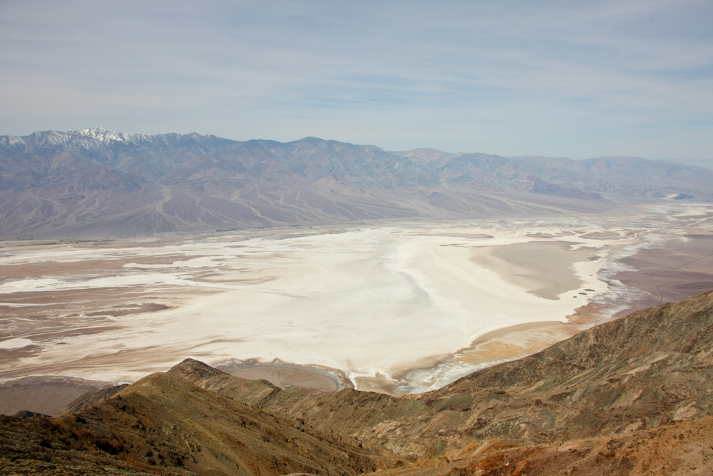
Death Valley from Dante's View with the 11,000' Panamint Range in the background.
All photos copyright, Bill Caid 2012. All rights reserved.The Trip
The western U.S. is one of our favorite areas, Mexico notwithstanding, and Death Valley is one of the more scenic areas in the desert regions. We have visited this area before with our Unimog (see Death Valley 2008) and had a great time and saw some wonderful sights. But, unlike previous trips, this trip would be with a group of fellow unimoggers. The expedition was expected to take a full week and would take us to some of the remote areas in the Death Valley National Park.
As an added perq (as if one were needed...) we had a buddy that invited us skiing for a week at Mammoth Mountain, so we will piggy-back skiing in the high Sierra as a welcome juxtaposition to the heat of Death Valley at the conclusion of the trip. Finally, as an added twist, the whole area is expecting a rather large, late-season storm that is lowering snow levels down to 2500'. Since much of the park is higher than that elevation, it should be interesting. The storm is forecast to bring heavy rains to the higher elevations as well. Heavy rains in the Panamint Range could wash out some of the trails we intend to travel and turn the lower areas into muck bogs.
Regional Map
A copy of the National Park Service map for the Death Valley area can be seen by clicking here. Our plan is to enter the park from the south from Shoshone along SR178. From there, we will leave the pavement and head west along Butte Valley road. This path will take us to the striped butte valley and then over the crest of the Panamint Range and down Goler Wash (near where the Manson Family holed up after their killing spree). We will then go north along the Panamints to Ballarat, Wildrose, Charcoal Kilns and then cross the Panamints via Emigrant Pass. Once we are in Death Valley proper, we will get supplies and see the standard tourist sights and stay in the Furnace Creek area. From Furnace, we will head north to Scotty's Castle and then into the back country again at Ubehebe Crater. From the crater, we would head south toward Hunter Mountain and from there to Saline Valley.Trip Details
The link table below contains links to the photos and dialog for each of the days of the expedition.
| Part | Dates | Adventure Locations |
|---|---|---|
|
1
|
20120318
|
San Diego to Tecopa Hot
Springs |
| 2 |
20120319 |
Tecopa
Hot Springs to Butte Valley |
| 3 |
20120320 |
Mengel
Pass |
| 4 |
20120320 |
Mengel
Pass to Stovepipe Wells |
| 5 |
20120321 |
Dante's
View and Zabriskie Point |
| 6 |
20120322 |
Badwater
Basin and Titus Canyon |
| 7 |
20120323 |
Scotty's
Castle |
| 8 |
20120323 |
Ubehebe
Crater, Racetrack and Hunter Mountain |
| 9 |
20120324-25 |
Hunter
Mountain and Saline Valley |
Conclusion
Back to Bill Caid's Home Page.
Copyright Bill Caid 2012