After
staying with one of Kathleen's Zeta sisters in Overland Park, we
headed south toward Bonne Terre. Along the way we decided
that we would see a local tourist trap the Bonne Terre mine.
The photos below are what we saw.
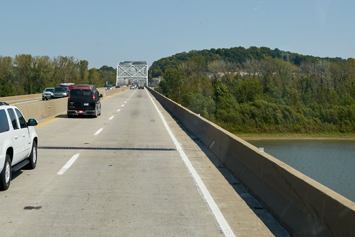
Our
first crossing of the Missouri River. This was a big
bridge, but the steel span in the distance was bigger.
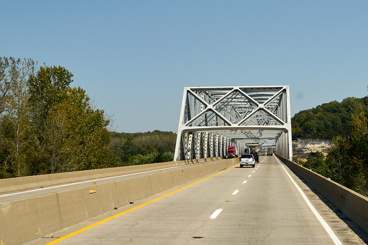
The
steel span abutted the limestone cliffs on the far river bank.
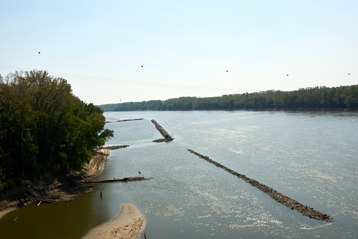
On the
banks of the river we spotted this protected area which must be
to prevent swimmers from being carried away by the current.
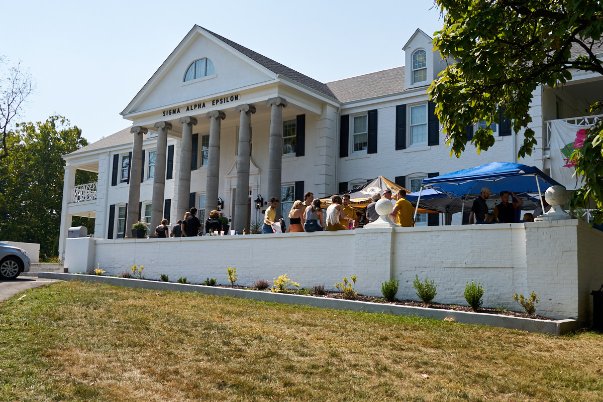
Our
destination for the day was the Sigma Alpha Epsilon house at the
University of Missouri campus in Columbia, MO. I was not
an SAE, but our hosts' son is a house member. Mission for
the day was a pre-game party. Football is a huge deal back
here, but sadly the Missouri team was soundly beaten. But,
there was plenty of beer (duh) and other frivolities.
Nothing like young, svelte coeds in summer attire.
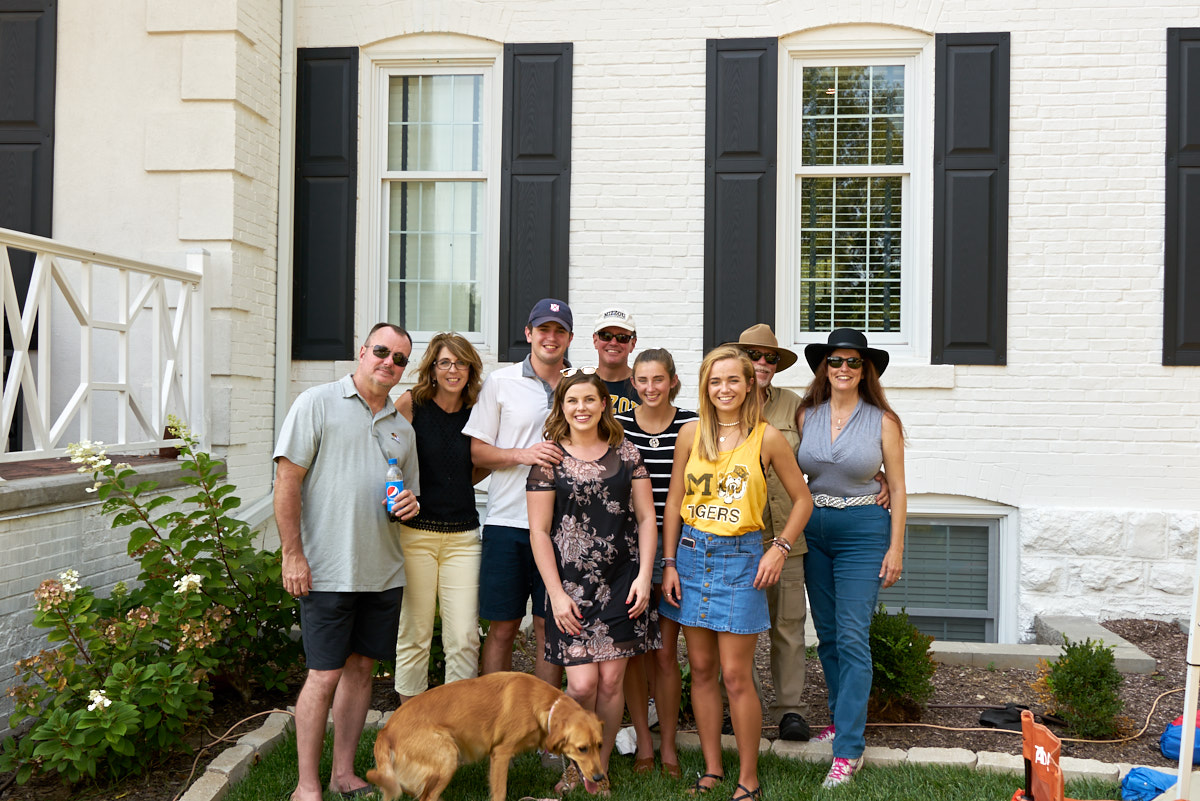
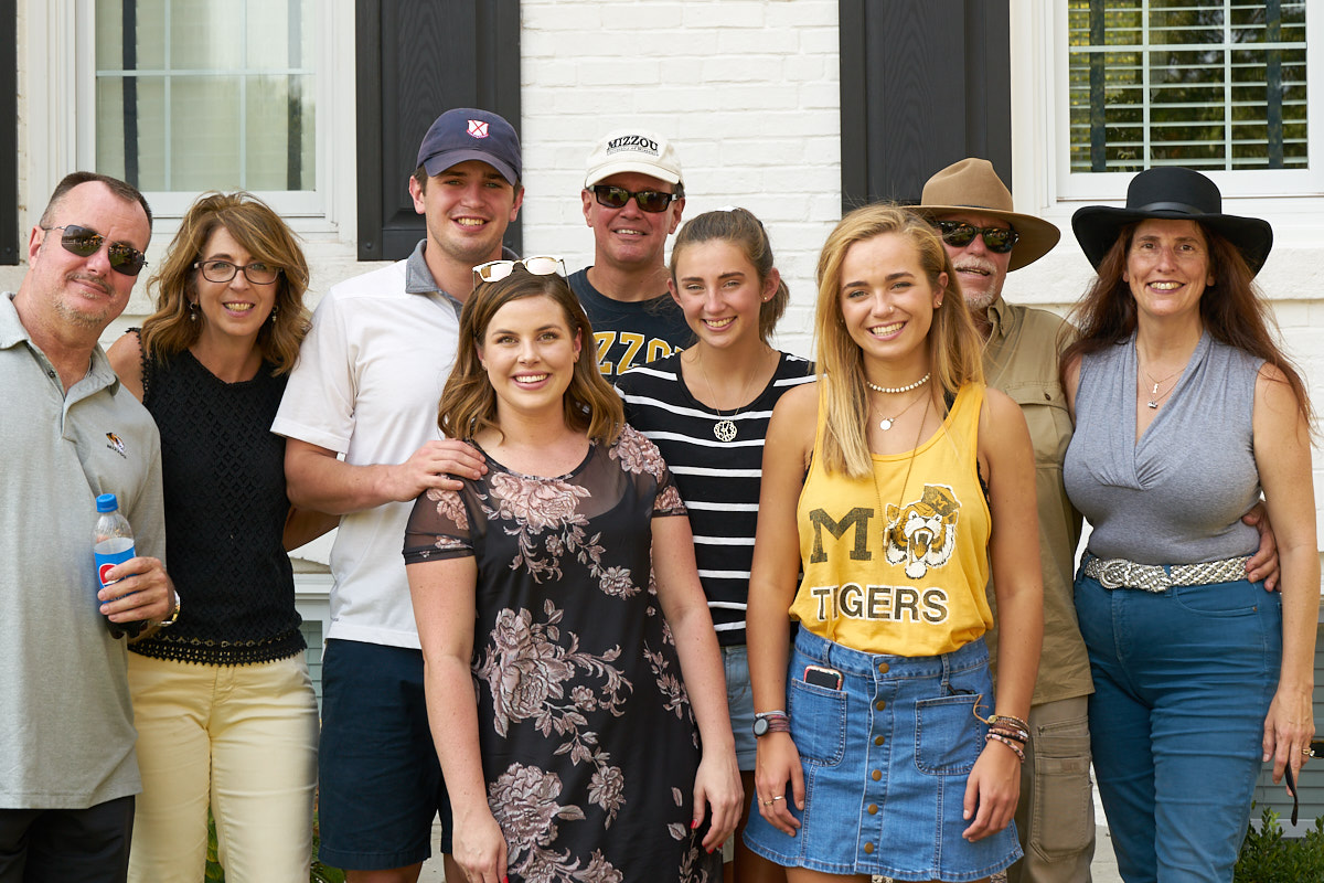
Our
group (L to R): Roy; Kathy Joe, Brandon, Lindsay, Jeff, Carly,
Kaitlyn, Bill and Kathleen.
Smiling
faces before the tragic defeat of the home team.
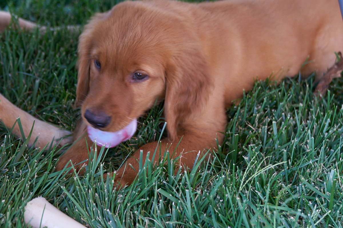
This
little fellow was the show-stopper.
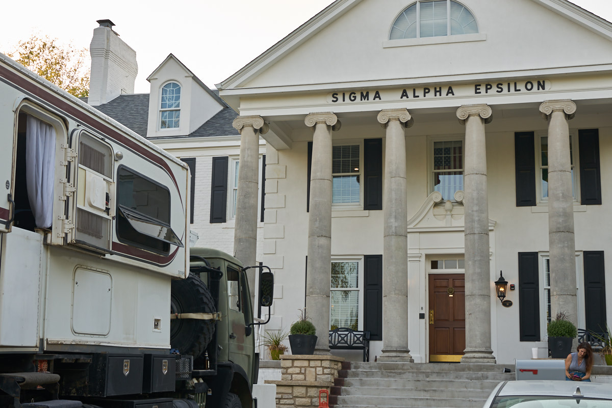
The
brothers were nice enough to allow Thor to be parked right in
front. After all the beer, we spent the night right where
we parked. Next morning we broke camp and headed
southeast.
We
spotted a sign along the highway for the Bonne Terre Mine tour,
so we decided to check it out. Bonne Terre was one of the
biggest lead mines in the country and was started back in the
late 1700s by the French. It was worked continuously until
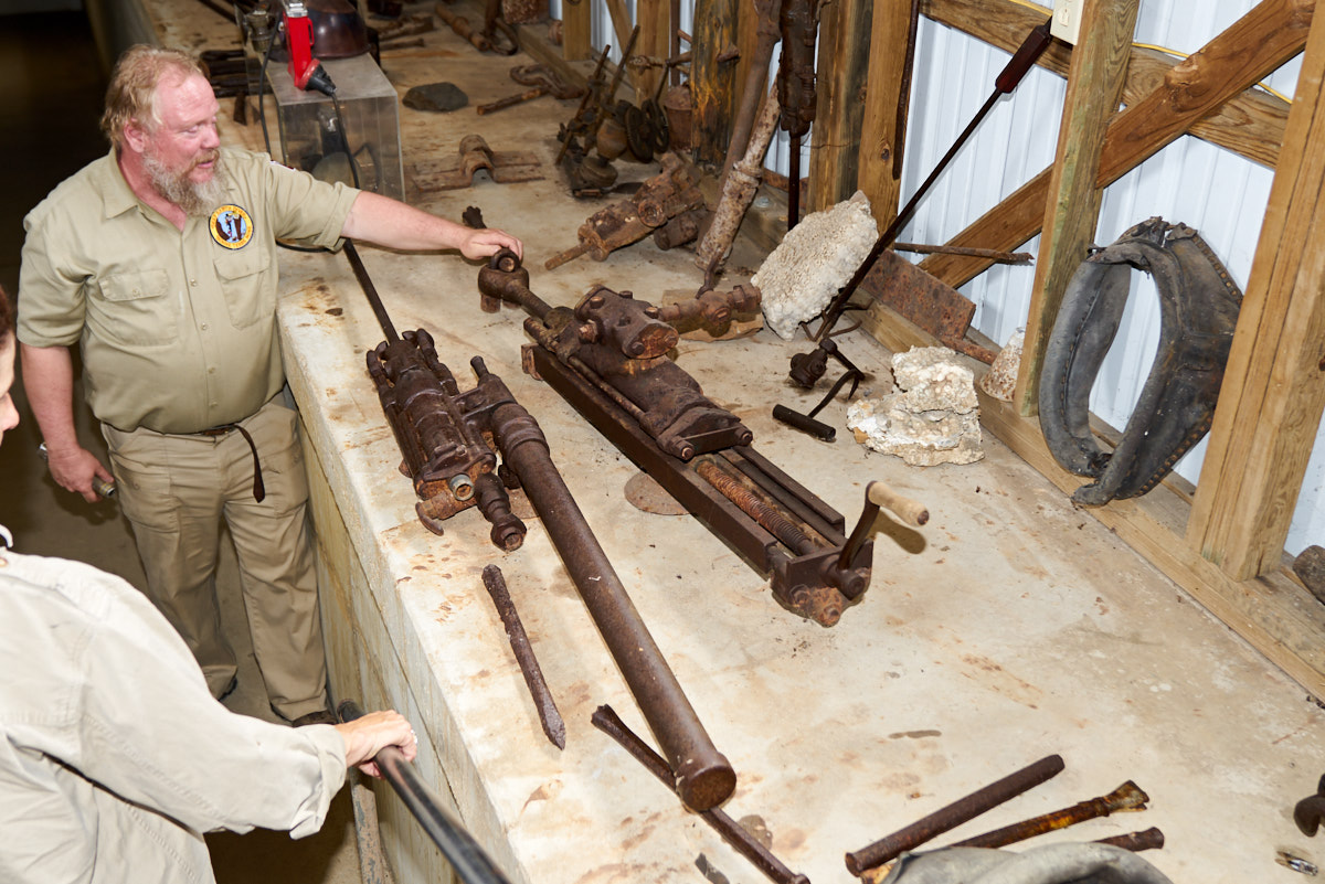
it was closed for good in the 1960s. Above, the guide
shows off some of the old artifacts from the mine.
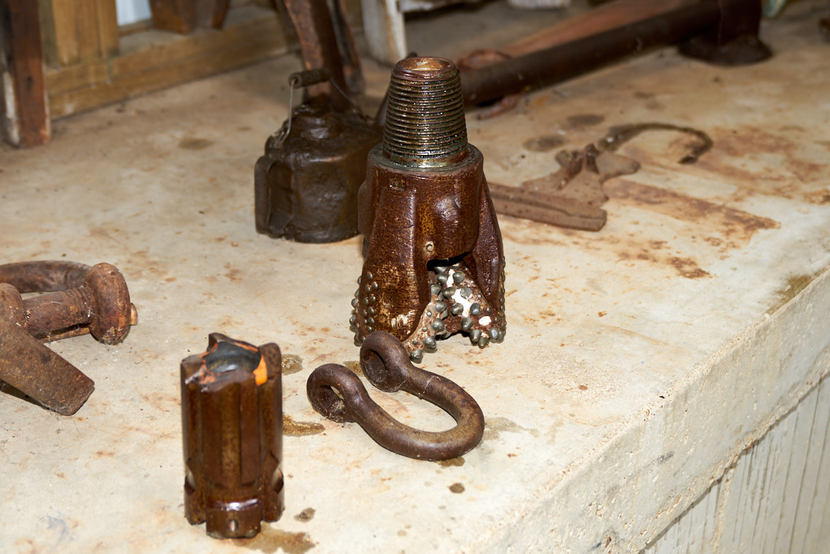
Some
drill bits and a coupling shackle.
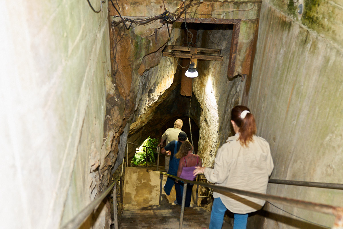
Entrance
to the mine was a set of stairs that went right into the upper
level of the mine.
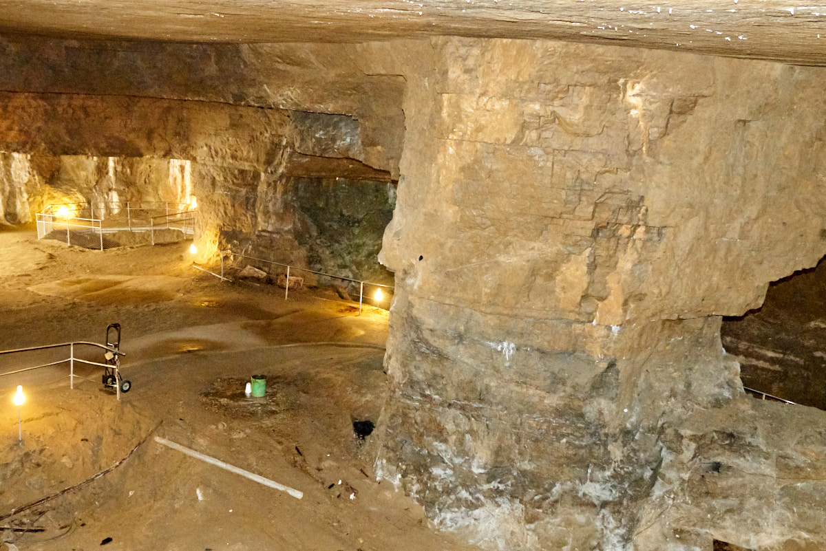
The
interior lighting was very dim making photos hard. But,
aided by the flash the Sony A7RM2 did a pretty good job.
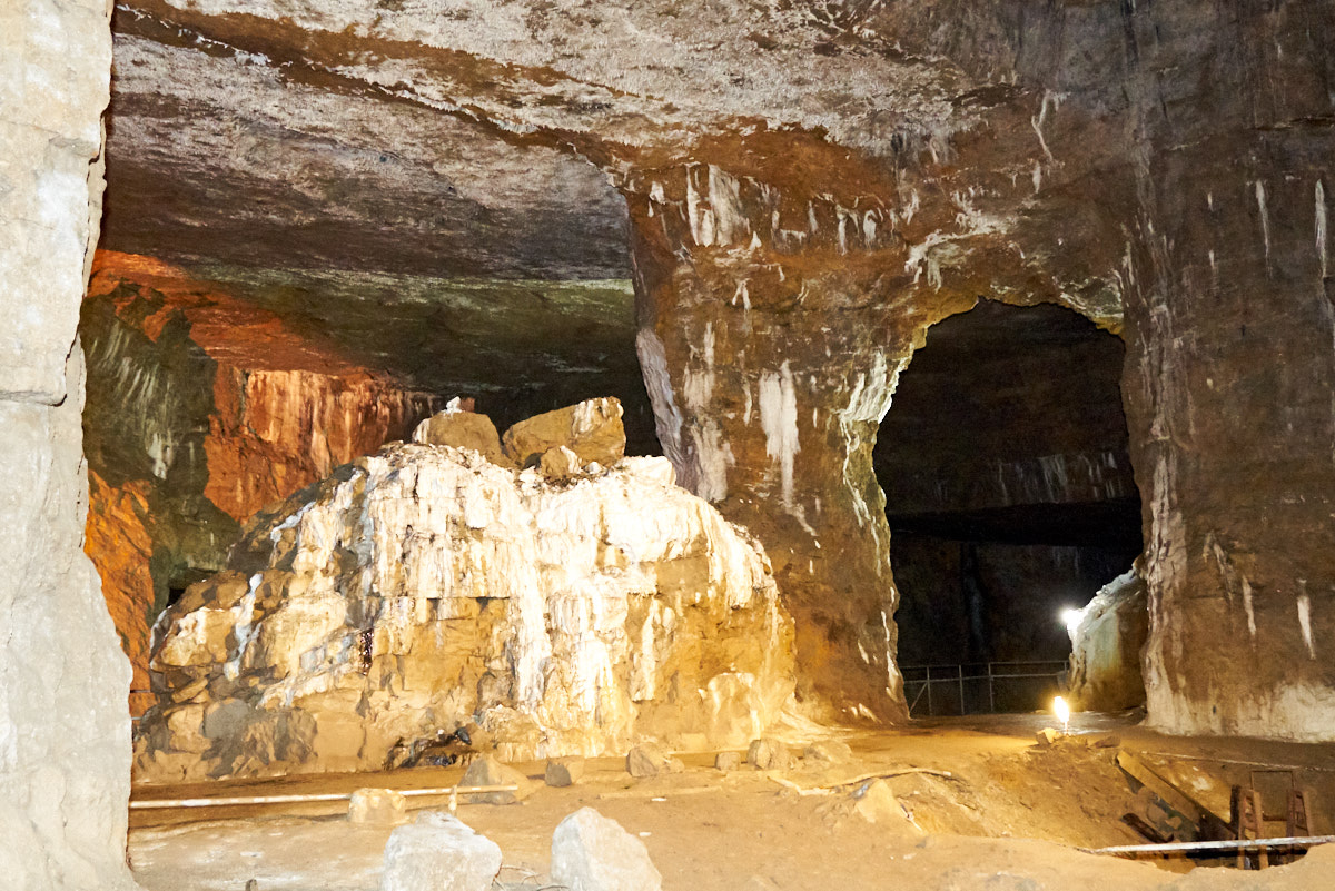
This mine is of "room and pillar" design with rooms of materials
removed and pillars left to support the overlaying strata.
Ore was extracted up to one of the bedding planes resulting in
(generally) smooth ceilings.
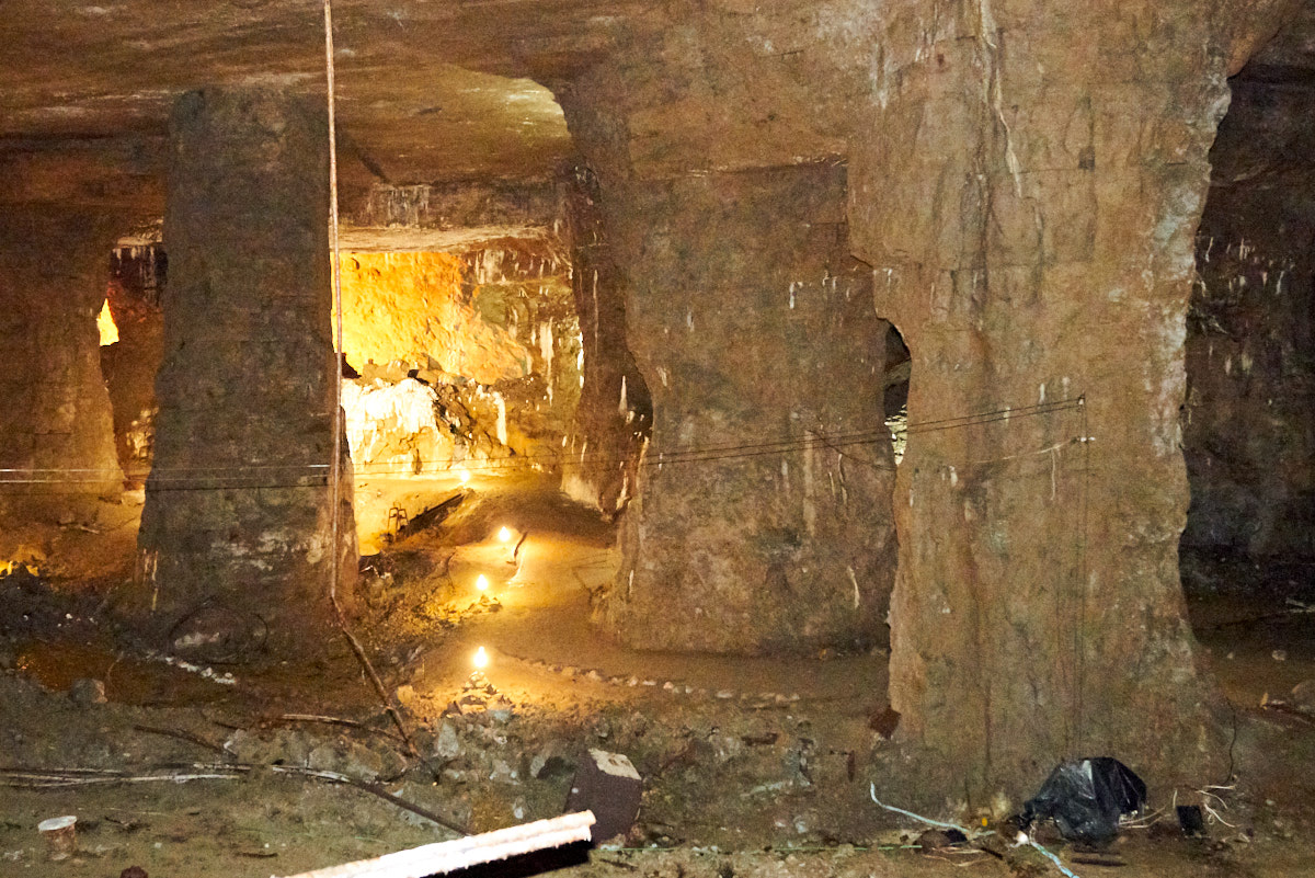
The
stripes on the wall are accumulations of calcite from water
seepage. The tour walkways are visible in the photo above.
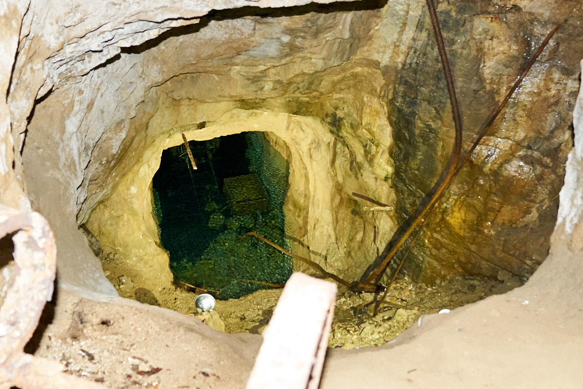
The mine
offers both dry and wet tours. The wet tours require scuba
gear and are conducted along a set of "trails" that have
illumination from the in-mine electrical system. The
bottom levels of the mine have been flooded for 50 years and
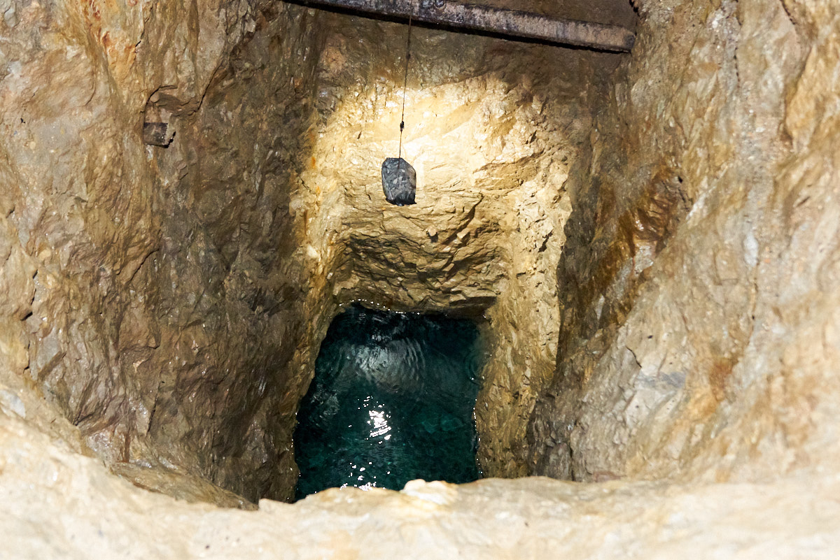
there are many more wet trails than dry ones. Above, you
can see into one of the shafts and can see some equipment just
under the water's surface. The
water in the mine has outstanding visibility.
The
mine's predominate strata is pre-Cambrian Dolomite which also
produces nice caves and flow structures. This flow
occurred after the mine was shut down.
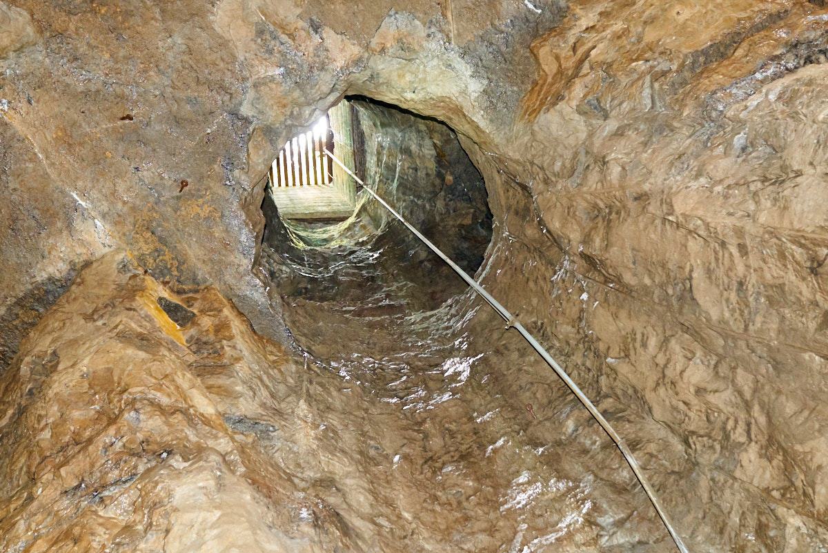
Looking
up to the ceiling 40 feet above is one of the entrances to the
mine. This entrance has been sealed off.
Another
water-filled shaft that goes to the lower levels of the mine.
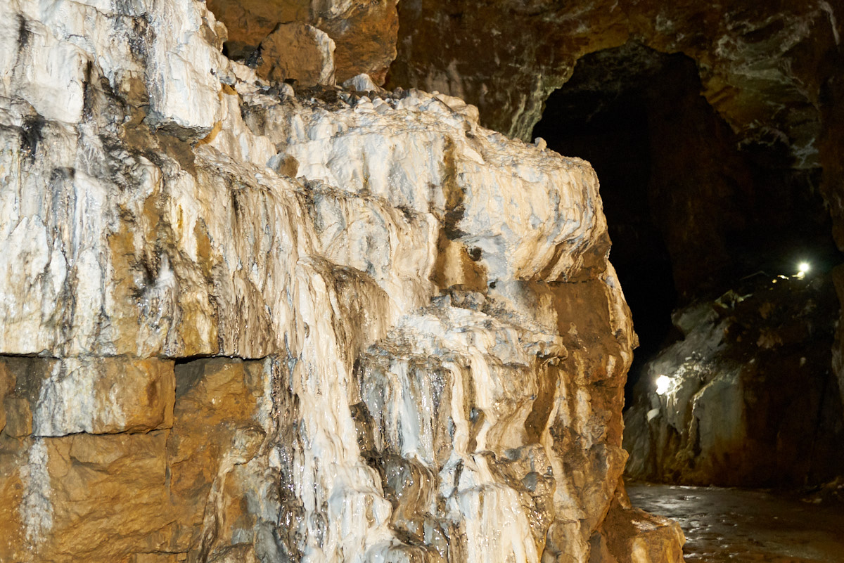
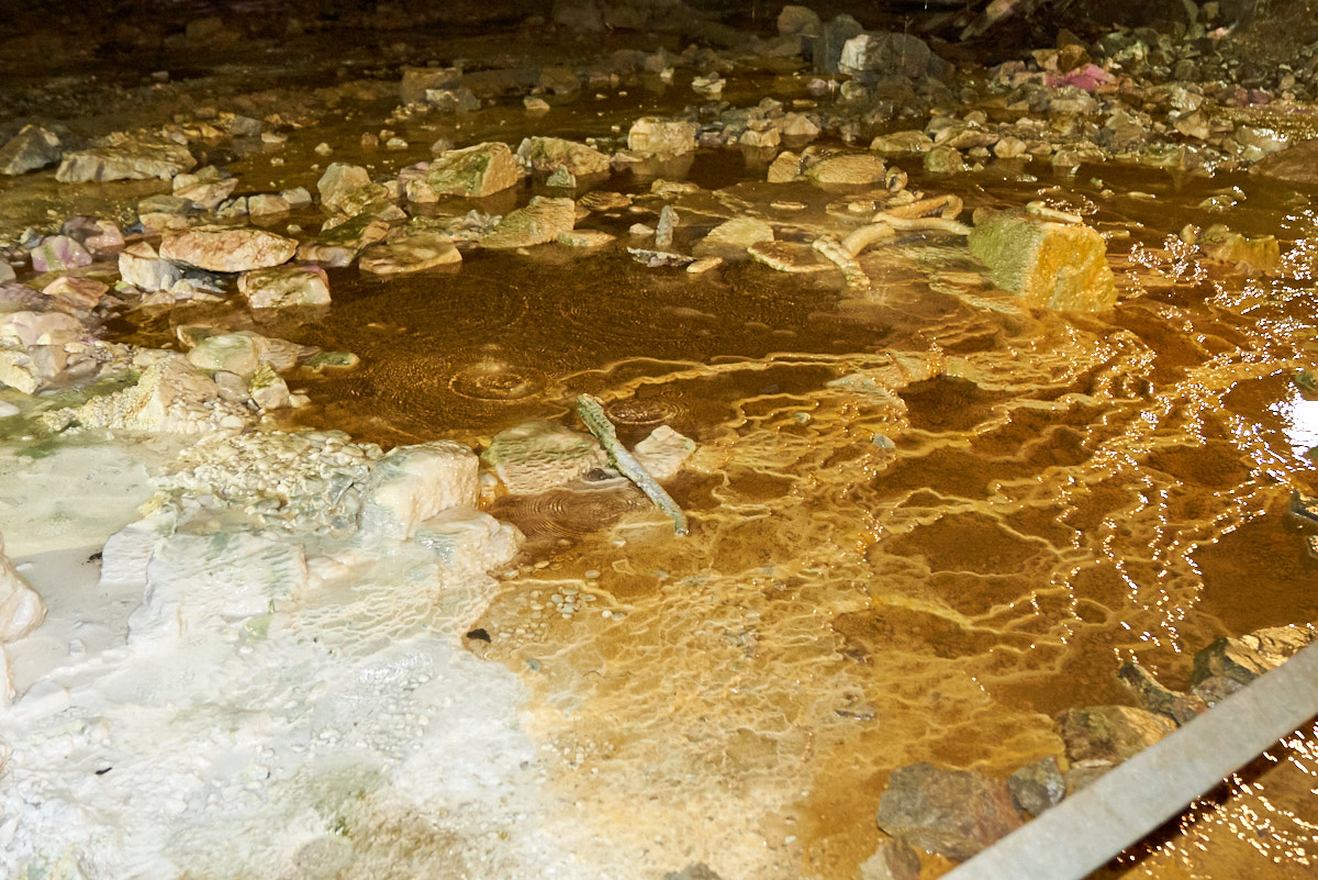
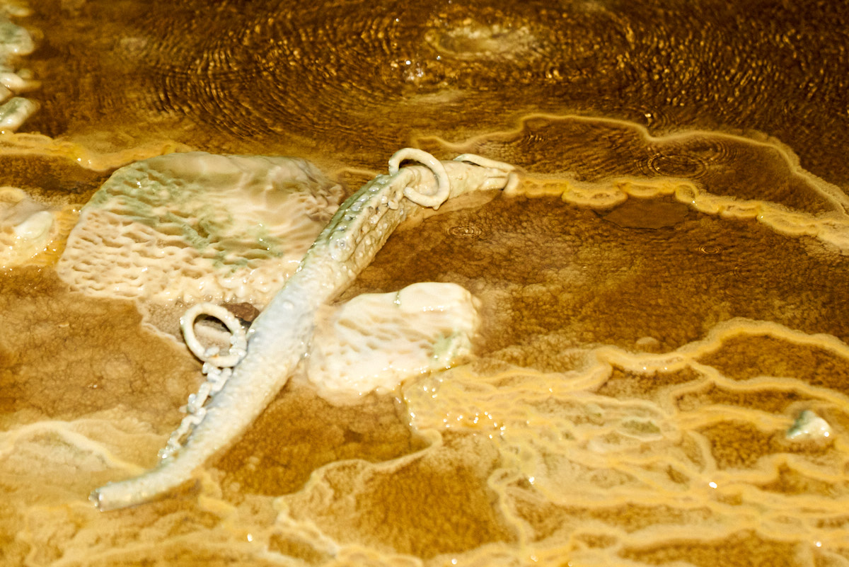
More
flow-stone being deposited alongside one of the trails.
Flow
stone coats the walls where ever there is a water seep.
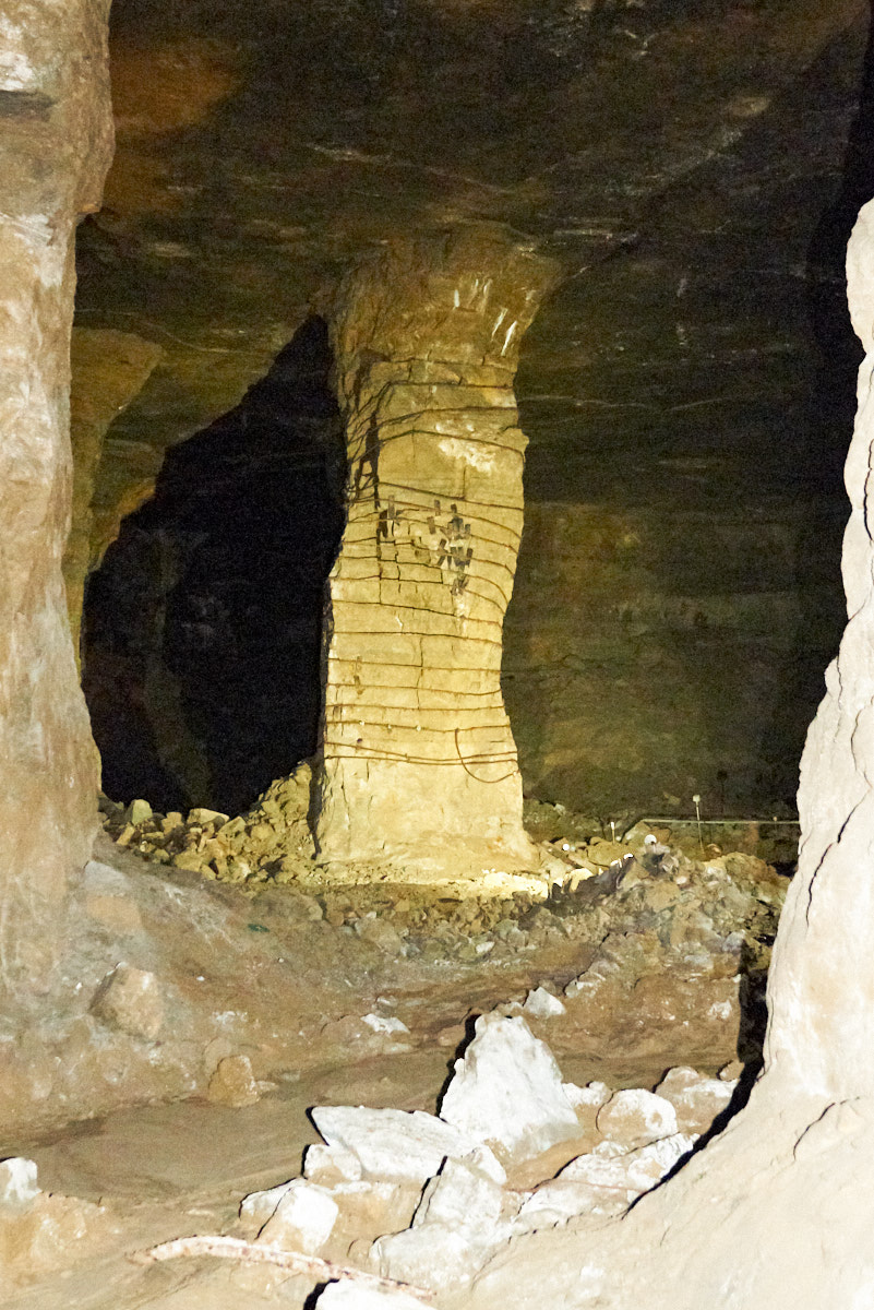
This
pillar was cut too small and was starting to fail, so the early
1800s miners reinforced it with steel cable and inserted wooden
wedges to put the cable into tension. The patch is still
holding today.
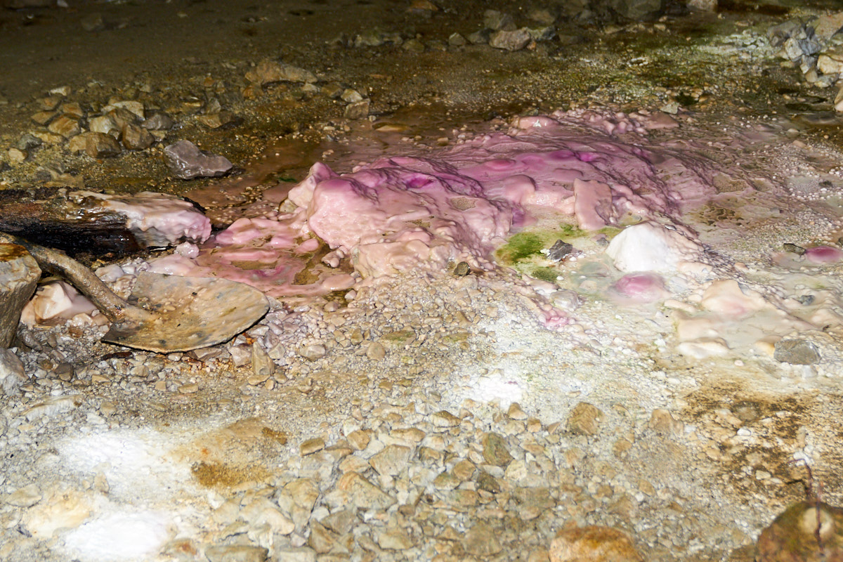
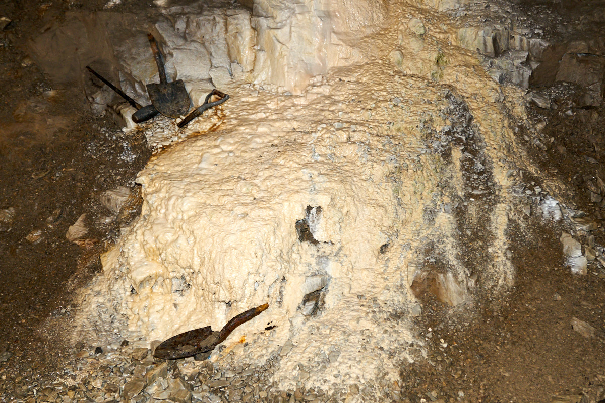
Cobalt
dissolved in the mine seepage results in the pink cast to the
flow stone. Note that the shovel is already developing a
coat of calcite.
Dikes
and terraces develop where a seep drips onto flat ground.
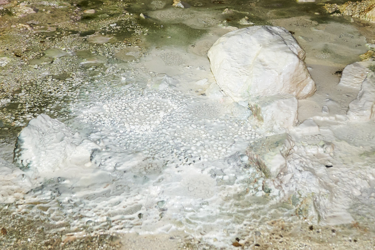
Cave
popcorn grew in some of the sheltered areas.
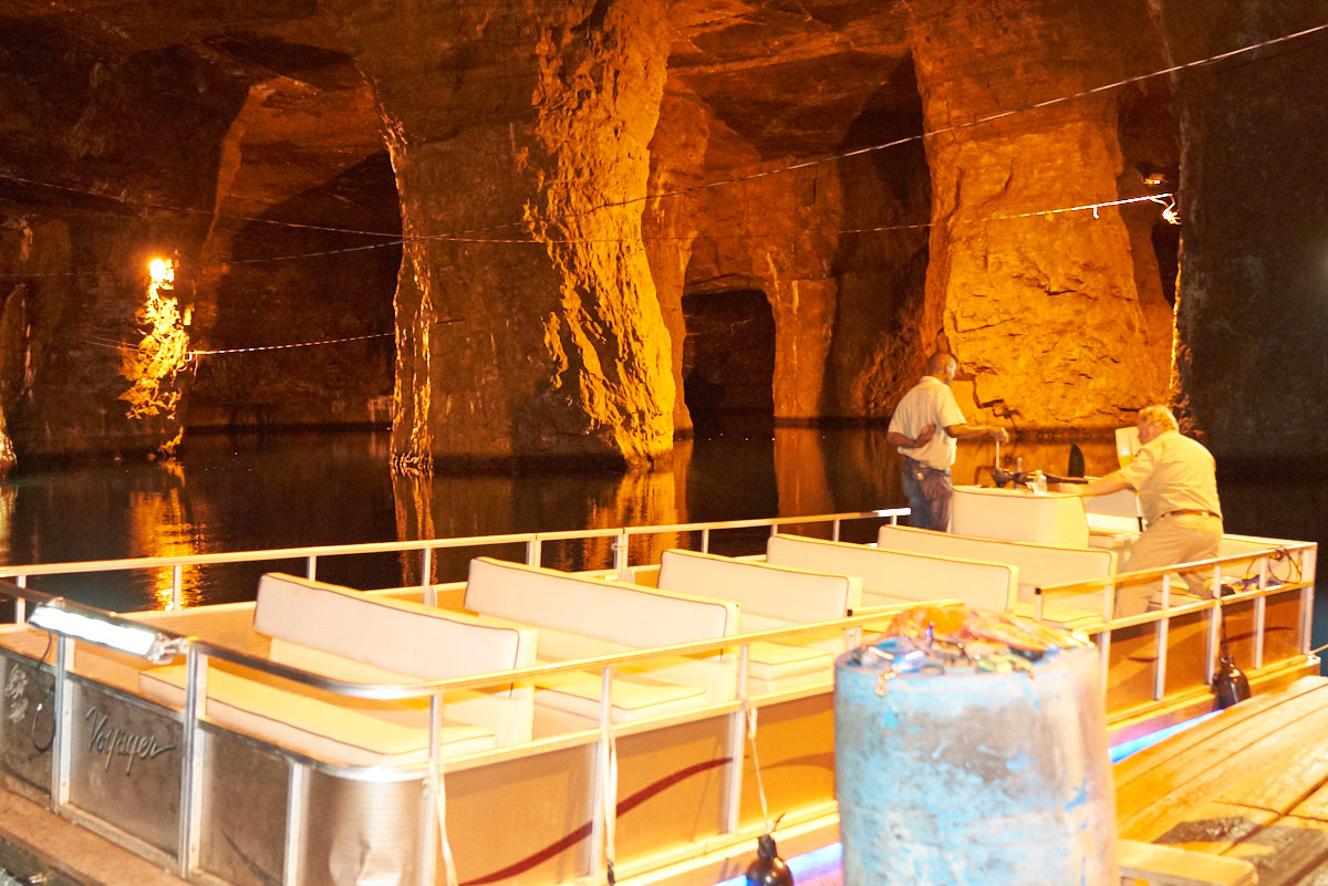
The
guide was on a mission. The boat above had a motor failure
and they decided that they would do the tour anyway by paddling
the boat.

They
paddled the boat into the water-covered portion of the
mine. Water depth under us was about 150 feet.
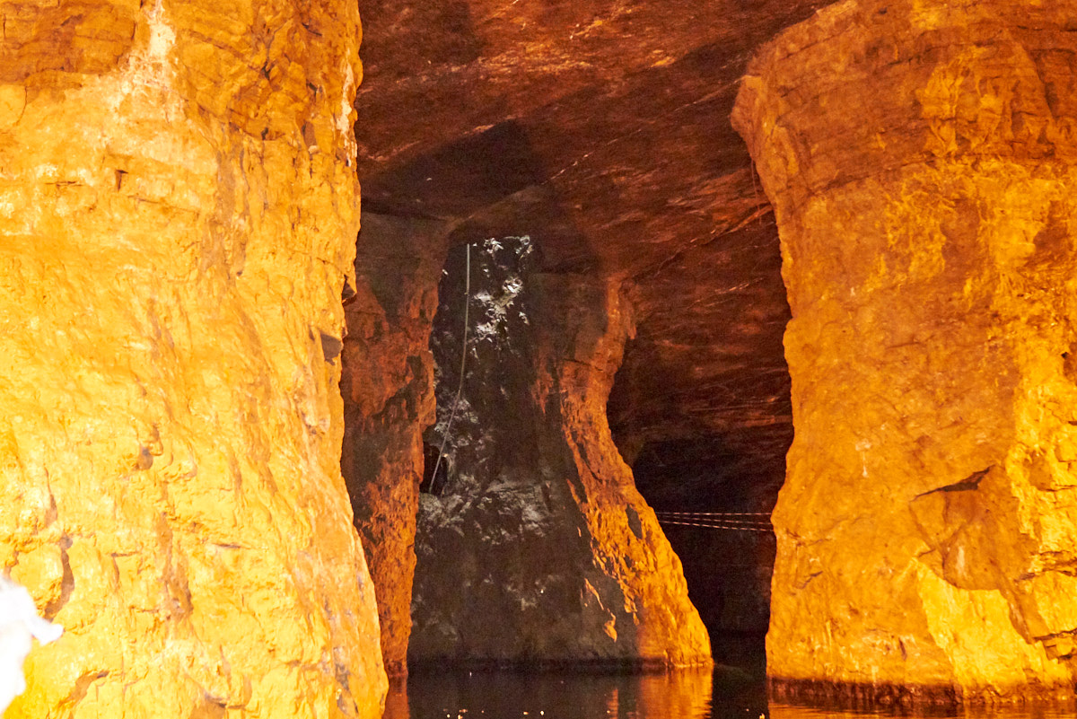
In the
distance we could see sunlight. This was one of the access
shafts to the mine and was used to lower the boats into the
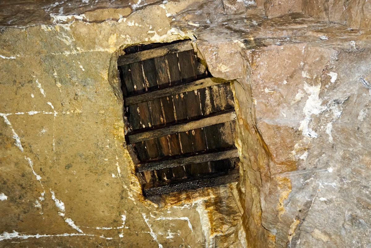
gallery.
The conduit
contained the electrical service for the mine. The shaft
has been blocked off on the surface.
| Previous Adventure | ||
| Trip Home Page |
Photos and Text Copyright Bill Caid 2017, all rights
reserved.
For your enjoyment only, not for commercial use.