We
traveled south and west from Bend to Grants Pass, OR to see our
buddy Mark. Mark has a great place on the banks of the
Rogue River, but it was very hot. Summer was had finally
come to the Pacific Coast. We stayed several days and then
motored south to Petuluma, CA.
The photos below are what we saw.
The
journey from Grant's Pass, OR to Petaluma, CA took several days
at "Thor speed", but we did meet our objective in time to meet
with our friends Kevin and Kirsten. Kevin had never been
to the Point Reyes lookout, so we loaded up in his diesel
Expediton SUV and headed west. We arrived in the middle of
the day and the weather was as nice as could be expected from
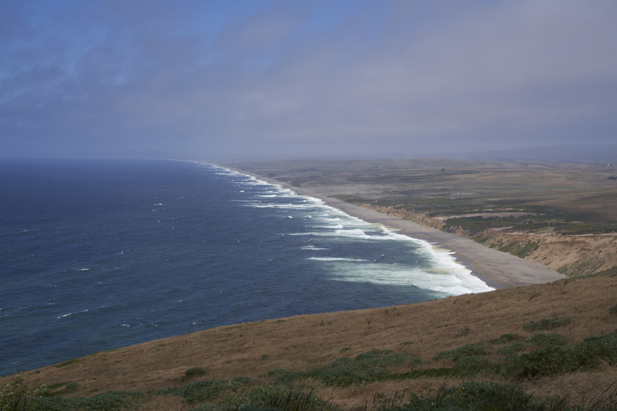
this location: mostly clear, but high, cold winds. From
the point, we got a clear view of the wind-swept beaches to the
north. The beach area was within the National Preserve, so
there were no beach-goers nor any homes.
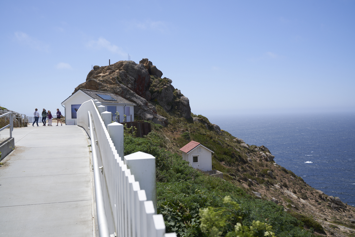
Approaching
the actual point, the wind was so strong that it made walking
difficult. The shelter was right next to the high point on
the cliff.
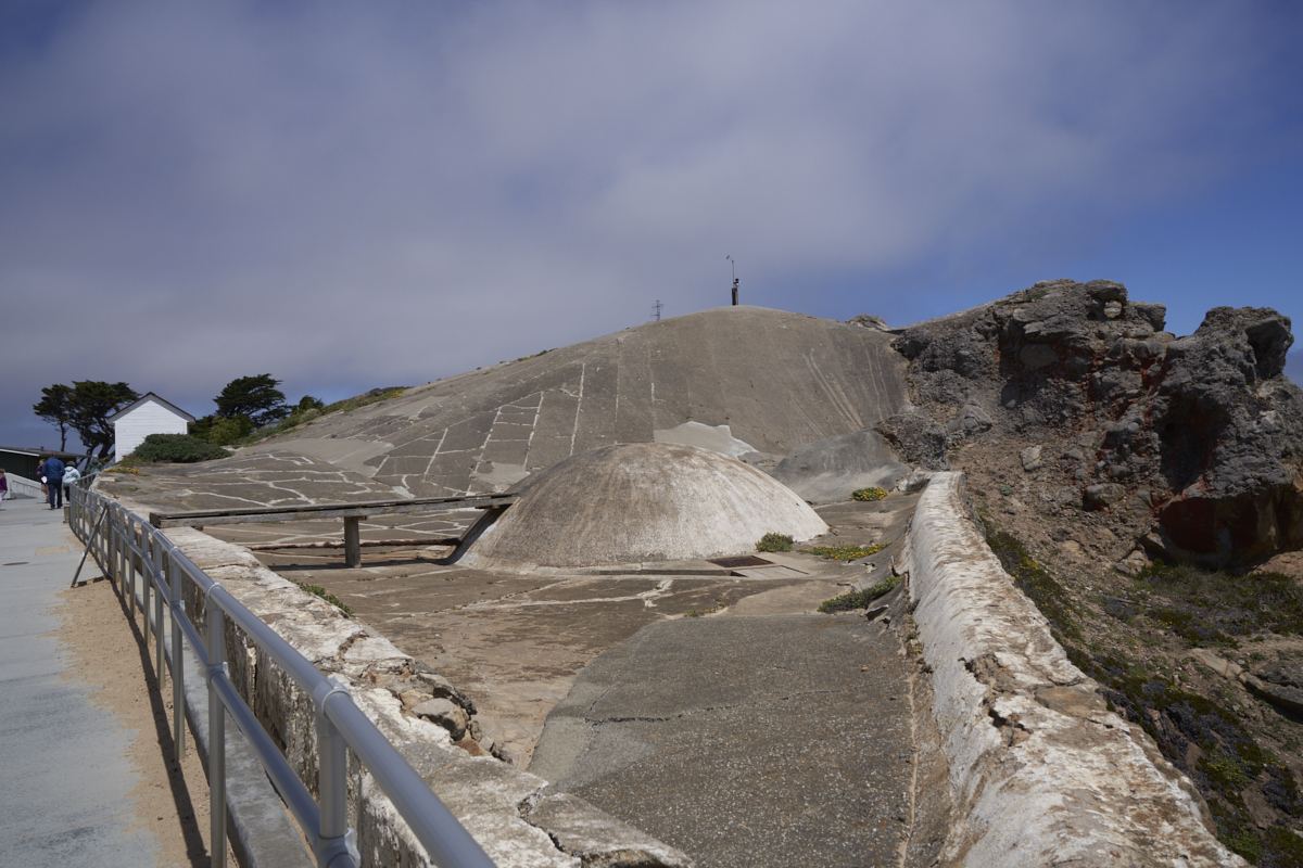
This
area is remote, but back in the day it was really remote.
A cistern collection mechanism for rainwater had been
constructed to provide water for the lookouts and lighthouse
crew.
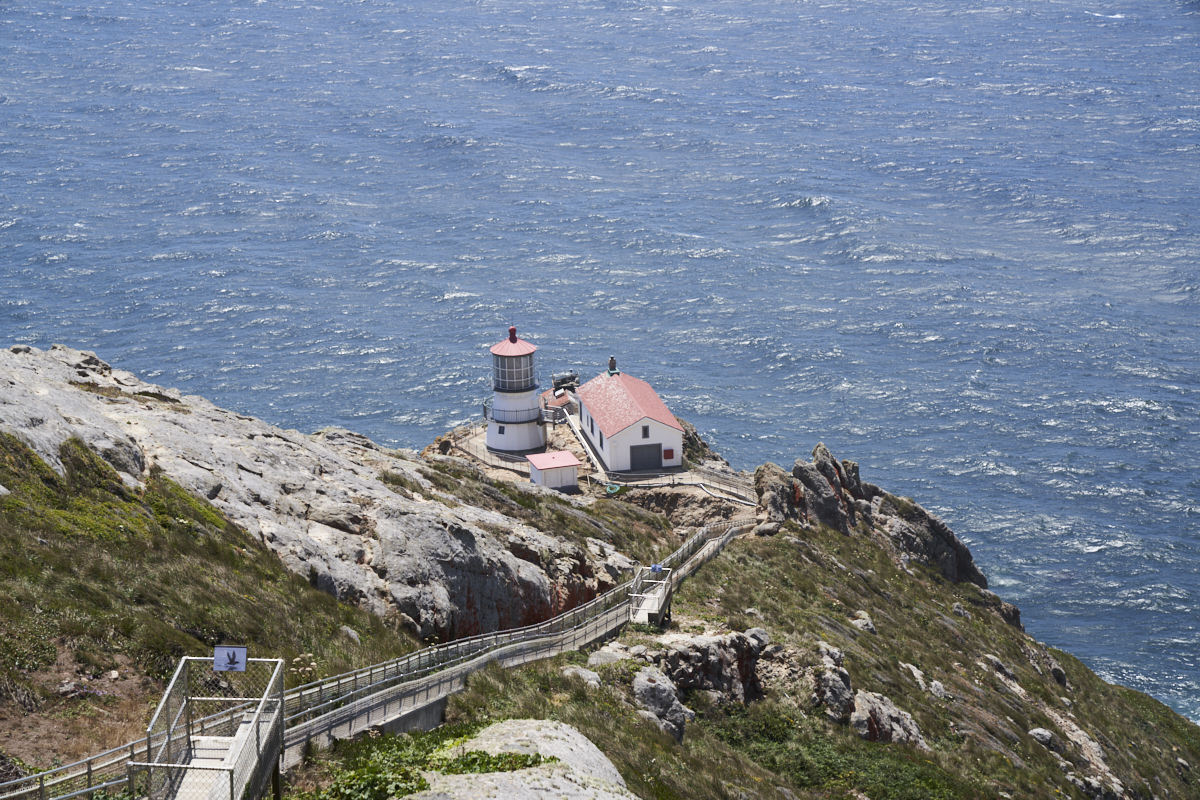
Access
to the Pt. Reyes lighthouse was via a set of steep stairs built
into the cliff. The stairs were about 350 steps, but the
entire area was closed due to the high winds. To the best
of my knowledge, Pt. Reyes lighthouse is still active.
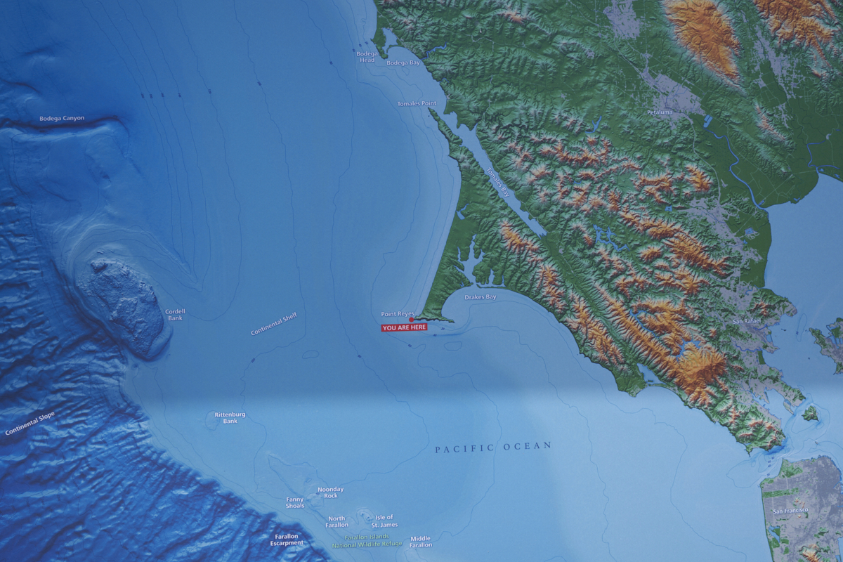
In front
of the shelter area was a nice map of the area. Pt. Reyes
is on the Pacific Plate and the San Andreas fault runs right
through the center of Tomales Bay (the narrow channel running
from upper left to lower right).
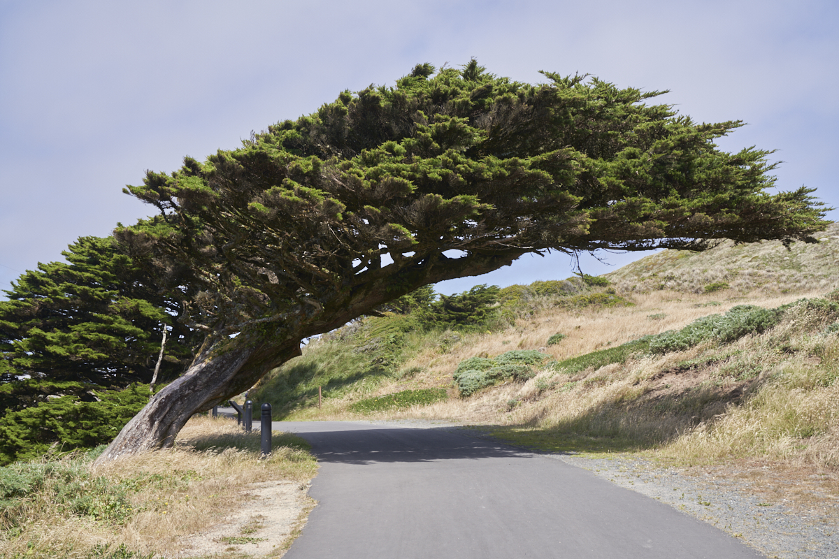
Strong
westerly winds are a noted feature of this area. Trees
have been bent in response to the constant prevailing winds.
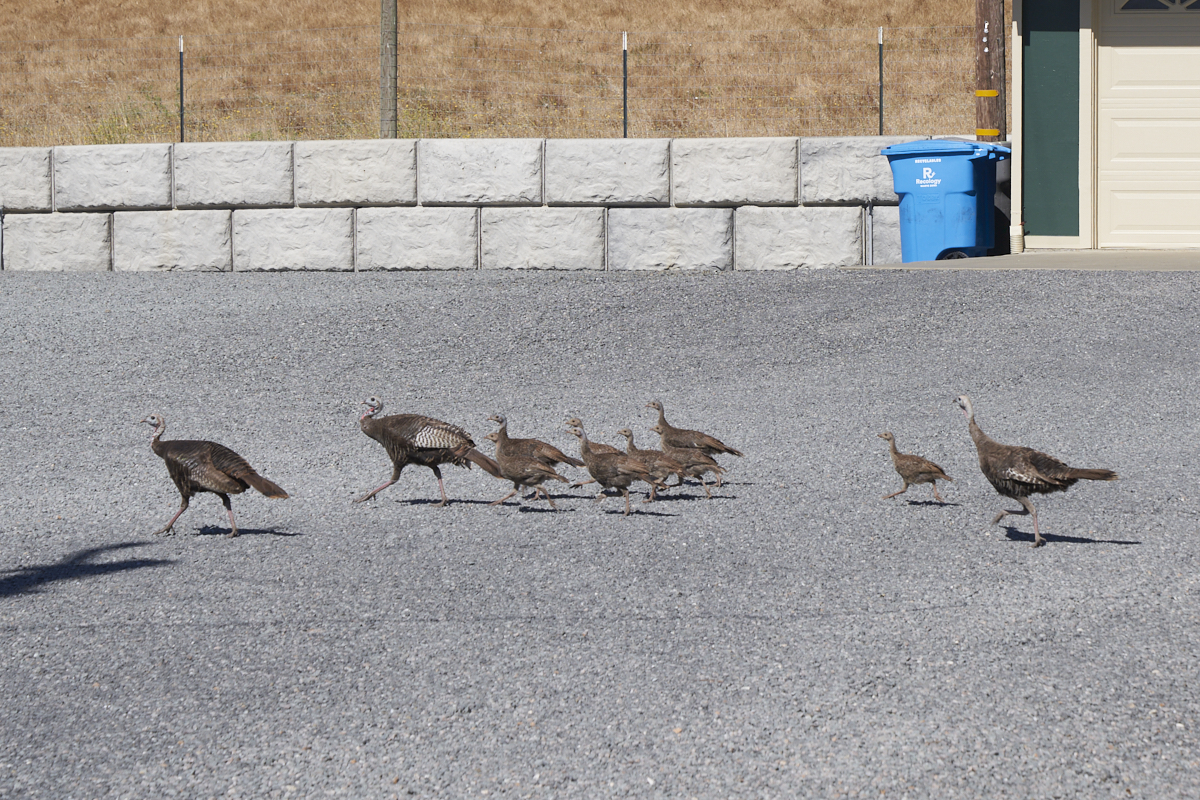
As we
were leaving Kevin and Kirsten's ranch we passed a gaggle of
wild turkeys in a driveway near US-101.
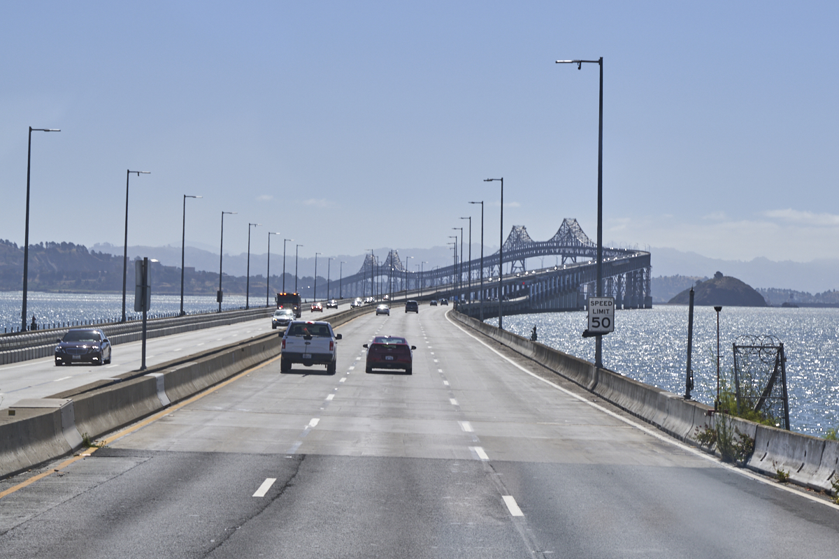
The
weather was actually quite nice the morning we departed.
We got a nice view of the Richmond Bridge that crosses part of
San Francisco Bay from San Quentin to Richmond. Our travel
path took us through the belly of Oakland and finally spit us
out at the south end of the bay on US-101. We would travel
US-101 for the next several days to reach San Diego.
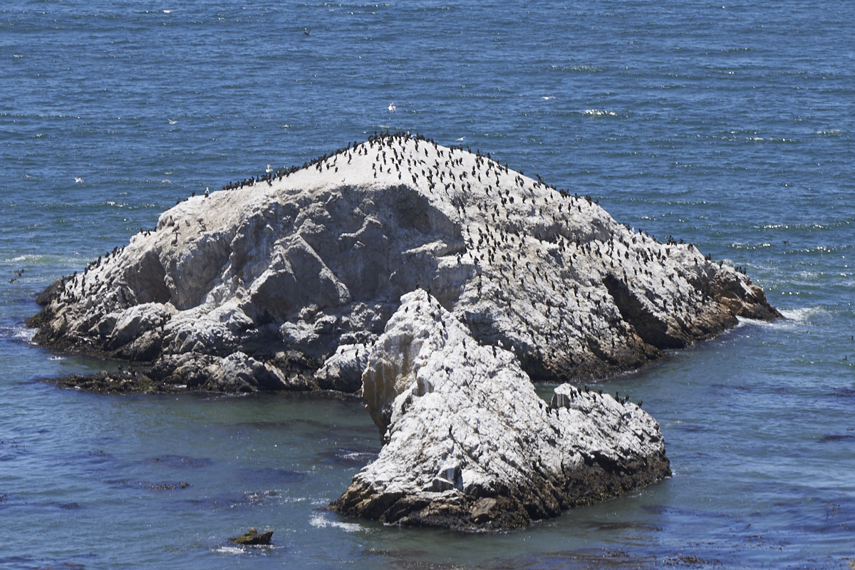
Kathleen
spotted this "bird island" near Pismo Beach. Our
destination for the night was Atascadero in the central coastal
region of California.
In
Atascadero, we stayed with our friends John and Judy at their
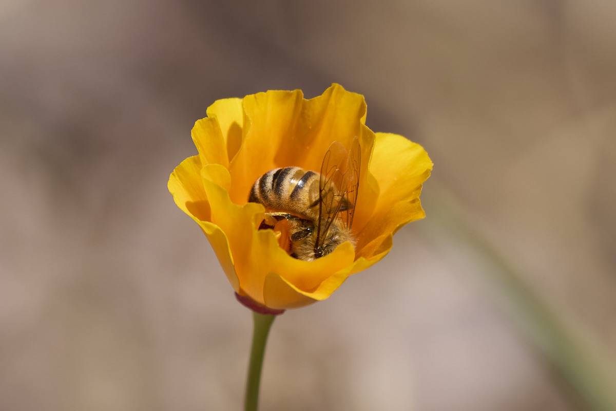
beautiful ranchette. The morning of our departure we were
having coffee outside on the patio and I spotted some bees
working the poppies. Above, an industrious bee does
a face-plant into the guts of the bloom.
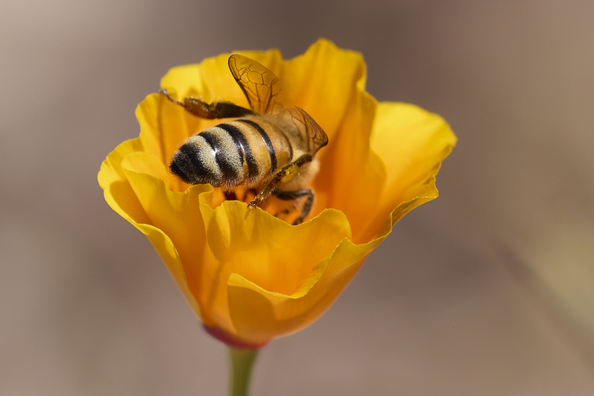
There
were a number of poppies in bloom and many bees were working the
blooms. Note that there is hardly any pollen on the bee's
rear legs, the usual collection and transport mechanism.
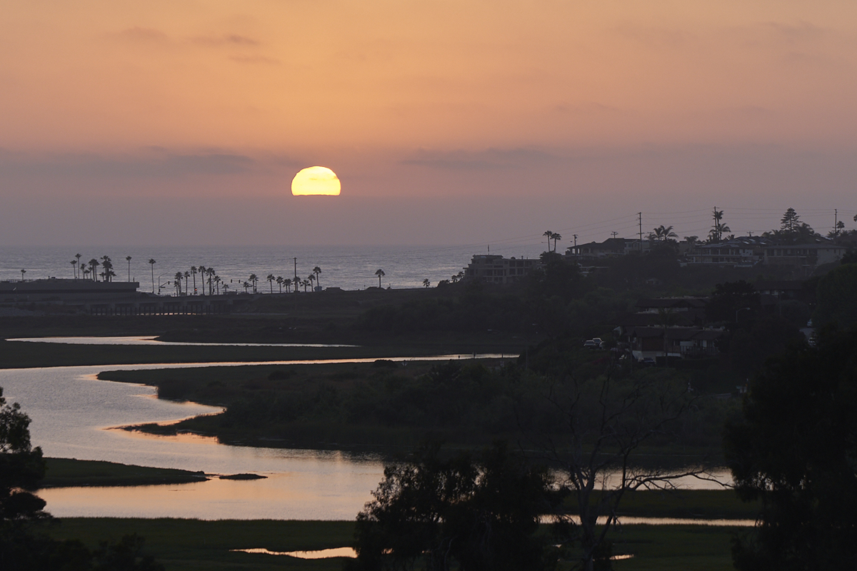
By the
time that we reached the northern reaches of the L.A. basin it
was late afternoon. We decided that we were close enough
that we could make it home that night so we steeled ourselves
for a transit of the L.A. basin in heavy traffic and proceeded
ahead. We were pleasantly surprised that the traffic was
much less onerous than expected and "only" took several hours
cross. Above, Kathleen grabbed a shot of the sun setting
over Cardiff, CA just north of our home. A fitting
"welcome home" for the end of a long trip.
| Previous Adventure | ||
| Trip Home Page |
Photos and Text Copyright Bill Caid 2023, all rights
reserved.
For your enjoyment only, not for commercial use.