It was
cold as a result of the "rain storm". It was not until a
few days later that we discovered that the storm was way bigger
than predicted and had brought over 6 inches of snow to the
higher areas (like Kanab, UT). We had a comfortable night,
but awoke several times due to the noise of the rain on the roof
of the Lance. Once we were up and dressed, we went outside
and discovered much to our dismay that camping in the canyon was
probably not the best overall decision.
The photos below are what we saw.
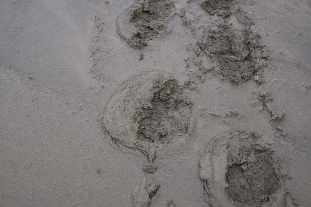
Once I
was dressed and out of the camper, it became apparent that the
situation was a bit more dire than we had predicted. The
snow was not on our menu and we were surprised, if not a bit
disturbed by the sight.
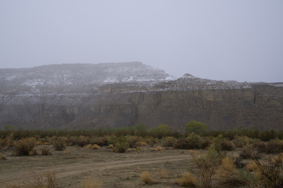
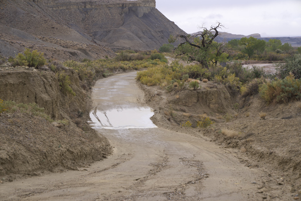
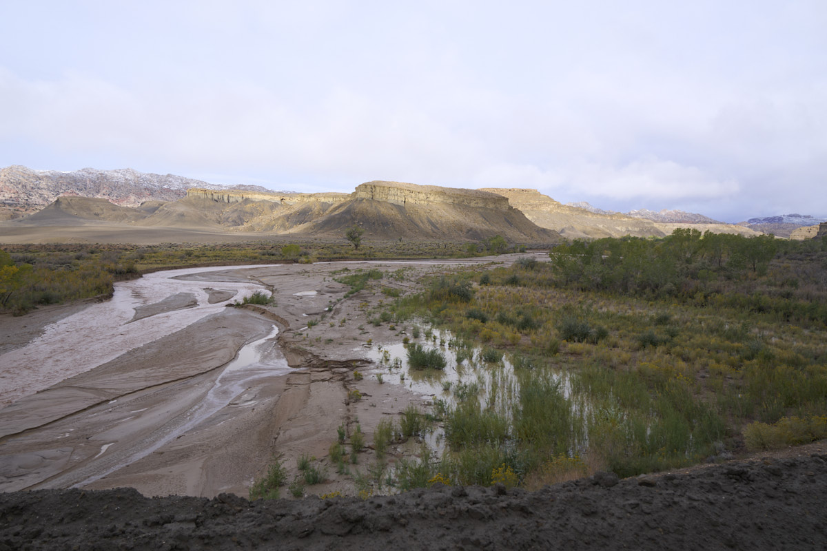
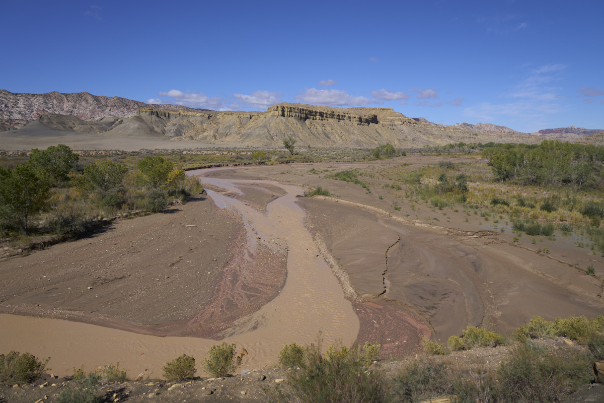
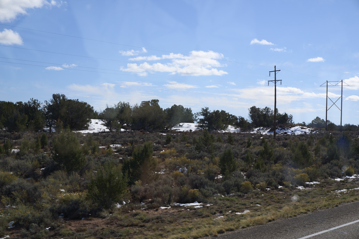
To the
west across the Paria River, the cliffs were dusted with snow.
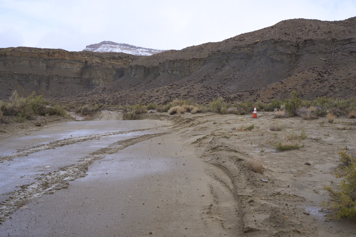
Getting
out of our camping area was a challenge. The soil in the
area was rich with thick, sticky clay-based mud. We
slipped and slid, even in 4x4, and managed to pass our first
obstacle for the day with no real issues. We bypassed the
side creek with no problems other than a tight sphincter.
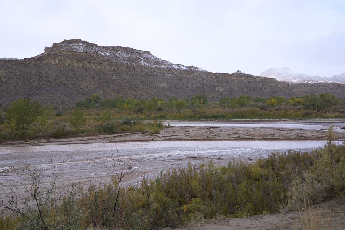
The
Paria River was a mere trickle the night before. It was
now flowing strong.
This
obstacle was unavoidable. The soft, clay-based terrain
presented a potential hazard. If we were to get stuck in
the crossing and more rain were to come, it would be a bad
outcome. There was a significant drop-off to the right of
the berm on the trail. I used my shovel to carve a drain
on the right and managed to eliminate most of the standing water
in the trail. That said, the road was still super soft and
slick. I got Thor in the correct configuration (4x4, low
range, differential locked) and we passed without issue.
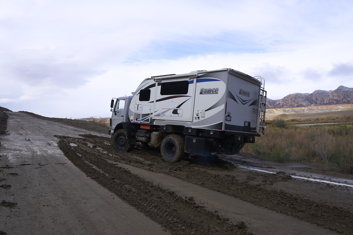
This
seemingly innocuous spot brought us to a halt. I tried
twice and then gave up. For every foot we went up, we slid
6 inches sideways toward the cliff. We finally ended up
with our right rear wheel in danger of going over.
A cowboy
proverb states "when you find yourself in a hole, it is best to
stop digging". So, armed with that wisdom, we dismounted
and assessed the situation. This grade is rather steep,
perhaps 15% or so. That, itself, would not present a
problem. But, the terrain is Tropic Shale which is slick
as snot when wet.
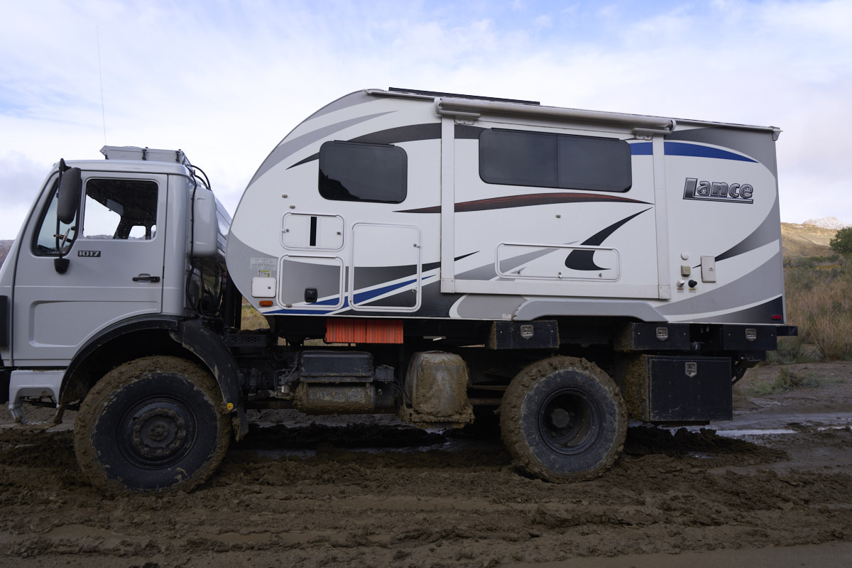
Thor's
large tires did a good job of turning the bottom of the hill
into porridge.

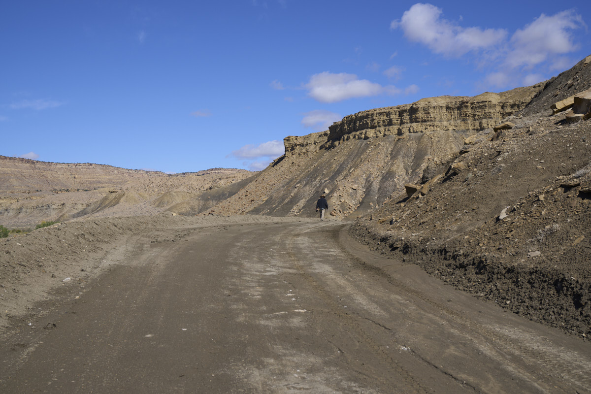
I took
the camera up the hill with me and it was an treacherous walk
indeed. I almost lost my balance several times and by the
time I got to where this photo was taken, my shoes were each
several pounds heavier due to the accumulated clay mud.
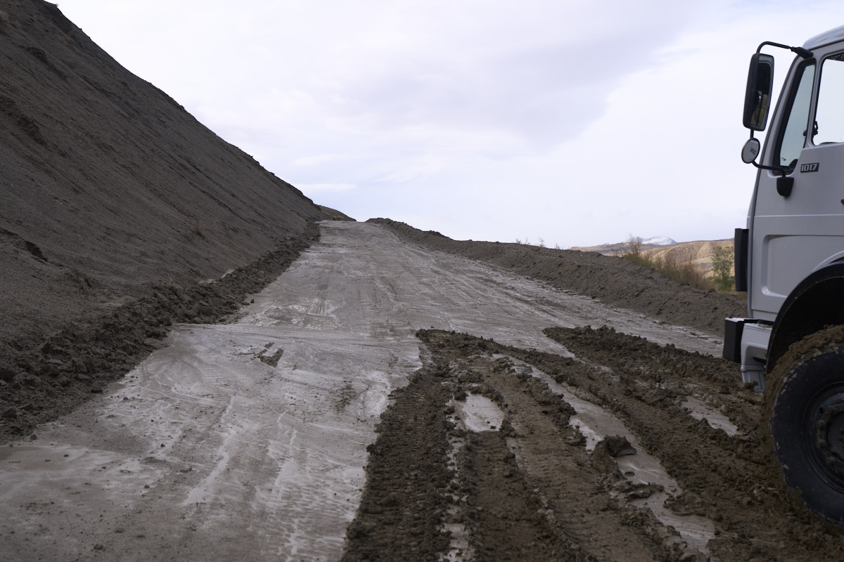
The top
2 inches were soup. The material underneath was soft but
less slick. The adhesion of the muck was tearing huge
holes in the road.
When I
got to the top of the grade I could see the extent of the
flooding of the Paria River.
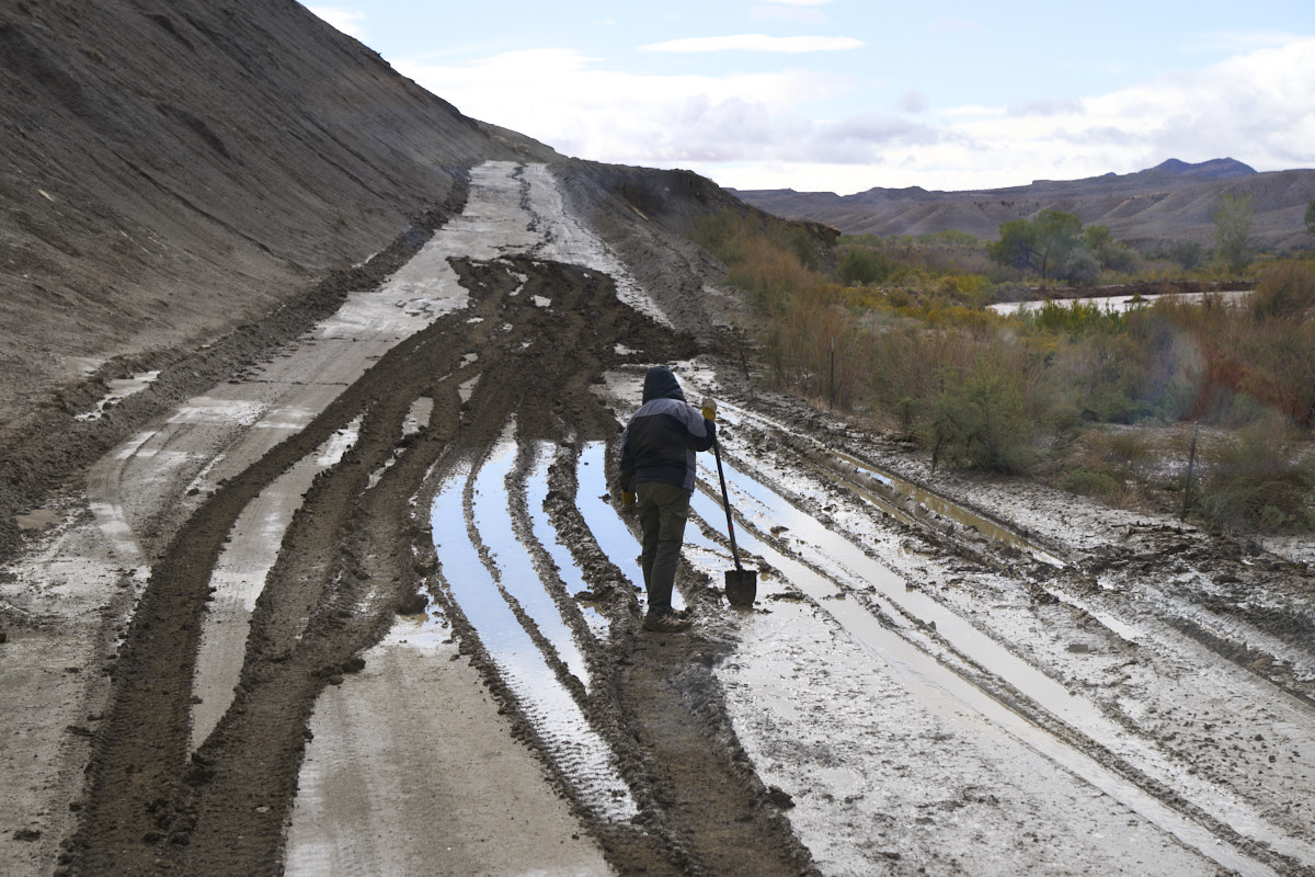
After
waiting about an hour, I was able to partially ascend the grade
enough to allow me to back down to a flat area. After an
extended discussion, we decided that the best course of action
was to do nothing until the road dried out. Kathleen
discovered that we were close enough to the mouth of the canyon
to have cell service, so I called the Kane County (UT) sherrif's
office and advised them of our situation: "stranded, but not
stuck; safe with sufficient supplies, no injuries; will advise
status tomorrow". At that, we settled in for a forced
down-day. After a couple of hours of just sitting in the
cab, Kathleen felt like she had to do something so she took the
shovel and attempted to drain the pond at the bottom of the
grade.
We spent
the balance of the day in the camper. The outside
temperature was in the 40's so it was cold. And, the wind
was still blowing strong. It started sprinkling later in
the afternoon, despite the forecast from weather.gov. The
night was cold and windy, but no rain.
The
morning was bright and clear, but still windy and cold. I
took my camera and headed up the hill to assess the
situation. The Paria River had shrunk over night and some
of the surrounding terrain was beginning to dry out. Most
of the patches of snow on the ridge lines had melted.
By noon,
patches of tan were emerging in the mud. The wind was
still blowing hard, but that was good as the flow of air hastens
the drying effect.
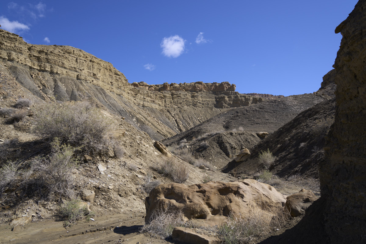
We
headed back to the camper and decided that if conditions
continue the same, by 3pm we would likely be able to exit
without problems. The photo above is the side canyon just
behind our parking place. Soon, a BLM employee came by in
a side-by-side quad. We talked at length and he agreed
that waiting was the correct strategy. He also felt that
by 3 or 4pm it would be dry enough to make it to the top of the
grade.
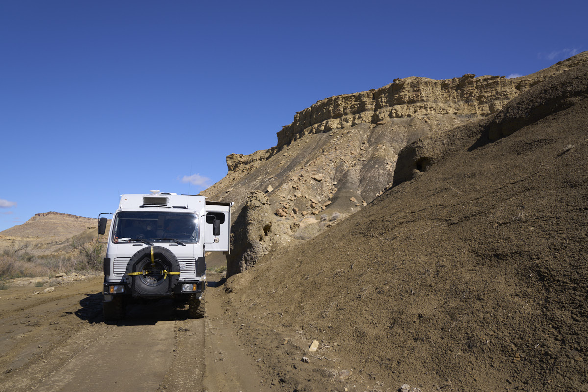
Our exit
from the canyon was a bit anti-climactic. We discussed
reducing air pressure, but knew that was always an option, so an
attempt with current pressure would save at least an hour of
airing down then airing up. Once we rolled, we rolled with
impunity. With low range, differential lock and 4x4 we
went up the grade with no issues. We continued on out to
highway US-89 and stopped to notify the sheriff of our
successful exit. We also texted the BLM guy with a similar
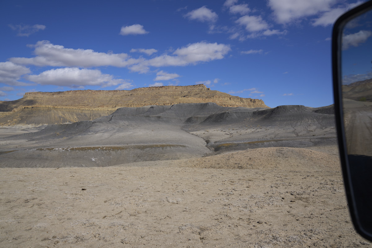
message. The dark gray formation in the photo above is the
evil Tropic Shale that had stopped our progress.
We
headed west on US-89 toward Kanab, UT and came upon significant
banks of snow on the south side of the highway. We
traveled until sundown and finally ended up in a parking lot in
Mesquite, NV. All the RV parks were full and we needed no
services, so a parking lot was fine. We had dinner at a
casino restaurant and it was great.
After a
pleasant night in Mesquite, we decided that breakfast out was a
good idea. The food was good, but the service time was
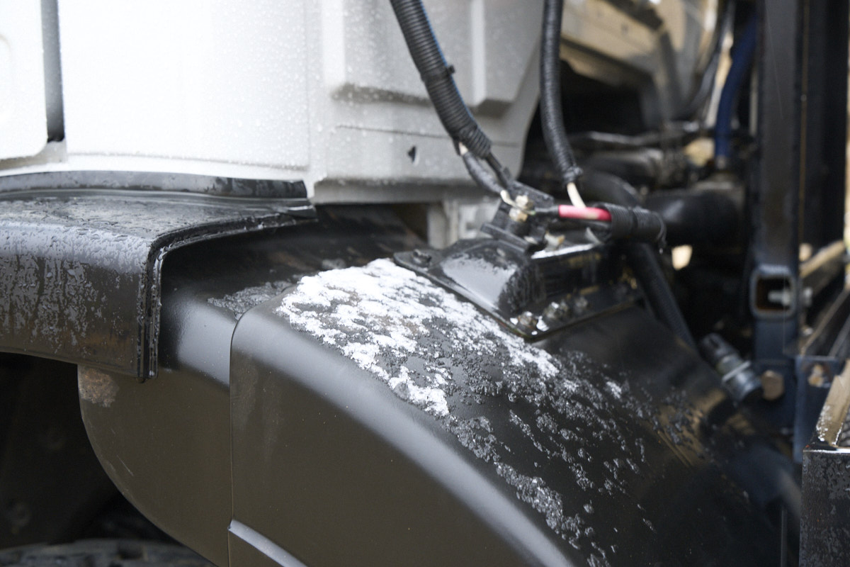
excessive. And, as a final insult, Thor had starting
issues. The starter stuck in the on position with the
motor running full blast and smoking from heat. We were
able to resolve the issue by disconnecting the battery and
attacking the starter motor with a breaker bar and a
hammer. The pounding was sufficient to reset the solenoid
and allow a normal start. After a hour of screwing around
with the starter, we headed to Las Vegas and then on toward
MogFest in Calico, our original destination for the previous
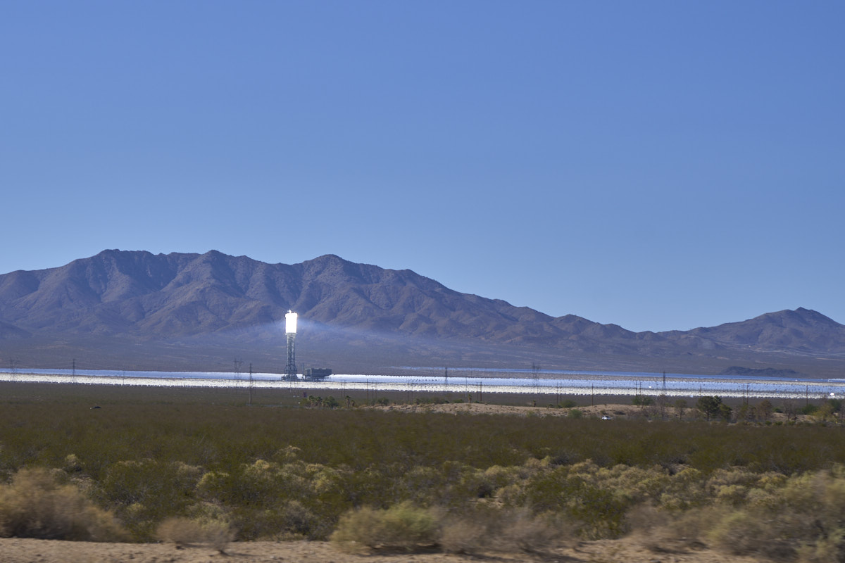
day. Along the way, we passed the Ivanpah Thermal Solar
Plant.
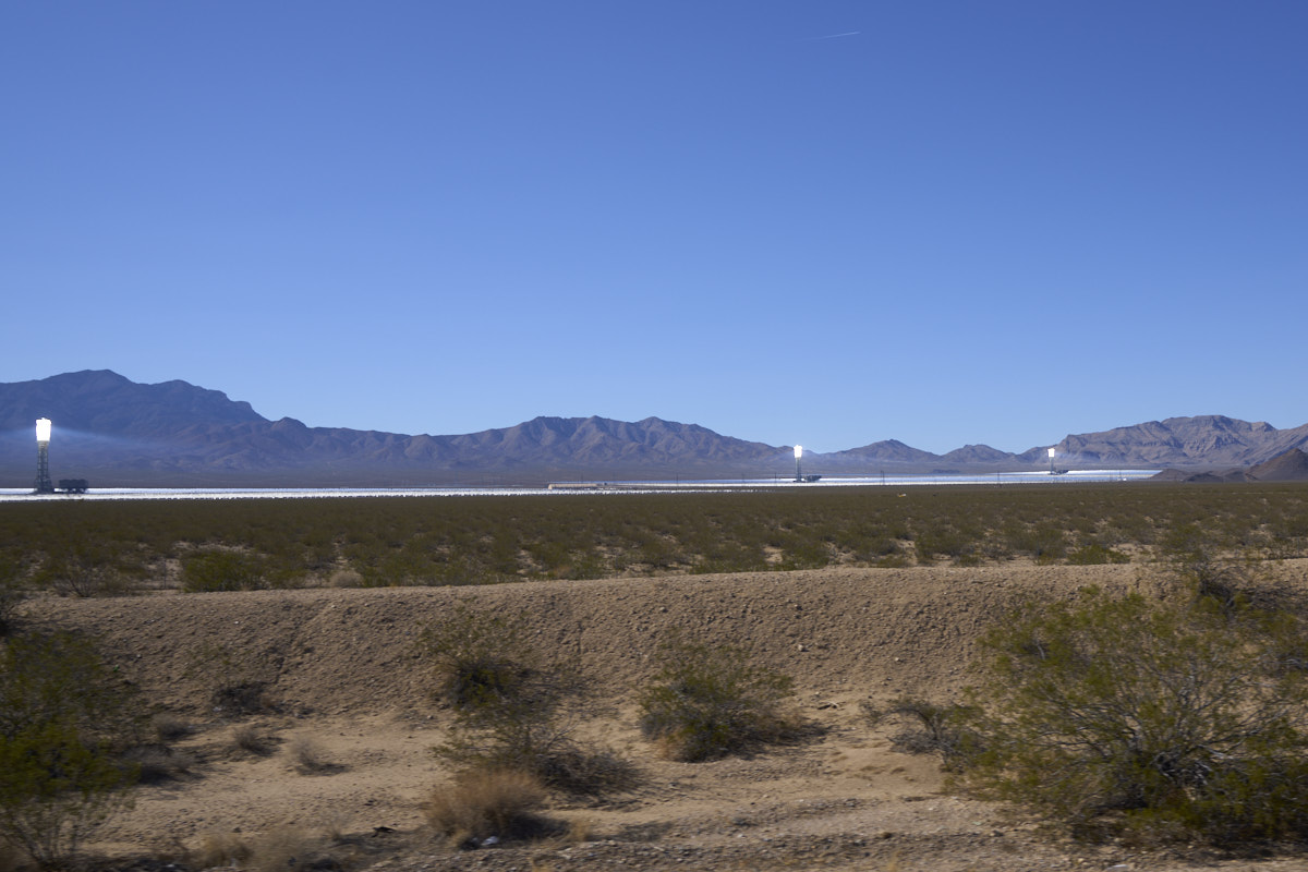
The
towers collect reflected sunlight from the acres of steerable
mirrors and converts the heat into steam for turbines.
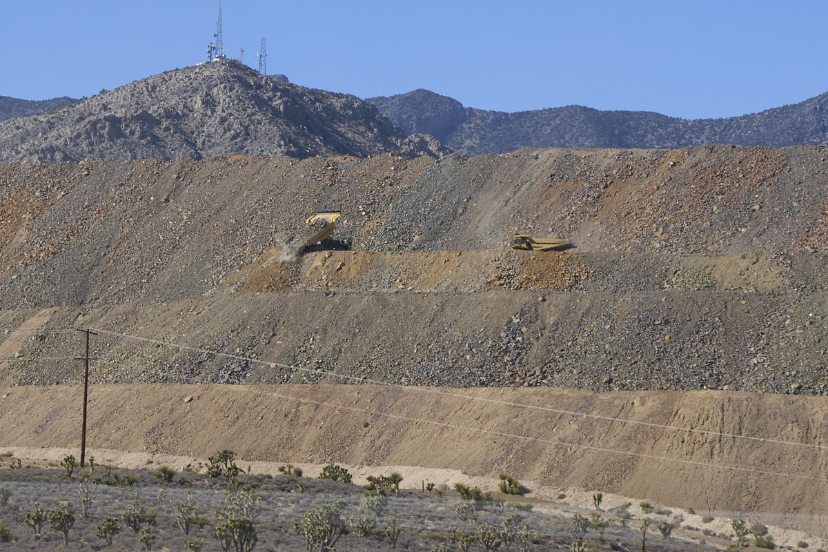
Further
west we passed trucks working at the Mountain Pass Mine.
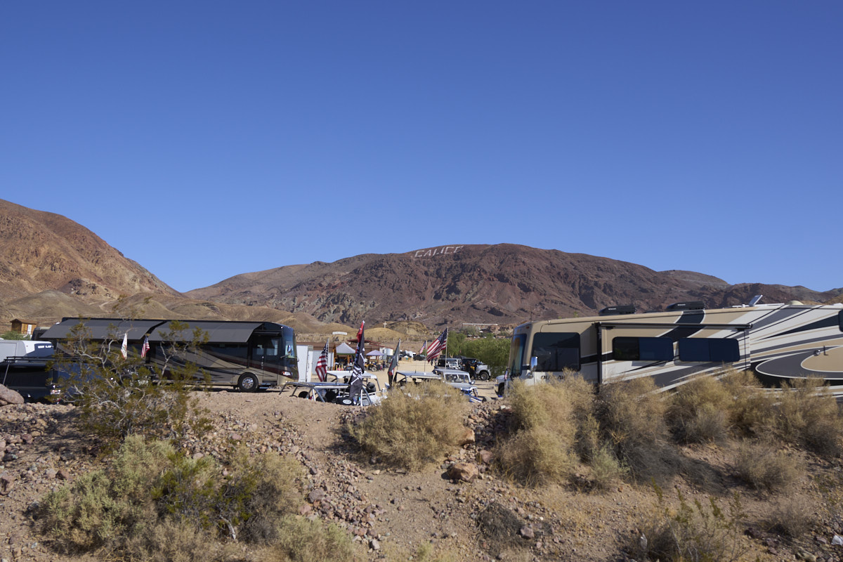
Quite a
long trip for the day, but we finally arrived at Calico on
Thursday night. We were still a bit worried about the
starter motor issue and we also discovered that one of the
enhancements we had added to Thor had failed as well. One
of our hydraulic locks for the rear stabilizers had locked,
fortunately in the up position.
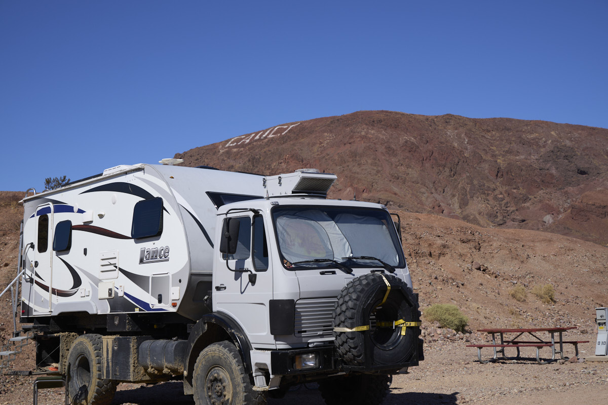
Other
campers started arriving later in the day, but our campsite was
not on the main path so we missed seeing most of them.
Kathleen
and I had been on the road for about 4 months and we were kind
burned out. We decided not to go on a trail run, but stay
in camp. Unlike Cottonwood Canyon, Calico was sunny and
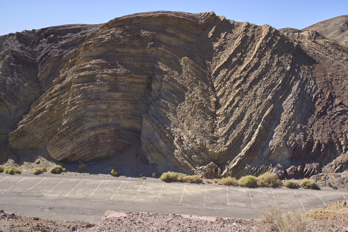
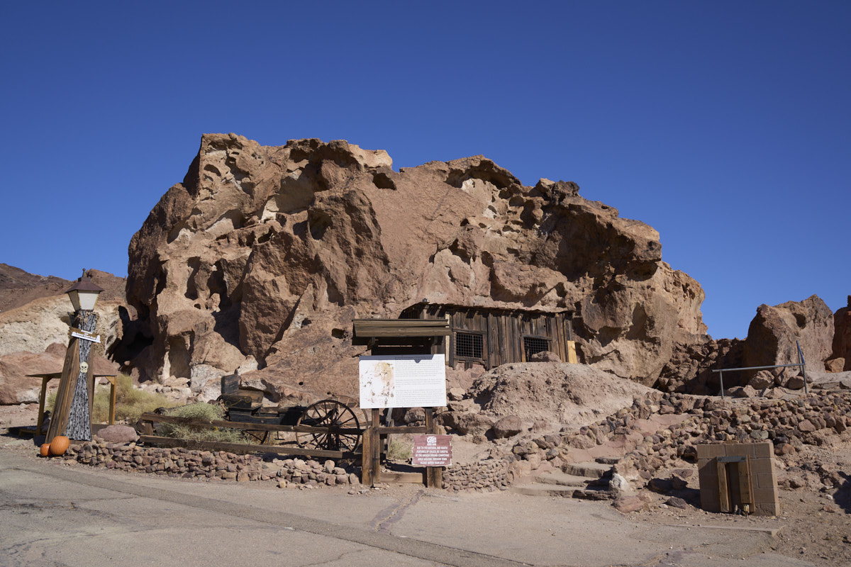
hot. Later in the afternoon, we hiked up to Calico Ghost
Town to take in the sights. From one of the overlooks we
could see the intense folding of the local strata.
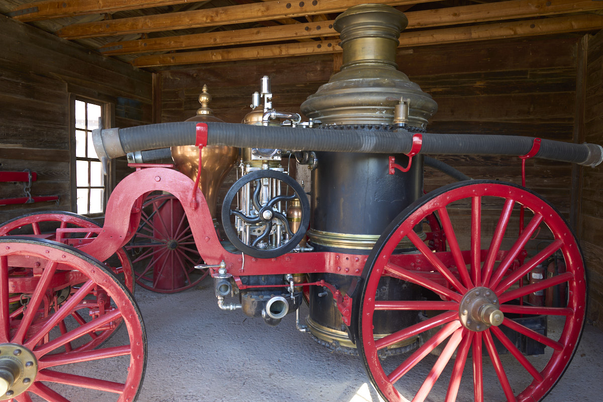
The ghost town had
plenty of artifacts including this steam-powered fire pump.
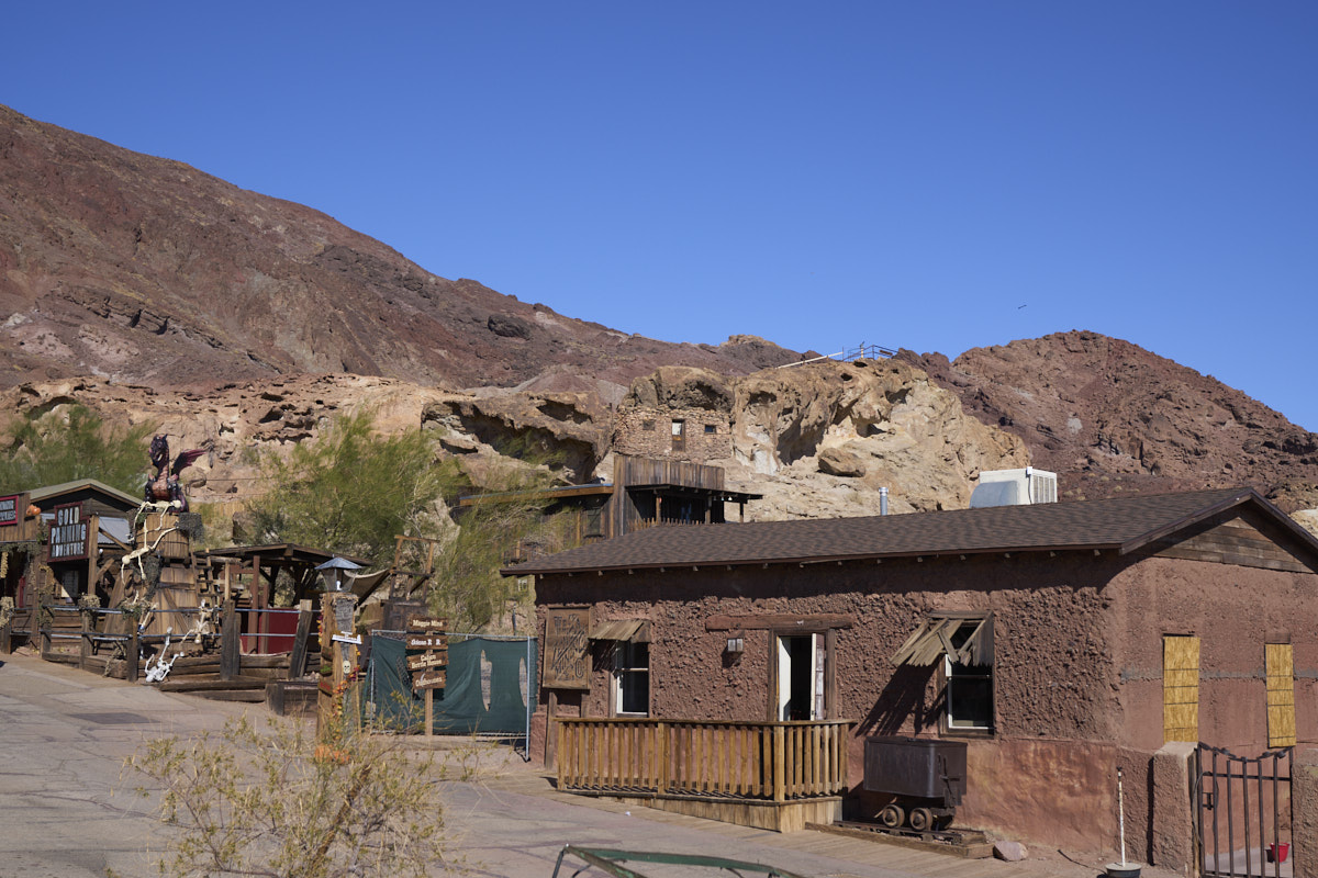
The story here is not
the old buildings but rather the eroded volcanic strata behind
the buildings.
The trip back to San Diego was filled with close-calls on the freeway. I am amazed at how clueless folks are when they drive. Happily, none of the close calls resulted in an "event".
| Previous Adventure | ||
| Trip Home Page |
Photos and Text Copyright Bill Caid 2021, all rights
reserved.
For your enjoyment only, not for commercial use.