Kingston
Lake was a reasonable campsite. It was starting to get
cold at night, but we had extra blankets. Next morning,
our mission was to make it to Copper Harbor and check out the
sights.
The photos below are what we saw.
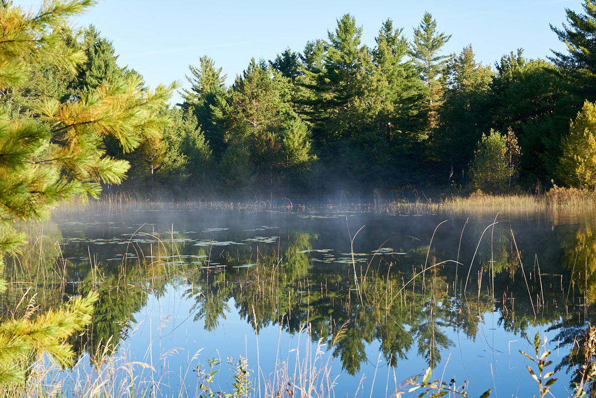
Our
campsite was right next to Kingston Lake. This small lake
was calm in the early morning providing a mirror-like surface.
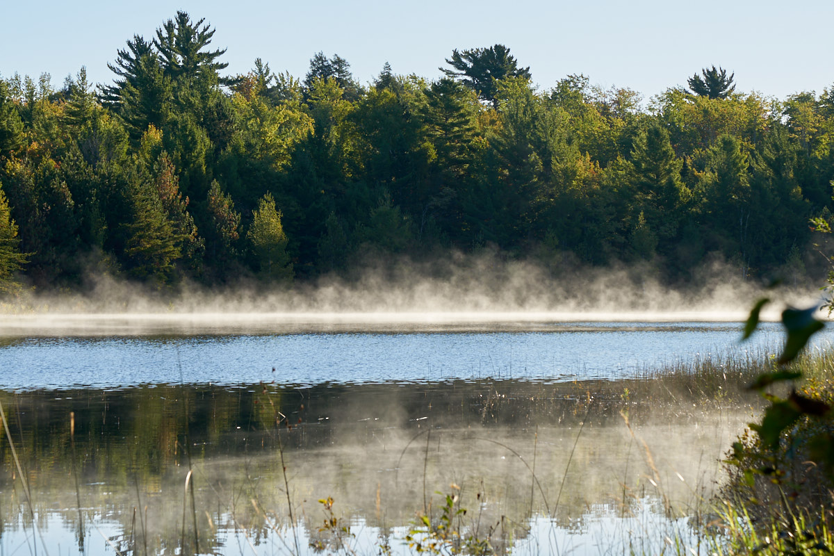
The cold
morning air produced steam on the warmer waters of the lake.
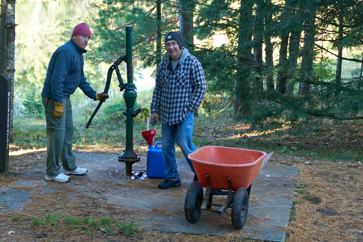
Kingston
Lake had water delivery the old fashion way: hand pump.
These fellows had totally different reactions to Thor as we left
the lake. Note the look of shock-and-awe on the face of
the fellow pumping the water.
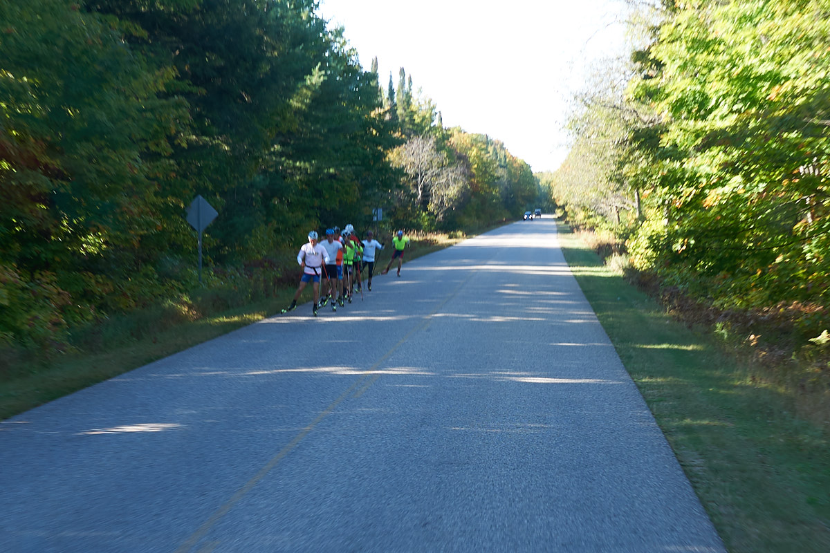
South of
Kingston on the county road we encountered the ski team from the
local college doing early season training on roller skis.
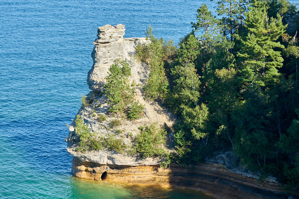
This area
of the Upper Peninsula has many mines. This structure is
called "Miner's Castle" and is a small outcropping on the southern
shores of Lake Superior in an area known as Pictured Rocks.
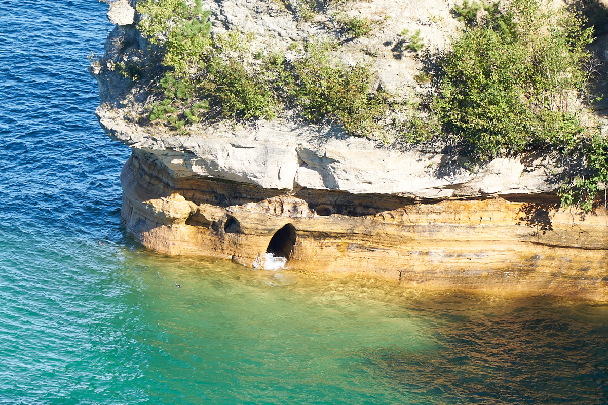
At the
base of Miner's Castle is a small through-hole that has been cut
my the relentless wave action. Over time, this will expand
to a full arch and then will cause the collapse of the Castle.
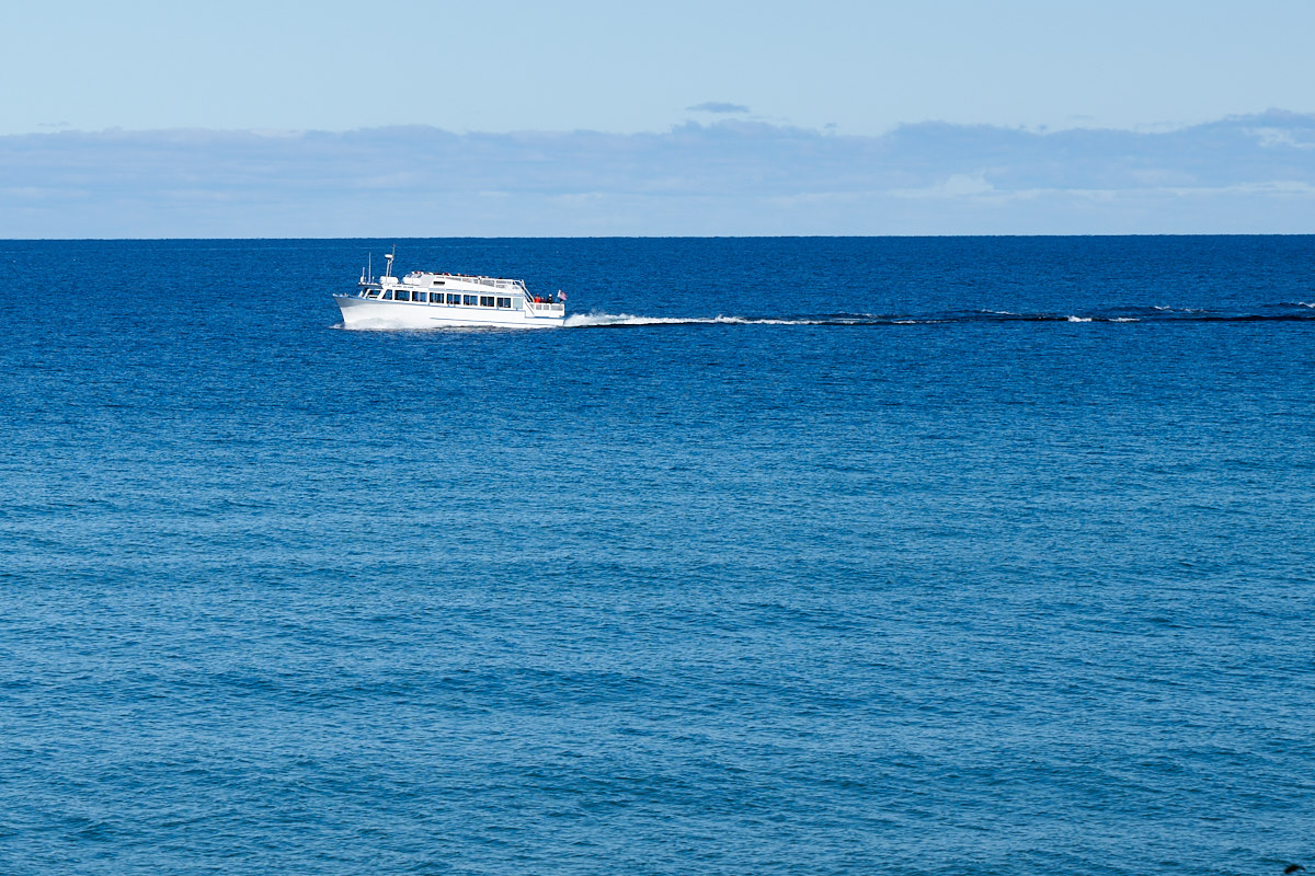
Pictured
Rocks is a large tourist draw and most of the rocks are only
visible from a tour boat. The small town of Munising
offers plenty of tour boats including this tour.
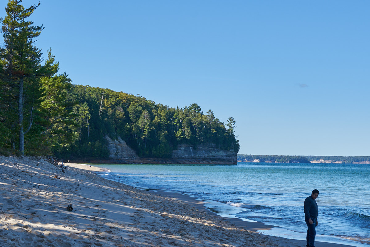
From the
castle, we drove to Miner's Beach which is an actual sand beach
(as opposed to the cobbles that are typical of this area).
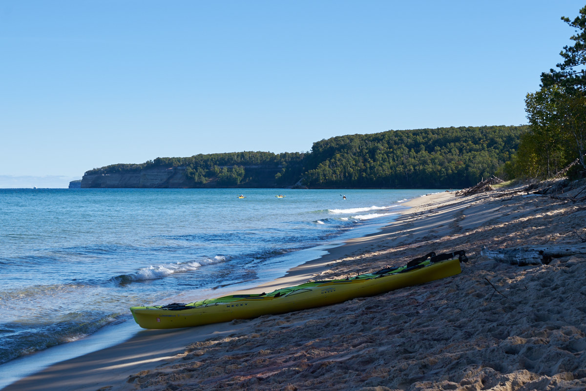
In
addition to tour boats, kayak tours are available for those not
afraid to get cold and wet. Due to the potential wave
height, sea kayaks are required for operation on the lakes.
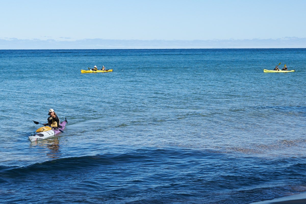
This
guide is bringing his group back to shore. He spotted me
with the camera and gave me the thumbs up. At least I
think it is a thumb.
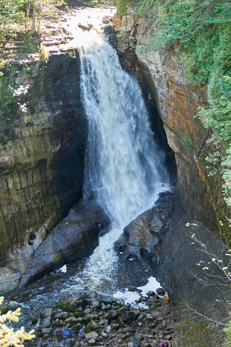
We took
the one mile trail to the not-suprisingly-named Miner's
Falls. This was a pretty good-sized creek that dumped over
the cliffs into Lake Michigan.
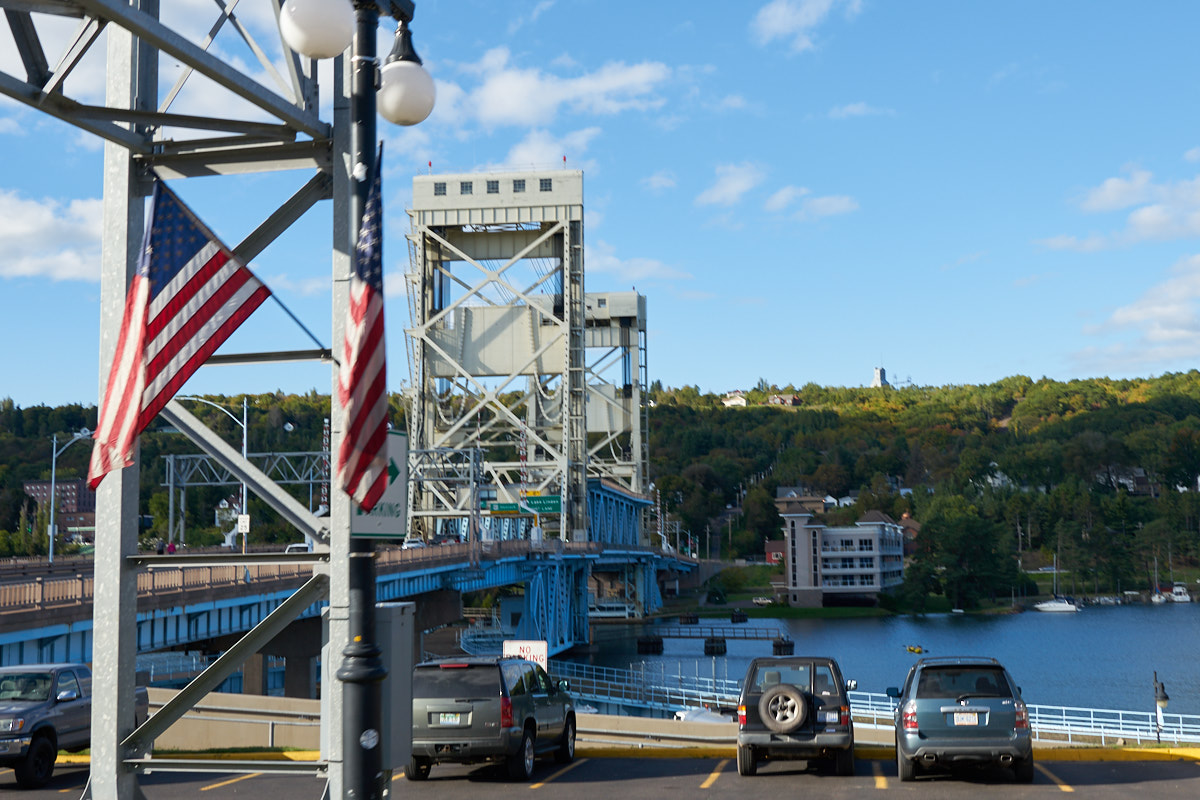
At
Houghton we came upon this lifting bridge to accommodate the large
ships in the area.
Our
destination for the night was the Michigan State Park at Copper
Harbor. The park is at the end of the Keweenaw Peninsula
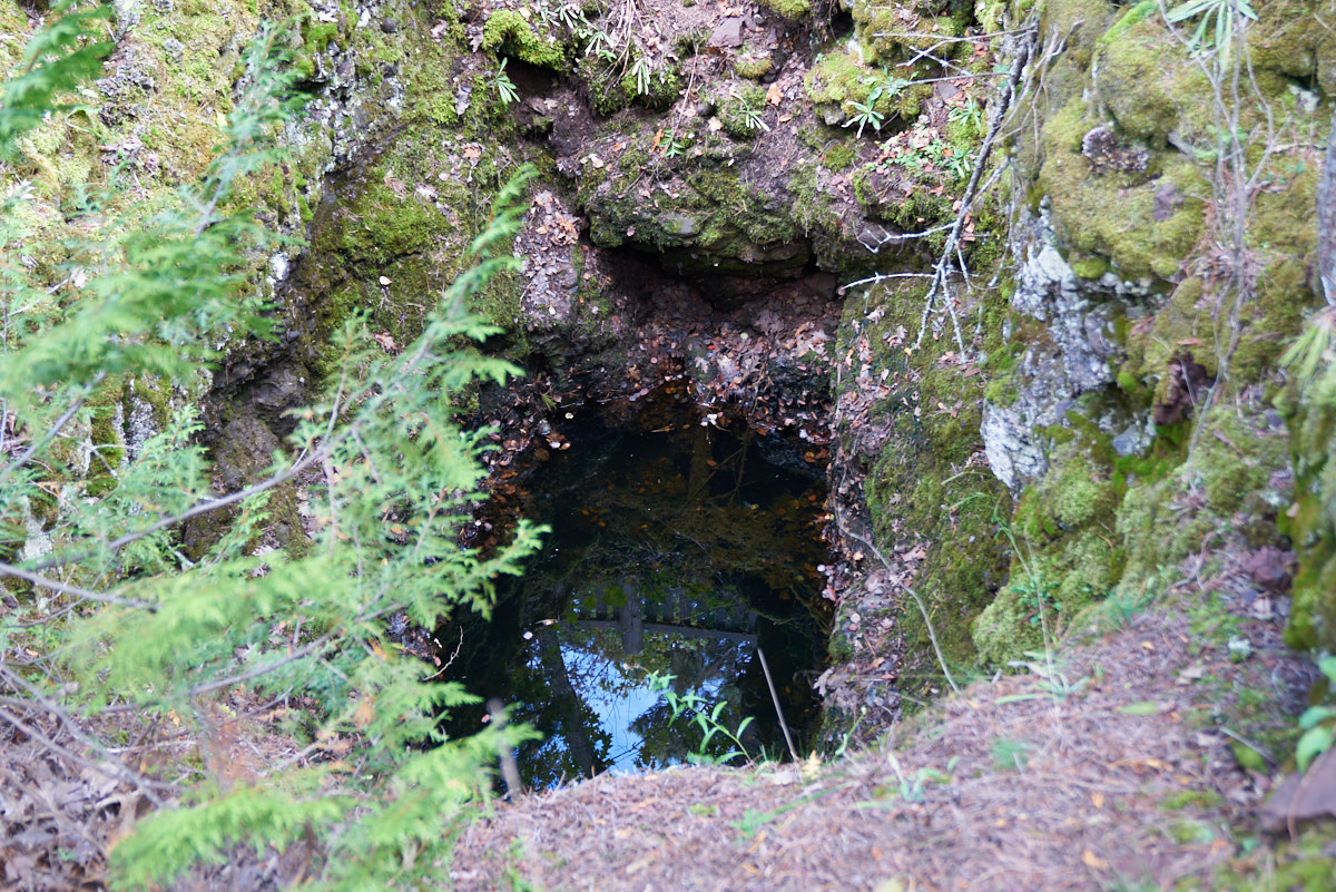
and is right next to Fort Walton. At the fort, we came
upon this mine that was filled with water. This was the
first active copper mine in the area with the fort being built
to keep the locals in line during the frenetic land rush that
came with the discovery of the metal. The shaft is only 40
feet deep, but it did produce a substantial amount of copper
before the vein ran dry.
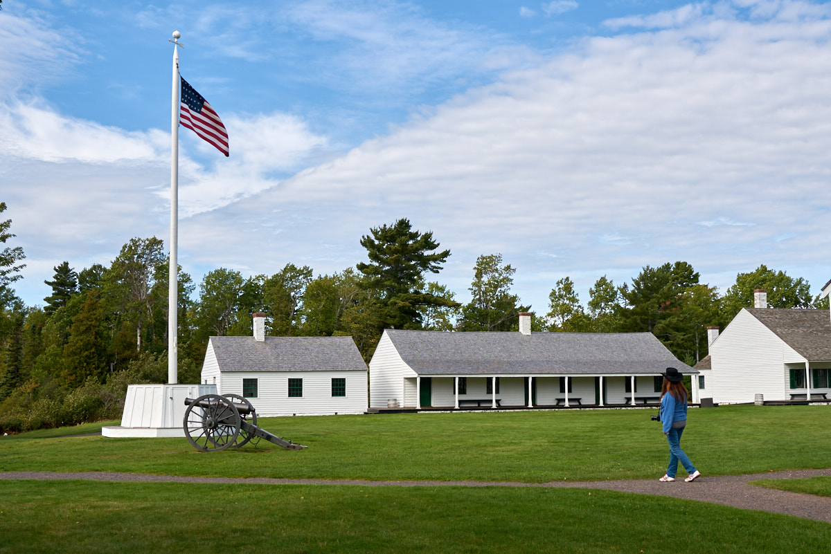
Being
Sunday morning, the fort was essentially deserted.
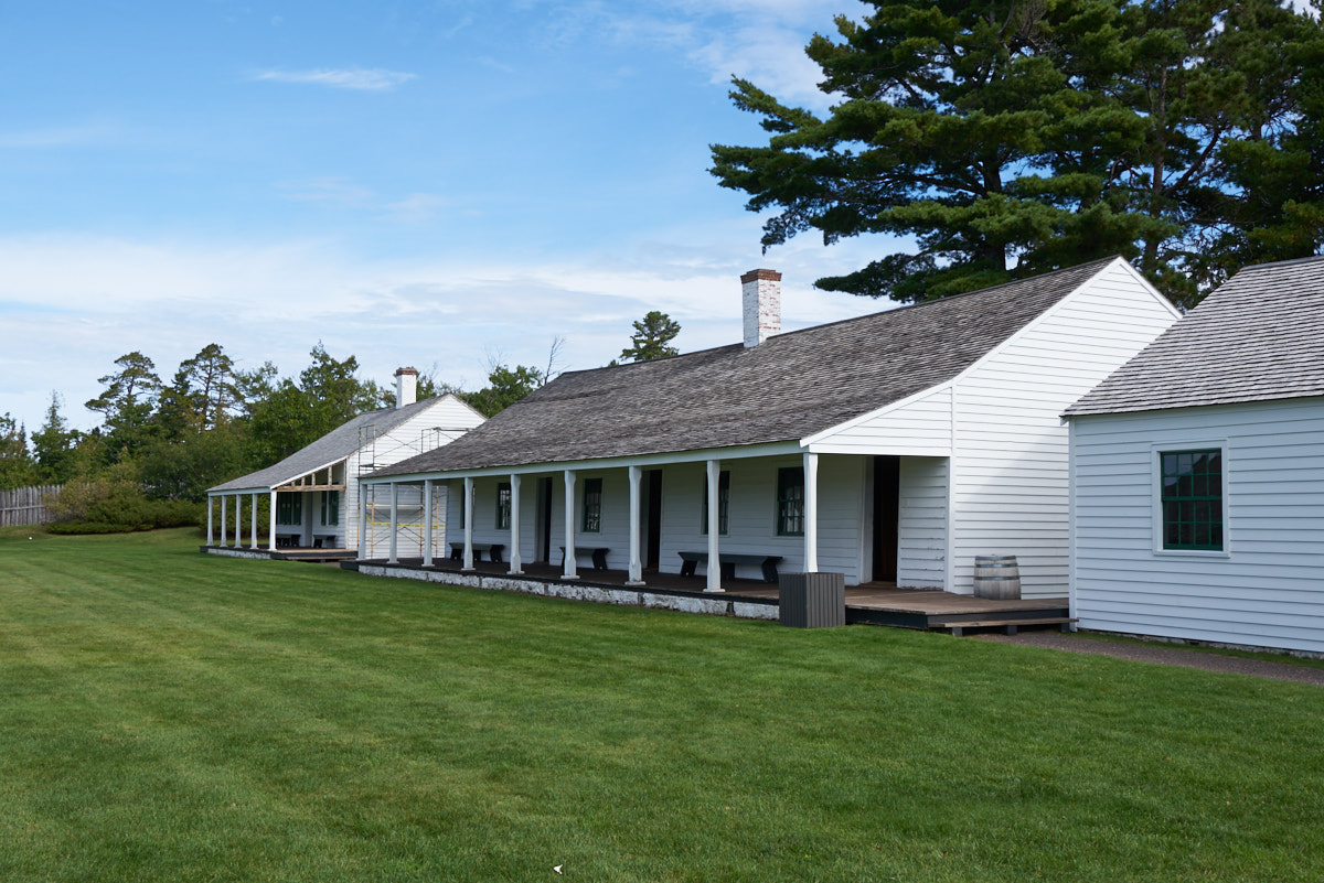
The fort
has been nicely restored and has exhibits in most of the
buildings. After being constructed, the fort was only used
for a few years before being abandoned.
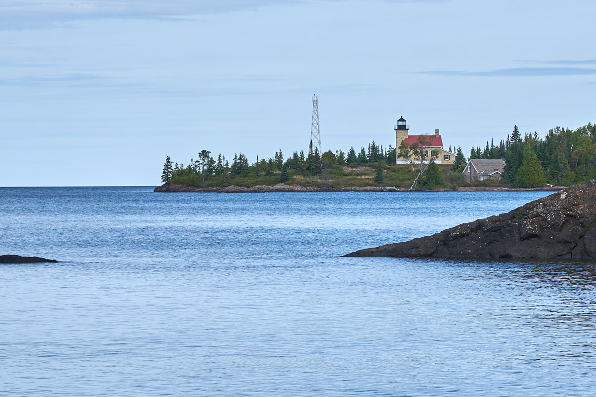
The
lighthouse at Copper Harbor was closed for the season so we had
to settle for seeing it at a distance.
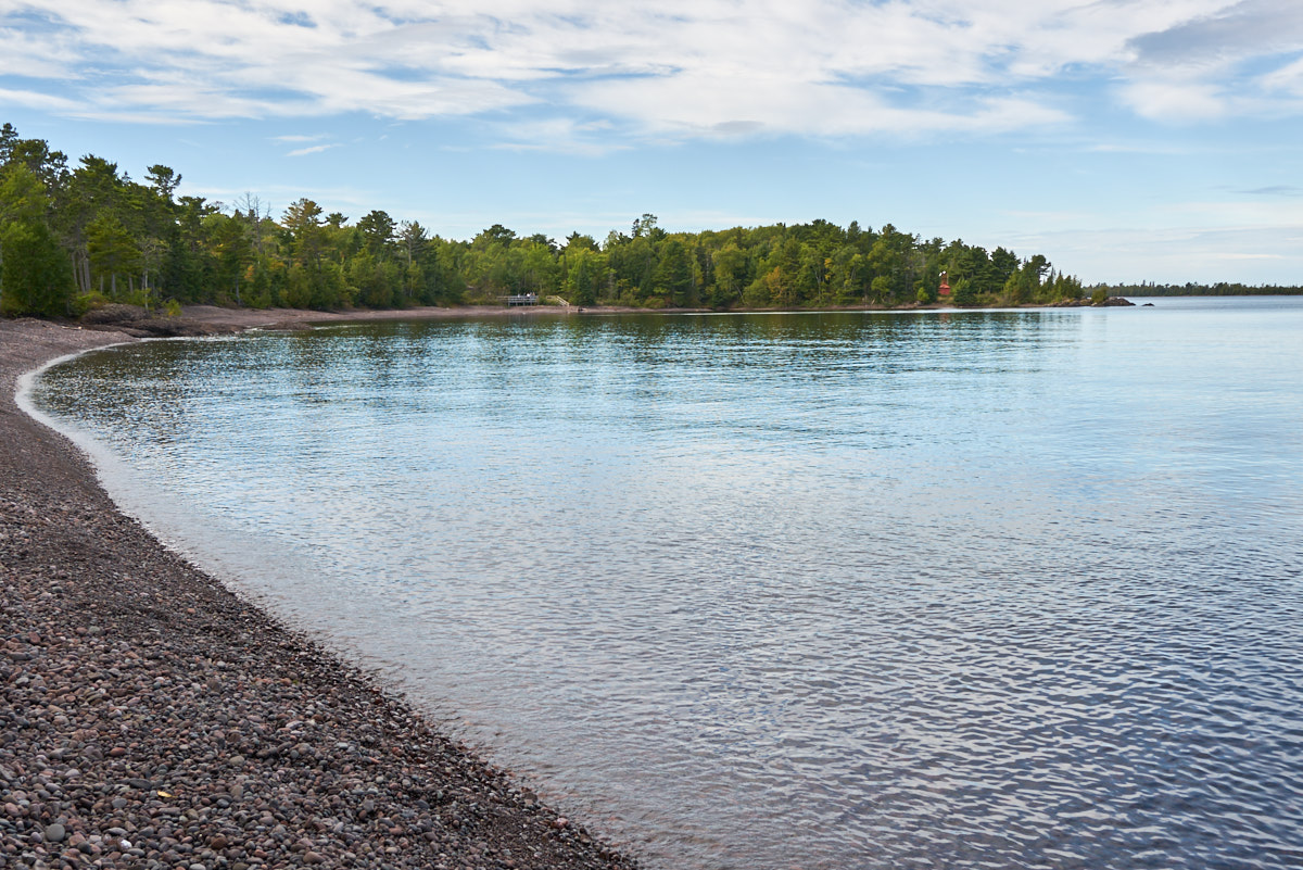
The
cobbles in the photo above are more typical of the beaches in
this area.
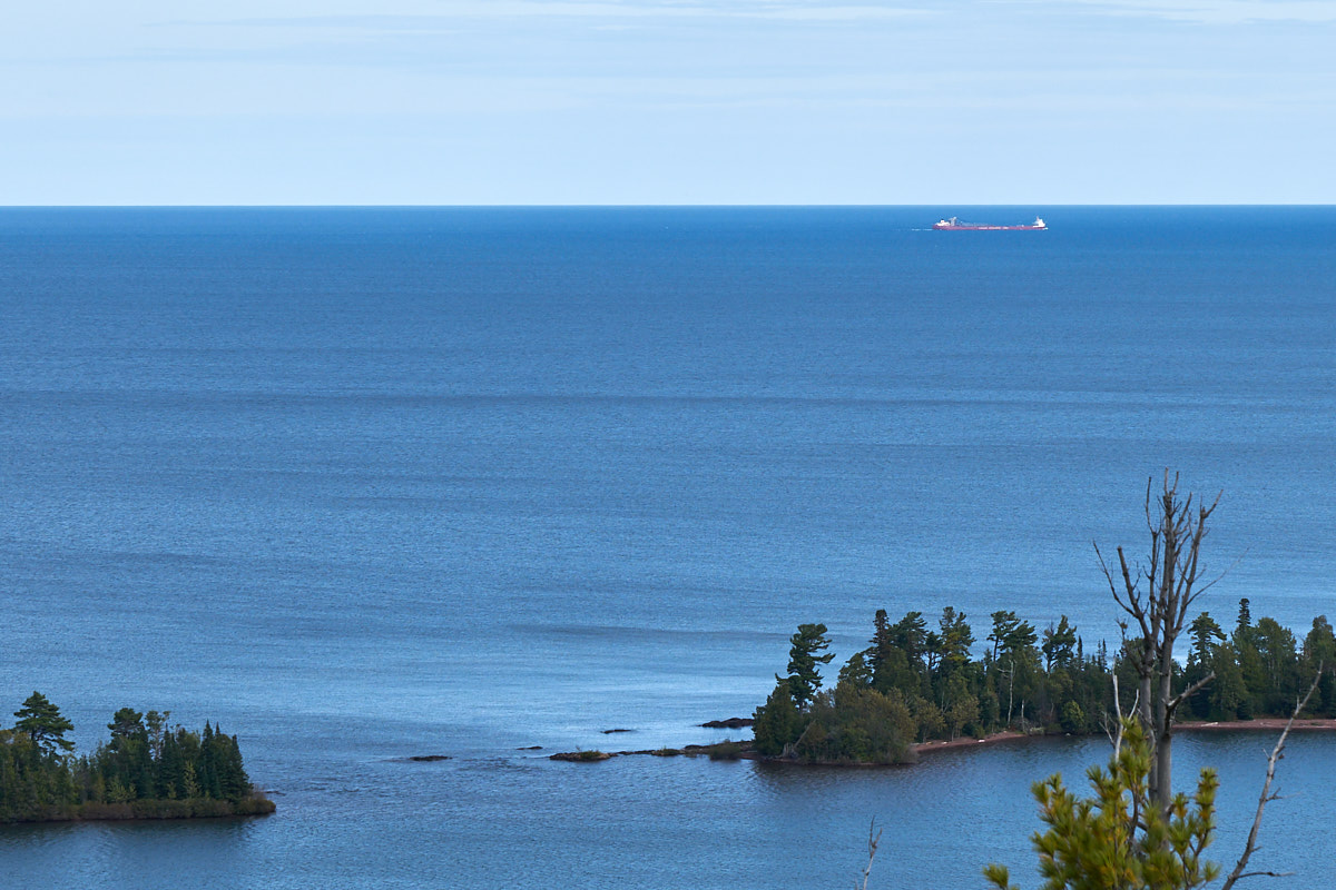
We took
the scenic road that ascended the cliffs onto a high ridge that
provided a sweeping view of the harbor and Lake Superior.
In the distance we could see a freighter hauling cargo to the
east.
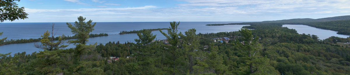
The
access to Copper Harbor is dangerous due to submerged rocks.
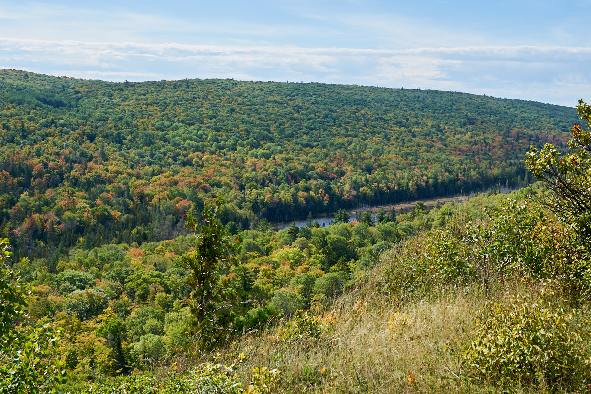
To the
south we could see the trees starting to turn colors for the
fall. The locals told us that the turning was delayed by a
"heat wave" in the recent weeks. Normally, the change is
complete by the end of September.
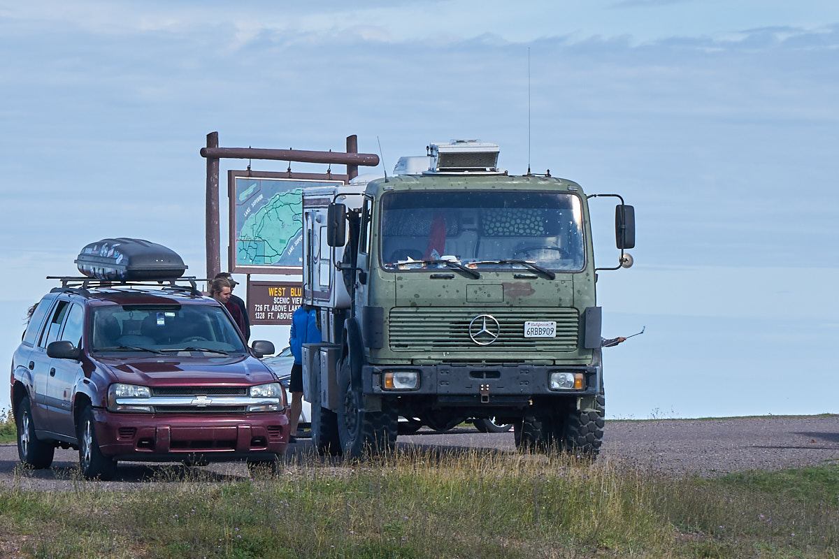
All Hail
Thor! The group of guys gawking at Thor caused us to
laugh. Note the gal with the selfie-stick on the driver's
side.
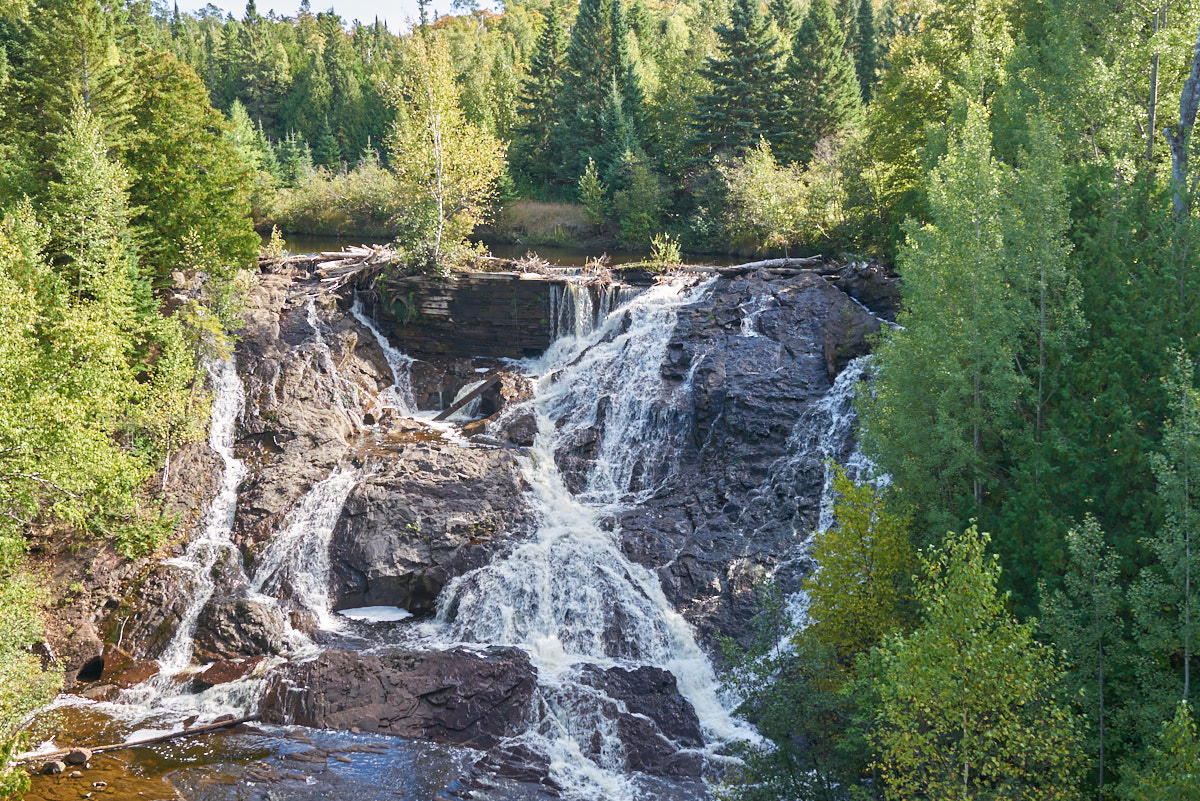
The road
passed the falls on the Eagle River. This view point was
provided by the old highway bridge that has been decommissioned
for vehicle use.
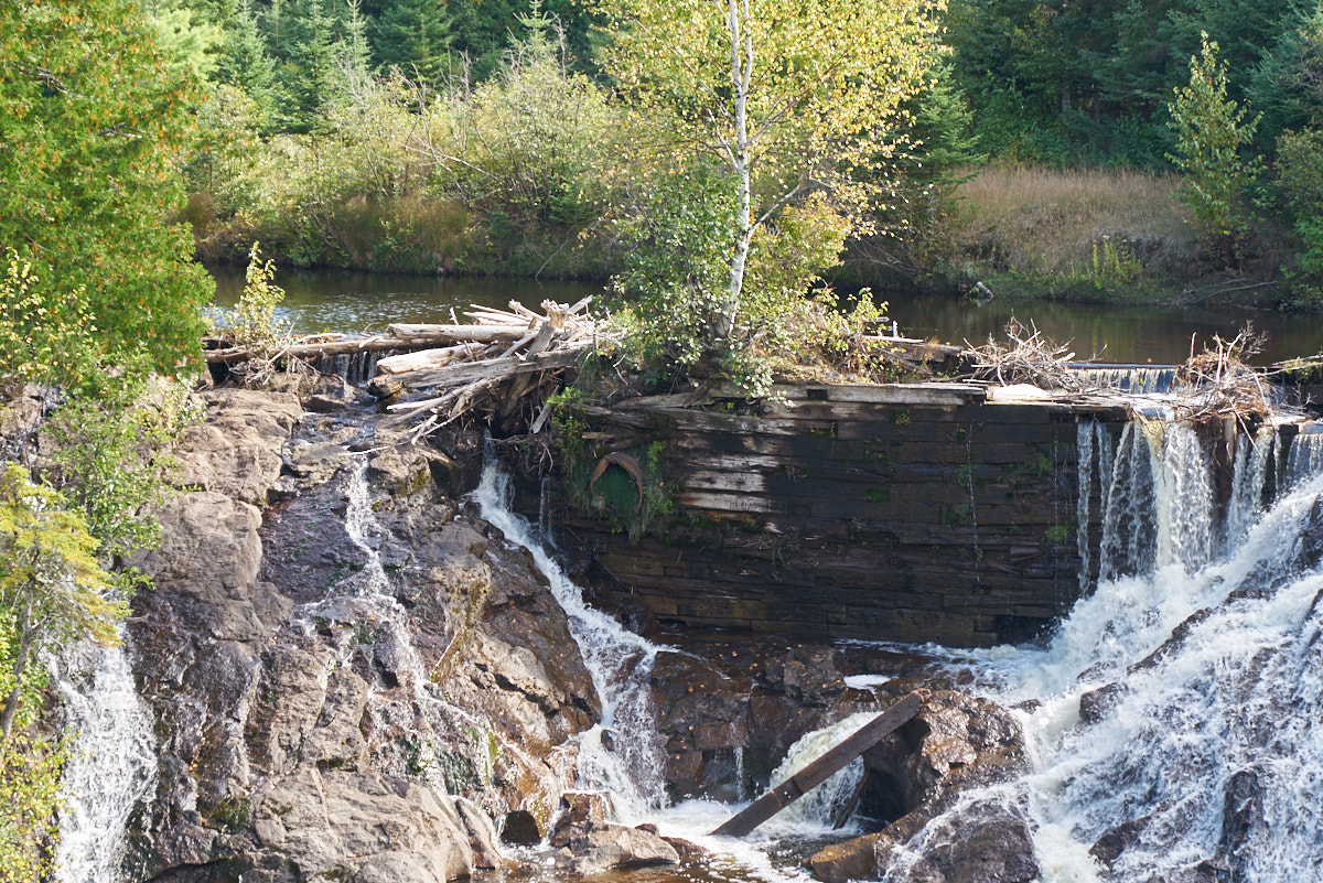
Many
years previous, some locals added this wooden dam to the
river. But the dam is disintegrating and will soon fail.
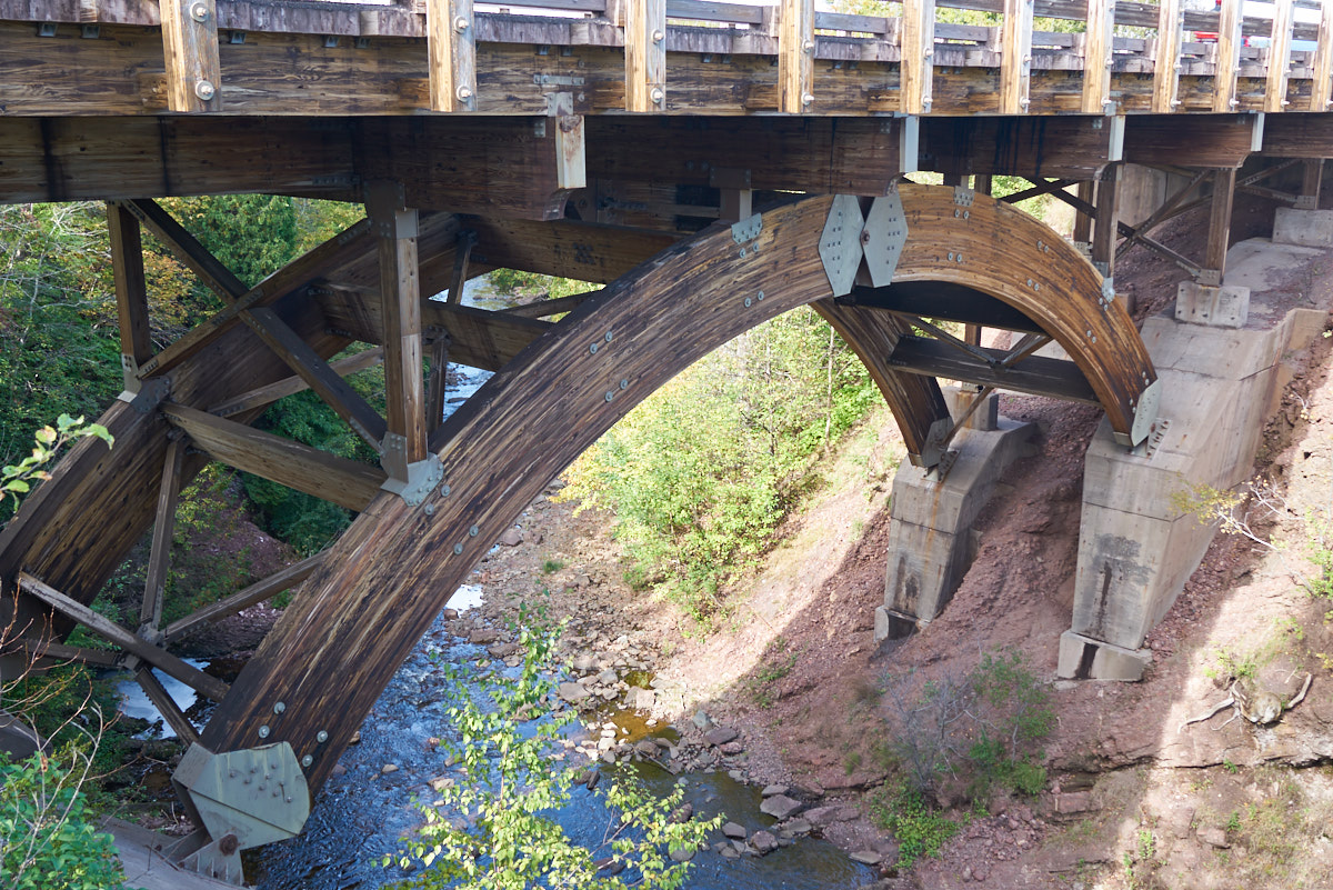
The new
highway bridge is made of glued wood with steel fittings.
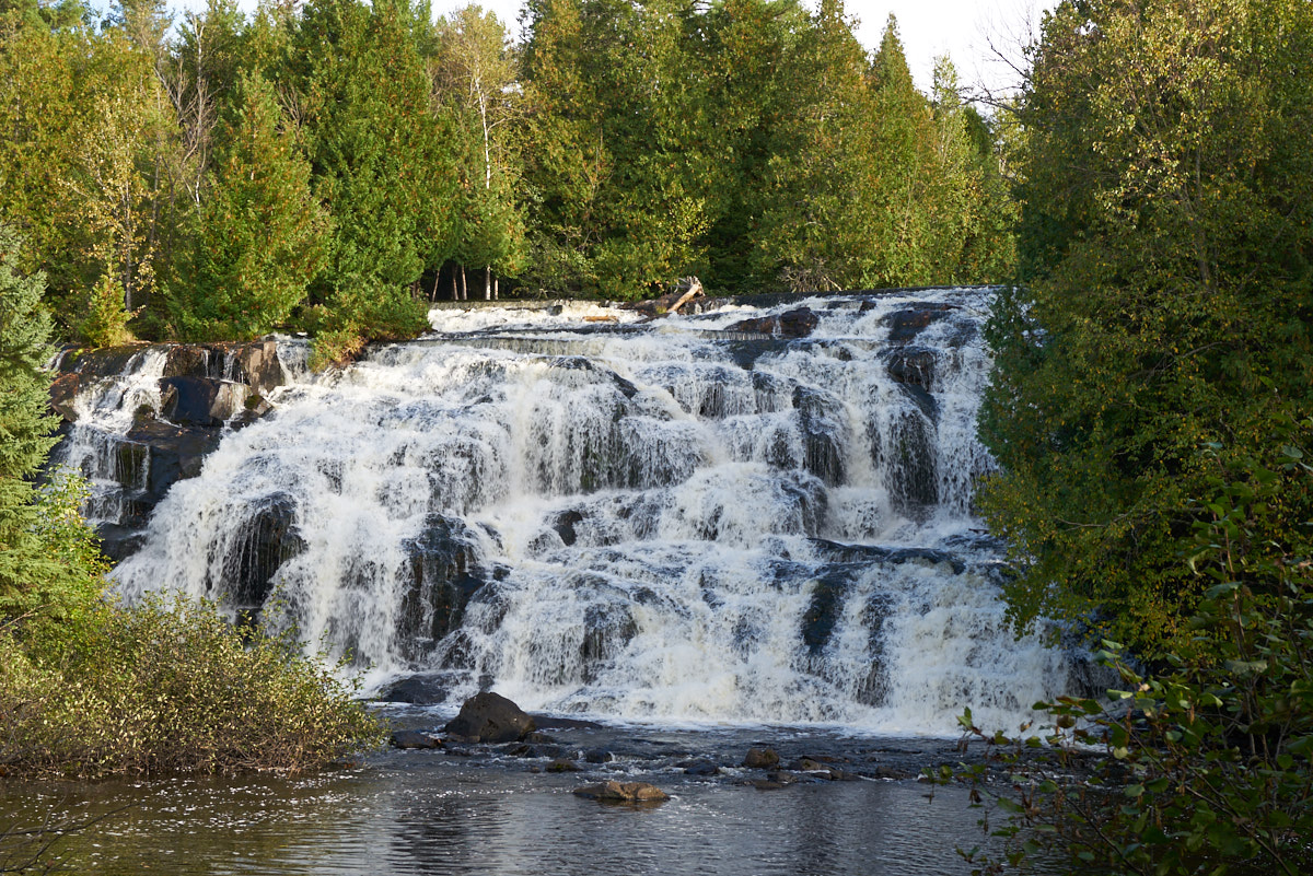
Our path south took
us past Bond Falls. This is only part of the falls.
To get the "creamy"
water effect I had to brace the camera and slow the shutter to
0.1 seconds at ISO 50 and f/16. The late afternoon
shadows made the light a bit flat.
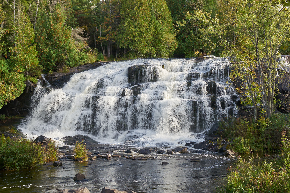
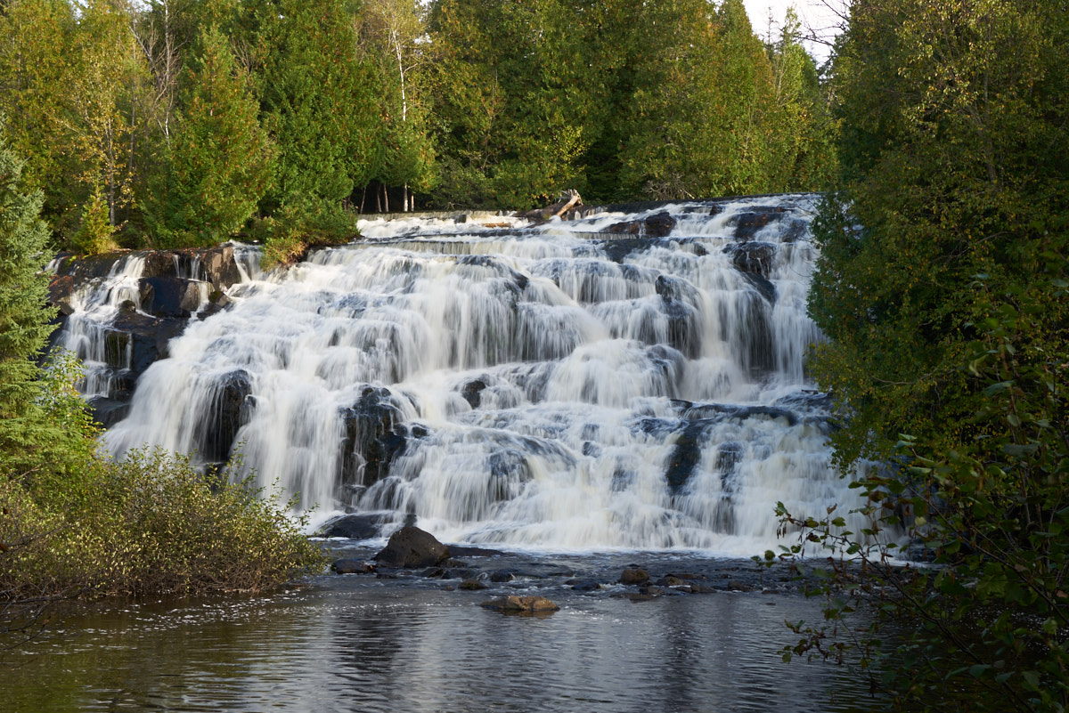
The other section of
Bond Falls looked similar.
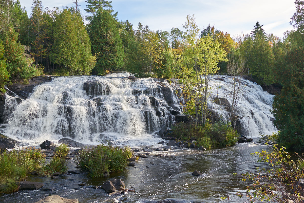
The far viewpoint
allowed getting the entire falls in the same photo. This
is a very nice place.
Bond Falls had camping so we decided to stay there. It rained again, but not so much as to cause an inconvenience. Tomorrow, we continue south then east on the UP back to the Mackinaw Bridge.
| Previous Adventure | ||
| Trip Home Page |
Photos and Text Copyright Bill Caid 2017, all rights
reserved.
For your enjoyment only, not for commercial use.