It was
a cold, windy and rainy night at Wilderness Park. When we
chose our campsite, we chose an area that was less
populated. We discovered, that despite it being a state
park and charging $9 for an entrance pass and another $28 for
camping that the restrooms/showers were closed for "an
electrical problem". So, essentially we paid for services
but discovered after setting up that no services were available,
somewhat of a rip-off in my opinion. But still, we soldiered
on.
The photos below are what we saw.
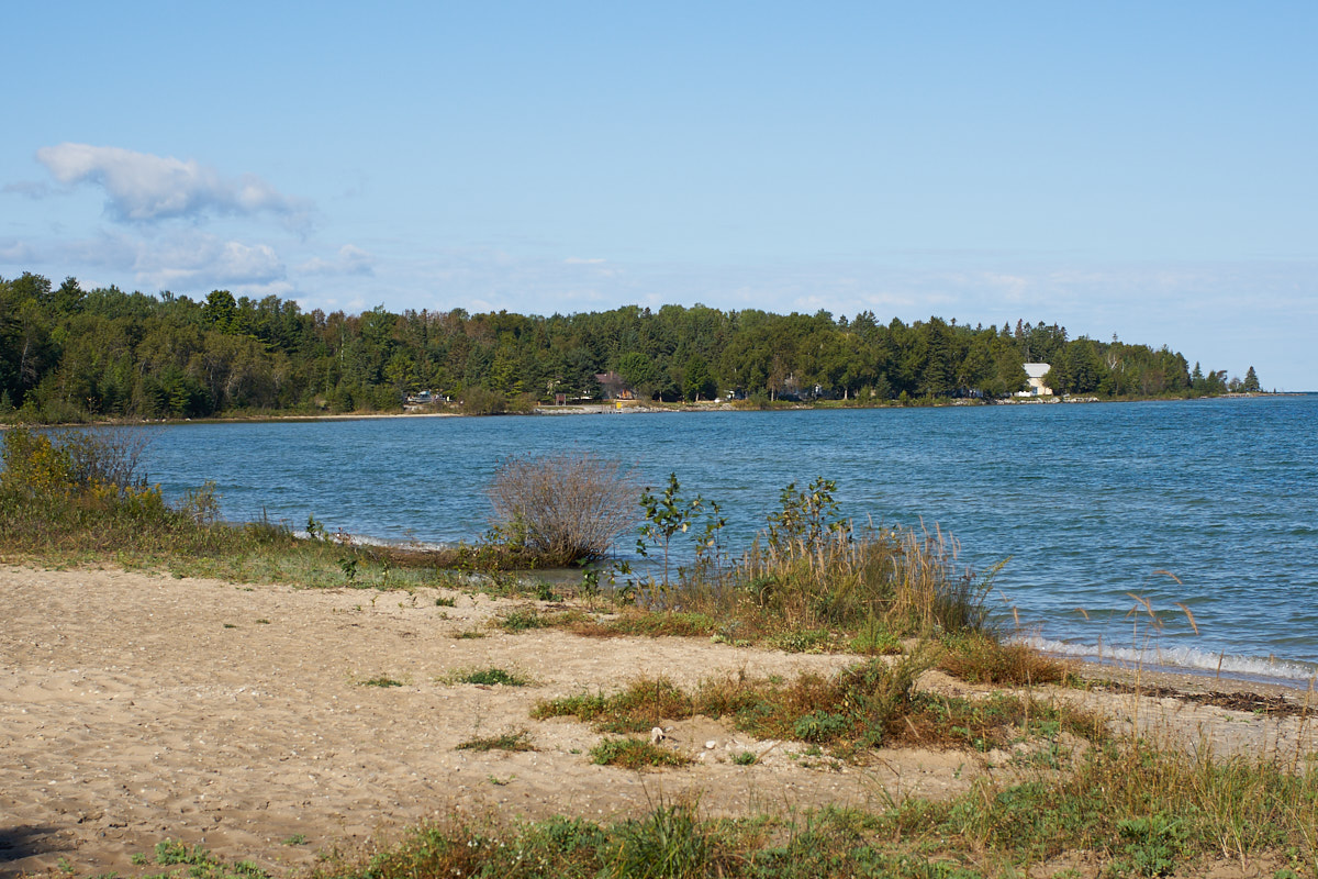
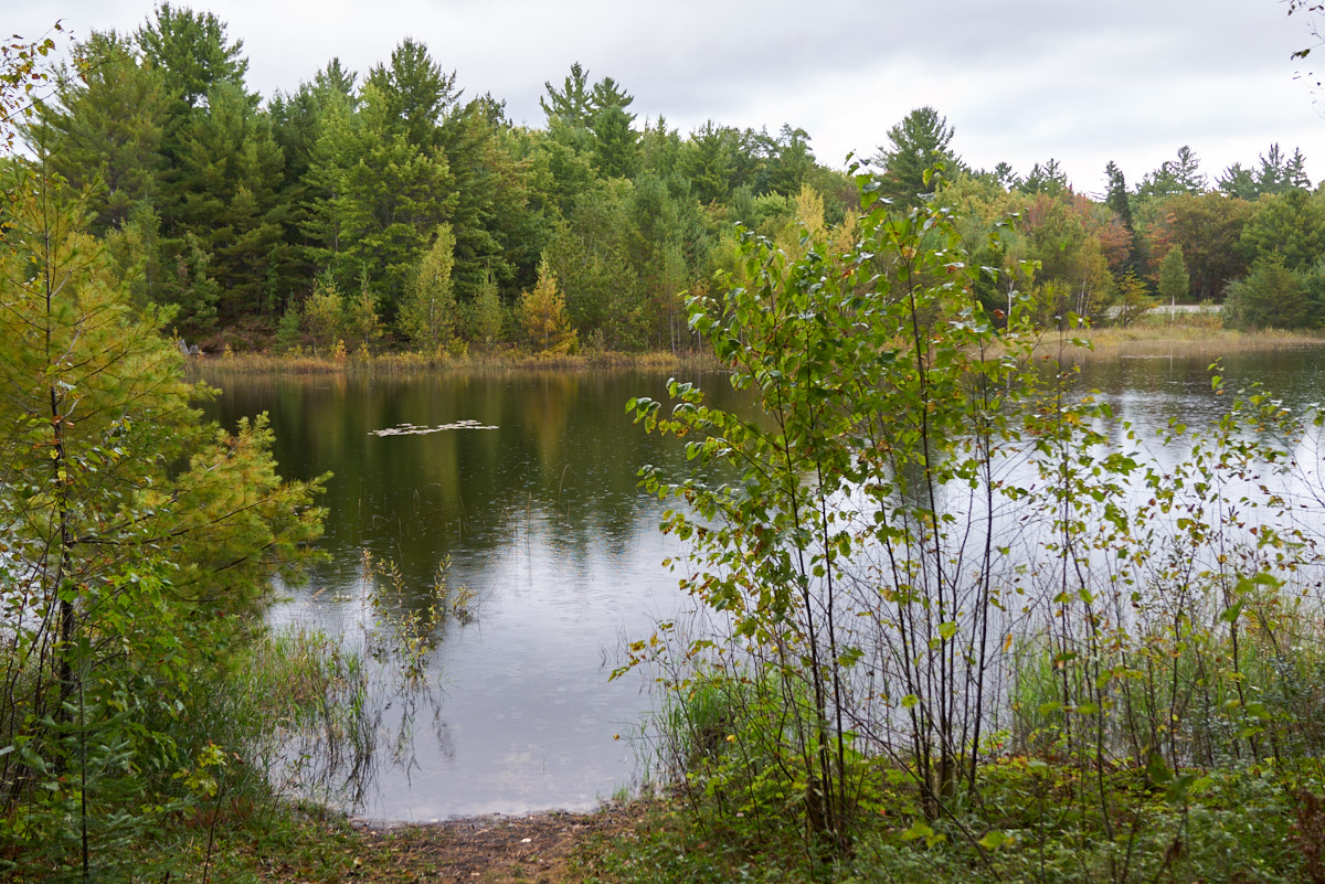
After a
windy and rainy night the dawn broke calm. Once the wind
abated, the lake returned to its placid state. The bay
that the evening before was covered with white caps was now calm
as a Hindu cow.
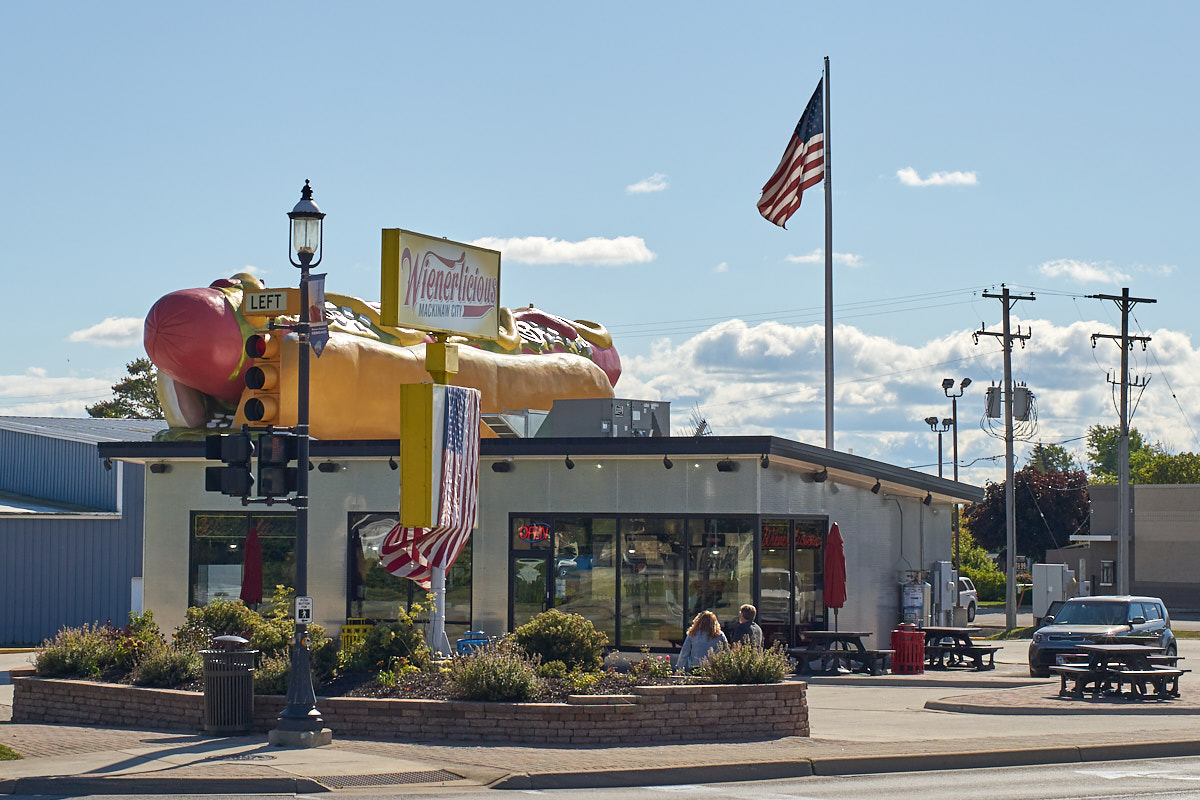
We
traveled east to Mackinaw City and spotted this bit of
Americana. The Weinerlicious spent a ton of money on its
signage.
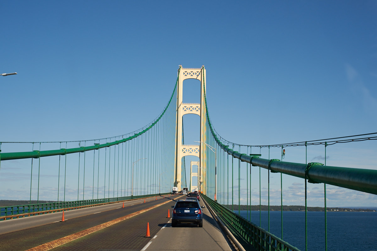
Our
route to the Upper Peninsula of Michigan took us over the
Mackinaw Straights Bridge. This is a huge bridge that is
over 5 miles in length. Oh, and a $10 toll.
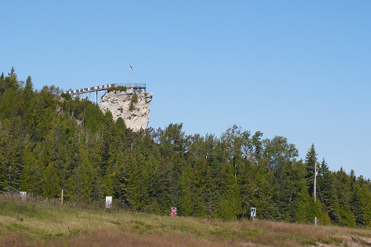
And
speaking of Americana, only a very optimistic businessman would
build a stairway to the top of a rock outcropping and hope
customers will pay. That said, this was the
highest point for miles around and did have a view of the bridge.
But, no takers when we passed by.
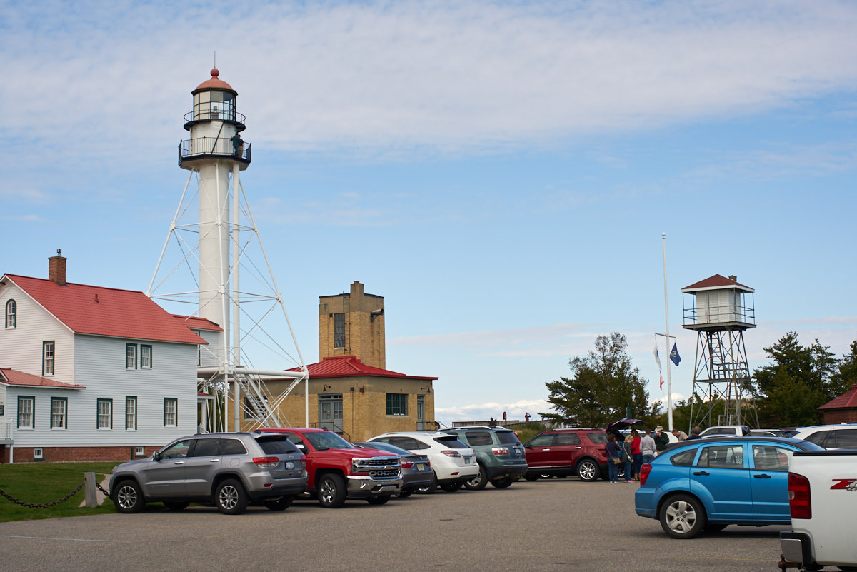
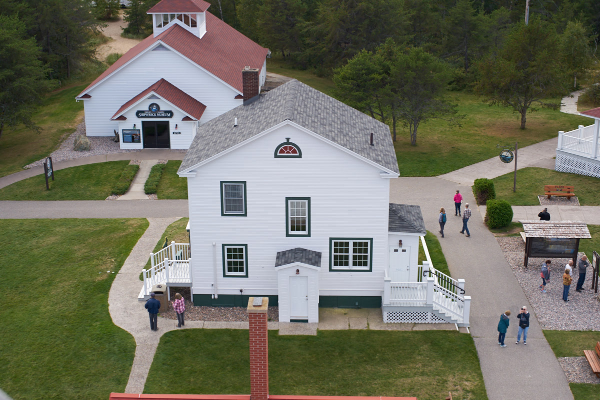
We traveled north all the way across the Upper Peninsula to Whitefish Point and the Great Lakes Shipwreck Museum. The museum is located on the Whitefish Point Lighthouse Station. Visible in the photo above is the museum building, the lighthouse, the fog horn and the lookout. The lighthouse tower was constructed around 1850 and is made of cast iron. The claim was that this was the only design that could withstand the huge waves that crash ashore during large winter storms.
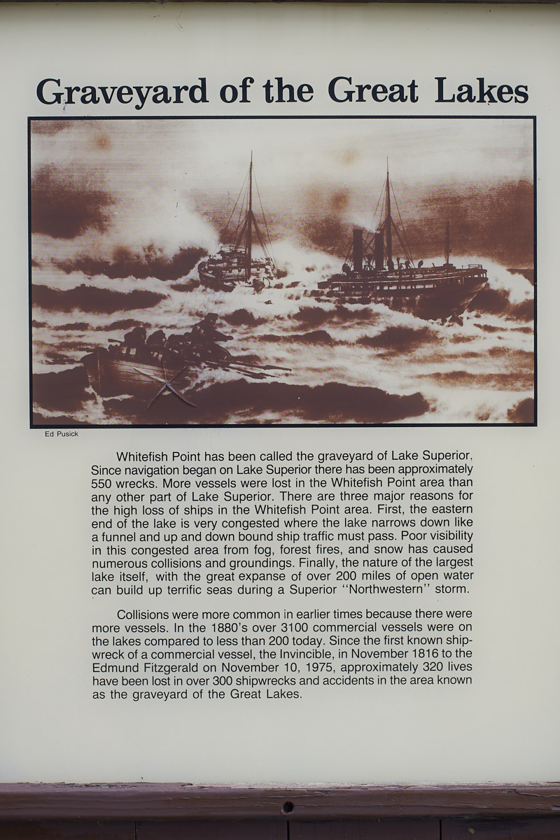
A plaque
tells the story of the area's macabre history.
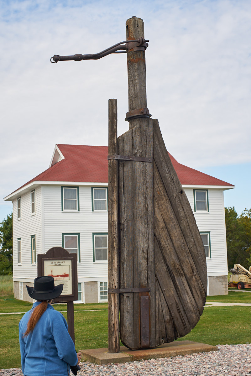
This
large wooden rudder was on a monument in the open area.
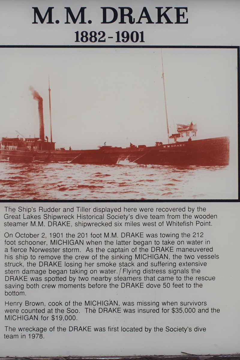
The museum has a long history of diving to shipwrecks in the area and recovering artifacts. The above reference to "the Soo" means the Soo Locks at Sault Ste. Marie.
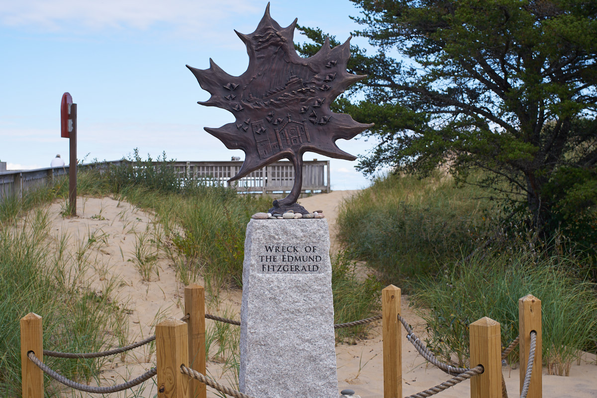
The most
famous shipwreck in the area was the Edmund Fitzgerald, made
famous in a 1970's song by Gordon Lightfoot called "The Wreck of
the Edmund Fitzgerald".
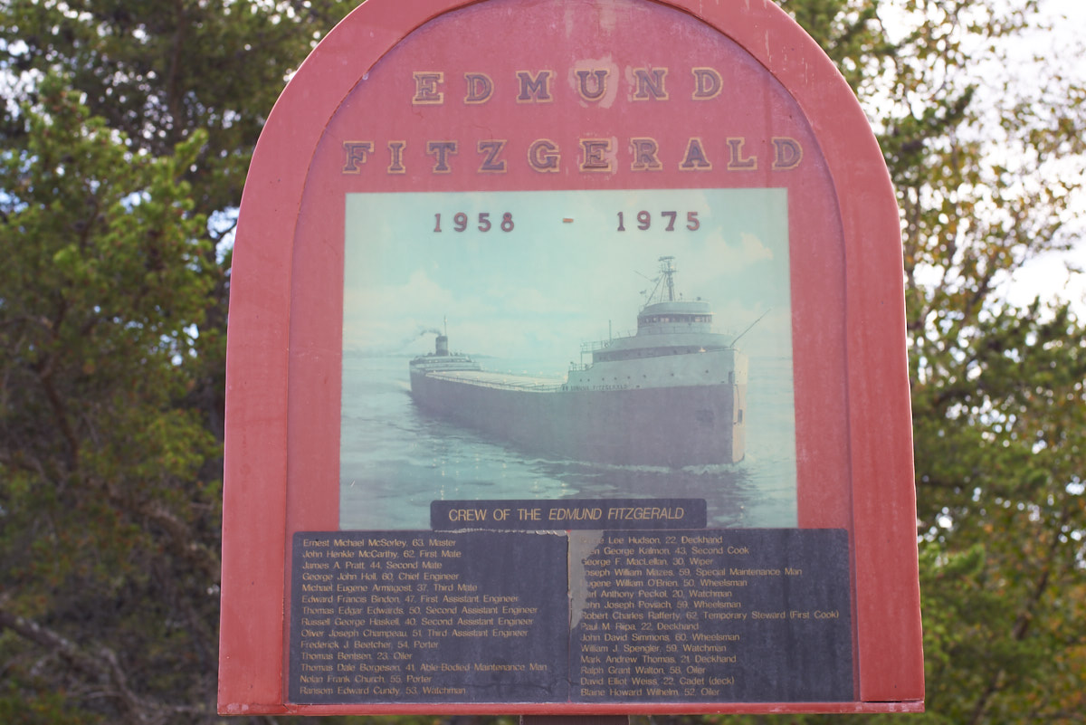
During
its time, the Edmund Fitzgerald was the largest ship in
operation on the Great Lakes. The ship was designed to
haul taconite ore from the mines in Minnesota to the steel mills
near Detroit. The entire crew of 29 was lost when the ship
broke apart in an unexpectedly strong early season storm.
It is postulated that the ship bottomed out in the trough of a
rogue wave, breaking the hull in two.
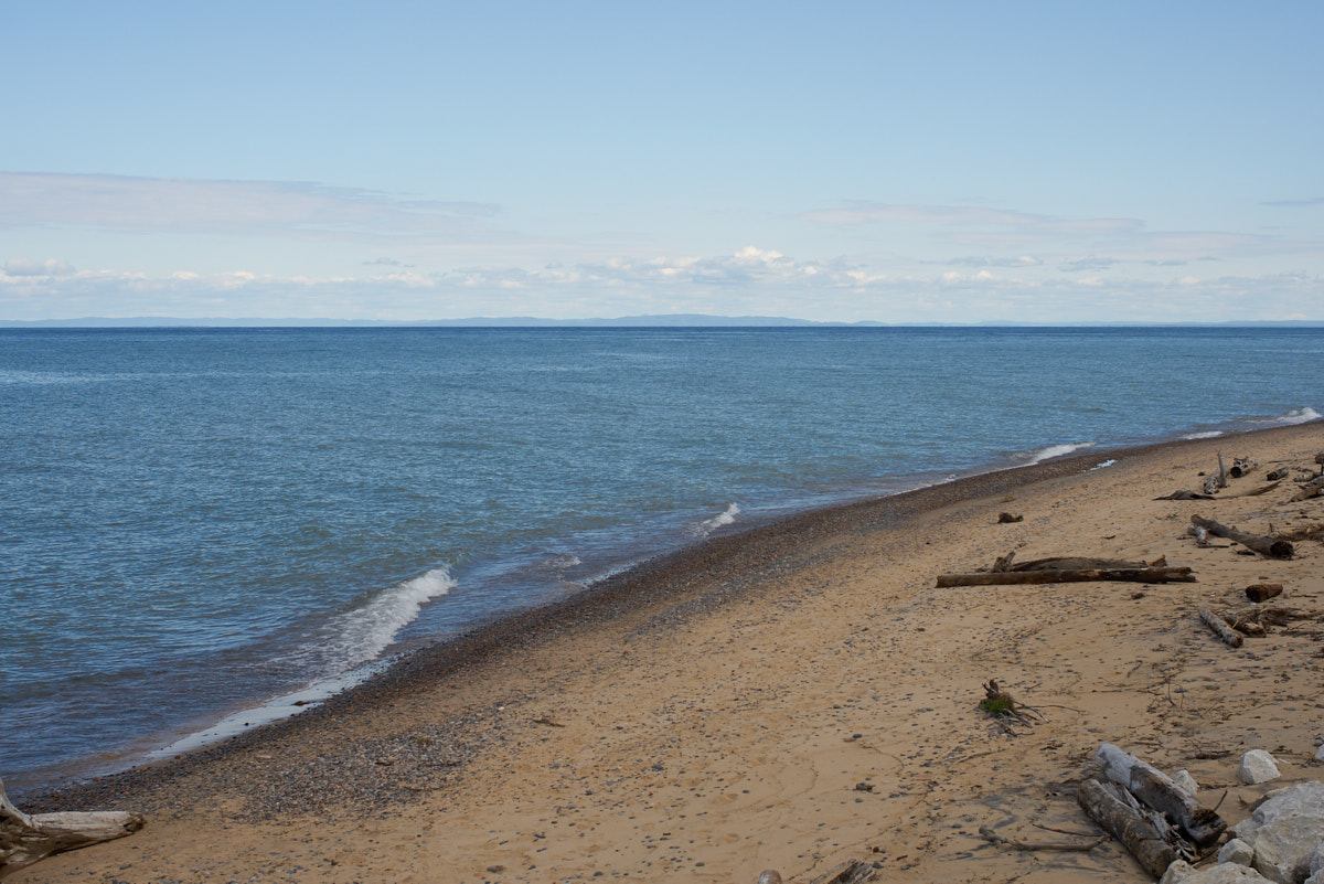
From the
beach observation deck, Ontario Canada can be seen across the
narrow strait.
To the
west of the deck was a small beach that has been reinforced with
stone to prevent erosion during strong, storm-driven waves.
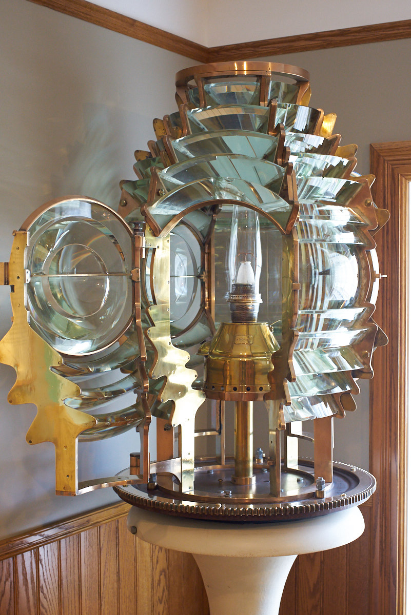
One
price buys entrance to the museum and the lighthouse. The
museum was detailed and had many exhibits including this Fresnel
lens used in the lighthouse.
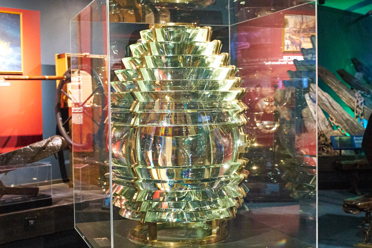
Another
Fresnel lens.
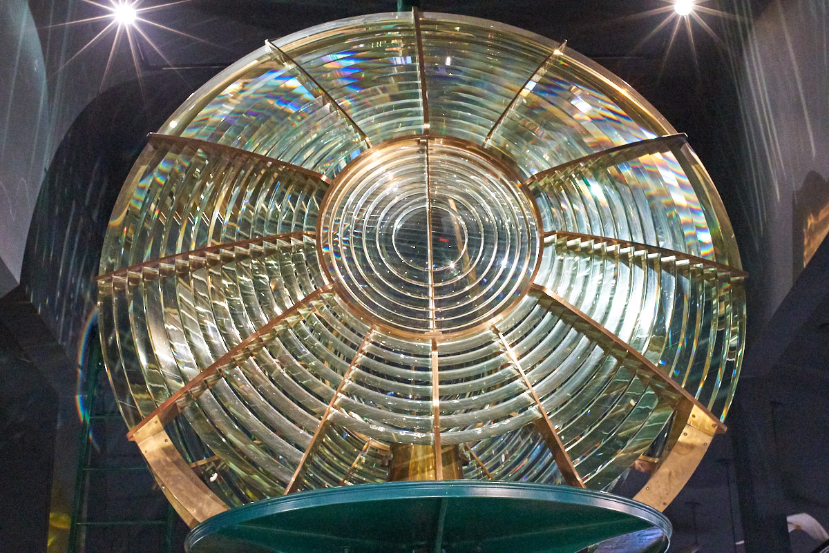
A huge
lens that was in service at the facility.
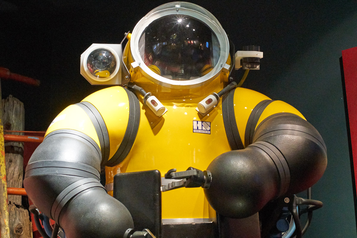
The
HardSuit that was used to recover artifacts from the Edmund
Fitzgerald in 500 feet of water. This is a manned
exoskeleton that allows very deep dives.
The
lighthouse tours were "on the clock" so when our appointed time
came, we left the museum (early) and climbed the tower.
From the catwalk we had a clear view of some of the other
buildings on the site.
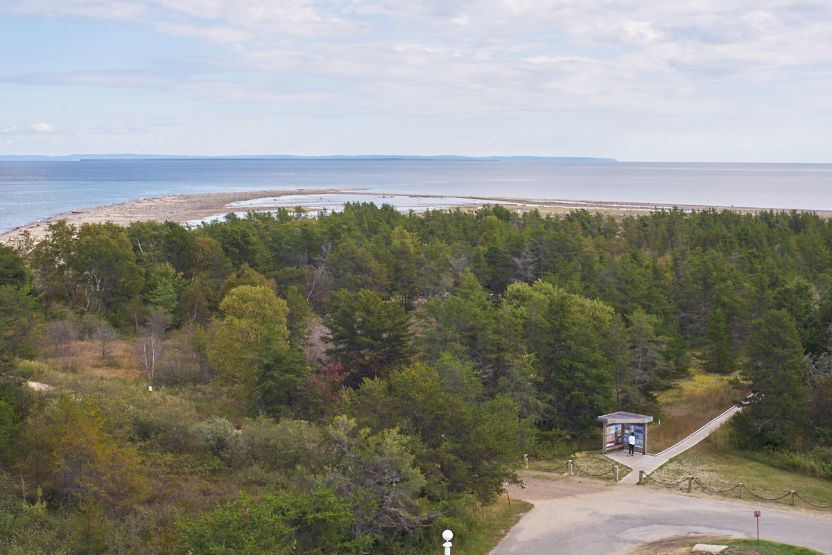
Whitefish
Point is the sand spit in the left-center of the photo
above. Whitefish Bay is to the right and can be delineated
by the brownish water indicating shallows. The blue water
is the main passage. In the distance is the province of Ontario.
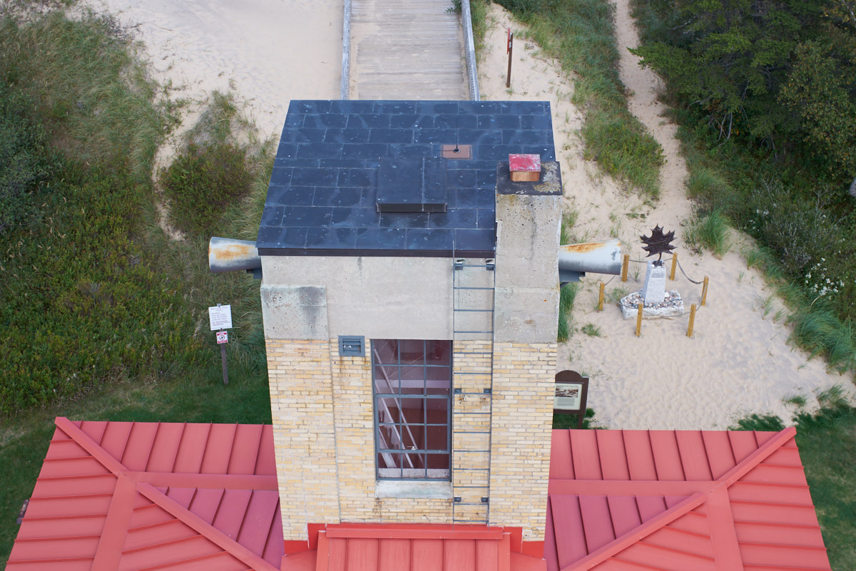
The
lighthouse tower allowed a down-looking view of the fog horn
building.
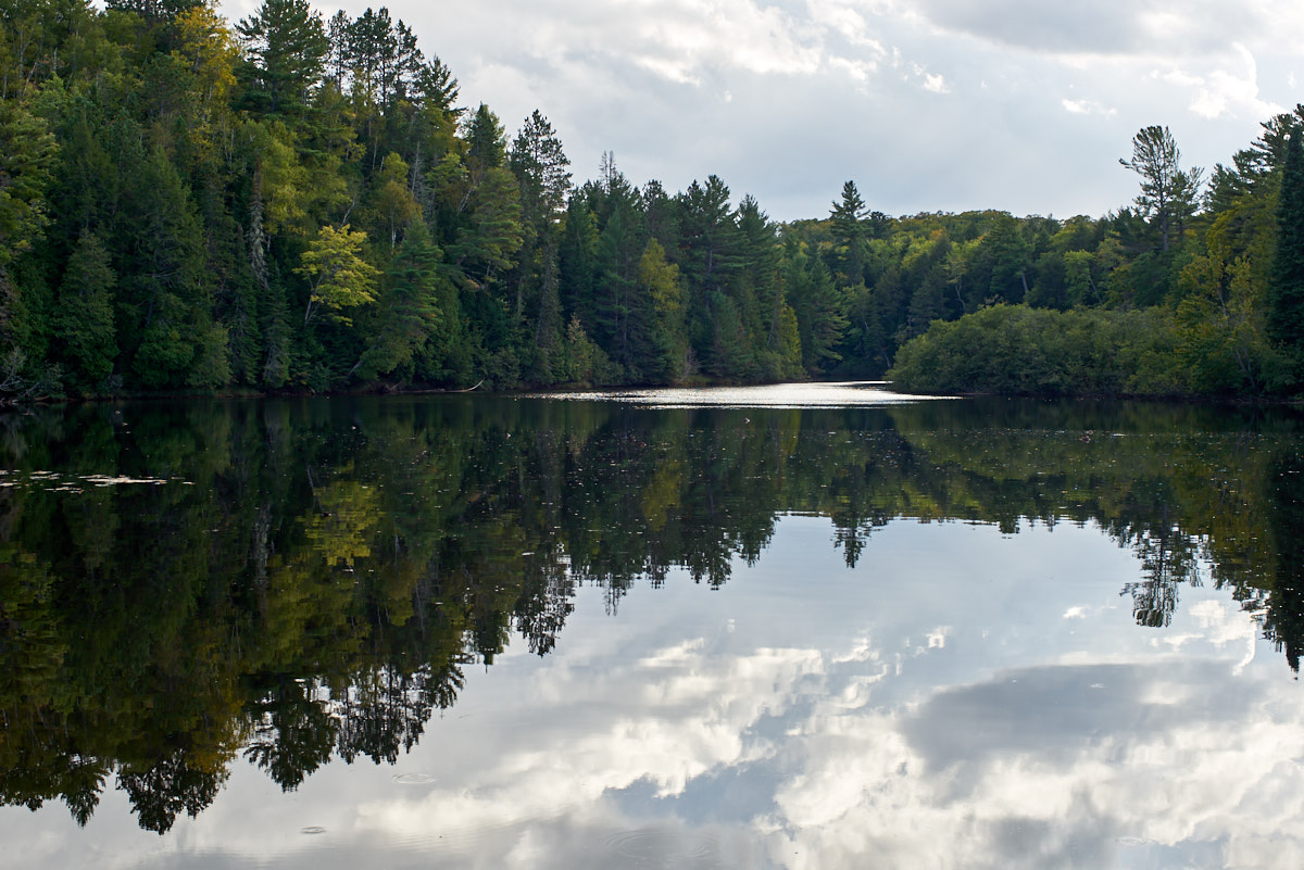
From
Whitefish Point we traveled west to Tahquamenon State
Park. We camped at the lower falls area and unlike
Wilderness Park, this was a nice place with all facilities
functional. Below the lower falls the calm waters provided
a great reflecting surface for the cloudy sky.
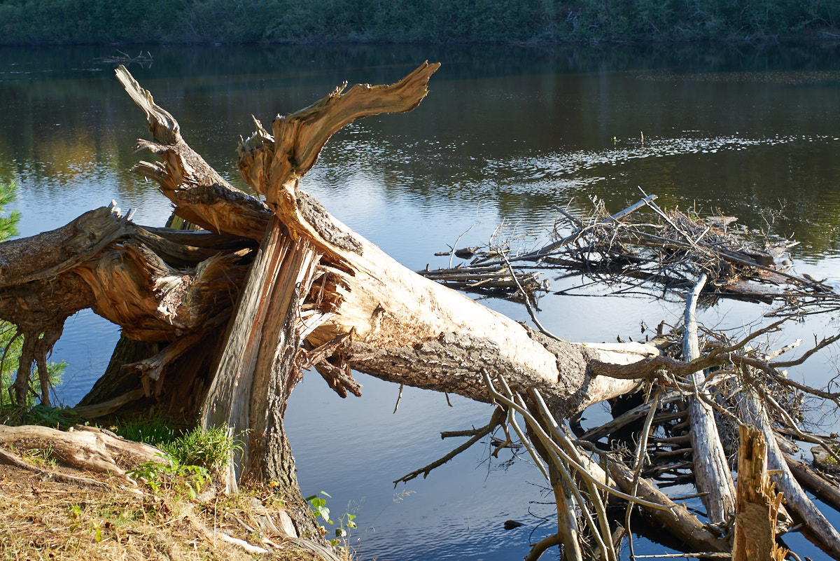
Even
strong trees cannot resist the force of the winter storms.
Lower
Tahquamenon Falls was somewhat underwhelming but in a generally
flat area any waterfall is noteworthy. It rained hard most
of the night and it was quite cold.
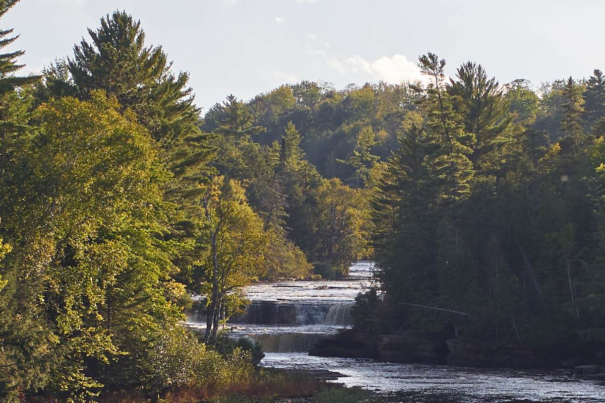
Next
morning we broke camp at the lower falls and headed west on the
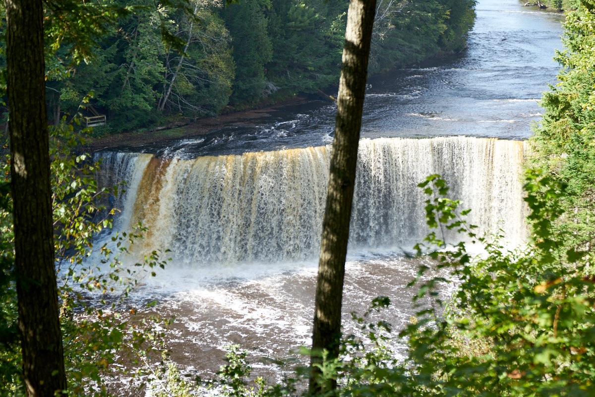
highway to the upper falls. The upper falls were much more
impressive at about 50 feet of height. The Tahquamenon
River has the somewhat unique property of being laden with tanin
from rotting leaves. Note the brown stripes in the falls,
particularly on the left side.
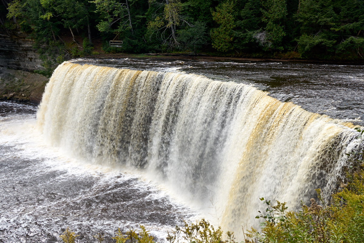
The
sunlight highlights the tannin in the water resulting in the
streaks.
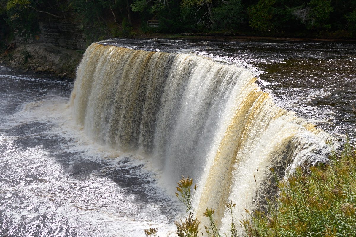
The location of the
tannin stripes vary with the viewpoint and position of the
sun.
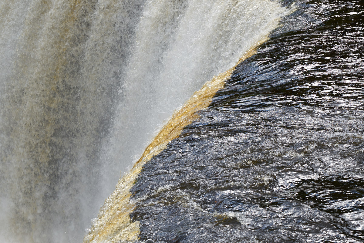
The tanin coloring
becomes visible as the water hits the crest of the waterfall.
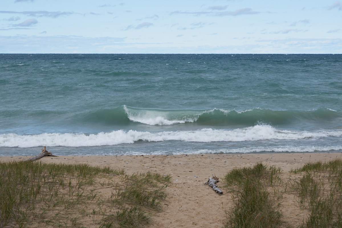
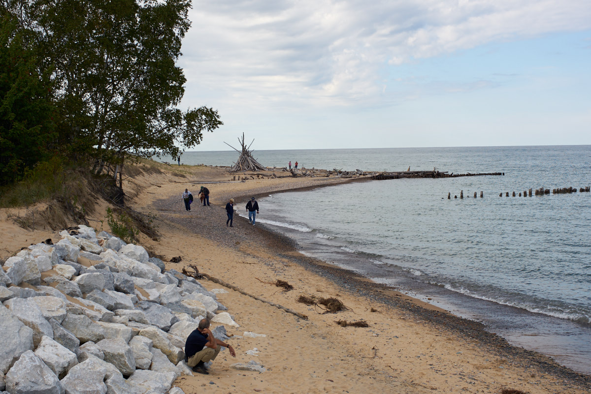
Our path west along
the shore of Lake Superior brought us to a beach near Deer
Park. The winds continued resulting in small
whitecaps. The cold water and the wind also resulted in
an empty beach (and the fact that this was a remote area that
was close to nothing).
The shipwreck museum is a must-see if in the area. It surely gave us a feel for the dangers of shipping on the Great Lakes. And, of course, if you see the museum then you should see Upper Tahquamenon Falls as well.
| Previous Adventure | ||
| Trip Home Page |
Photos and Text Copyright Bill Caid 2017, all rights
reserved.
For your enjoyment only, not for commercial use.