The photos below are what we saw.
We
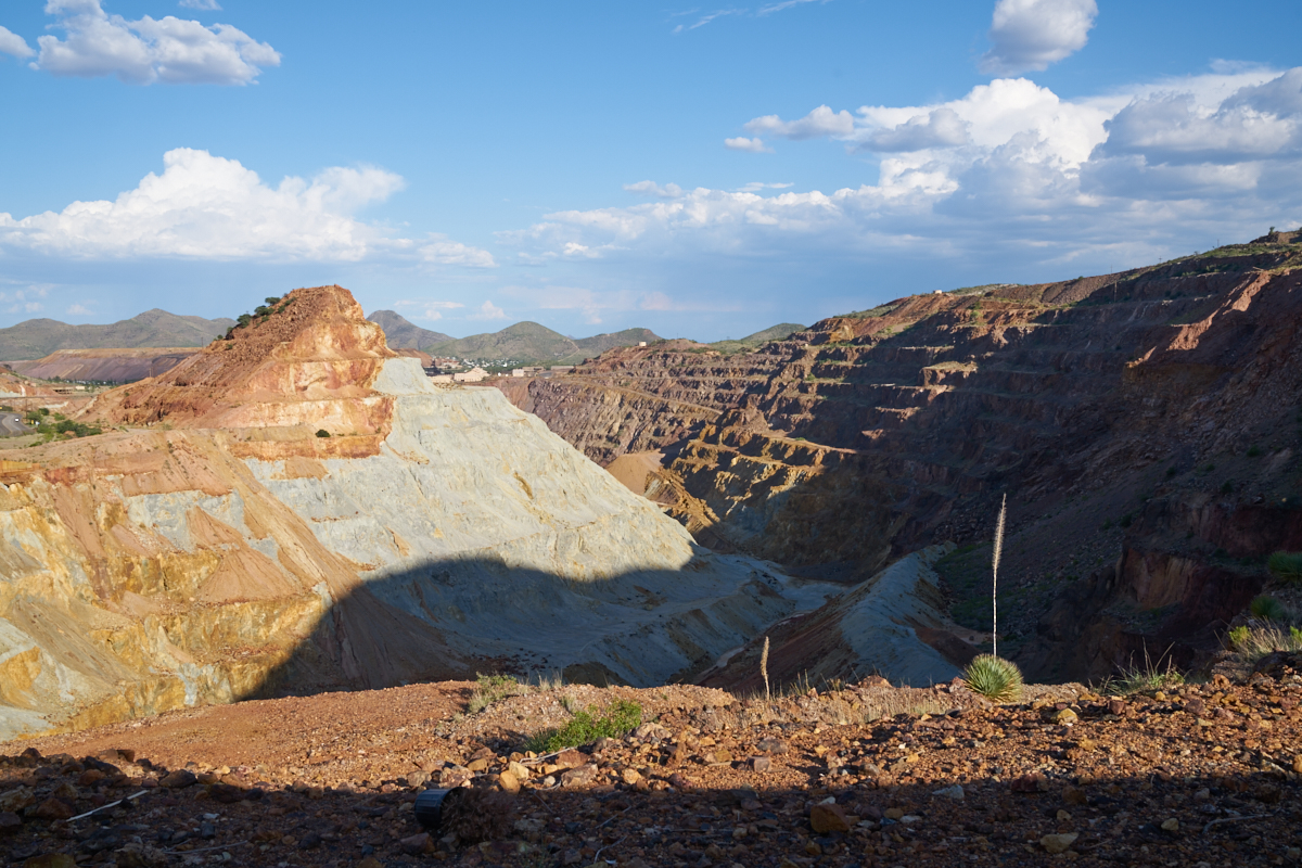
stayed a the Queen Mine RV right next to the large pit mine in
Bisbee. Our site was right on the rim of the pit.
The late afternoon sun cast long shadows in the deep hole.
The various colors in the rock are an indication of the level of
mineralization in the area.
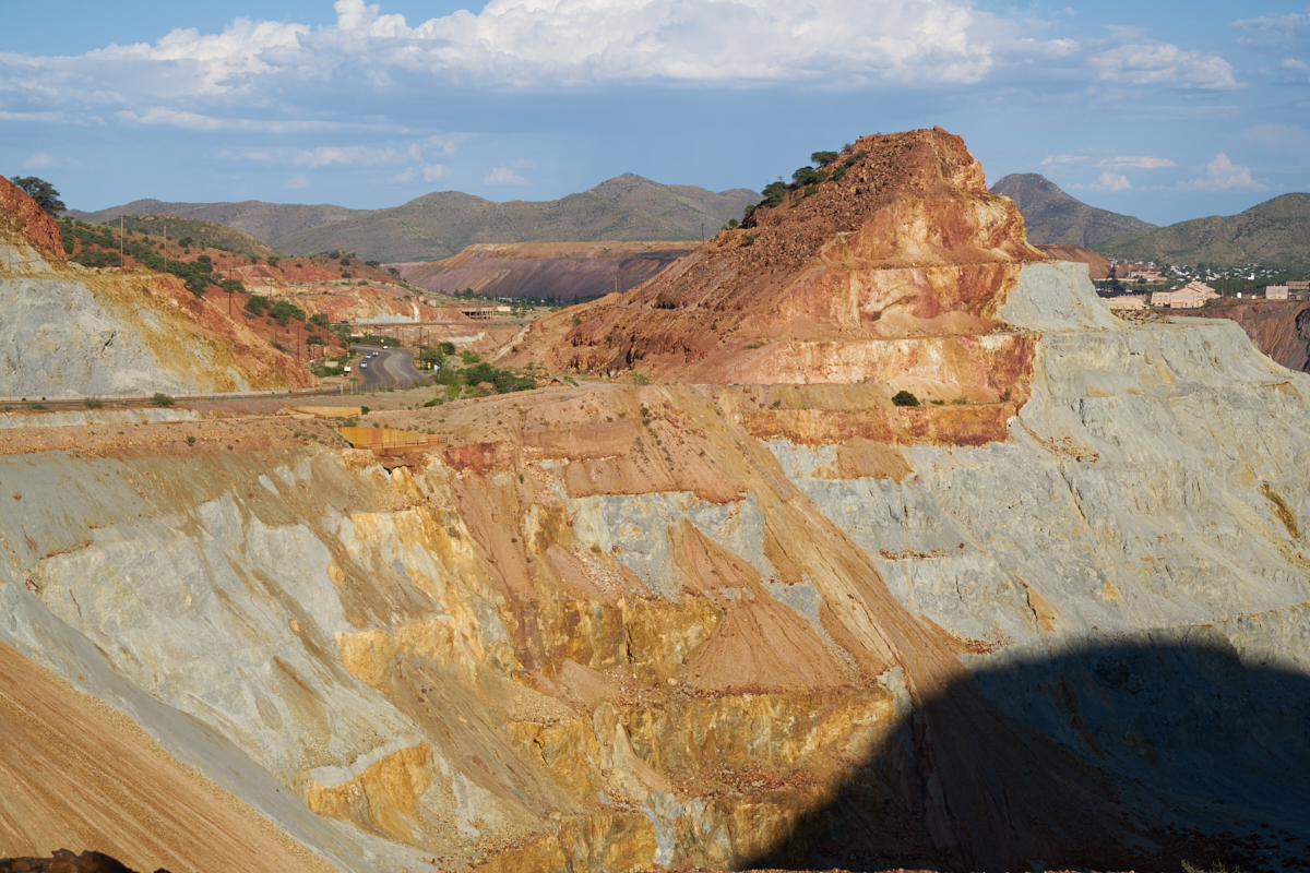
The
steep walls of the pit were not fully stable and were subject to
slumps and slides.
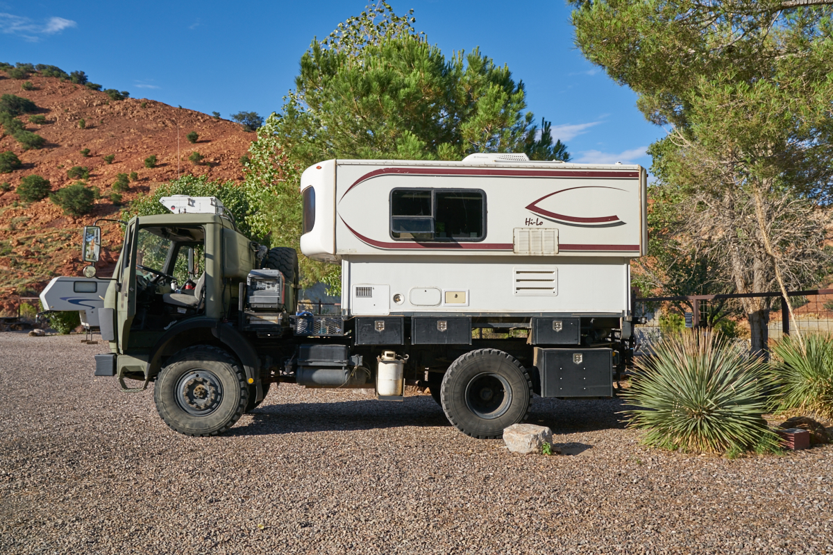
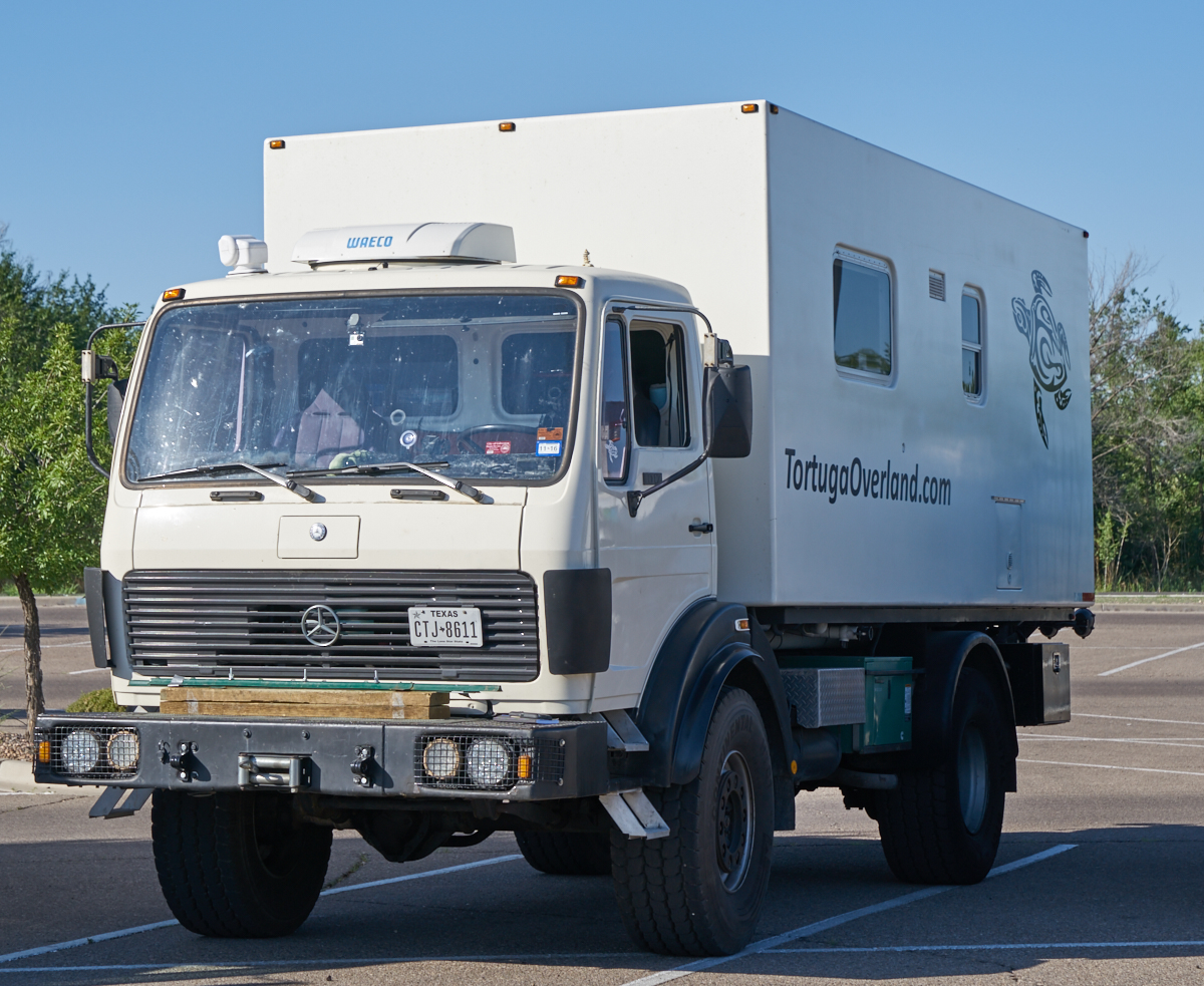
Thor
presents a daunting site in any RV park.
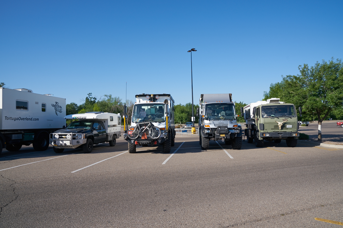
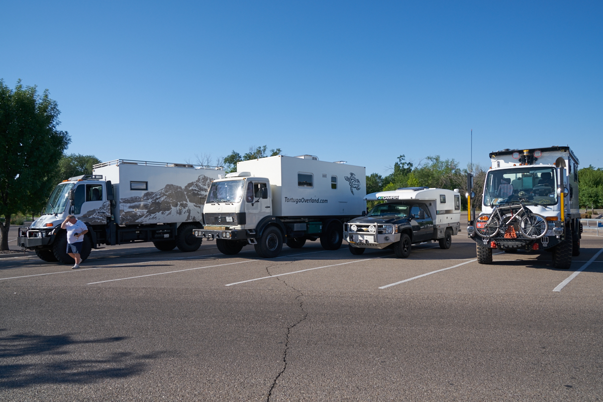
We got
out of bed at 0500 and rolled into Douglas to make our 0700
meeting in the parking lot of the local Walmart. From the
left: Len's 1017A, Mark's high-low pickup camper, Vince's U500,
Chris's U500, Thor.
From the
left: John's U500, Len's 1017A, Mark's high-low pickup camper,
Vince's U500.
Len's
1017A was of particular interest to me as it was the only
identical platform to Thor. This rig is running 425/65
R22.5 concrete truck tires and has a front winch.
Additionally, it has a diesel generator and extended living
quarters.
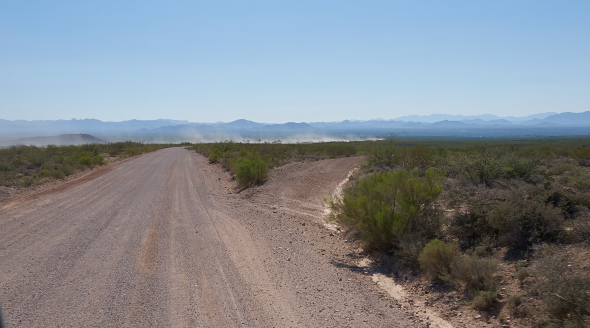
We rolled
out of Douglas and got onto the Geronimo Trail that crossed over
the mountains into New Mexico. Once the group got onto the
dirt, we spread out to help minimize the dust. Above, note
the extent of the dust plumes raised in the calm morning air.
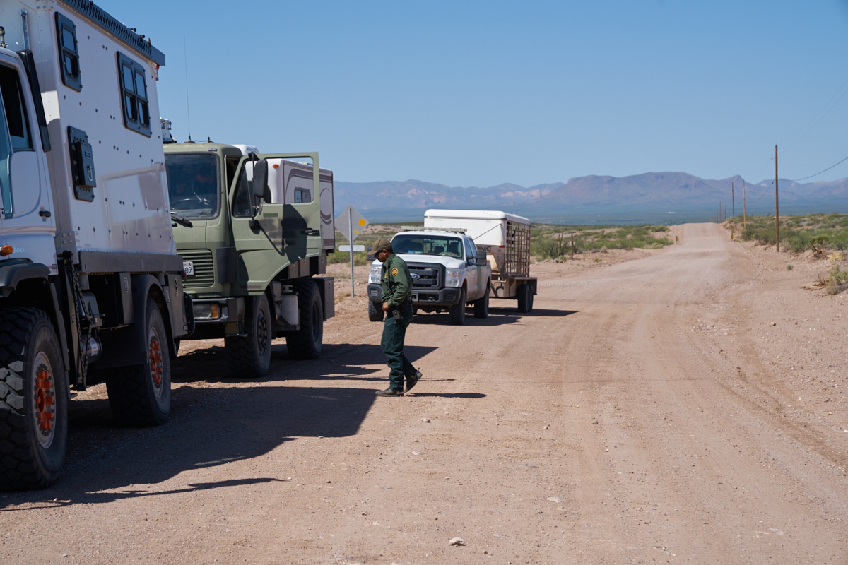
Len
suffered a "mechanical" and we stopped to check it out.
The Border Patrol also stopped to see what we were doing.
The Patrol runs all manner of vehicles, aircraft and horses as
part of their normal day-to-day operations. The group
above were on horseback.
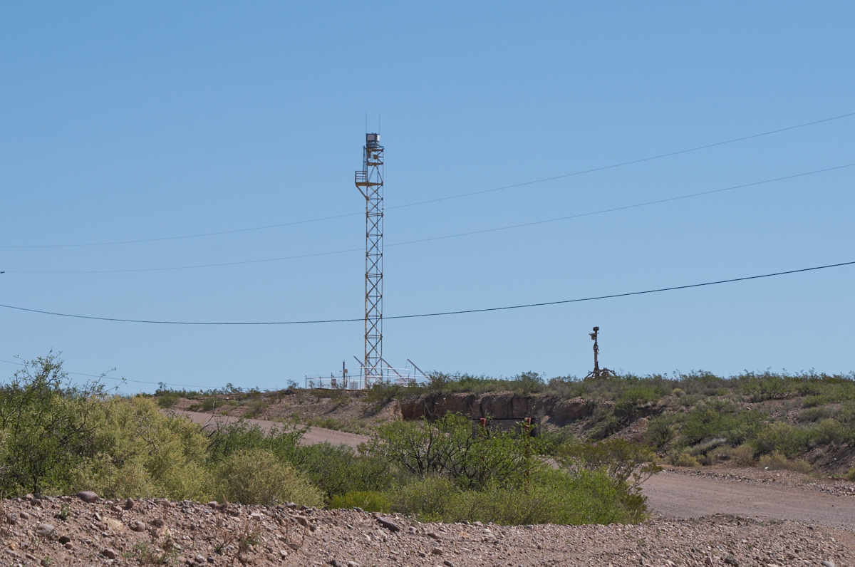
New
watchtowers were being constructed along the entire
border. The new tower is on the left, the old (portable)
tower is truck-mounted and on the right. Both have
cameras, infrared, radar and other sophisticated detection
equipment.
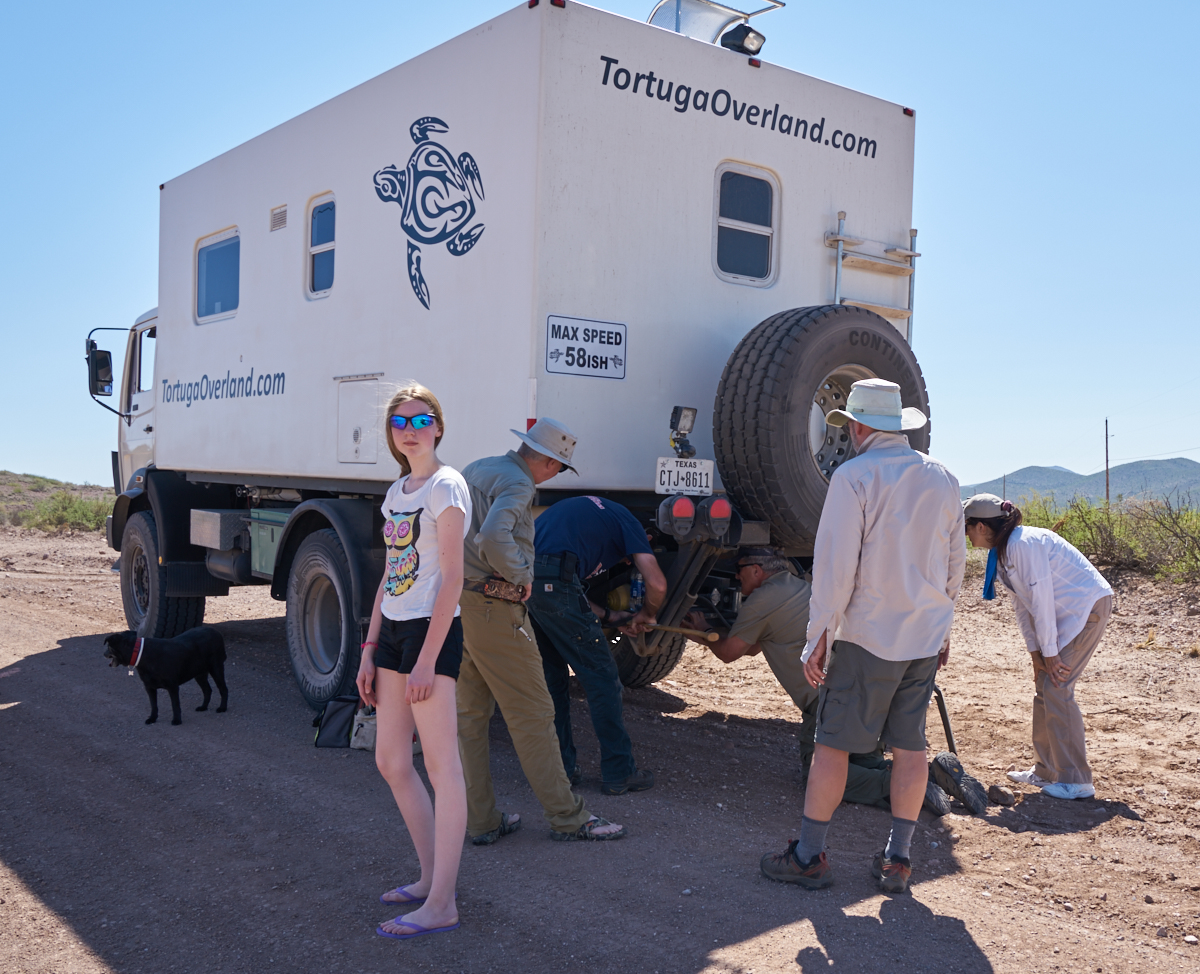
A real
"oh, shit" party. We caught the failure before it became a
catastrophe. Anika, the young gal, is visiting the U.S.
from Germany and is traveling with Chris and Anne.
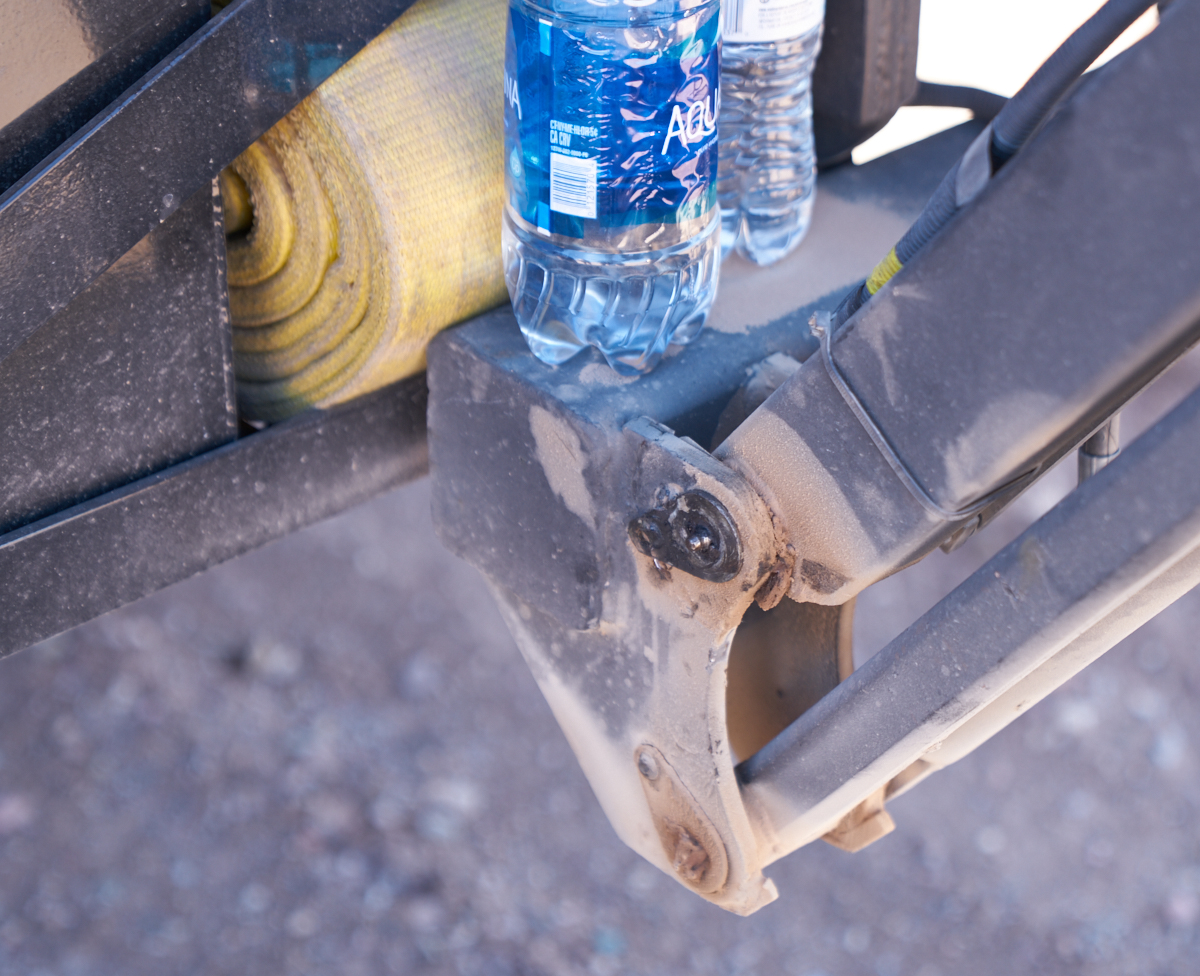
The
issue was the rear-mounted hydraulic spare tire mount. One
of the pins on the 4-bar mechanism had worked loose and was in
danger of coming out. The weld holding the retaining plate
had broken, thus allowing the pin to slide. A road-side
fix was effected using a pop rivet and a C-clamp and we headed
out.
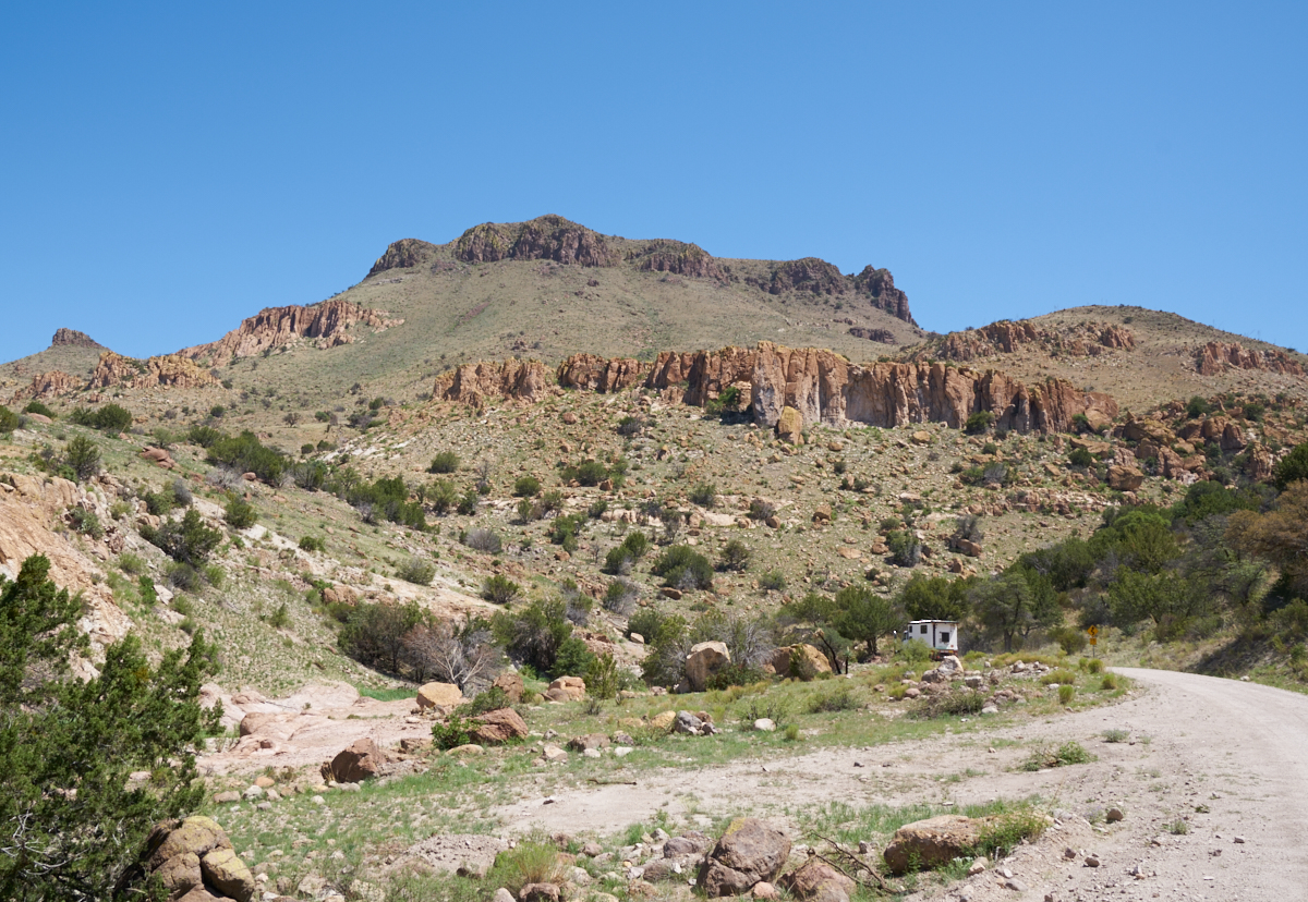
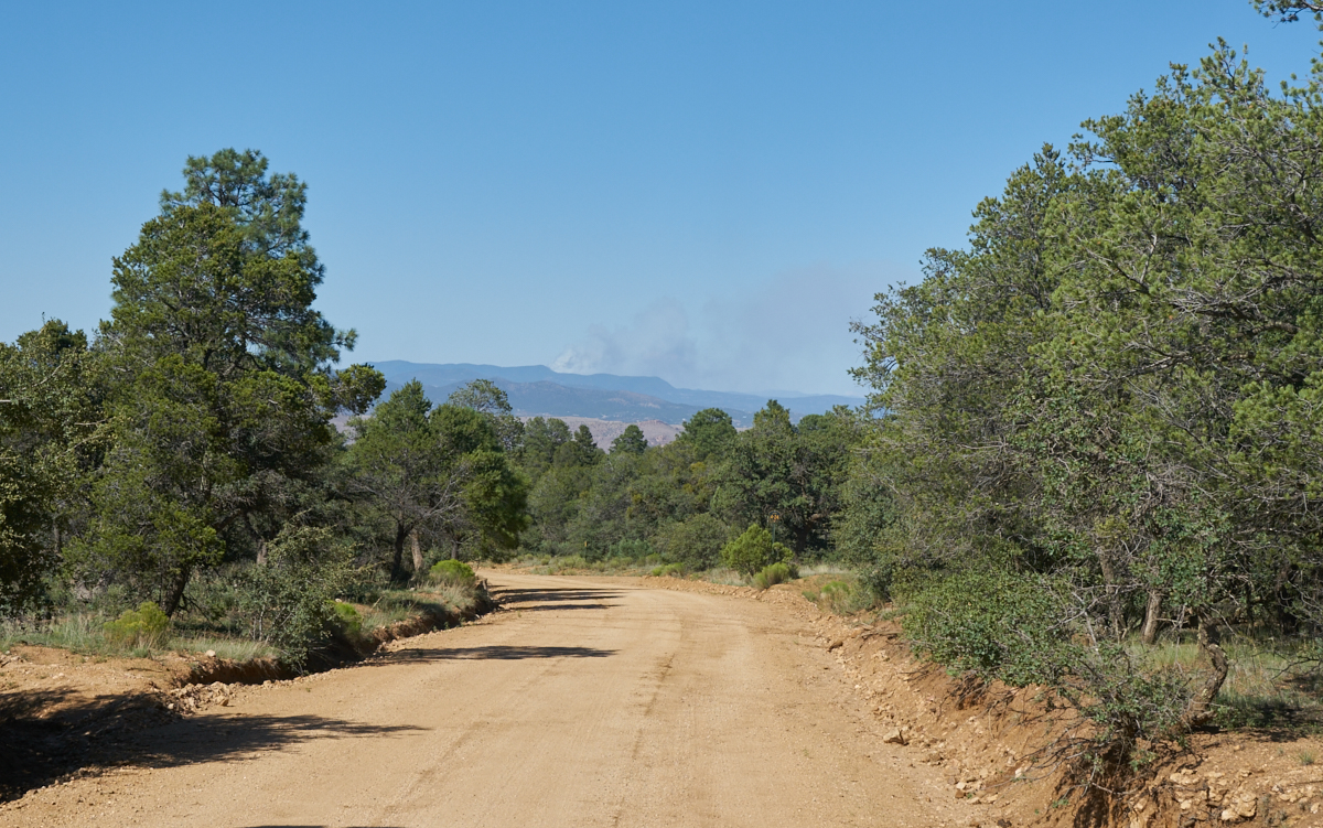
We
headed into the mountains east of Douglas, AZ.
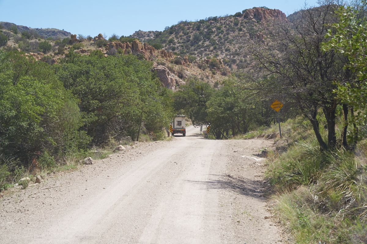
Most of
the road was in really good shape but had narrow bridges and
overhanging brush to clean the top of our campers.
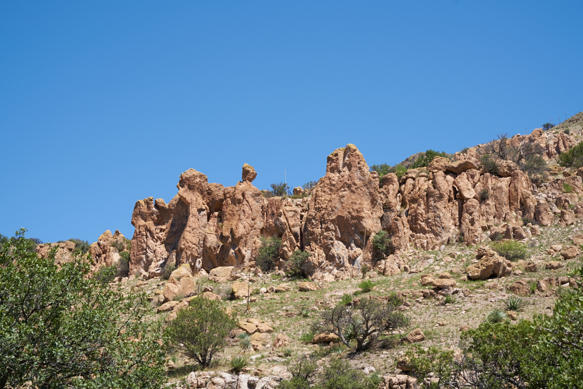
The rim
of the canyon had nice hoodoos.

We found
this monument at the Arizona-New Mexico border. The road was
built in 1932.
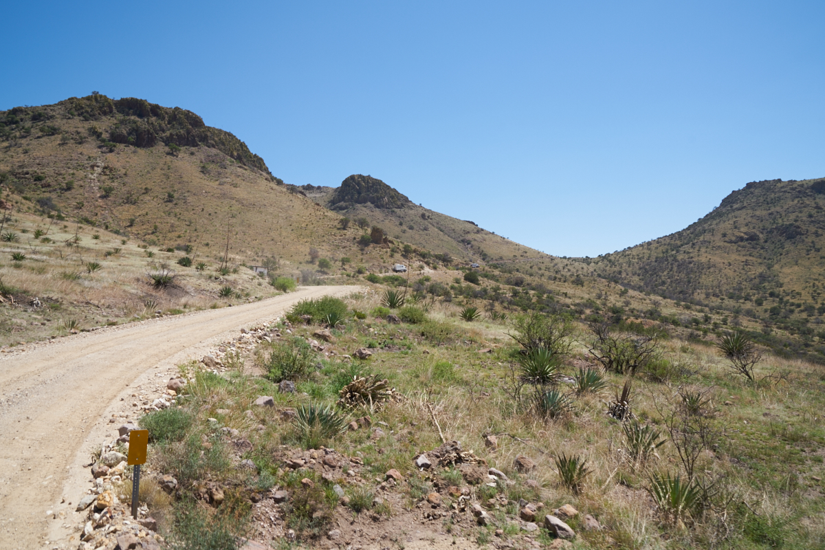
As we
approached the pass, the road got steep.
We stopped at the pass to take some photos.
The view to the west shows the Douglas Valley.
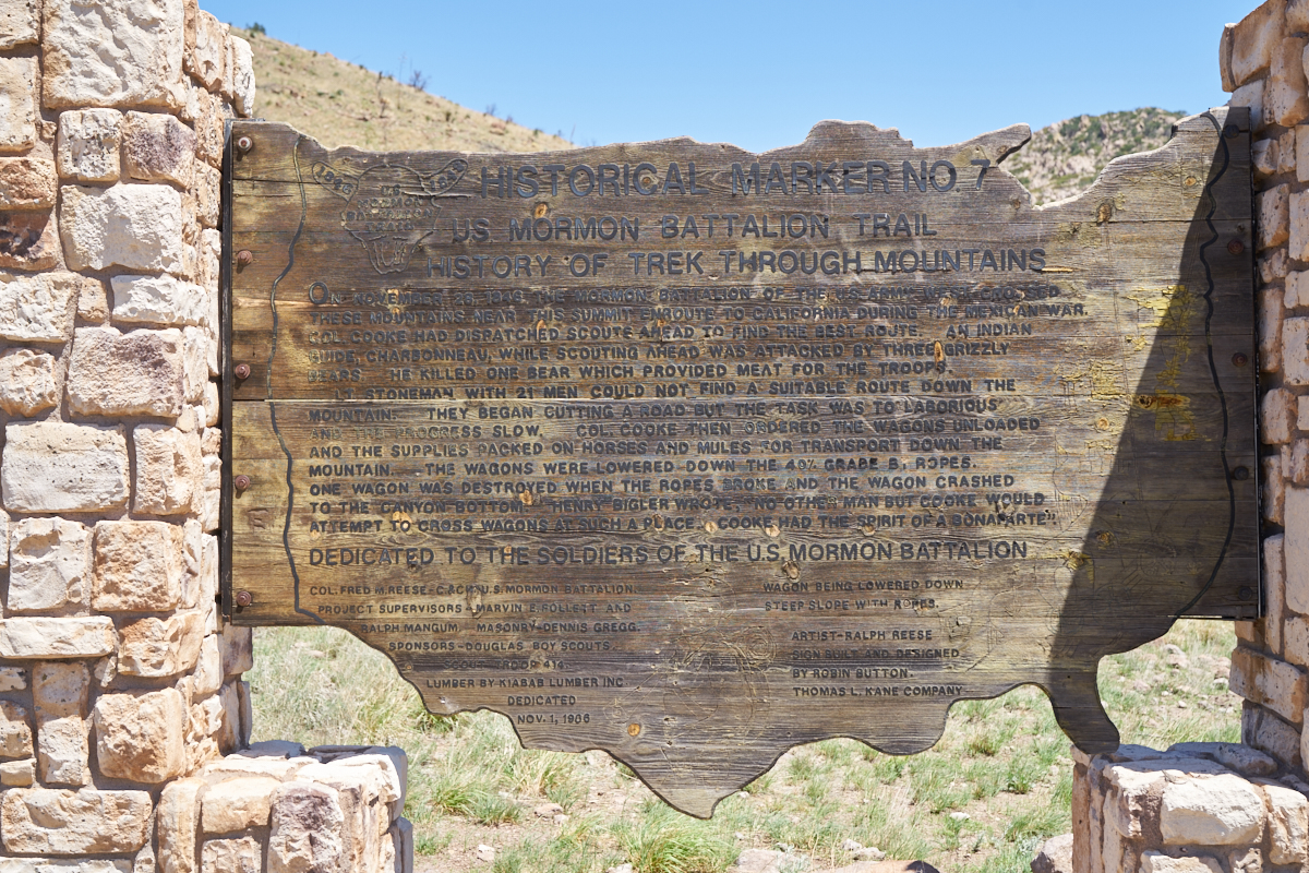
Even though
the road was built in 1932, the path has been used for over a
hundred years. The pass was used by the Mormon Battalion
in 1846 during the Mexican War.
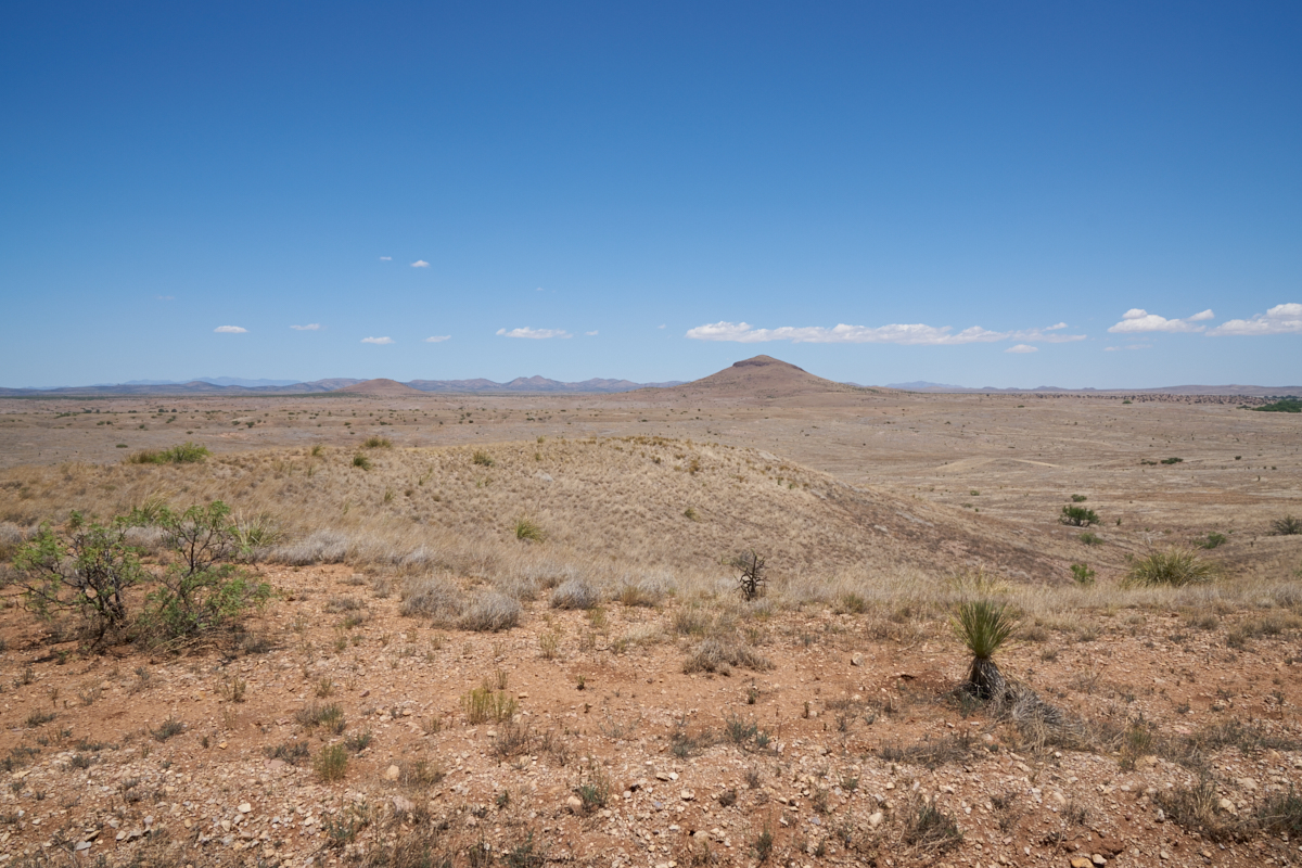
The
trail took us down the eastern slopes of the mountains into the
Animas Valley. The terrain was quite barren.
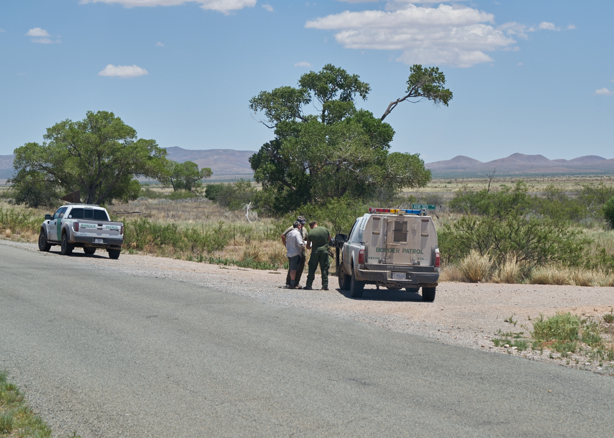
We hit
the paved road and headed north through the Animas Valley and
encountered, no surprise, more Border Patrol agents. In
this case, we were stopped to determine if we could take the
Adobe Creek Road, but it turned out that the land was
private. As we waited to see if the owner would allow us
to pass, the agents stopped to check out the trucks.
Above, Mark gets some pointers on routes that would be interesting.
We stopped
for chow in the little town of Animas. Then we headed
north to Lordsburg, NM. The lord had forgotten the town
many years ago and it is a now a god-forsaken shit hole on the
side of I-10. From Lordsburg, we headed north to Redrock
and then over the mountains toward Silver City. From the
crest of the mountains we could see one of the fires burning the
Gila Wilderness (which, sadly, was our destination). It
turned out that the fire was east of our destination, so no
diversion was required.
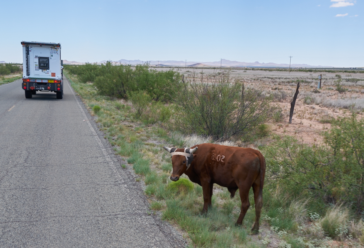
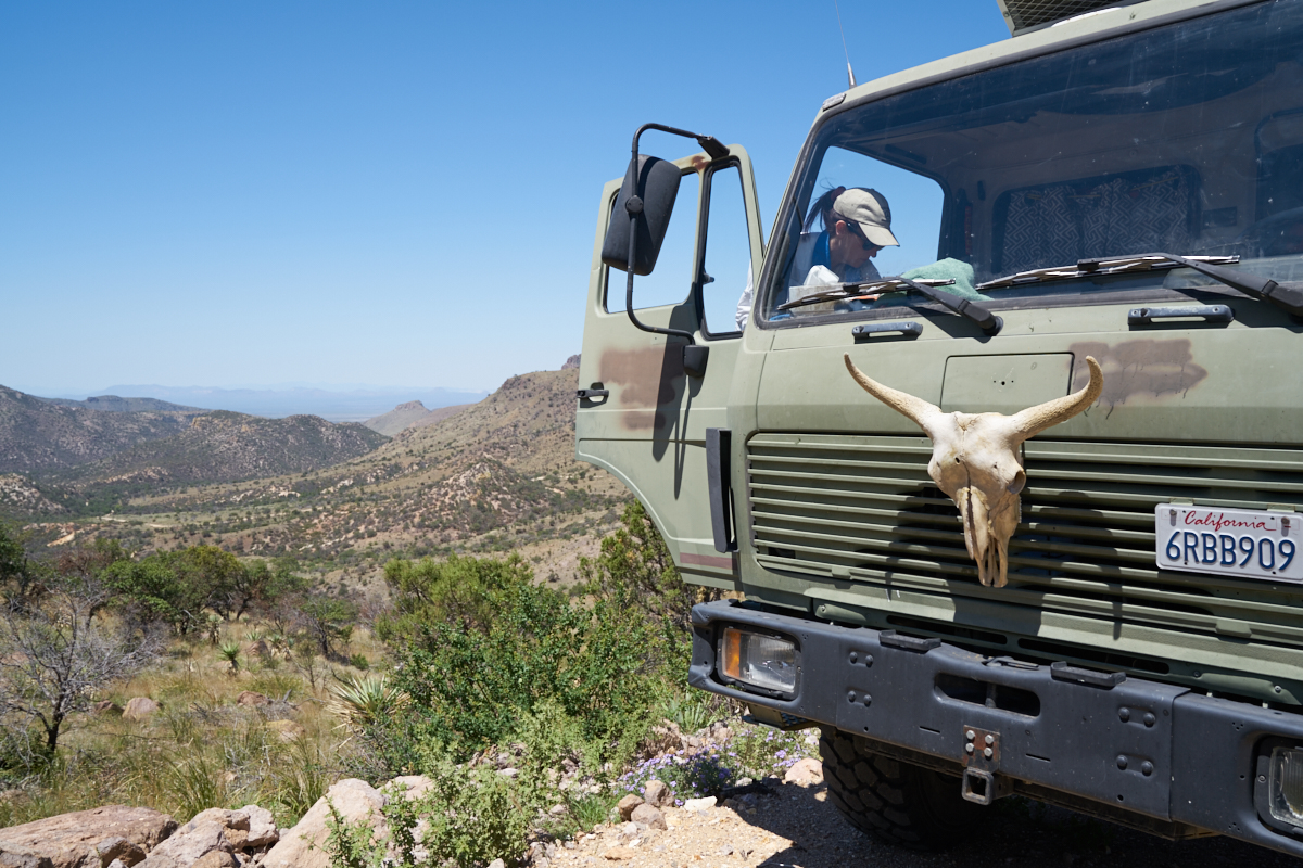
Cattle on
roadways are a persistent hazard when traveling in the
west. You can pretty much count on them doing something
stupid like bolting into your path. We have seen plenty of
cows but we had never seen cows that had this kind of leather
headdress. This cow has had his horns burned (for rancher
safety). The headdress, it seems, is this season's hot
bovine fashion.
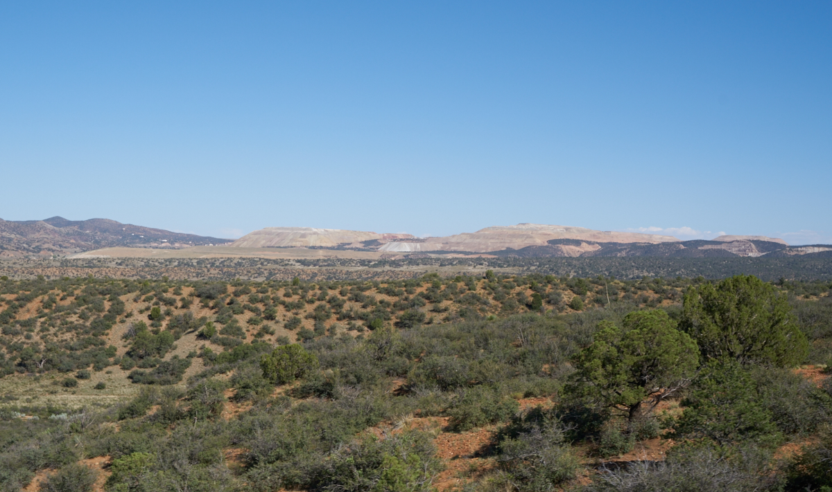
Approaching
Silver City, NM from the west, we had a view of the tailings
from one of the many mines in the area. We crossed the
Continental Divide (again) and headed into Silver City for fuel
and supplies.
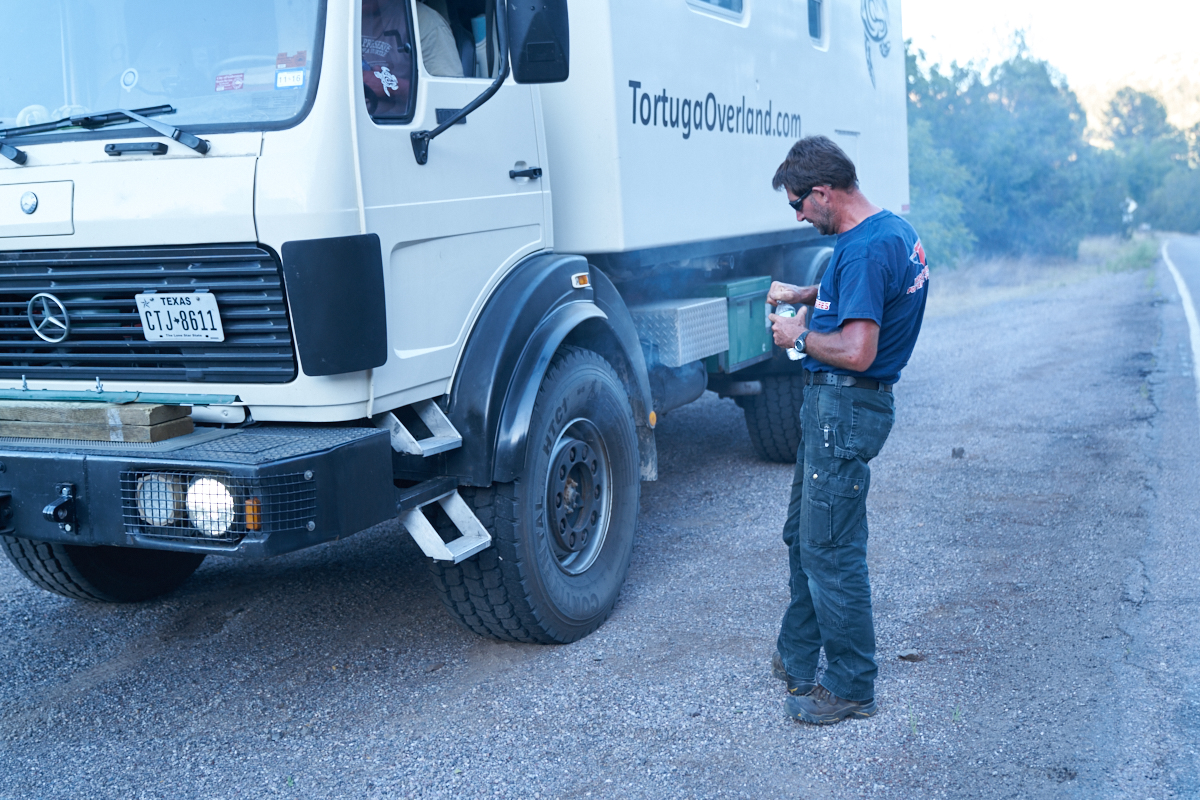
We left
Silver City and headed north into the Gila. The Pinos
Altos road was narrow and very steep with many tight
turns. Len was unaware his rig had an exhaust brake and
rode his service brakes down the 20% grade with predictable
results -- overheating.
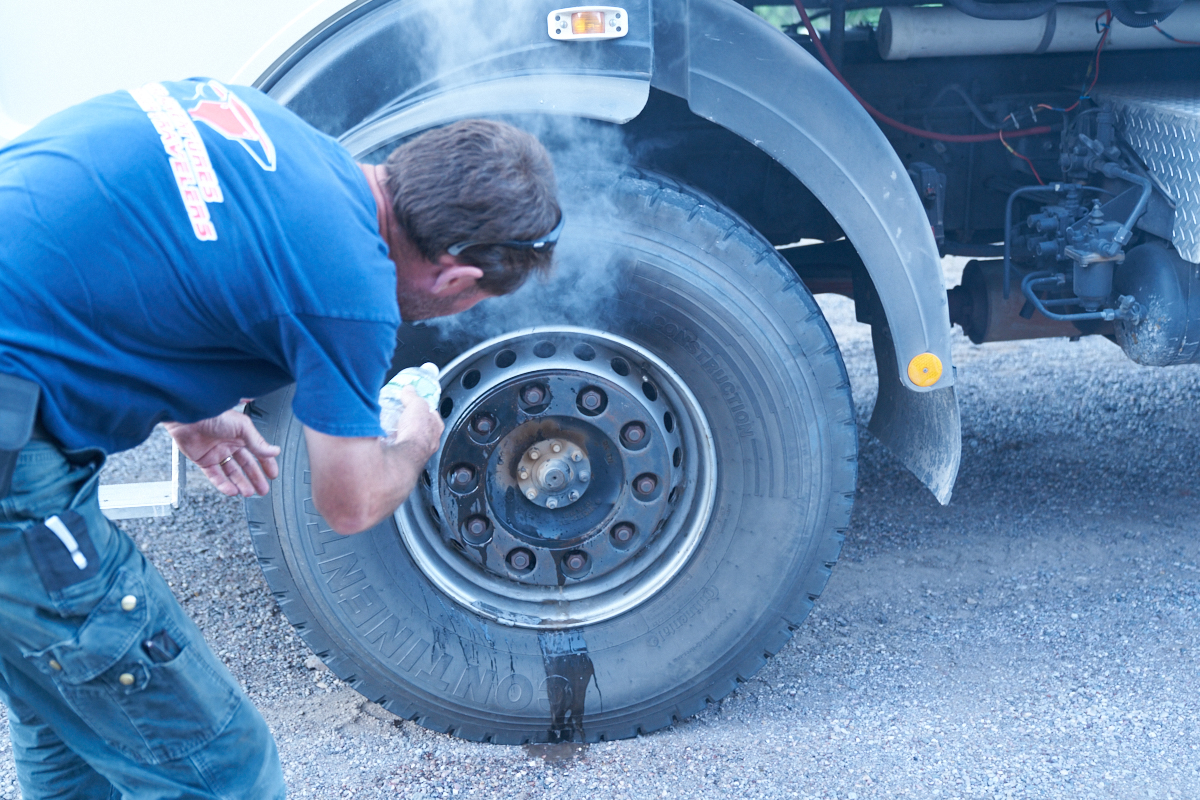
The
brake drums were smoking hot and were, in fact, smoking.
Chris sprays some water on them to help them cool.
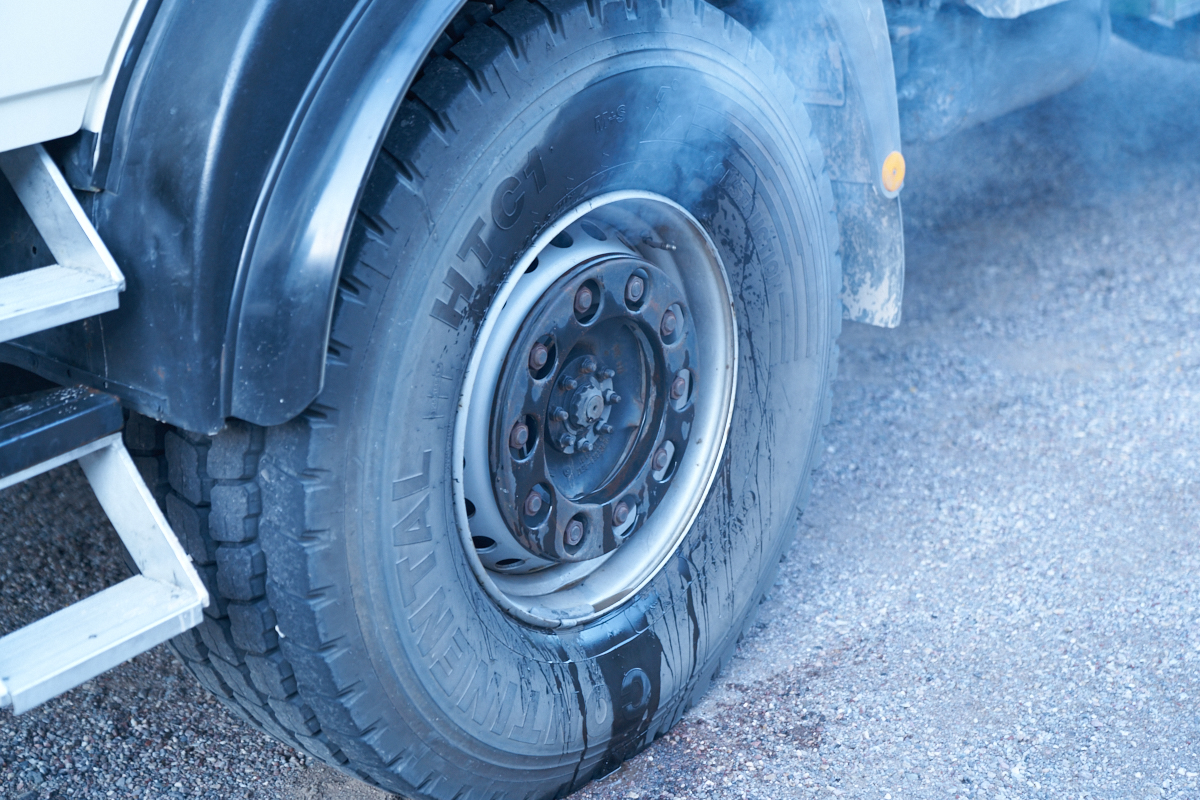
We were
not sure if anything was damaged, but at least now Len is aware
of the importance of his exhaust brake and how to use it.
| Previous Adventure | ||
| Trip Home Page |
Photos and Text Copyright Bill Caid 2016, all rights
reserved.
For your enjoyment only, not for commercial use.