Our trip south from Jackson Hole, WY was happily uneventful. Our path took us across Wyoming and into northern Utah and into Flaming Gorge. The photos below are what we saw.
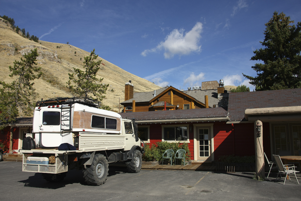
The small motel we stayed at was right next door to the four star restaurant we ate at the previous night. This proved quite useful as we were both pretty buzzed when we left the place after dinner. Next morning, the sun was out and it was a nice, crisp fall day.

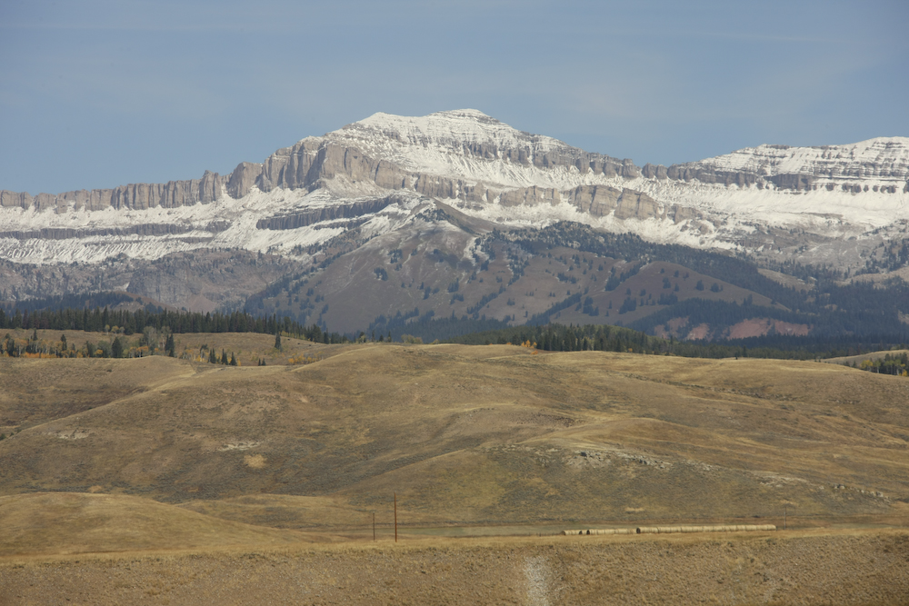
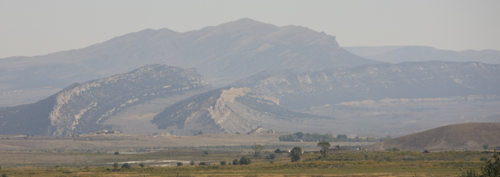
Our path south took us past the Wind River mountain range in Wyoming. This is a long range and provided us with excellent scenery.
The snow had already come to the high country.
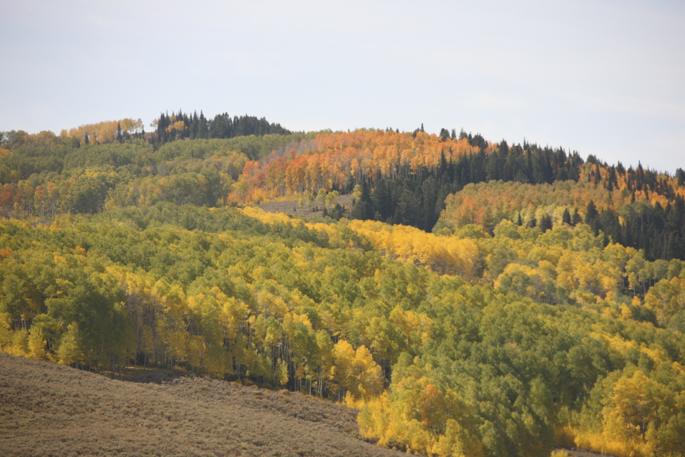
We went through several mountain passes that had nice fall colors.
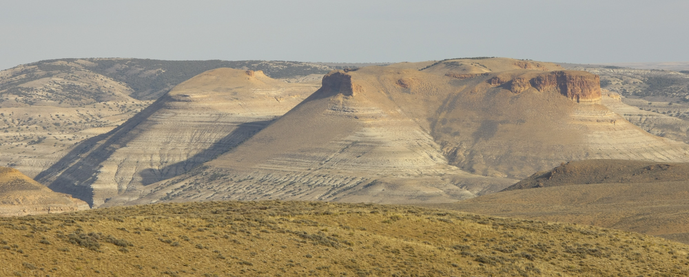
A bit further south, the Wind River range got more rugged.
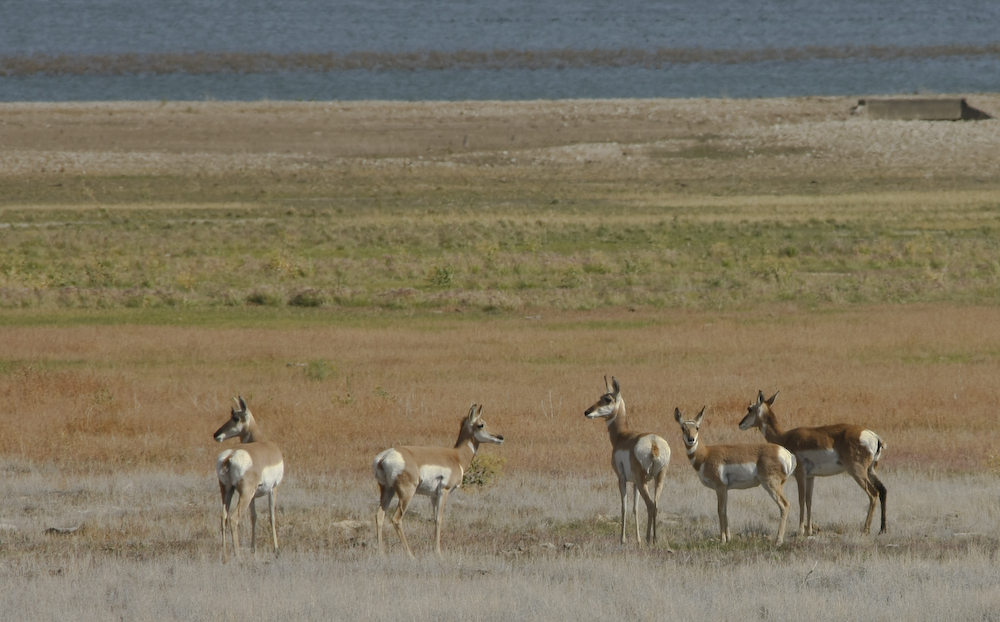
At the northern edge of Fontenelle Reservoir, we spotted this set of antelope.
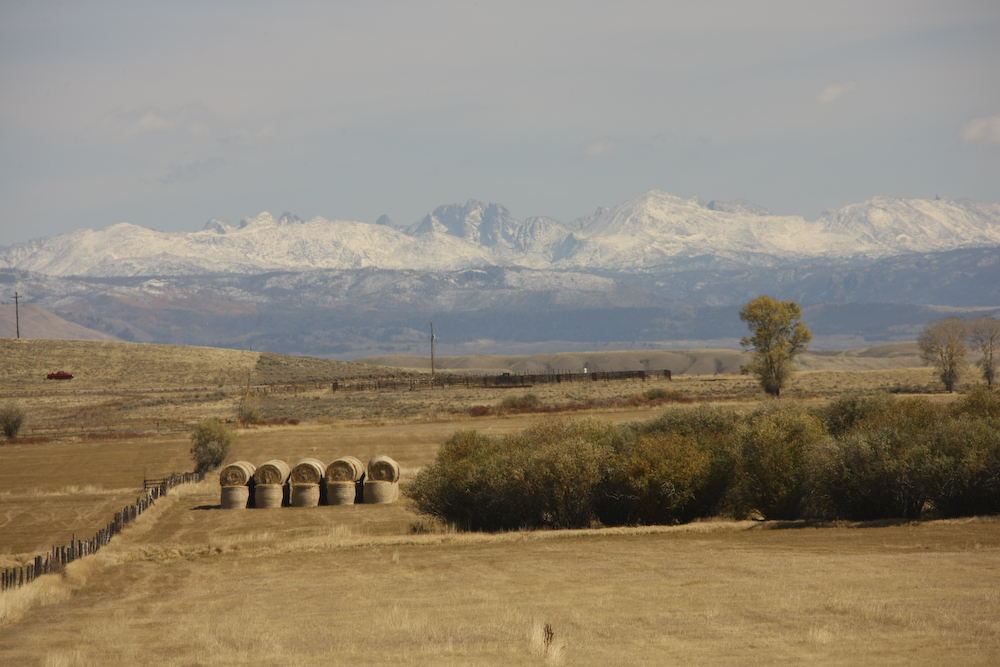
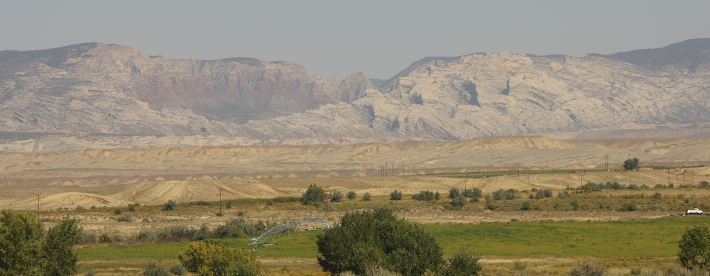
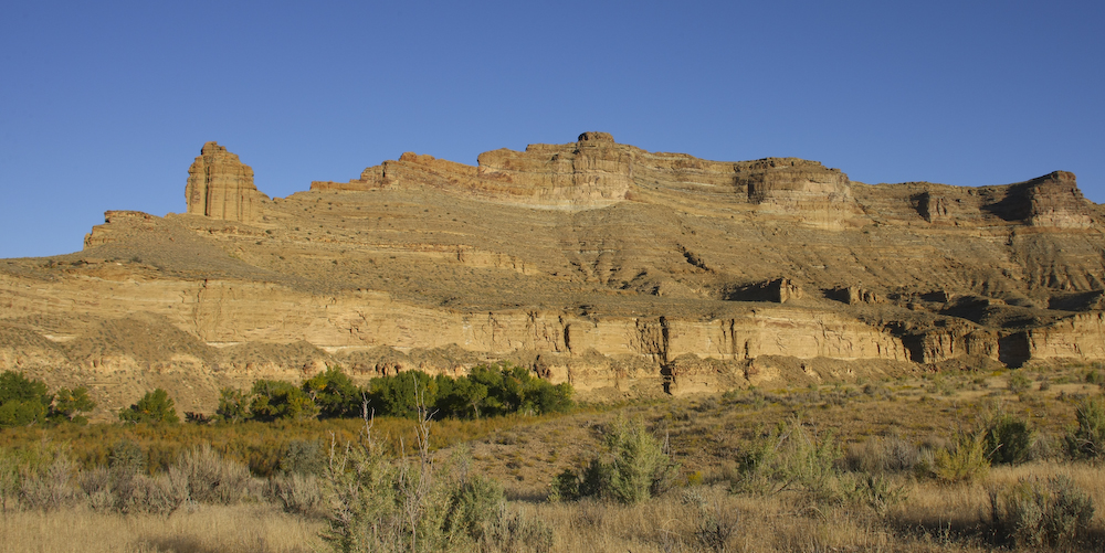
We resupplied in Green River, WY and then headed south to Flaming Gorge. On the ridge south of Green River, the eastern horizon had nice sandstone escarpments carved by the action of the Green River.
We spent the night at the Buckboard Wash camp ground. It was plain and unremarkable, but quiet and clean. The next morning, we continued our journey south along UT530 and over a pass by Manila, UT. The top of the pass gave us a clear view of the set of hog backs to the east of the pass. Note how the ridges have been both uplifted and twisted by the faulting action.
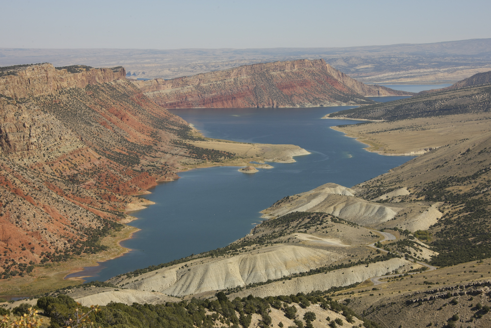
The top of the pass also allowed us to see the upper reaches of Flaming Gorge Reservoir and the associated cliffs. As can be seen in the photo above, they really are flaming red.
Further south, we resupplied in Vernal, UT and saw a whole host of "interesting" characters. These are not the sort of folks that I recall from my last visit to this area and they may be the result of the large amount of oil exploration and drilling that is happening in the area. What I saw was distressing, even traumatic. So traumatic, in fact, it has inspired me to write a poem about our experience in the local grocery store. I call this ditty, "Ode to Jed" named for that famous hillbilly, Jed Clampett. Trust me, this is not a flattering poem, but it is what we saw.
South of Vernal, there were nice views of the entrance canyon to Dinosaur National Monument to the east of town. Above, the mouth of the canyon can be easily seen. From Vernal, we headed south into the maze of dirt roads that are the Book Cliffs.
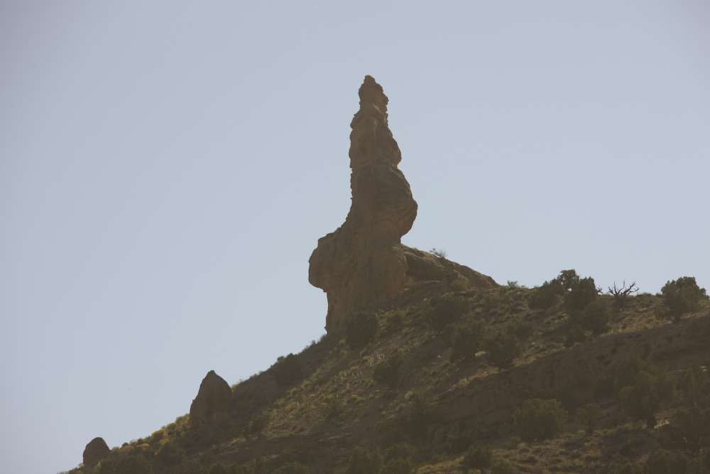
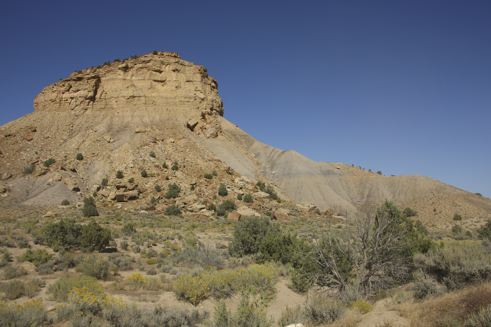
We found a potential primitive camp site on the map, so we headed to investigate. Our path took us past some very interesting rock formations.
The structure above had a halo from the sun (and a bit of sharpening in Photoshop). I had never seen anything like this before.
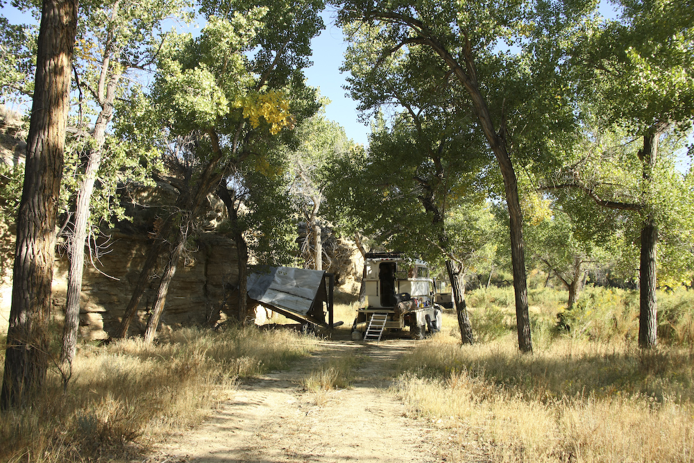
We followed the trail to a nice copse of Cottonwood trees in a flood plain of the White River. The structure to the left of the mog is an abandoned "cowboy camp". They had some logs and aluminum roofing to provide a semi-sheltered are. The construction was "totally Jed" as can be seen by the fact it is no longer standing. Plus, using typical Jed reasoning, the location they chose is in a low spot so the water accumulates when it rains.

We had the whole place to ourselves. We did see a number of oil field trucks as oncoming traffic, but nobody was following us. The camp was deserted and we planned to go for a swim, but the banks were muddy with clay-based sediments and the water was cold. In the end, we just sat at the edge and watched the brown water flow past sipping Cape Hounds. A Cape Hound is a new cocktail we invented that is a hybrid of a cape codder and a gray hound. It may sound nasty, but it is tasty. Perhaps too tasty. The formula is thus: 2 parts vodka, one part cranberry juice (or cran-rasberry) and one part Squirt. Use ice, of course, and stir. Vary proportions to suit your taste.
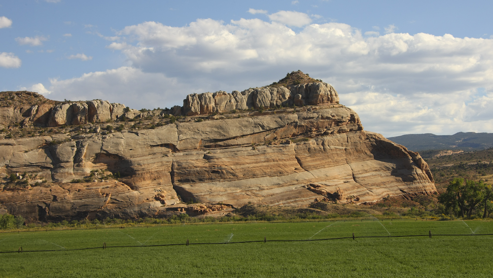
We had a great dinner that night. Kathleen fixed fried chicken with the trimmings and we watched a DVD on our laptop. We had a fantasy about a campfire, but it was pretty cold and the bugs were thick so we just stayed inside. Above, the morning sun provided a great view of the cliffs that line the White River water course.
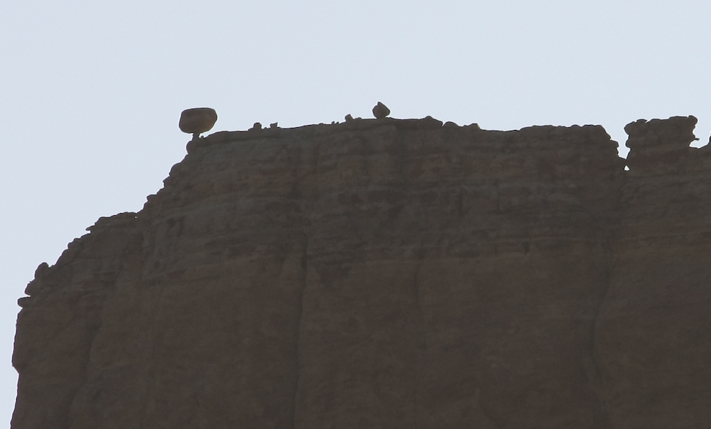
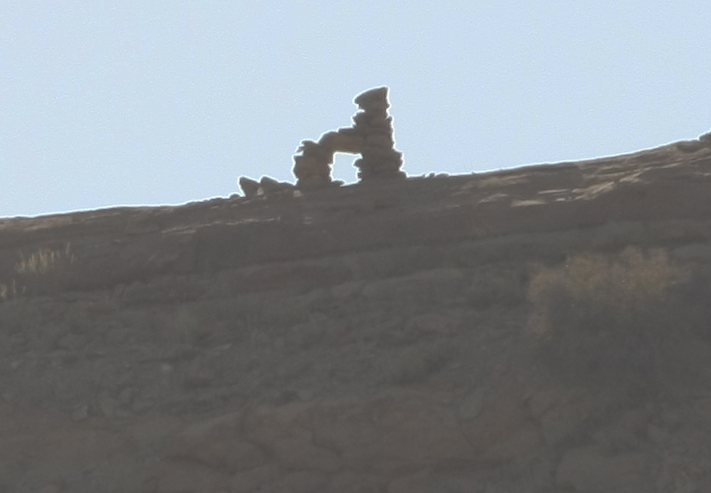
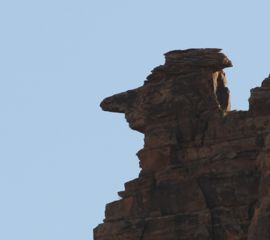
Visible on the far ridge were fantastical shapes eroded by the wind and rain. I have seen "balanced rocks" before, but never one as radical as this one.
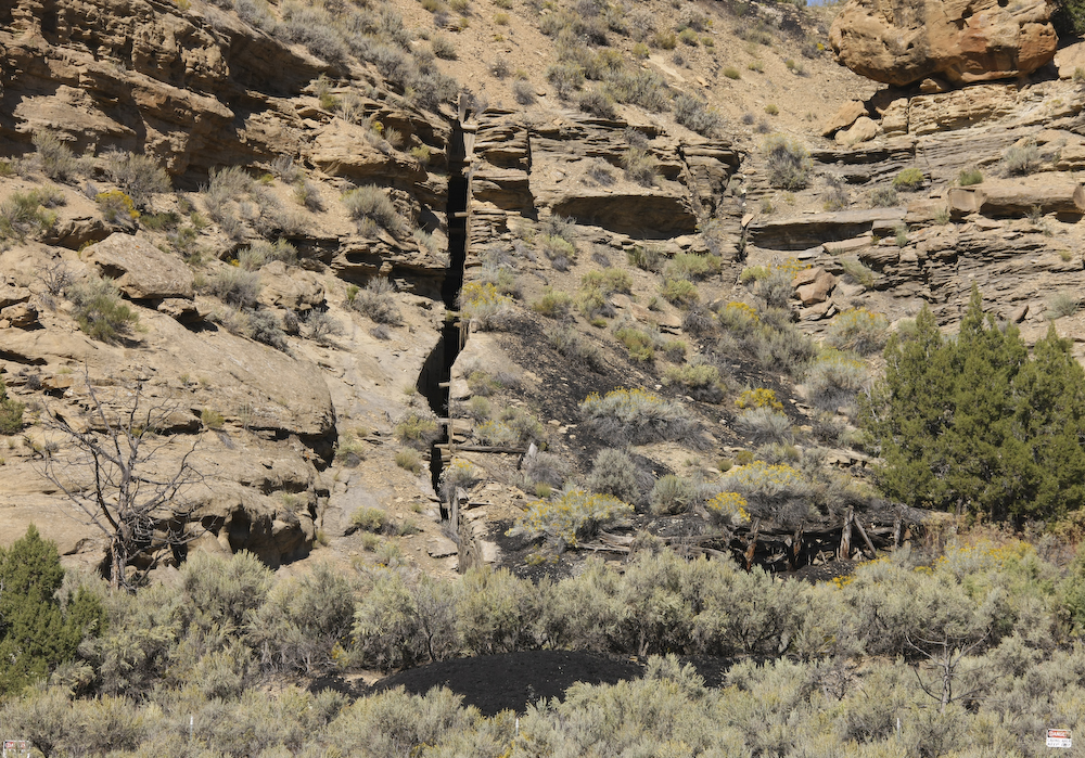
Our path south took us through Asphalt Wash and into some areas that were mined years ago. Above is a test-dig for coal and tar sands that was right by our path. Note the black pile in the foreground. The sign at the bottom says "Danger: Caving Area. Keep Out". Enough said for me. We moved on.
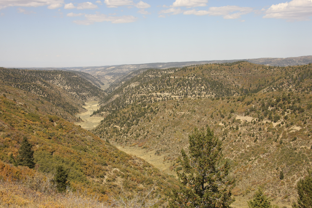
We got deeper into the Book Cliffs and the road took us to a narrow, steep ridge with excellent views.
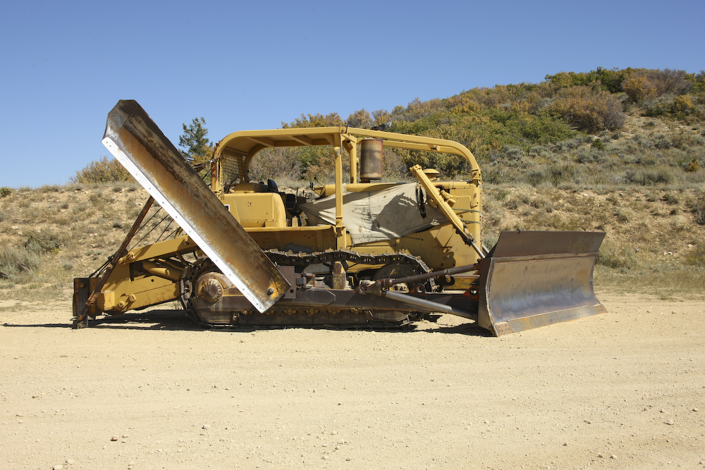
The roads in the area, while steep and narrow, were in pretty good shape. We came upon this customized bulldozer at the top of the ridge. I went over for a closer look and discovered that the side blade is raised and lowered by an interesting cable hookup with the ripper attachment on the back. The ripper is hydraulically activated and when it is raised, the cables allow the side blade to fall into the plowing position allowing the cat to clear a wide swath with one pass and push dirt over the edge of the cliff.
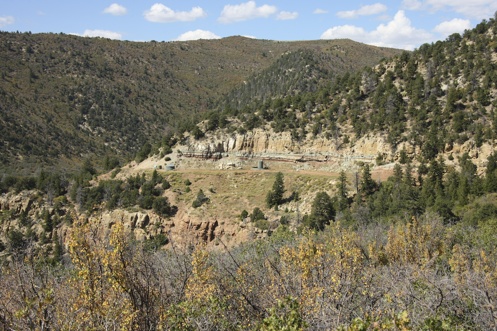
Deep beneath the Book Cliffs is a pretty big reserve of natural gas and oil. There were many pump stations and lots of pipes running along the trail.
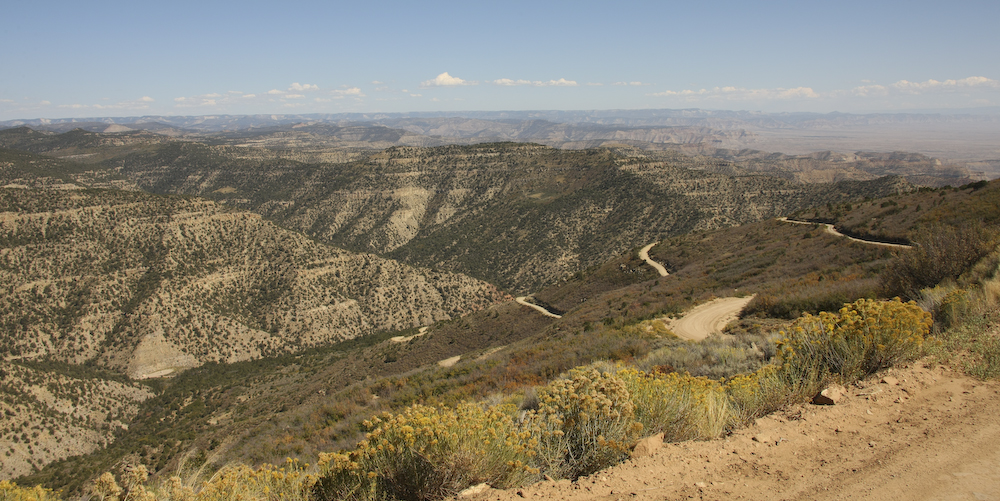
The trail that went along Book Cliffs was steep, narrow and scary. This is one of the tighter roads I have seen recently.
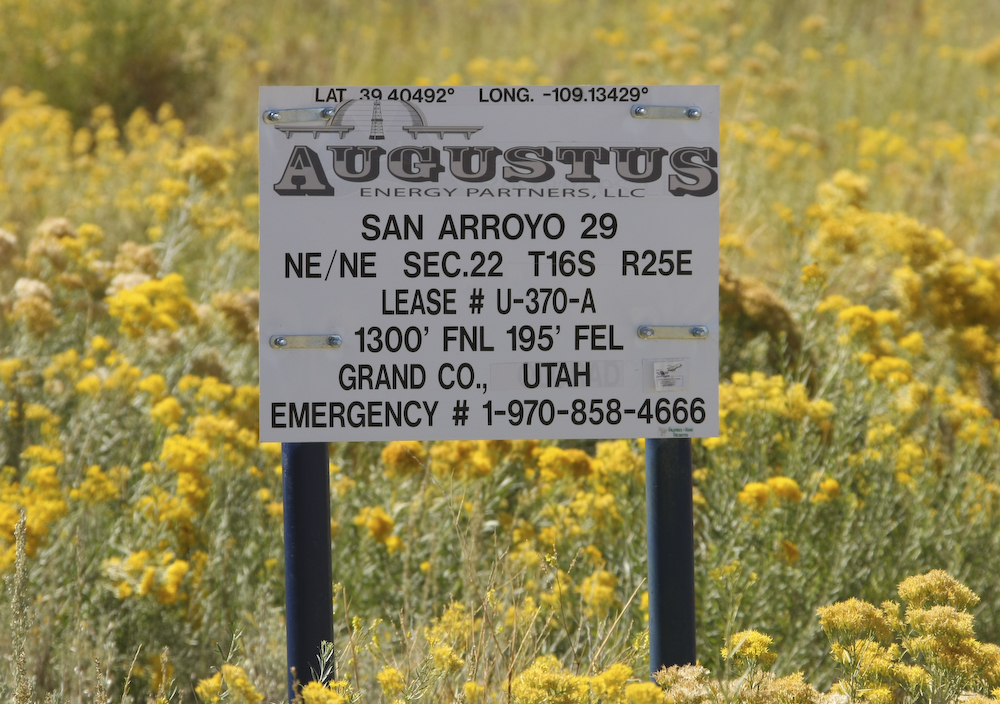
One of the many signs we saw next to pumping sites.
Further south, out of the Book Cliffs proper, the terrain opened up providing interesting scenery.
We did a short distance on the blacktop before we hit the interstate. From there, we went west, then south on a side road to the Colorado River. From there, we followed the river west to Moab, UT. The river bottom has some nice land and great views of the slickrock.
We passed many interesting rock outcroppings along the way. This one is pretty anthropomorphic, to say the least.
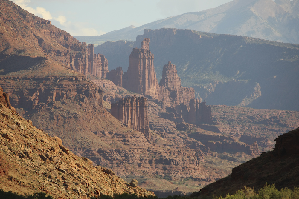
As we got closer to Moab, the structures got bigger and we were able to see the La Salle mountains.
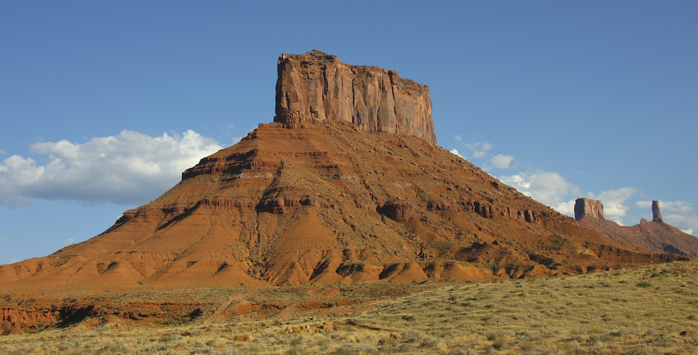
Finally, the canyon opened up a bit allowing us to see farther into the distance. These monuments were visible to the south of the road.
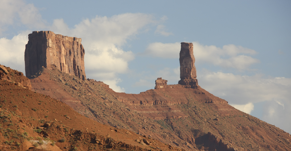
A number of the monuments were quite large.
We made our way into Moab and found that there was one first-rate restaurant in town -- the Desert Bistro. Since we had to go right past the place to get to town, we decided to stop and get reservations. Good thing too, as the place was packed. It seems that there was a Hummer Convention in town and they had rented the patio for their event. With a parking lot full of non-dirty, non-dusty, non-scratched, shiny Hummers, I HAD to pull in there with the mud-covered mog to show them "who's was bigger". No question here. Several of the guys came over for a chat, but most were intimidated and stayed on the patio.
Dinner was first rate, one of the better ones we have had this trip. I had the bison fillet and it was super. Moab was crowded and we had challenges finding a room. So many challenges, in fact, that we gave up and stayed in a campground. But, they had what we wanted which was a shower, water to fill our nearly empty tank and close proximity to the restaurant. In fact, it was right across the street. But, not wanting to re-create the excesses of the previous restaurant visit, we limited our consumption to only one bottle of wine.
Next day, we planned to explore Arches National Park , go to Dead Horse Point and then head south out of town.
| Previous Adventure | ||
Photos and Text Copyright Bill Caid 2008, all rights reserved.
For your enjoyment only, not for commercial use.