Since
we were in Tucson and have not been "up the mountain" in several
years we elected to drive up the highway into the Santa Catalina
mountains to the summit. There is a small town at the
peak, called Mt. Lemmon. Mt. Lemmon has been subjected to
a number of fires in the recent years, some coming right to the
limit of the village. The road is only 27 miles to the
top, but the road is narrow and steep with tight turns and large
cliffs. We loaded our cameras into the 535i and headed
uphill.
The photos below are what we saw.
Our
hostess lives on the northwest side of Tucson in Oro
Valley. So, to get to Mt. Lemmon, we had to traverse the
entire valley. Once we actually headed up the mountain,
the scenery was non-stop. We came to the first view point
and pulled over. The view point parking lot was cut into
the steep cliff walls and the parking lot offered nice views of
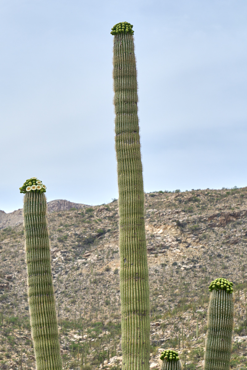
the surrounding cactus. The terrain was steep enough that
we had cactus-top views of the sahauros in bloom. One of the
bigger sahauros was preparing for a large bloom with many buds
"ready to go". We were perhaps 2 weeks early.
Only one
of the buds was actually in bloom, but it was not too hard to
imagine what this would look like in a week or so.
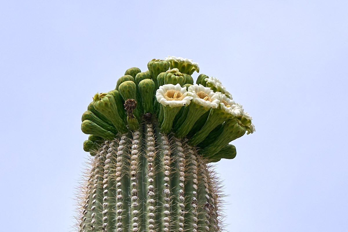
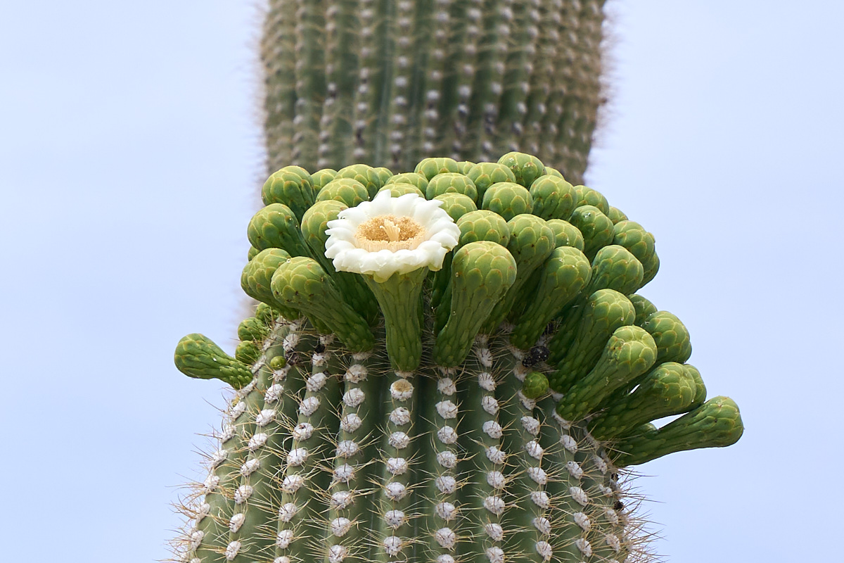
Most of
the bigger sahauros in the area were preparing to bloom.
This one had a number of buds with active flowers.
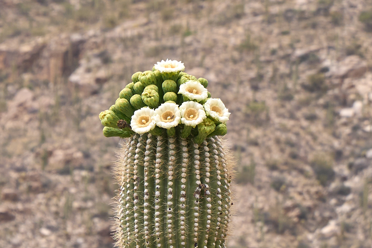
A variety
of insects and bats serve as the pollinating agents for the sahauros.
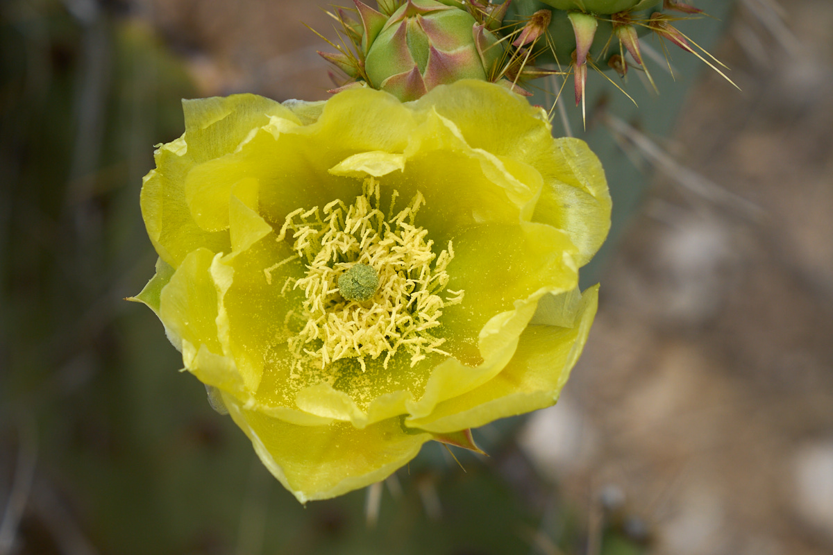
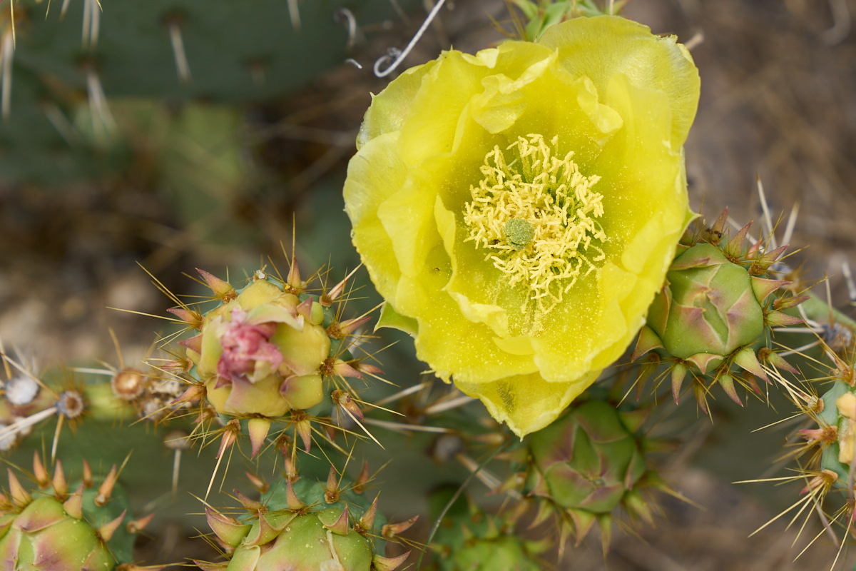
Other
cactus in the area were in bloom as well. This prickly
pear was in bloom as well. Note the intricate structure of
the flower.
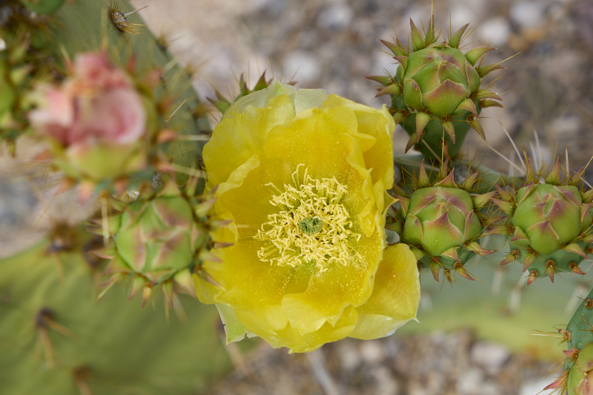
The
near-by buds would be blooming soon.
Note the
thorns on near-by buds.
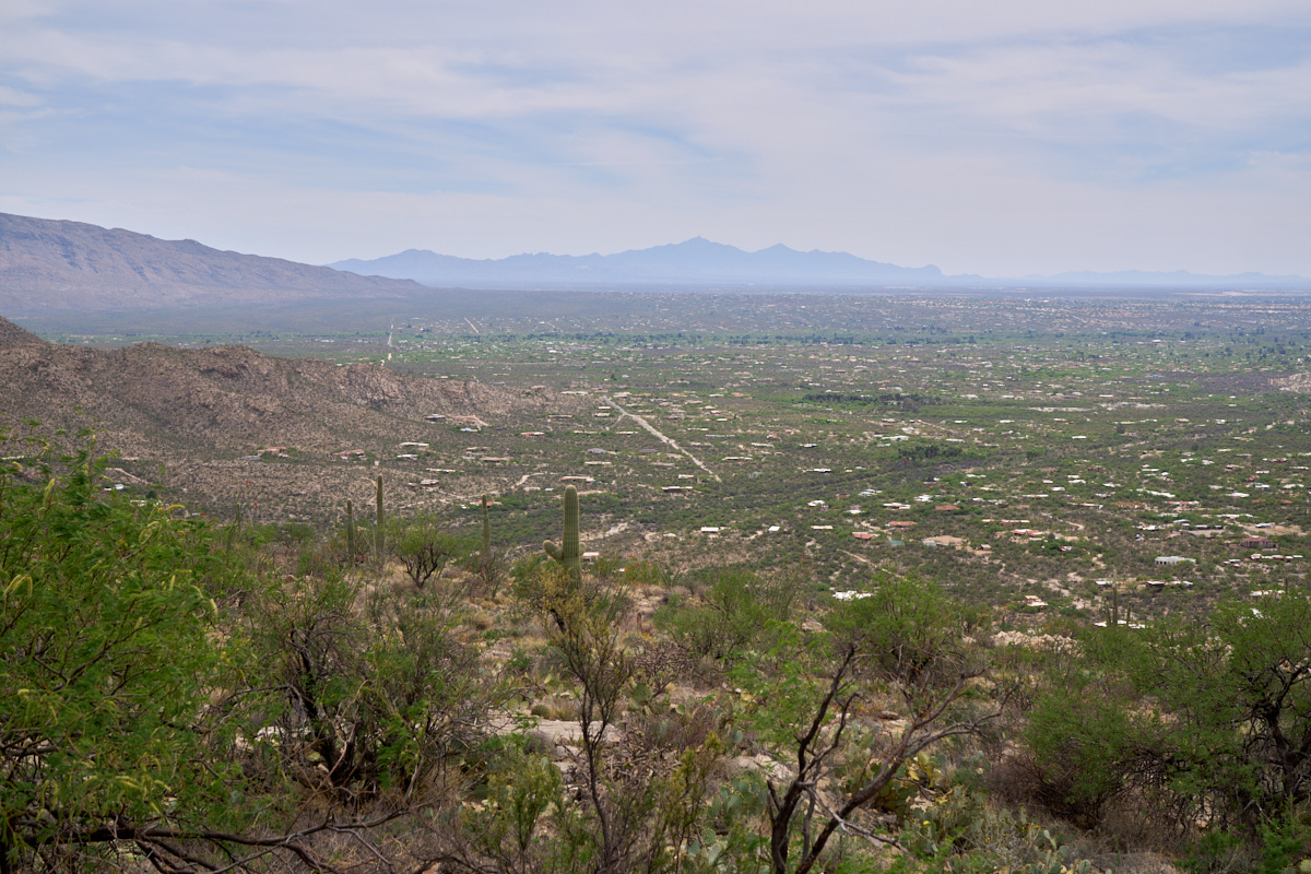
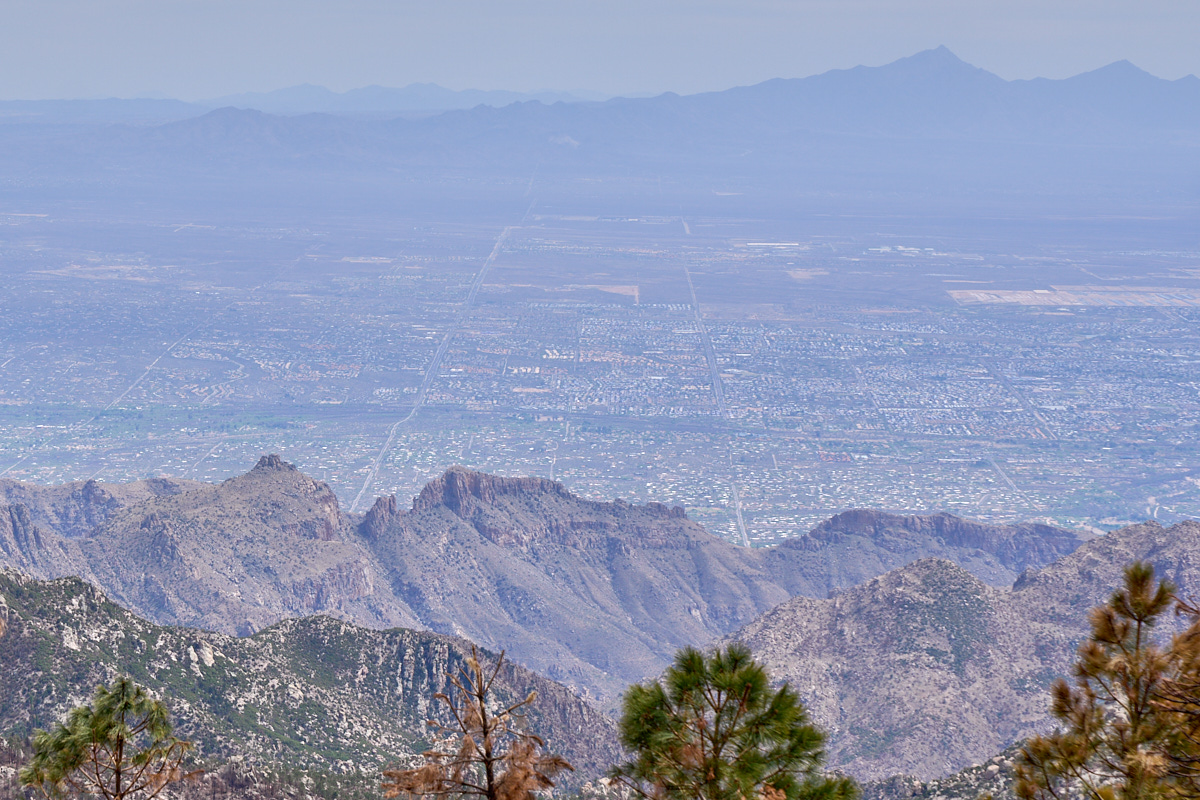
The
first viewpoint offered good views of the eastern portion of the
Tucson valley. At the left of the photo above is the
western flank of the Rincon Mountains. In the distance are
the Santa Rita mountains. "Elephant Head" is the steep
cliff at the right (west) edge of the mountains.
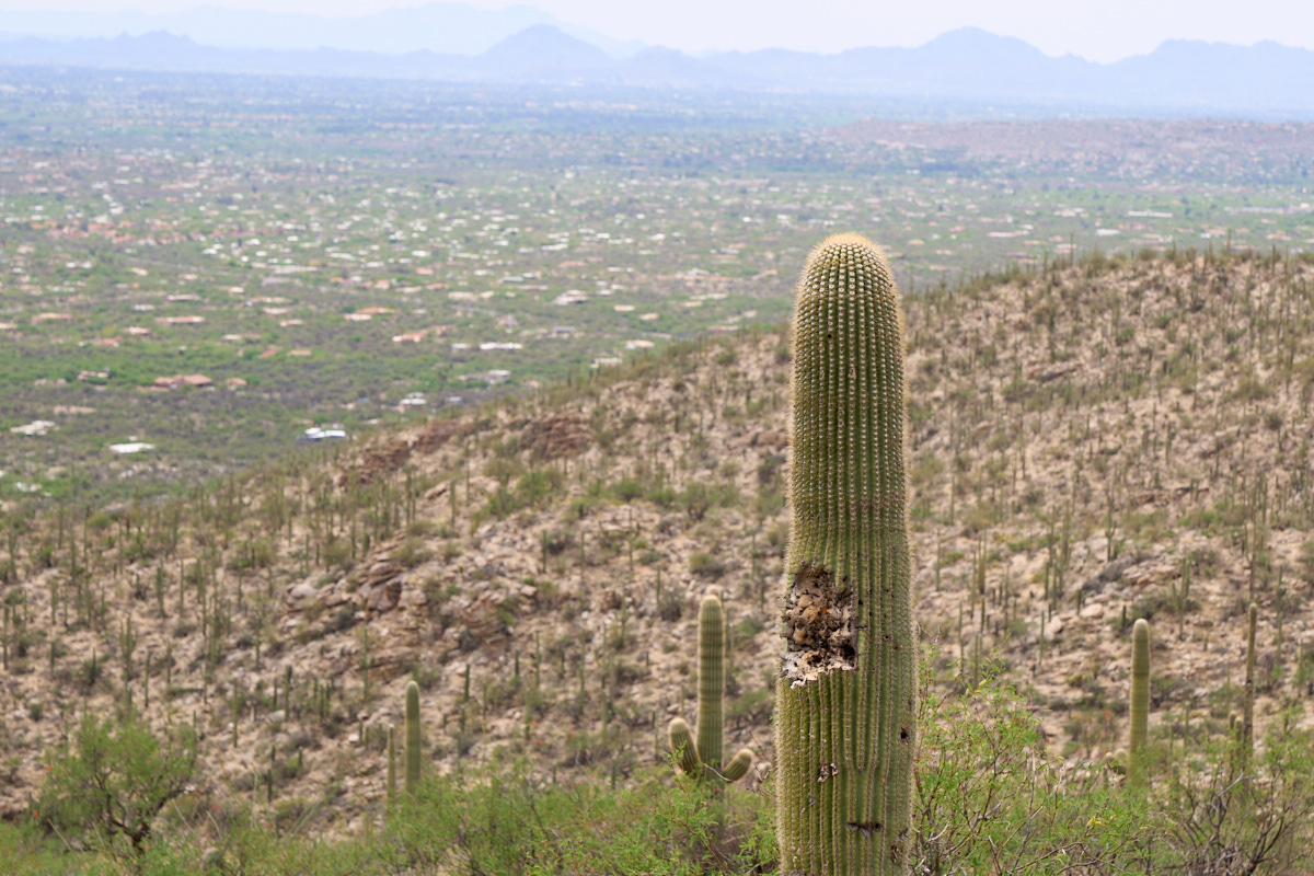
Note the
bird damage on the side of the sahauro.
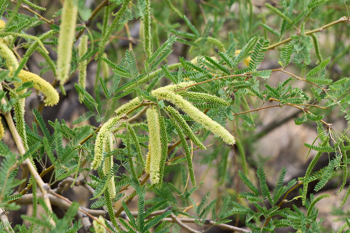
Also
visible was a "velvet mesquite" that was in early bloom.
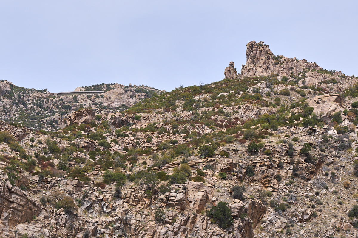
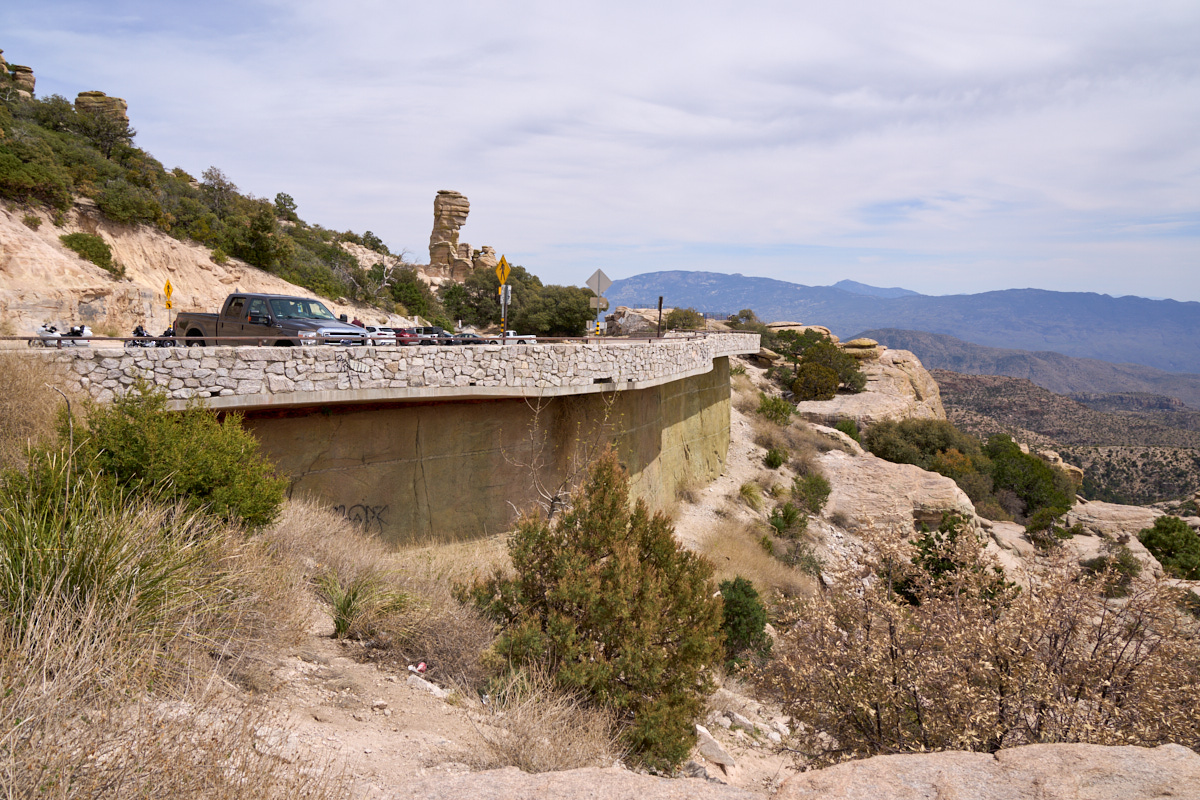
At
another turn-out further up the road we got a nice view of a big
fin of Catalina Gneiss that produced narrow hoodoos. But,
the real story in the photo above is not the hoodoos but rather
the "parking lot in the sky". Note the concrete structure
at the upper left of the photo. This is the parking area
for the "Windy Point" view point.
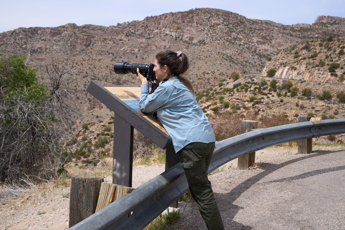
Kathleen
was enjoying her new Fuji XT-4 camera.
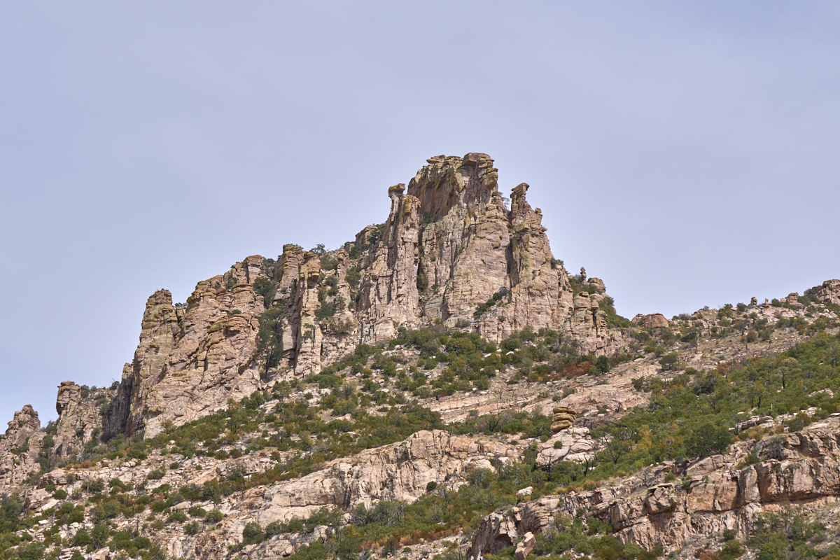
The
hoodoos on the far fin were steep and pronounced.
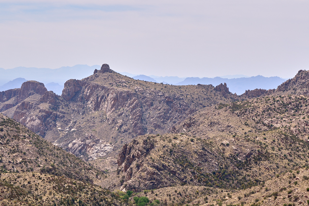
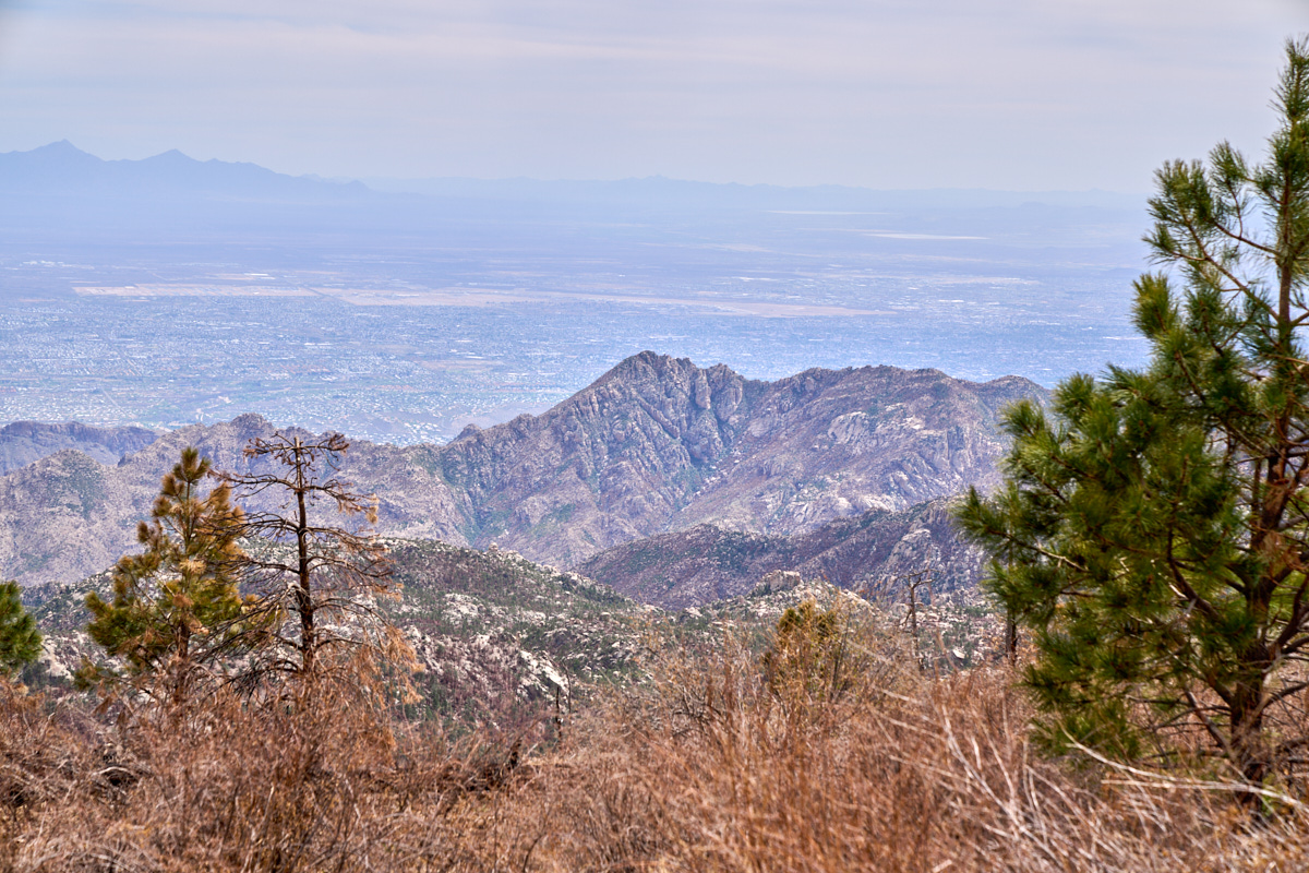
From our
turn-out we could see Thimble Peak, a prominent landmark clearly
visible from the valley floor and Sabino Canyon. Note the
REALLY steep east-facing cliffs.
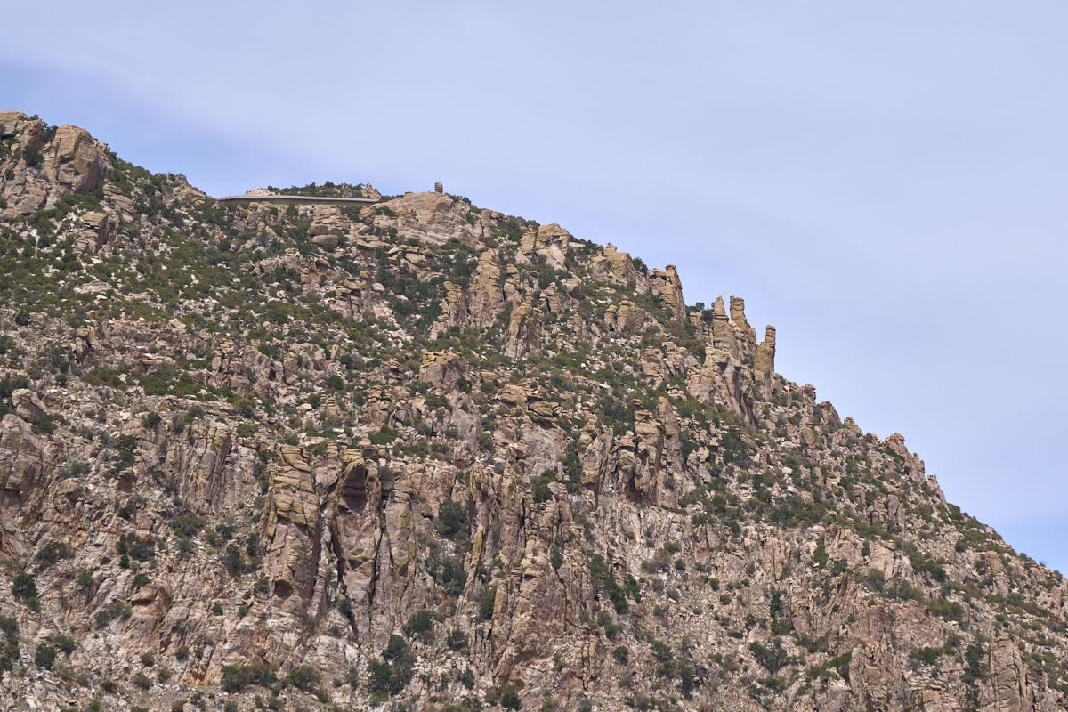
Another
turn-out further up the highway gave us another view of the
hoodoos on the upper riidges.
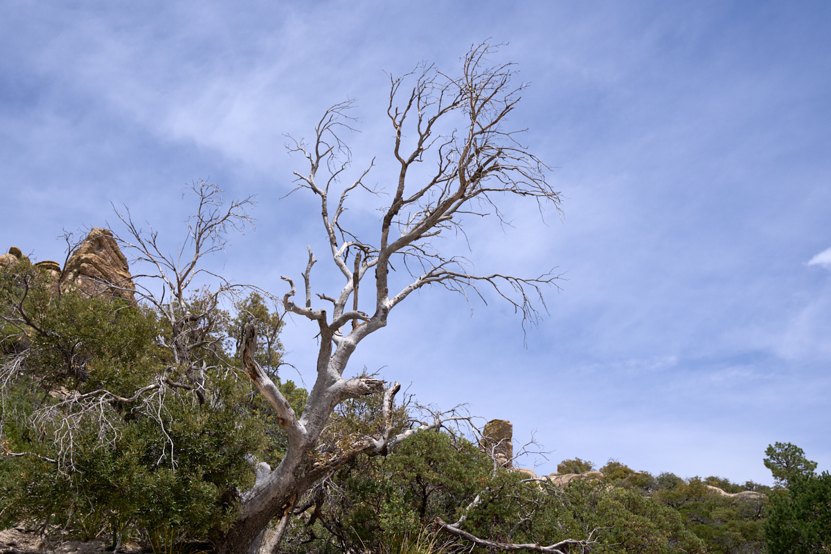
The
Santa Catalina mountains are desert mountains and are therefore
frequently subjected to wildfires. Indeed, in the last
several years there were several large fires it the area.
The bare tree above was one of the victims of a recent fire.
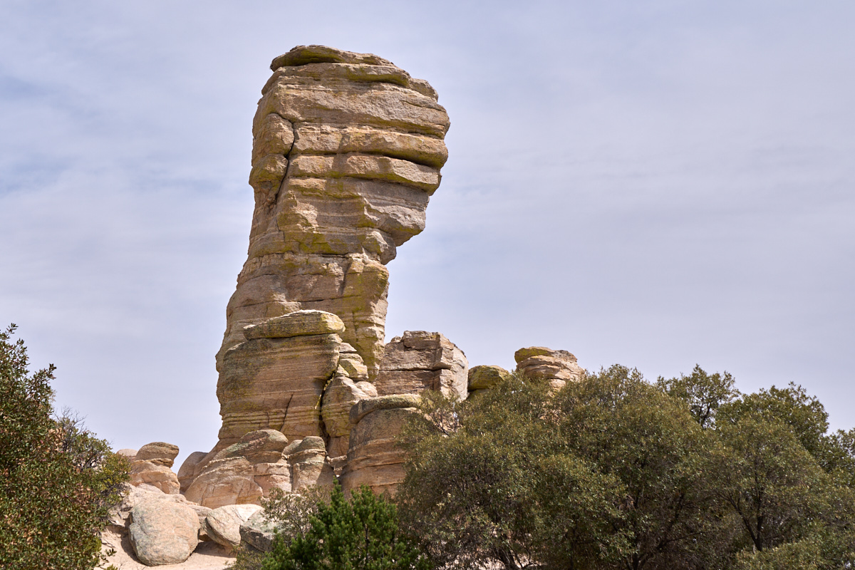
This
hoodoo is called the "General Hitchcock Monument". I
climbed this hoodoo back in my mountain rescue days for practice.
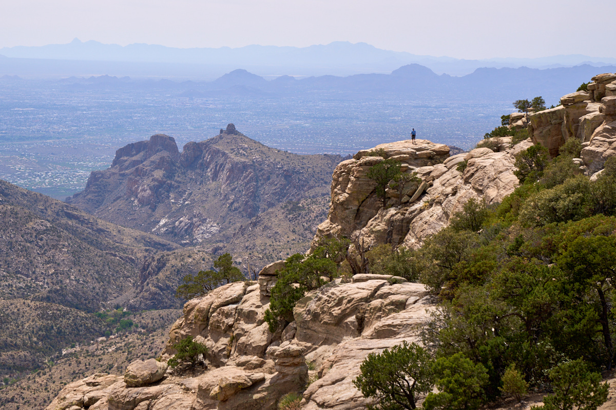
We came
to the Windy Point viewpoint and were rewarded with expansive
views of the valley below. Thimble Peak is clearly visible
as is the tourist taking in the magnificent view.
Closer
to the cliff edge, the reason for calling it the "parking lot in
the sky" becomes apparent.
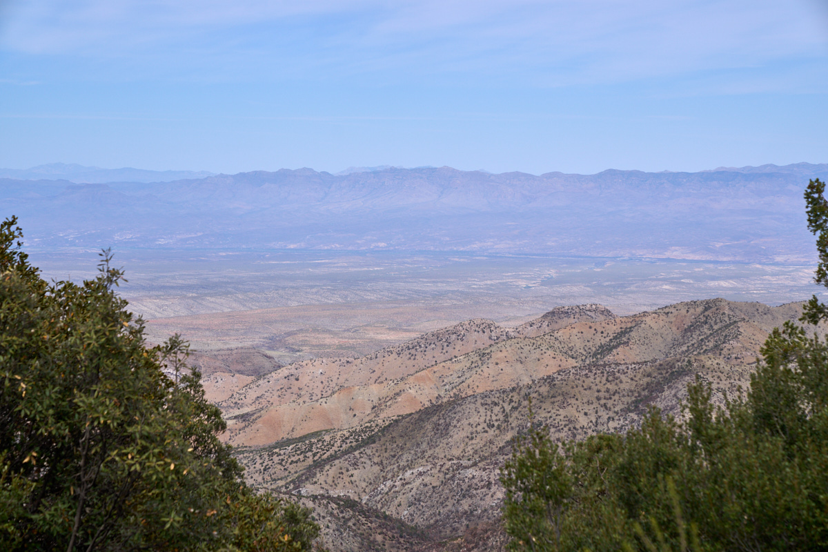
Further
up the highway, we came to a viewpoint offering an overlook of the
San Pedro River Valley. The course of the river is visible
in the photo above.
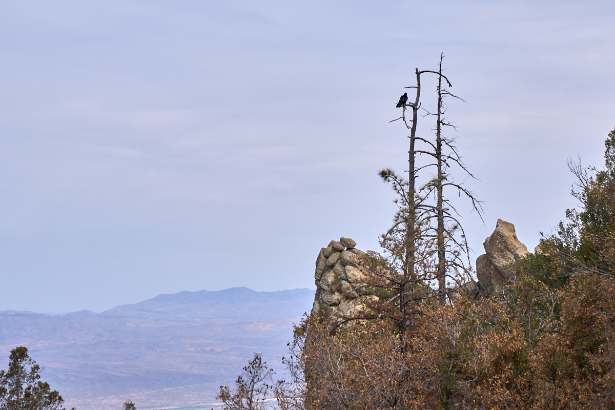
While
taking in the view of the San Pedro River, we spotted a crow
sitting on a snag.
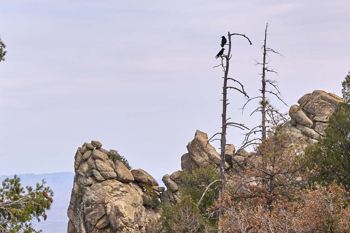
Within
seconds, the crow was joined by his(her) mate.
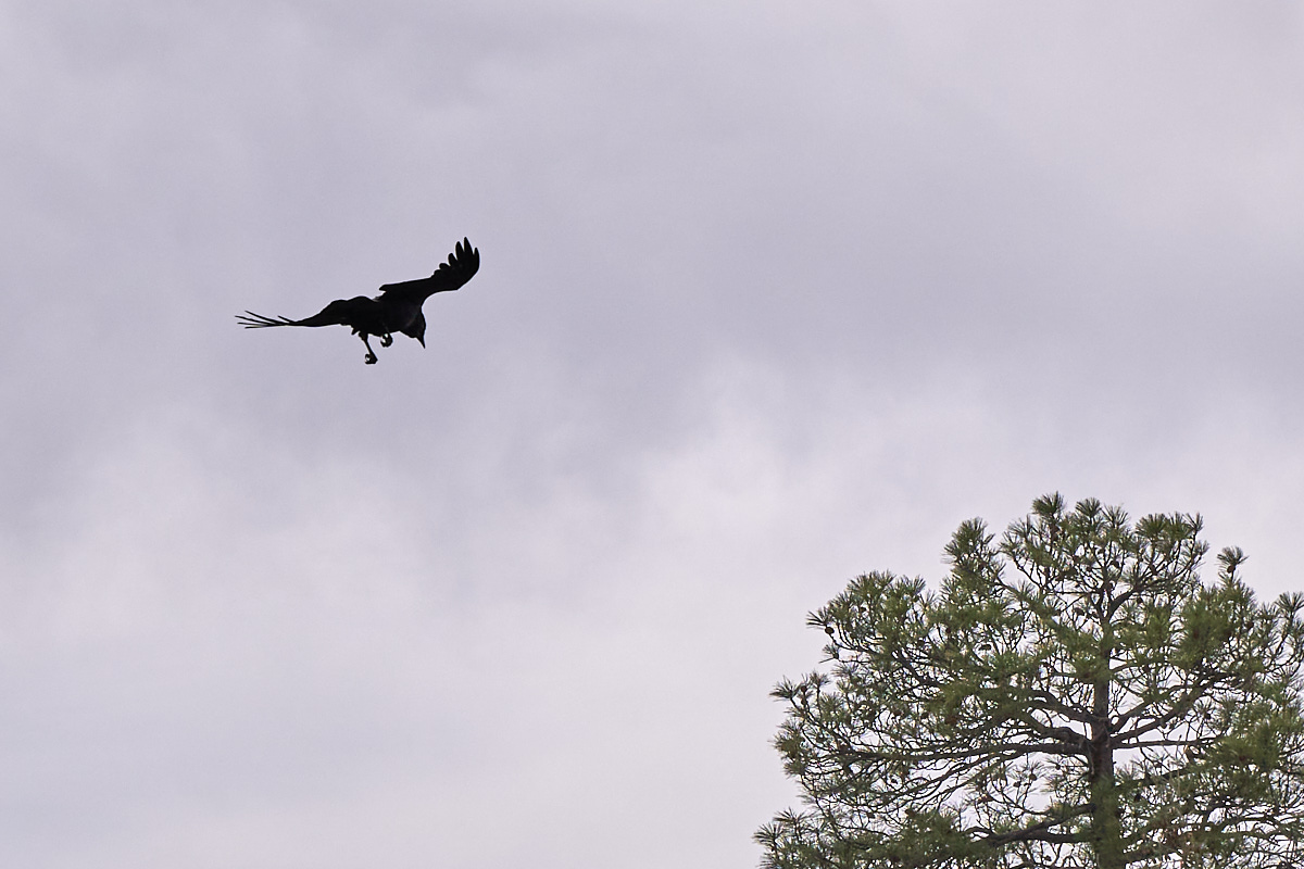
Within
seconds, the second crow flew off over our position.
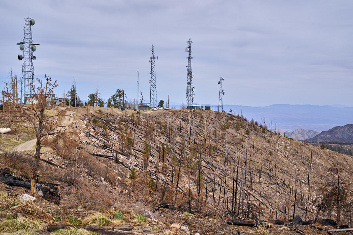
We
followed the road to the top of the mountain, past the ski
area. The road dead-ended in a dirt parking area that
allowed us to see some of the damage from the recent
fires. Visible at the upper right is the San Pedro River
Valley.
| Previous Adventure | ||
| Trip Home Page |
Photos and Text Copyright Bill Caid 2021, all rights
reserved.
For your enjoyment only, not for commercial use.