
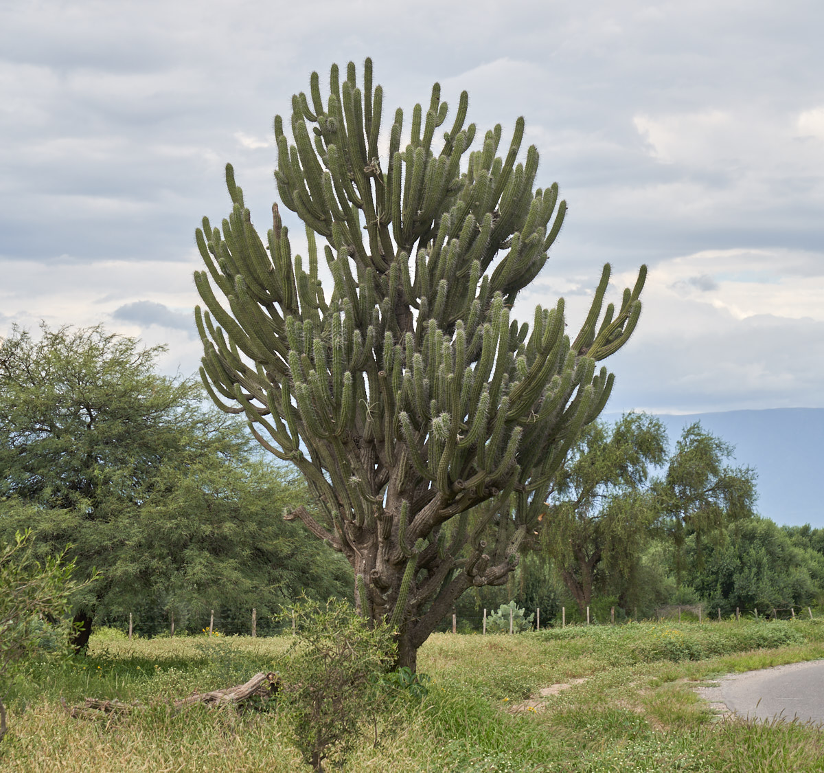
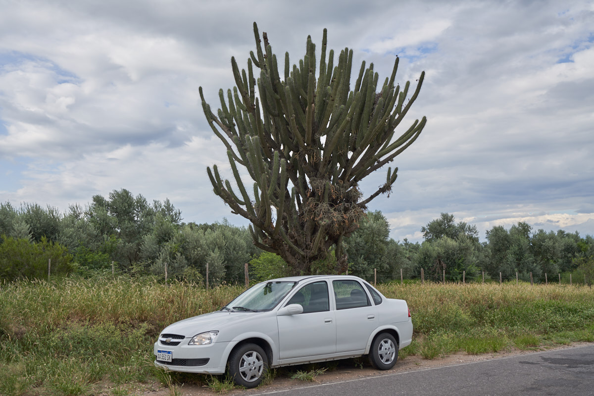
The photos below are what we saw.
Across
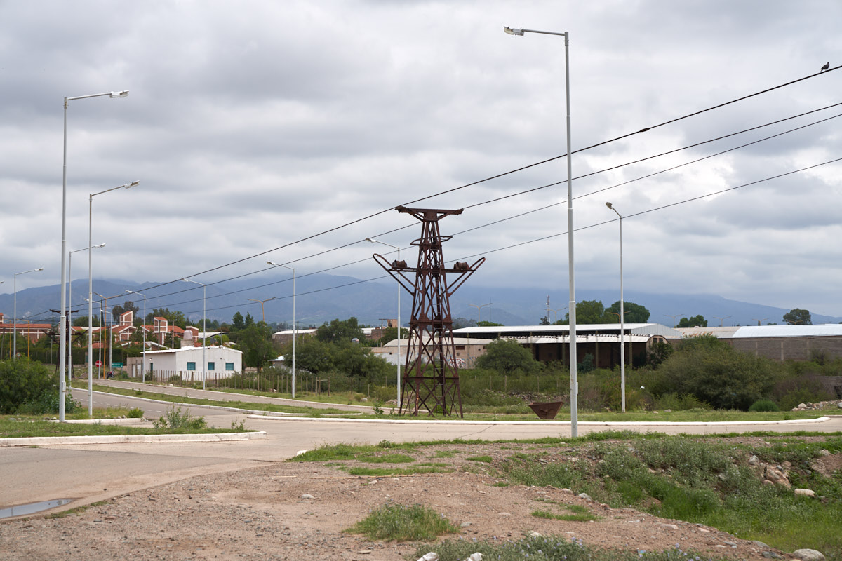
the round-about from the YPF fuel stop was this classic steam
engine. This was a stationary power unit, but built with
wheels so it could be relocated if required. While not
explicitly stated, I believe this unit was part of the Mejicana
mine near Famatina. More on that below.
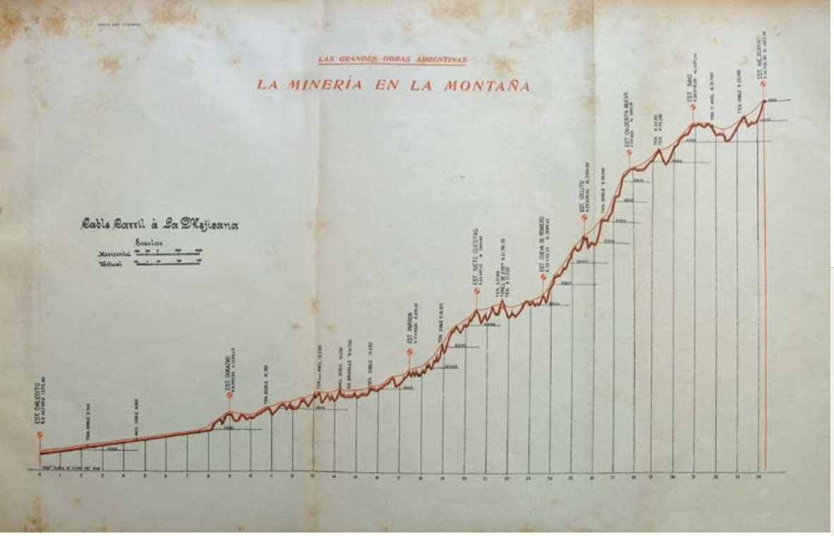
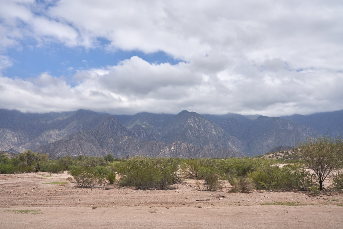
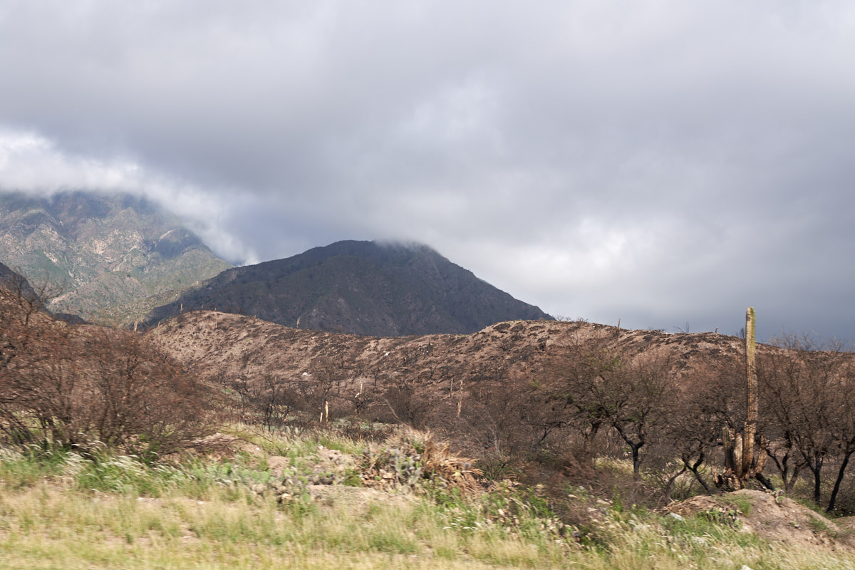
This
area of the Andes hosts a wealth of mineral resources.
Starting with the Jesuits, intrepid explorers have roamed these
mountains in search of gold, silver, copper, lead and iron
ores. In the late 1800's the area around Famatina and
Chiliceto had developed into an important mining area. A
substantial deposit was found high in the Sierra Famatina.
But, this area is remote, rugged and difficult to access.
A plan was developed to construct a cableway for transport of
ore and material, both up and down the mountain to the La
Mejicana Mine (The Mexican). I have a fraternity buddy
that has worked in these mountains as a geologist and he
provided me with a brochure that described the mine and the
construction of the cableway. I have taken screen-shots of
the most interesting photos included in that brochure.
Above, is an elevation profile of the access to the
mine. Due to the rugged terrain, a cableway was to
be constructed that would carry ore from the mine (at the top of
the mountain) to Chilicito in the flatlands below. In the
end, the cableway, called the "cable carril" (cable highway) was
36 km long and went from the elevation of Chiliceto at 1100 m to
the mine at 4600 m altitude. At one point, this was the
largest construction project on the planet. There were 8
sections using a total of 262 towers and 9 stations powered by 6
steam engines. 140 km of cable was used in the
system. Each bucket could hold 0.3 m^3 of ore. Over
the life of the mine 12,000 metric tons of ore were extracted
and processed. Work product was shipped to the outside
world via railway. Construction was started in 1903.
The photos below were captured using a chemical camera (AKA
"film") of course.
"Back in
the day", heavy objects were transported by pack animals.
Mules were used to carry heavy loads. The really heavy
loads were reserved for humans.
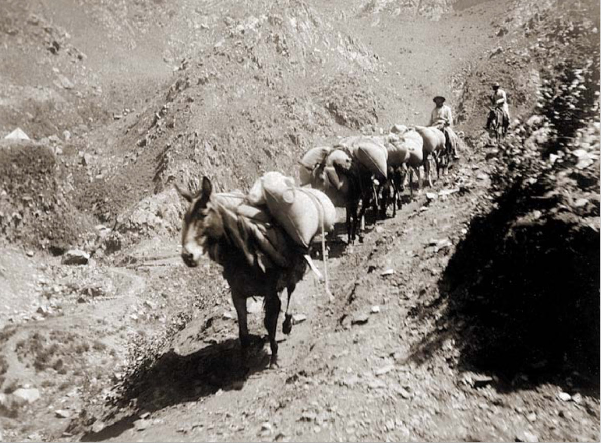
A trail
was established and trains of mules carried supplies and
material to the top of the mine. This was a dry camp, so
even water had to be brought up the mountain. Note that
these mules did not have leads, they knew what to do without
being led.
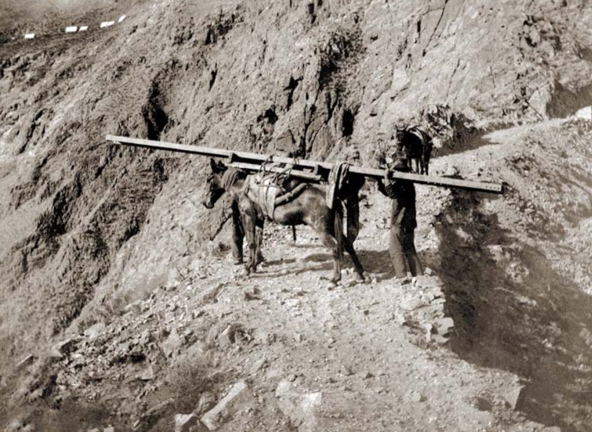
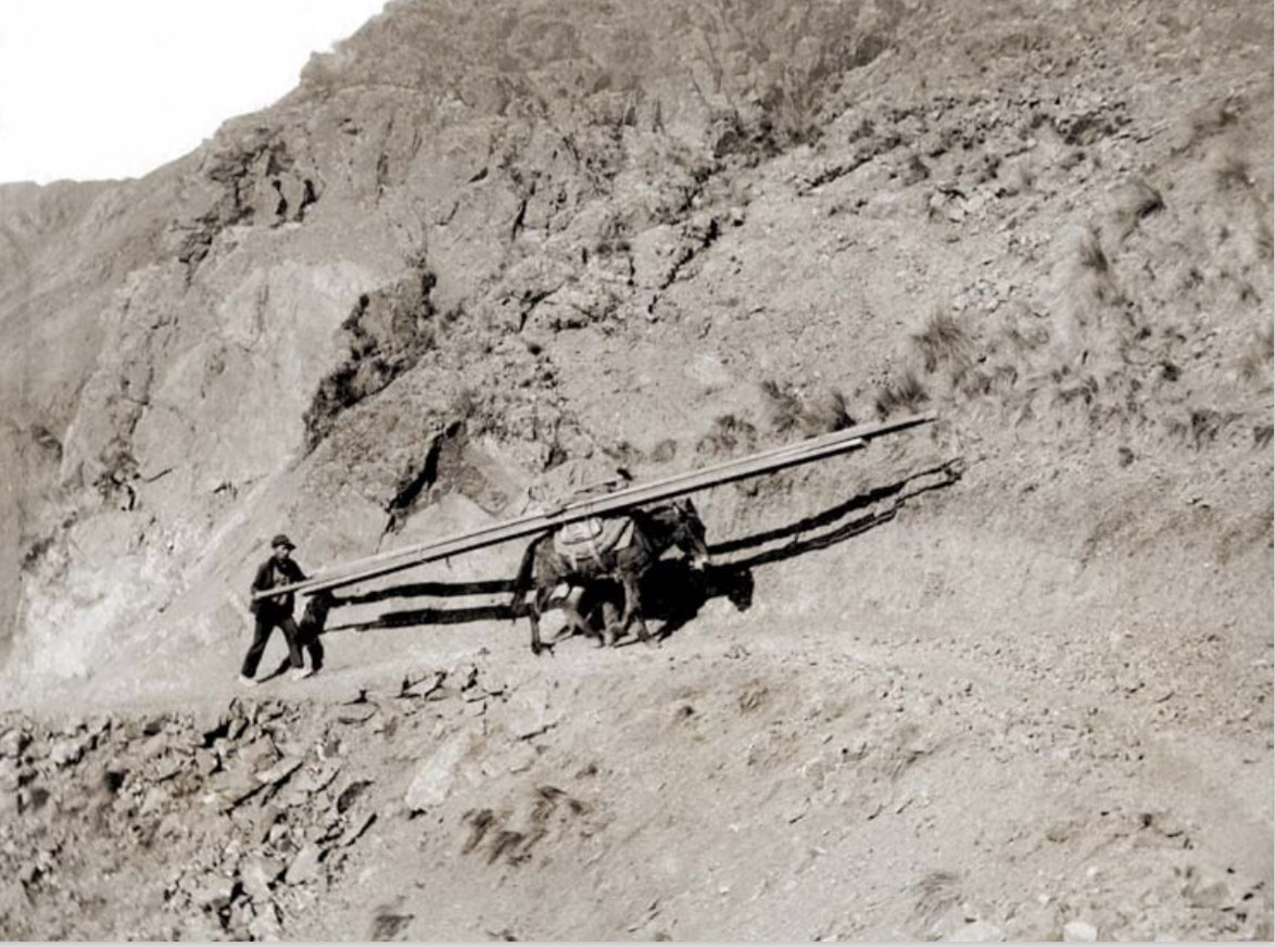
The main
beams for the cable towers required special treatment and
handling. In addition to being heavy, they were long,
awkward and required a human to "steer" the beam during
transport.
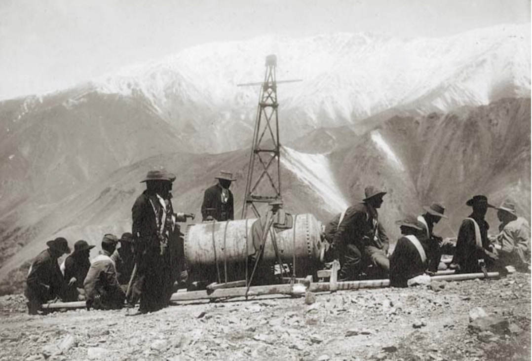
This is
a human transport team. Note they have straps over their
shoulders. These straps were connected to spars that held
the load, in this case a steam boiler. On command of the
leader, the team stands in unison and they start to walk up the
hill. A tower under construction is visible in the
background,
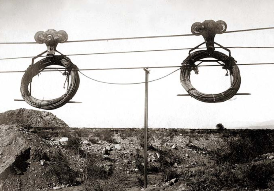
Once the
lower portions of the cable carril were constructed, it was used
to transport materials up the mountain. Above is a portion
of the 140 km of cable that was used in the carril.
For the
really intense portions of the construction, there is no
substitute for human power and coordination. Above, a team
moves cable. Each man is responsible for a length of cable
and they walk in unison.
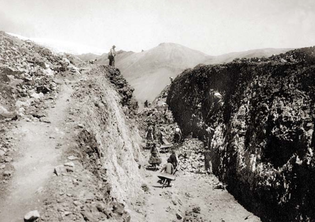
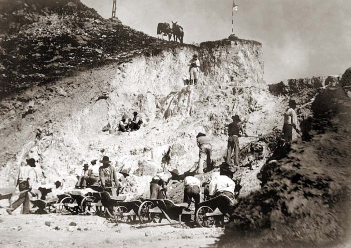
Generally,
the path of the carril was defined by the contour of the
mountain. In the case above, a trench in the mountain was
needed to clear the cable and buckets. This was performed
the old-fashioned way: pick, shovel and wheelbarrows.
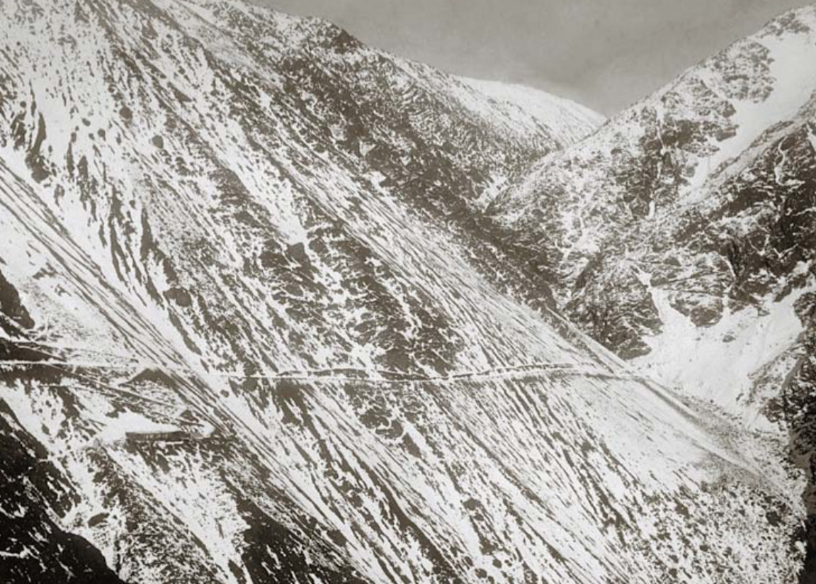
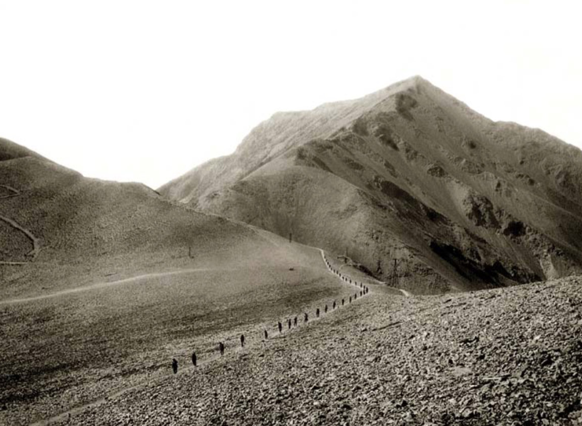
A view
of a small portion of the access trail to La Mejicana.
This trail crosses slippery scree slopes that were subjected to
repeated land slides.
Another
passage way for the carril.
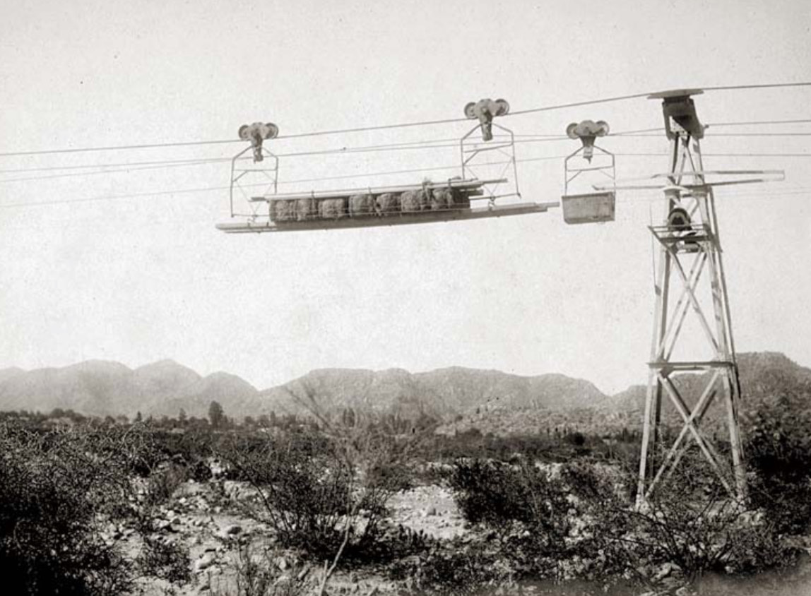
A load
of materials going up the mountain. A muck (ore) bucket is
visible on the rear cable.
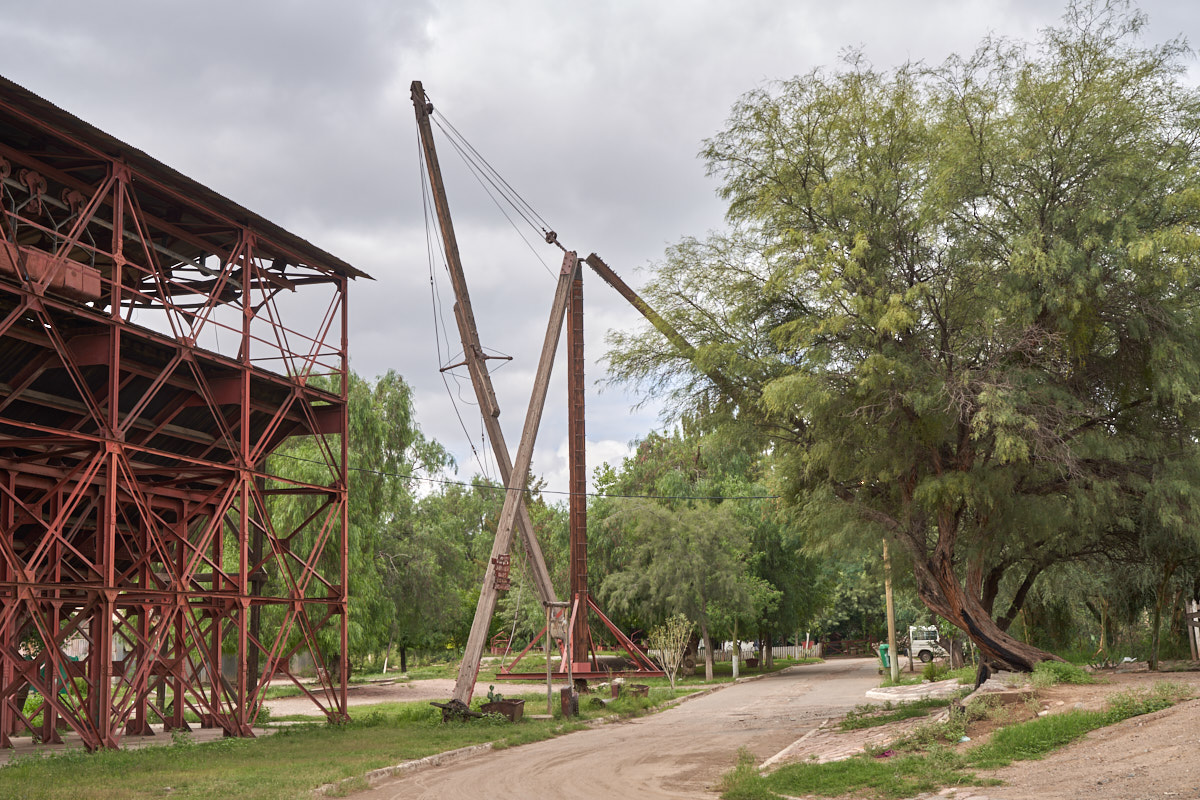
Our
travel path took us to Chilecito and the road went right
underneath the carril. One of the towers is visible in the
photo above.
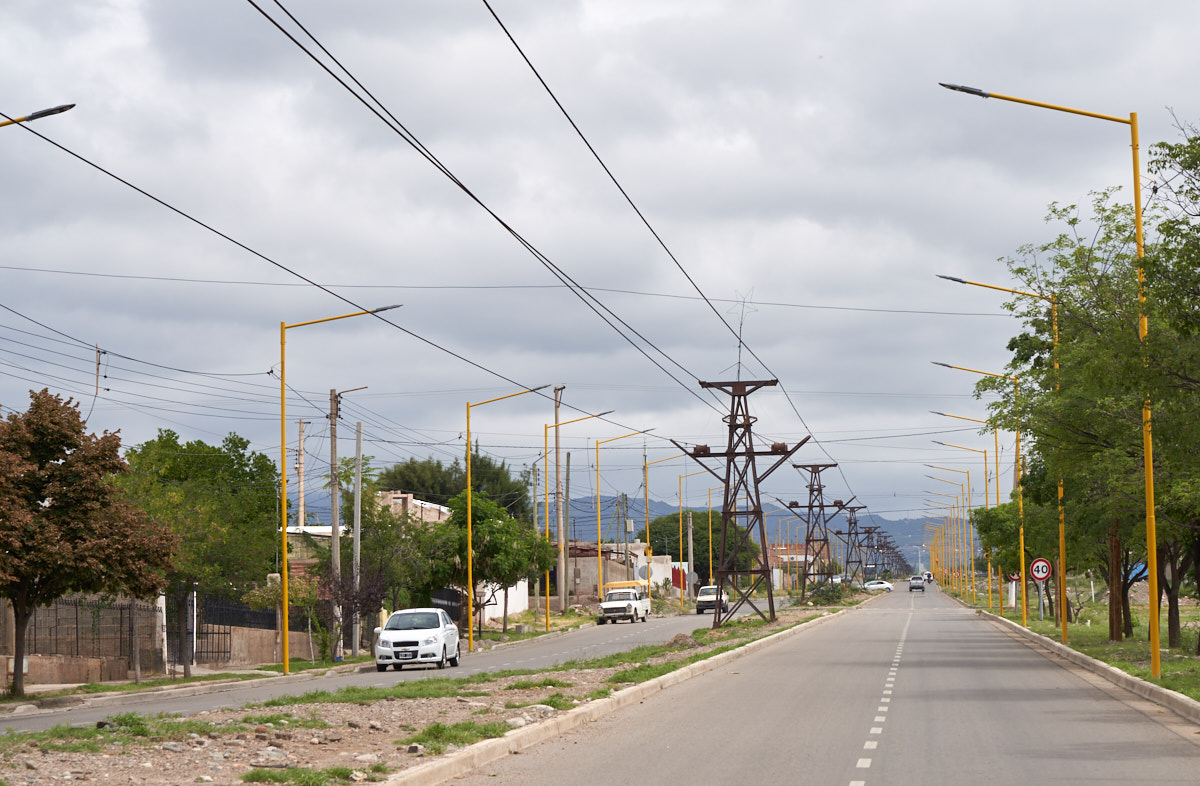 '
'The line
goes through town and the roadway straddles the carril.
The carril is 36 km long.
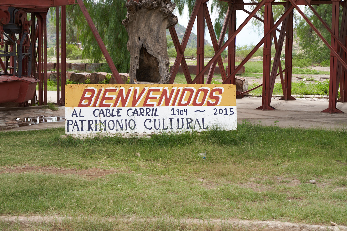
On the
highway there was a sign for a museum, so we stopped to take a
look.
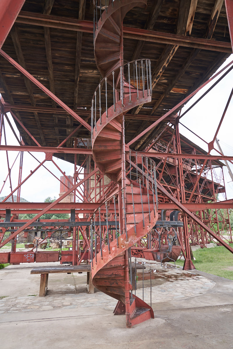
The
museum was really just Station Number 1 of the carril.
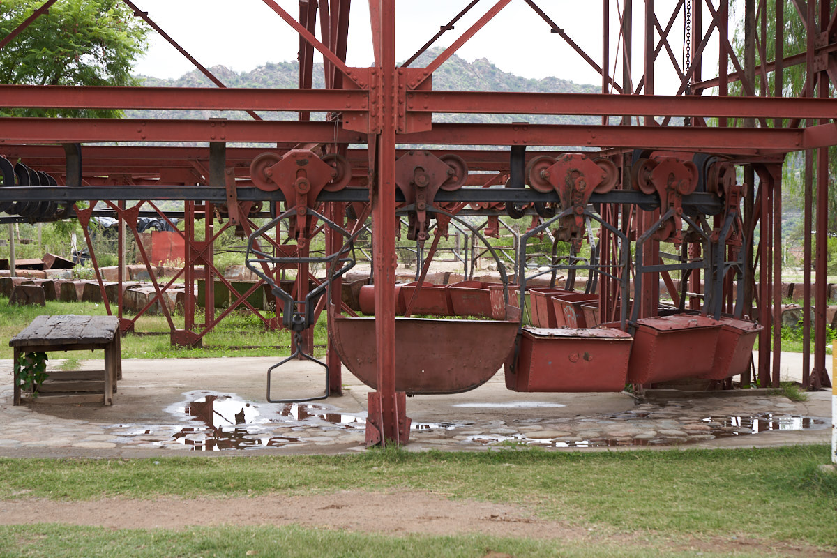
The
station was mostly intact with the cable still present and
buckets in place.
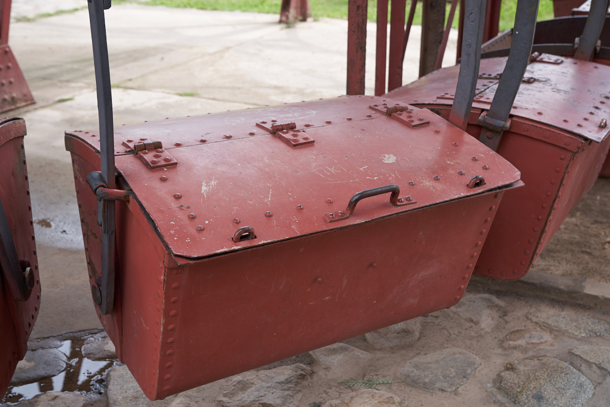
A
close-up of one of the buckets.
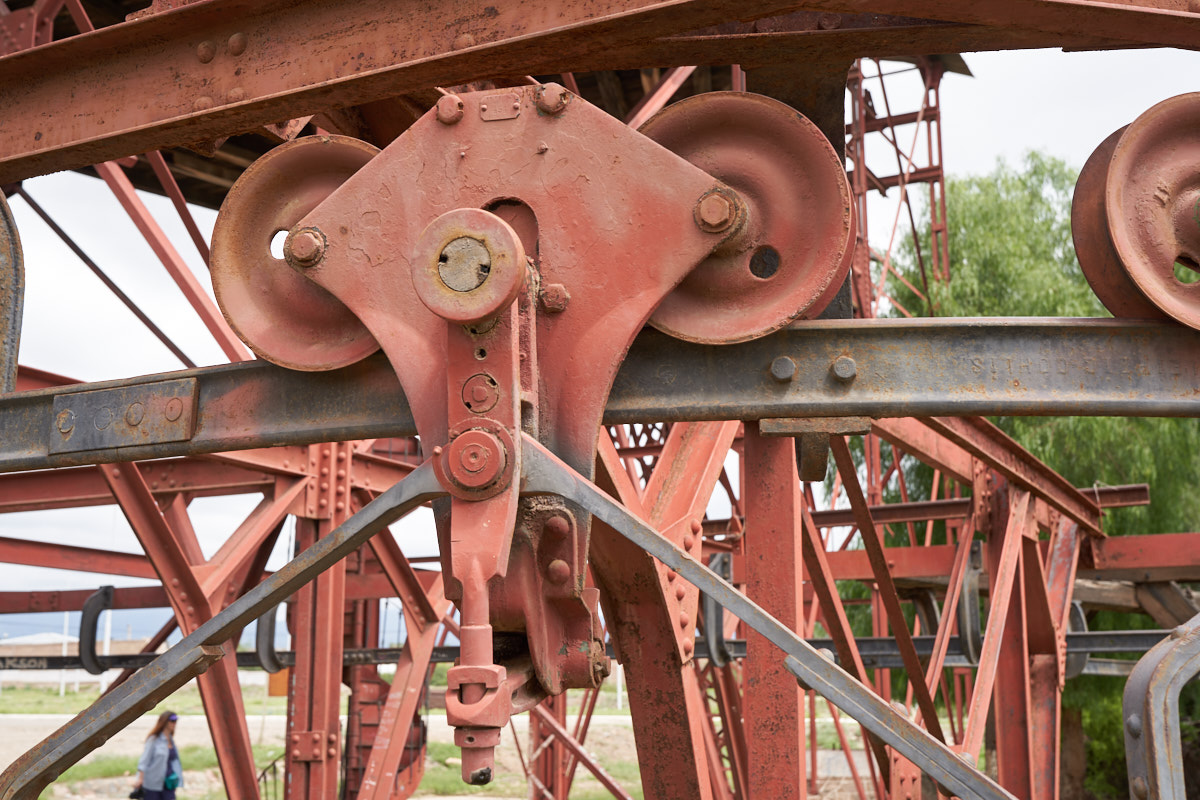
The
truck portion of the assembly consisted of two large pulley
wheels on a frame. The truck ran on support cables and
were pulled via a smaller tension cable.
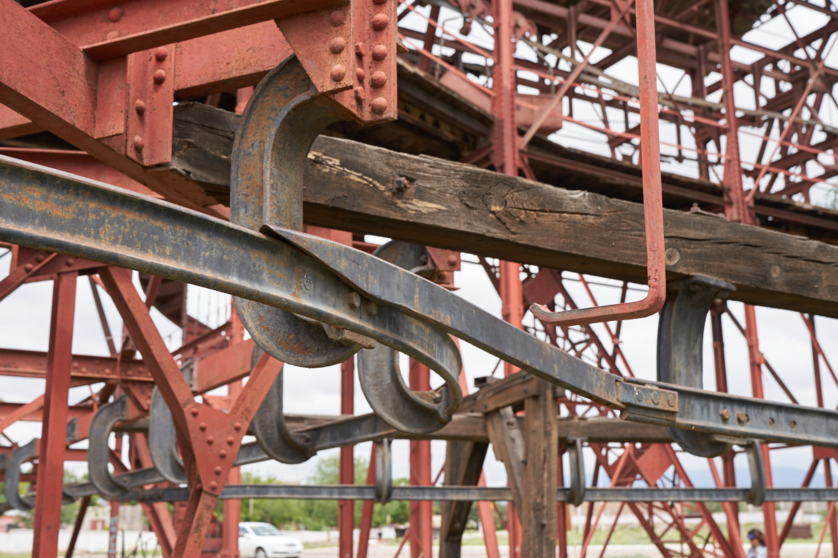
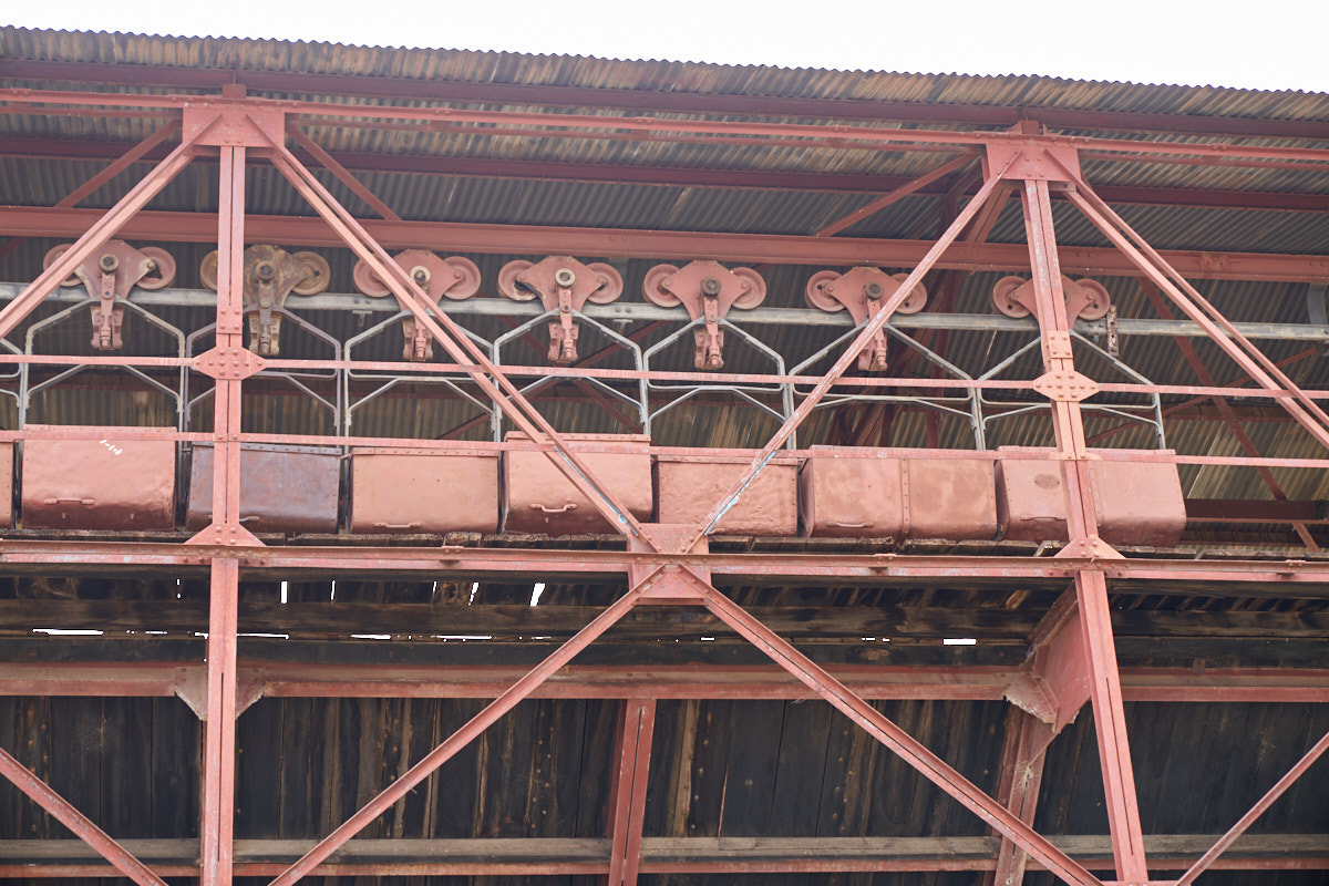
A
mechanical switching mechanism was used to get the buckets off
the support cable and onto a holding track at the station.
The diagonal bar is moveable and rests on the J-hook at the
right.
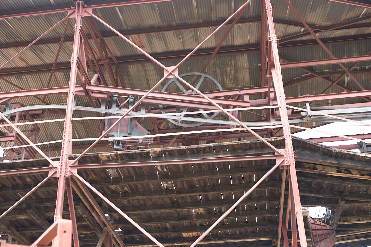
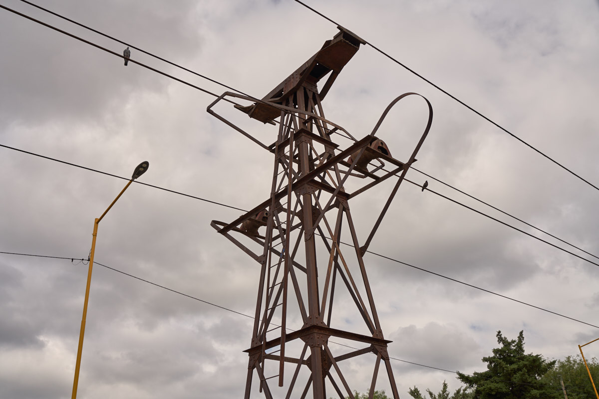
Large
pulley wheels, also known as "bull wheels" were at the end of
the carril.
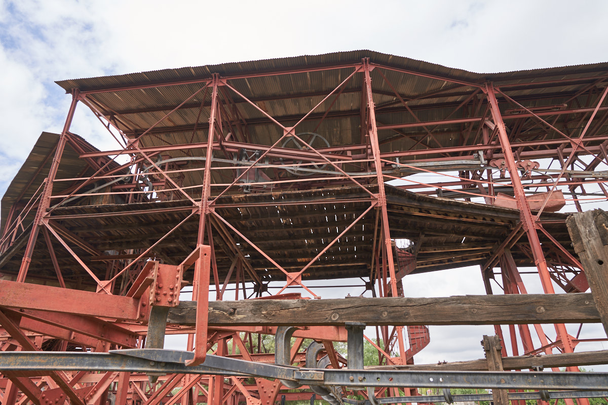
Station Number 1 was large enough to have two levels.
| Previous Adventure | ||
| Trip Home Page |
Photos and Text Copyright Bill Caid 2018, all rights
reserved.
For your enjoyment only, not for commercial use.