Death
Valley Road
Trip
Exploring
wild
flowers in the
desert.
20160308-10
Back to Bill Caid's Home Page.
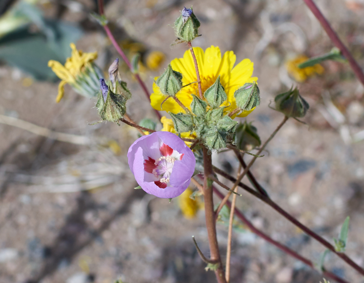
Wild
Flowers Bloom
in Death
Valley after
Copious Winter
Rains.
Sony Alpha 7R
Mark II,
1/500 sec, ISO 100, 35mm at f/8.
All photos
copyright,
Bill Caid
2015. All
rights
reserved.
The Trip
Wild flowers in the desert are truly a "dated commodity". The blooms happen within a short window and individual flowers exist only for a few days then wither in the intense sun and desiccating desert air. So with these factors in mind, we looked for places to stay within easy travel distance of Death Valley and discovered that there were "none". Excluding the Furnace Creek Inn and camping, the "closest" towns with accommodations are Pahrump, NV and Ridgecrest, CA. Neither were very close in an absolute sense. Since we had a mog buddy in Pahrump, it was the obvious choice. But, as we would discover, others were aware of these constraints as well.
The situation was further confused by road closures and highway construction and were it not for the information we received from our friend in Pahrump, we would have wasted at least a half a day re-routing our path.
Travel Route
Modern "smart phones" have GPS capabilities and now allow easy
capture of travel routes (and locations of the individual photos
taken!!). For this trip, we use the "Trails" application
on the iPhone to track our route (mostly as practice for an
upcoming road trip). The majority of our route (excepting
the most obvious freeway route to Pahrump, NV) is show in the Open
Streets map below.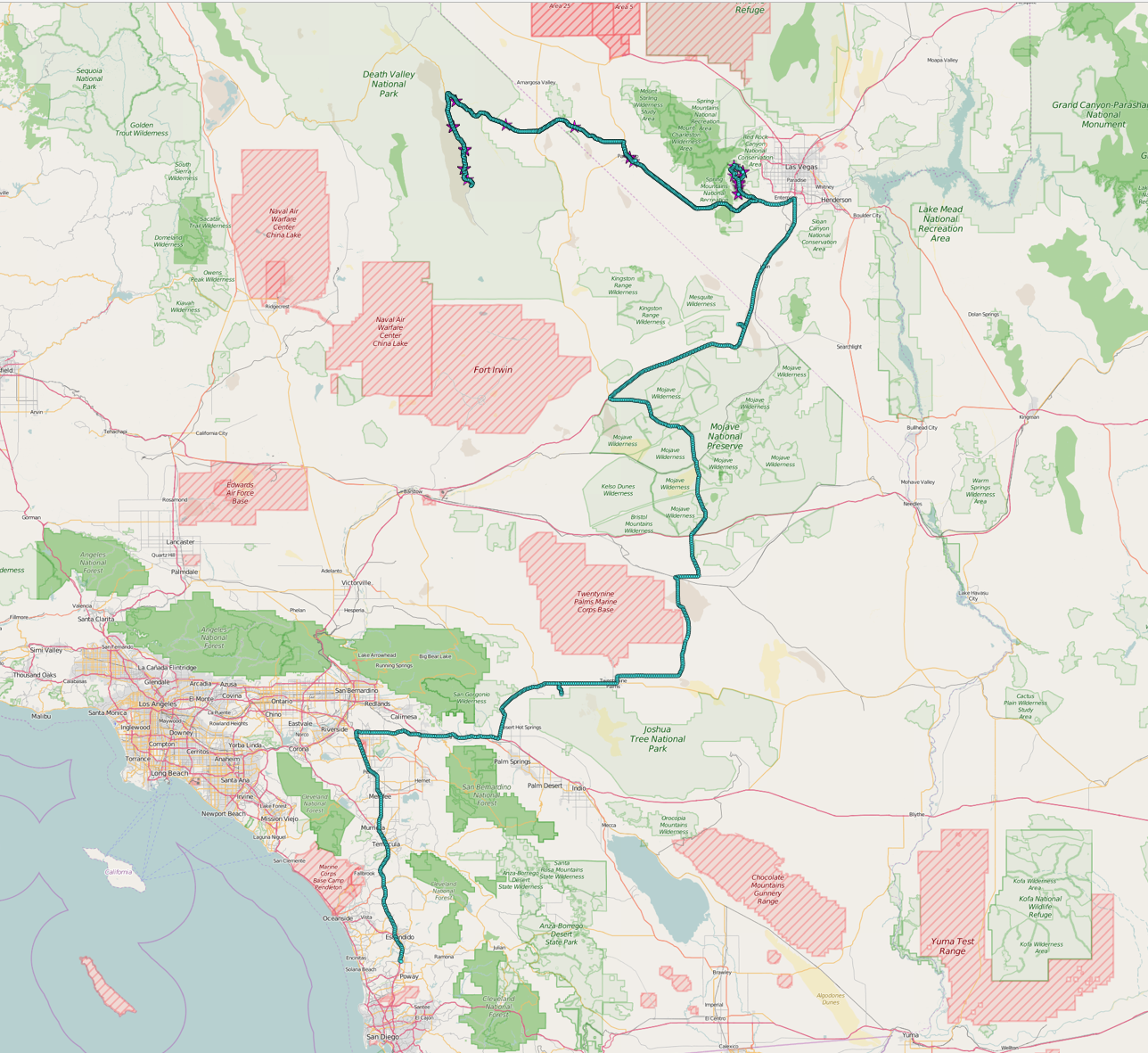
Equipment
For this trip, I used my Sony Alpha 7R Mark II camera with
Zeiss 50mm f/2 and Voightlander 35mm f/1.1 manual focus
lenses. I brought other hardware, but almost every photo
came from this rig. The camera does a good job, but
using the manual focus does requires some thought during
shooting.
Connecting and Contacting Us While on the Trip
Because of internet connectivity issues on a previous trip, we purchased a MiFi cell phone modem that allows us to connect nearly anywhere there is 3G service via cell phone (which is most of the cell phone service area available today). But, as we all know, cell phones are useful many places, but not everywhere has coverage, particularly in the remote areas of the western U.S. Our phones and the modem are enabled daily so you may contact us, although it may take a few days for us to respond. But, we will respond. My email, spelled out, is "bcaid at yahoo dot com".Trip Details
The
link table
below contains
links to the
photos and
dialog
for each of
the days of
the
expedition.
This table
will be
updated as the
trip
progresses.
| Part | Dates | Adventure Locations |
|---|---|---|
|
1
|
20160308-09
|
San Diego, CA to Bonnie
Springs, NV |
| 2 |
20160309 |
Red Rocks Park
and Death Valley |
| 3 |
20160310 |
Ivanpah Solar
Plant and Return to San Diego, CA |
Conclusions and Advice to Travelers
It is always good to be aware of what others are planning to
do. I fully underestimated the public's response to the
"super bloom". That said, had it not been for full hotels,
we would have never stopped at Bonnie Springs, NV. Every
bad has some good I guess. Had we been motivated enough to
get advanced reservations, we would have missed the Bonnie
Springs!The Mojave Desert is a very big place and frequently not that hospitable to travelers. The weather can go from very hot to very cold and back in one day. As a consequence, the range of temperatures can be extreme. Plan accordingly and understand the expected temperatures, particularly in the summer when heat can be life-threatening. Water is in very short supply and unless you are staying at locations that are known to have water, you will need to be self-sufficient. High winds and dust are common in this area and attempting to tent camp in high winds can be an exercise in futility. Sunburn is pretty much assured if you are wearing brief attire so sunblock should be used liberally and reapplied as needed for sun protection.
Many, if not most, of the areas in the Mojave do not have cell phone coverage so in the event of a mechanical breakdown, you might have to wait for the next passing car to get assistance. Planning on the kindness of strangers is never a good plan.
Back to Bill Caid's Home Page.
Copyright Bill Caid 2016