We spent the night in a rather marginal RV park in Price, UT. They had an interesting strategy with regard to cleaning: 3 showers, so disable 2 so you only have to clean one. Ditto with the toilets. And, the simplest method to reduce litter from paper towels is to not provide any. These detractions stated, there was plenty of hot water in the shower that did work and there is plenty to be said about that. Plus, they had a laundry facility and that was the real reason for our stay.
Once
the laundry was completed, we headed
back out into the
boondocks. Our chosen path was to go
up Nine Mile Canyon
just to the east of Price.
I chose the canyon based on map
notations about the large number
of petroglyph
panels in the canyon. I
was surprised to find that
unlike shown on the map, the
road was recently
paved. While not
longing for another
dusty hammering on a
rutted dirt
road, I was mildly
disappointed.
And, despite
what our
map suggested,
most of the
bottom land in
the canyon was
private, so we
elected to
take another
road toward
the Green
River to see
what was
there.
The photos below are what we saw.
It
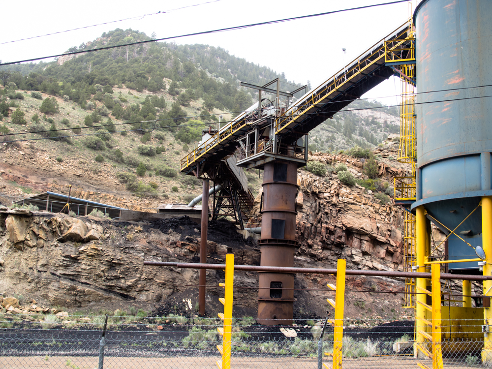
was overcast, windy and starting to rain. Early in
Nine Mile Canyon we encountered this coal mine next to the
side of the road.
Price, UT is in
Carbon County so the presence of a coal mine was no
surprise.
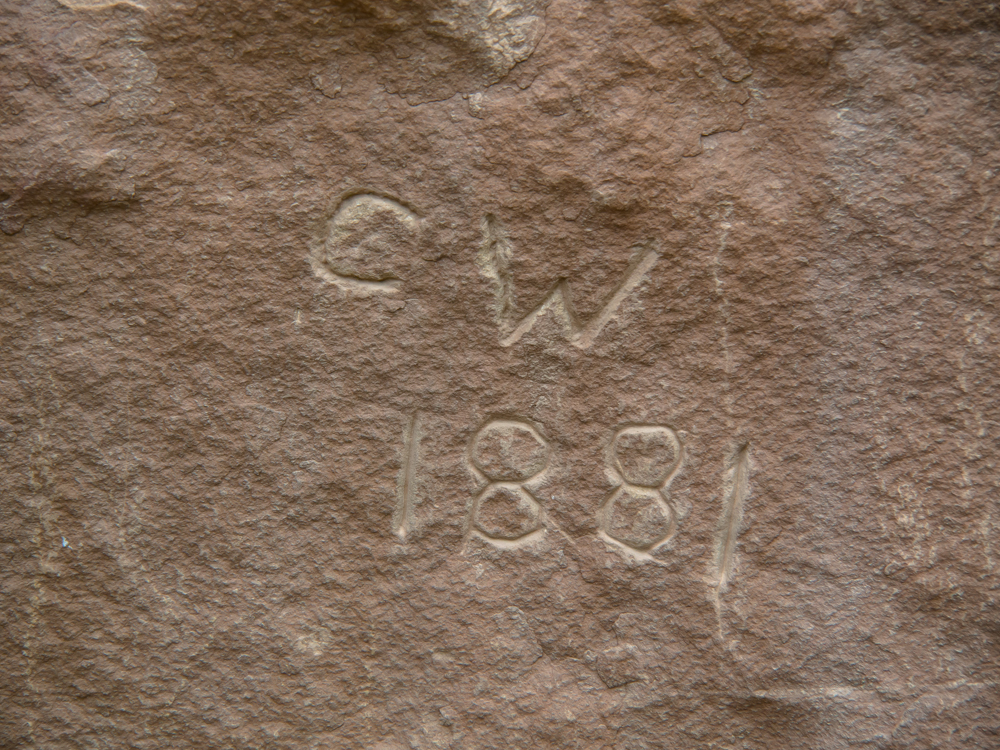
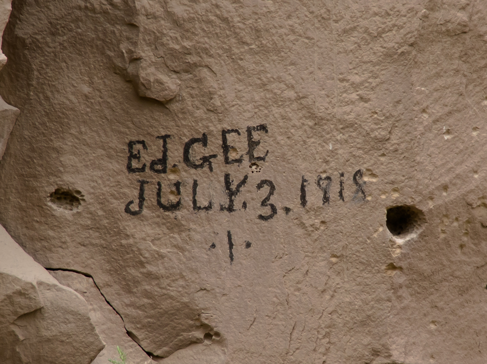
At
one of our stops I found this inscription carved into the
walls. There were many, many petroglyph panels in the canyon.
Some were
better preserved than others and I have culled the
photos to
show
the best ones. This inscription was
characteristic of many of the panels where
late-comer white men chose to deface the
rock art for their own reasons. This
one was noteworthy due to the age and
is clearly associated with an early
settler.
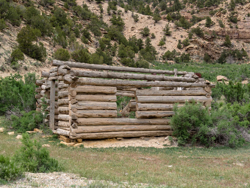
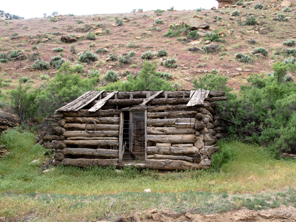
There
were many old abandoned log cabins that were used by the
early occupants of Nine Mile Canyon. This one included cut timber
for the door jam.
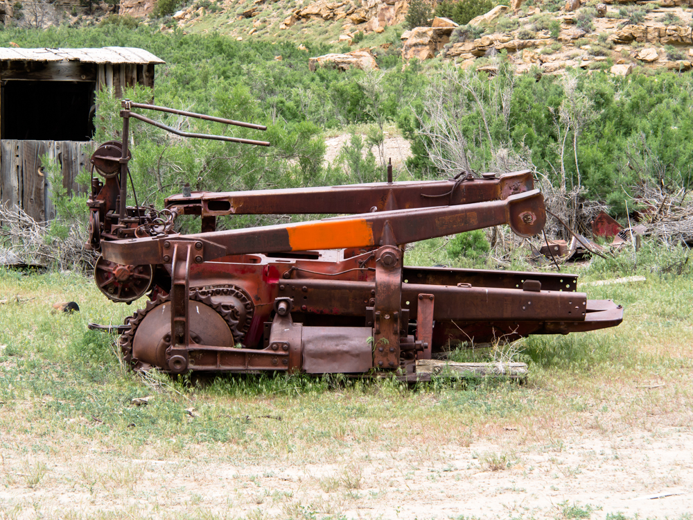
This bulldozer frame is left over from the early
part of the 1900s.
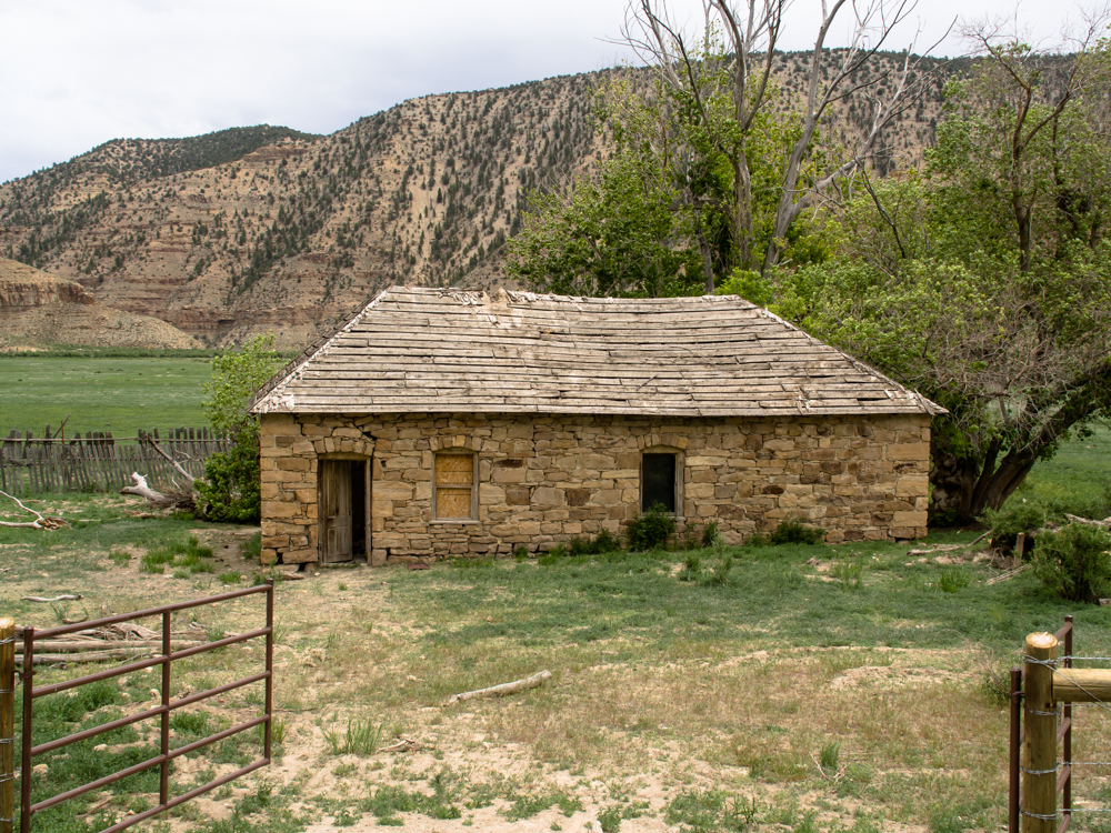
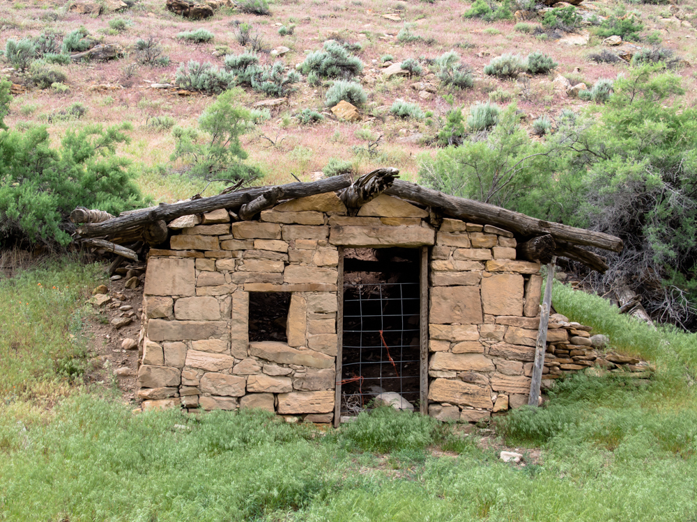
This rock house was on private land next to the road
and was not typical of the older dwellings we saw.
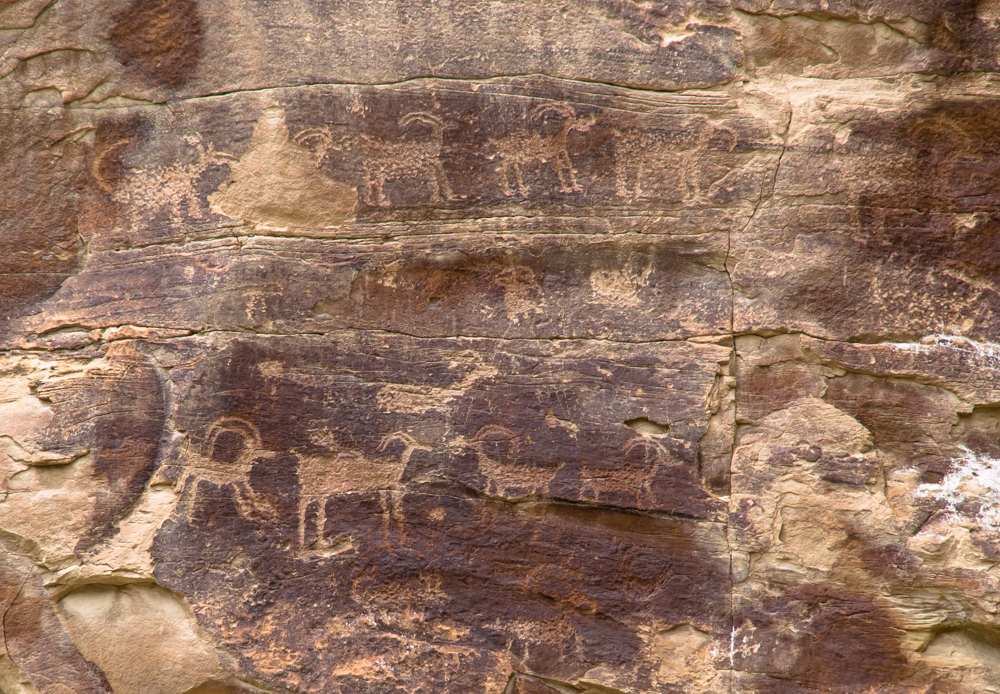
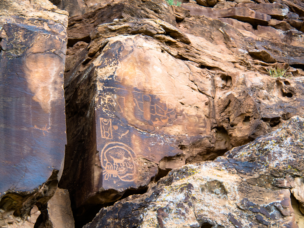
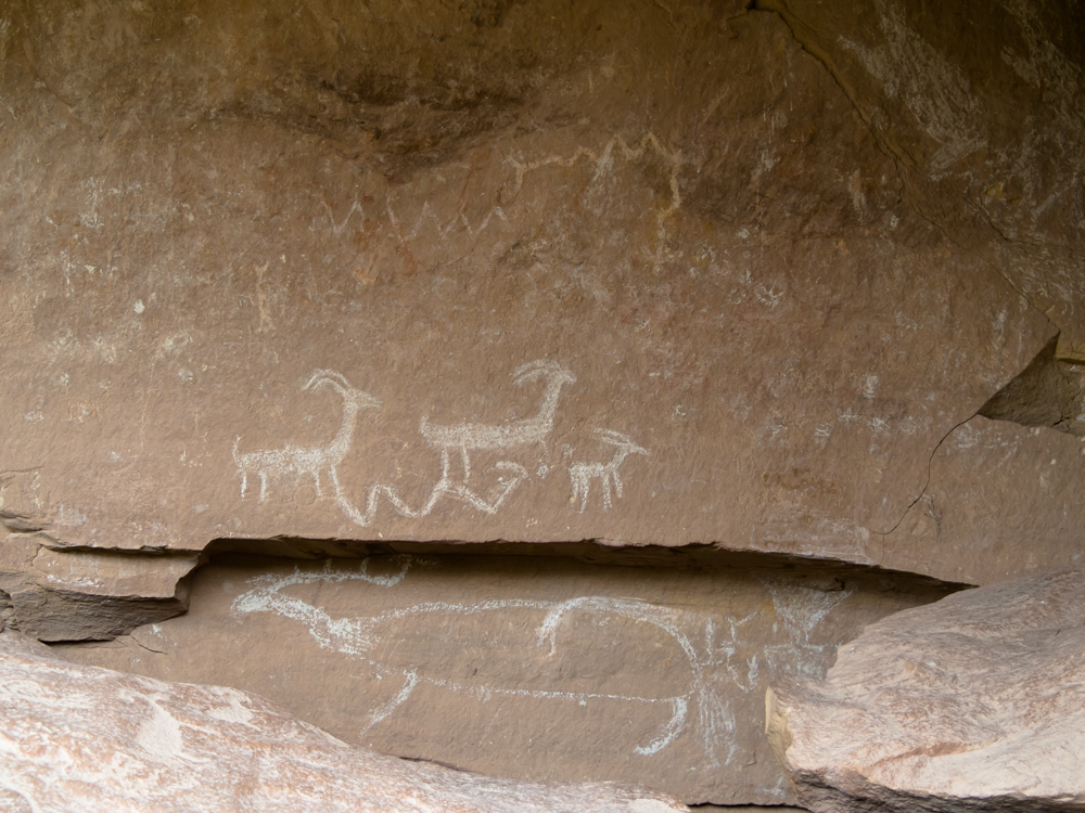
This
rock art panel shows the classic scene: mountain sheep. These
figures were likely carved by members of the Fremont
culture.
These sheep were
"pecked" deep
into the sandstone walls thus resisting erosion.
Other figures on this panel were already weathered
away.
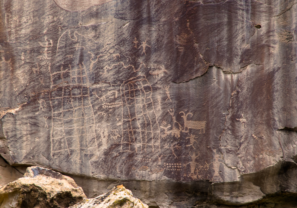
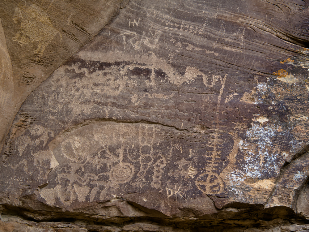
This panel was interesting for several
reasons. In
addition to multiple types of figures including abstract ones, the
panel seems to suggest the use of nets to capture game.
This inscription is dated 1818 which
would make it pre-date the Mormon settlers arrival. It
is possible that the first "8" is really a "9", but the
style seems to closely match the second eight.
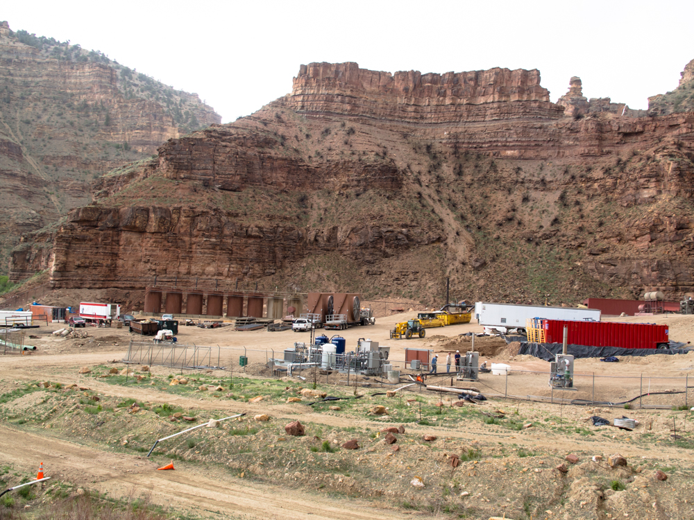
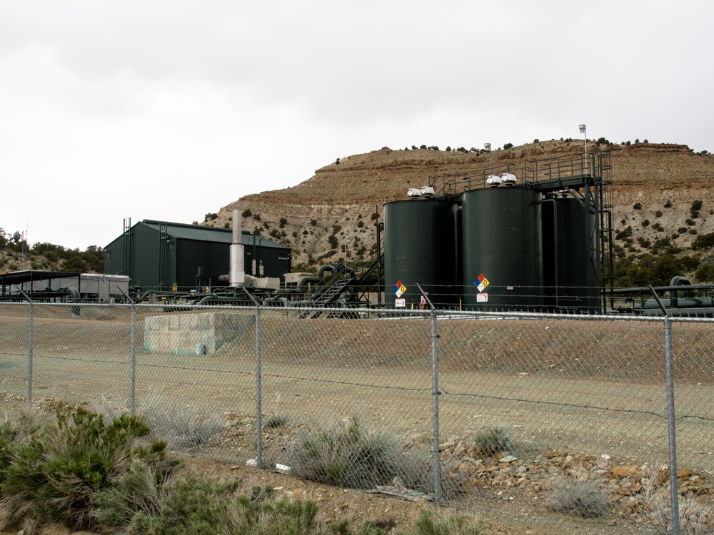
Deep
into the canyon we came upon a natural gas compressor
station under construction. Note the radiators on
truck beds in the center of the photo.
A
short distance up the canyon we came upon this detailed panel.
This
panel was carved into a spalled section of the cliff and the canvas was not dark
resulting in
low-contrast images. But, despite the poor
contrast, this is a very busy panel with sheep, buffalo, snakes
and shamanistic figures.
This panel used a different style of
writing: a scratching method rather than pecking.
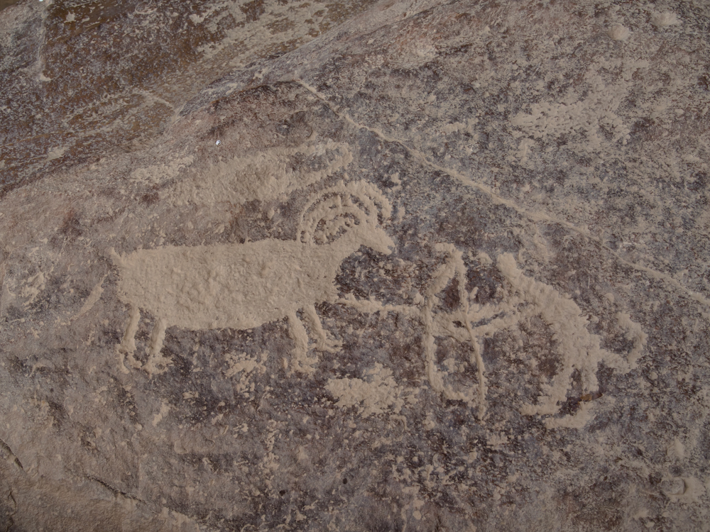
This
panel, pecked
into sandstone coated with desert patina, shows a hunter
with bow engaging a sheep.
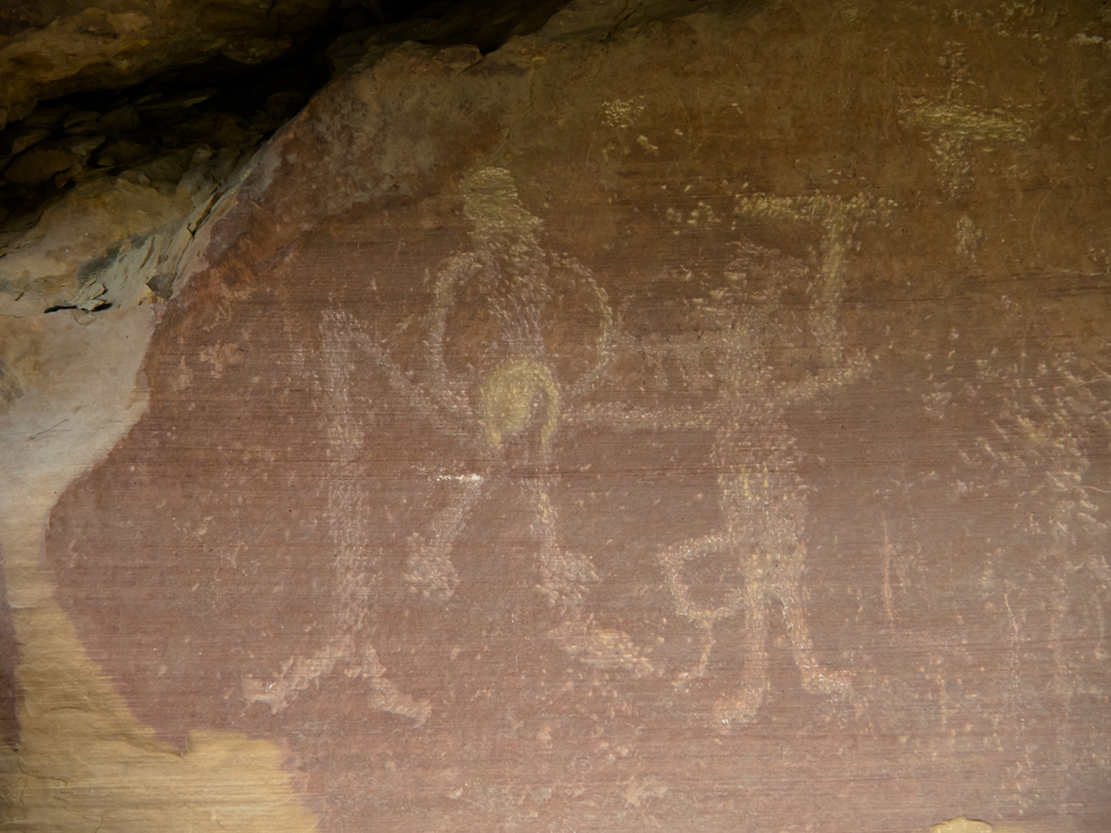
At
my first glance at this panel, I thought it was a
depiction of a birthing
scene. Now I am not sure.
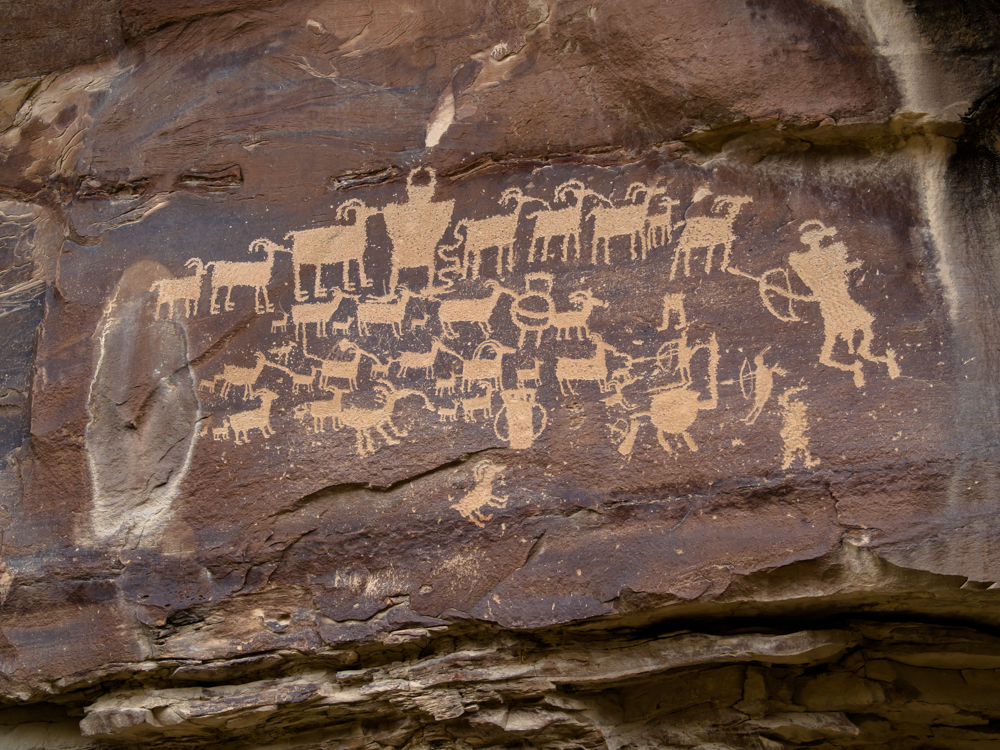
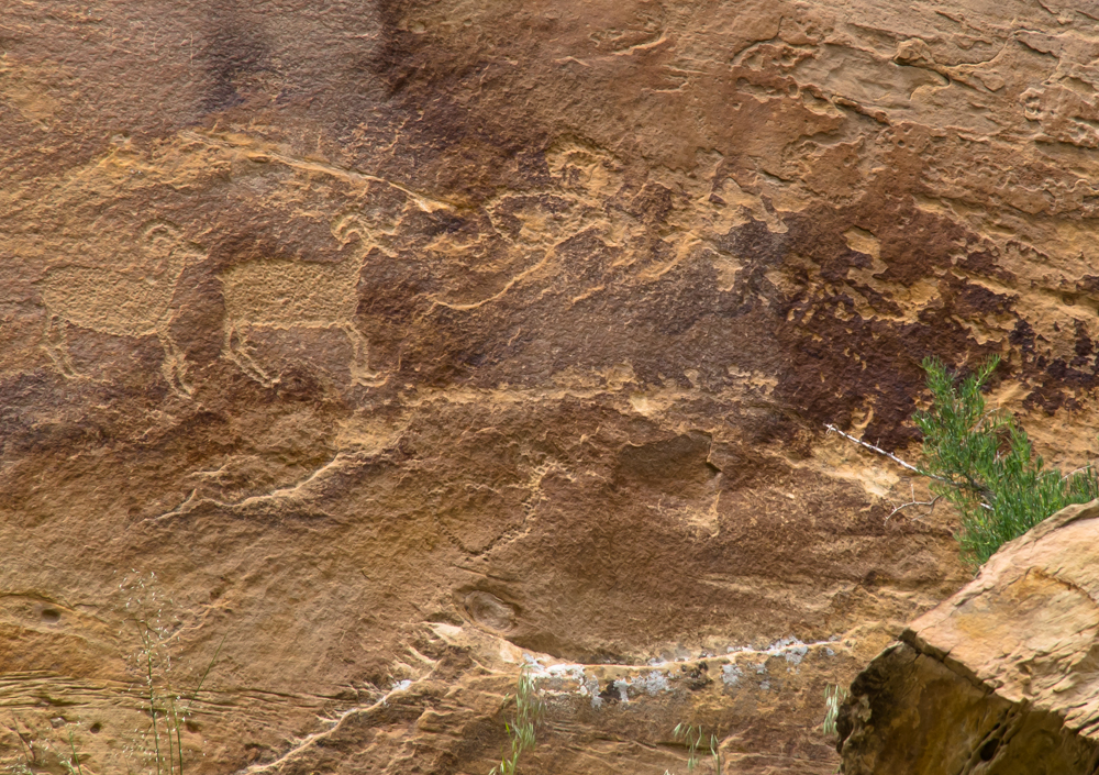
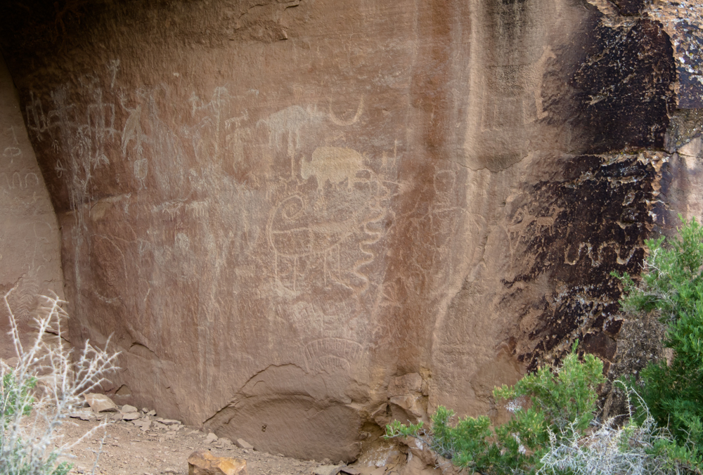
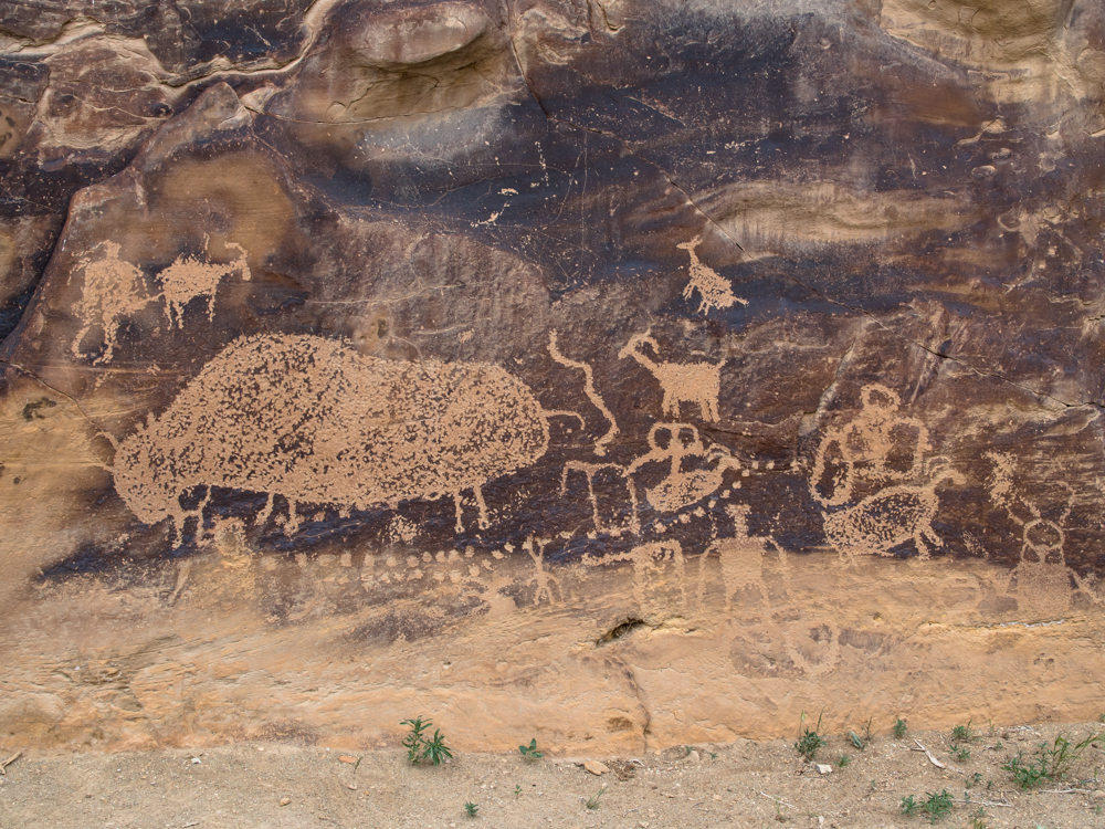
This
panel was the best preserved and highest contrast site in
the canyon and
was named "The
Great Hunt". The panel shows rams, ewes and lambs being
engaged by hunters with bows.
Interesting that sheep are almost always shown with
their heads on the right.
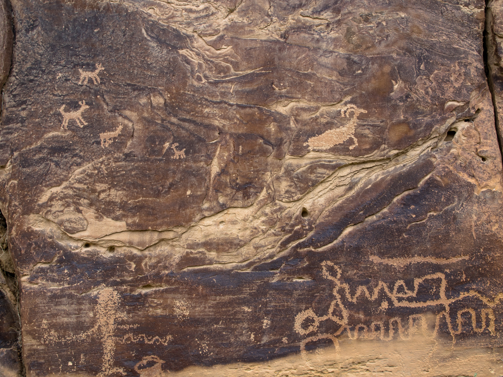
Close
to The Great Hunt there was more
evidence of
graffiti
damage. Despite the weathering, this busy
panel contained interesting symbols that were repeated throughout
the west.
This
panel was named
"Big Buffalo"
for obvious reasons.
The
abstract symbol at the lower right may be a representation of a
snake. It is not clear if the icons at the upper
left are dogs or deer.
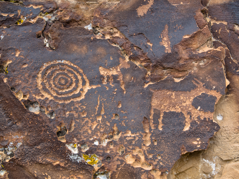
Concentric circles are a common icon throughout
the west.
The
canyon continued for many miles and finally dead-ended in
private land. This log cabin was visible from our turn-around point.
I
think this was the V2.0 dwelling after the log cabin was
abandoned.
Due
to the private land holdings, finding a camp spot was out of
the question. So we took a side road and
headed north
further into the cliffs. We turned east
toward the Green River and crested a large ridge to
find this gas compressor station on the
ridge. The dark wire on the fence is
an intrusion detection sensor
to prevent vandalism. Too bad
that the petroglyphs did not have a similar
system.
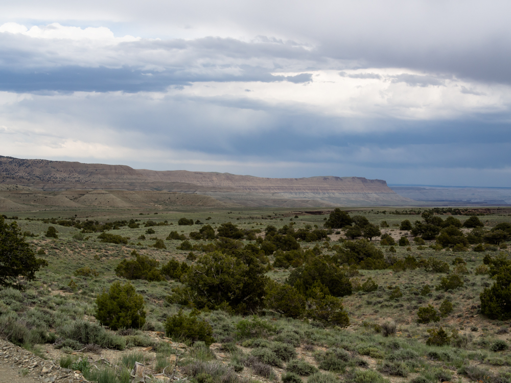
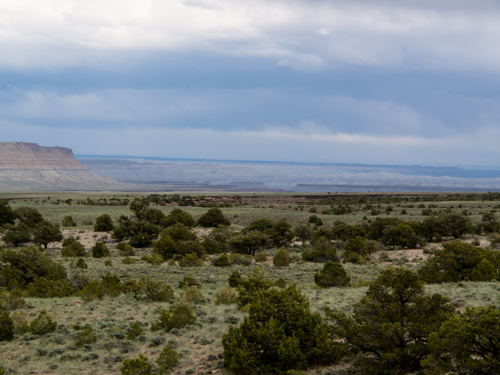
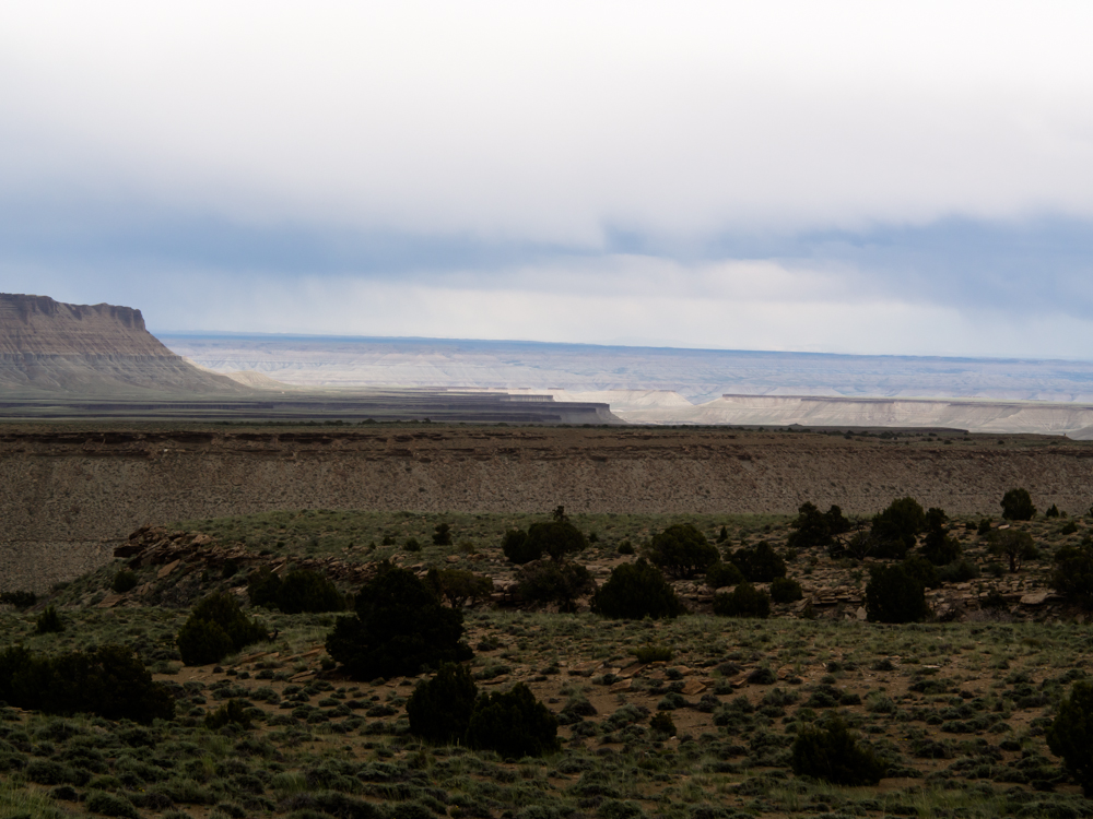
The
east side of the
ridge had expansive
views of the canyons that lead to the Green River drainage.
It
was blowing hard on the ridge and rain was getting stronger.
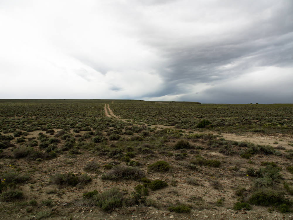
To
the east of the ridge, I spotted this track that headed south toward the cliff
escarpment.
We were looking for a camp and being on the cliff
seemed like it would provide a great view, so we
followed
the trail.
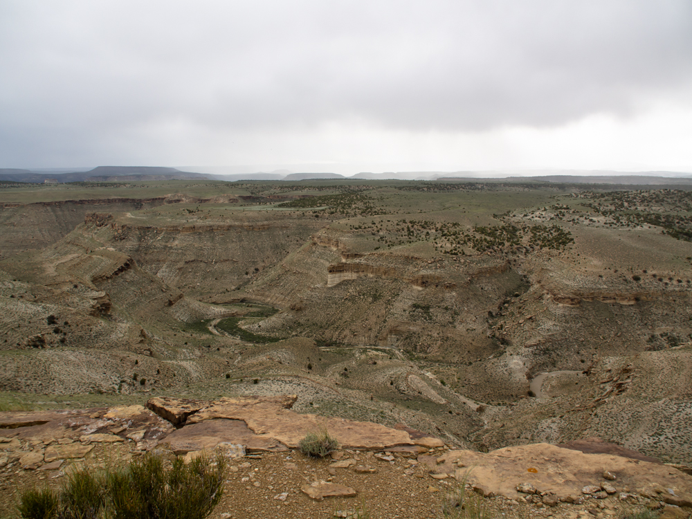
The
trail ended at an escarpment as predicted and the view was better than
expected. But, the wind was about 50 mph on
the lip so we decided to retreat a few hundred meters
to reduce the rocking of the camper.
Despite our set-back from the lip of the cliff, the wind was howling as we set up camp. But, our site still had a great view of the canyonlands to the east.
Price, UT is a working-class town centered on ranching and mining. We found several good places to eat and got all of our re-supply needs met. If you are in the Price area, you should stop at the Main Street Grill. Nine Mile Canyon is a paved road with easy access to the petroglyph sites and is a must-see if you like rock art.| Previous Adventure | ||
| Trip Home Page |
Photos and Text Copyright Bill Caid 2013,
all rights reserved.
For your enjoyment only, not for commercial use.