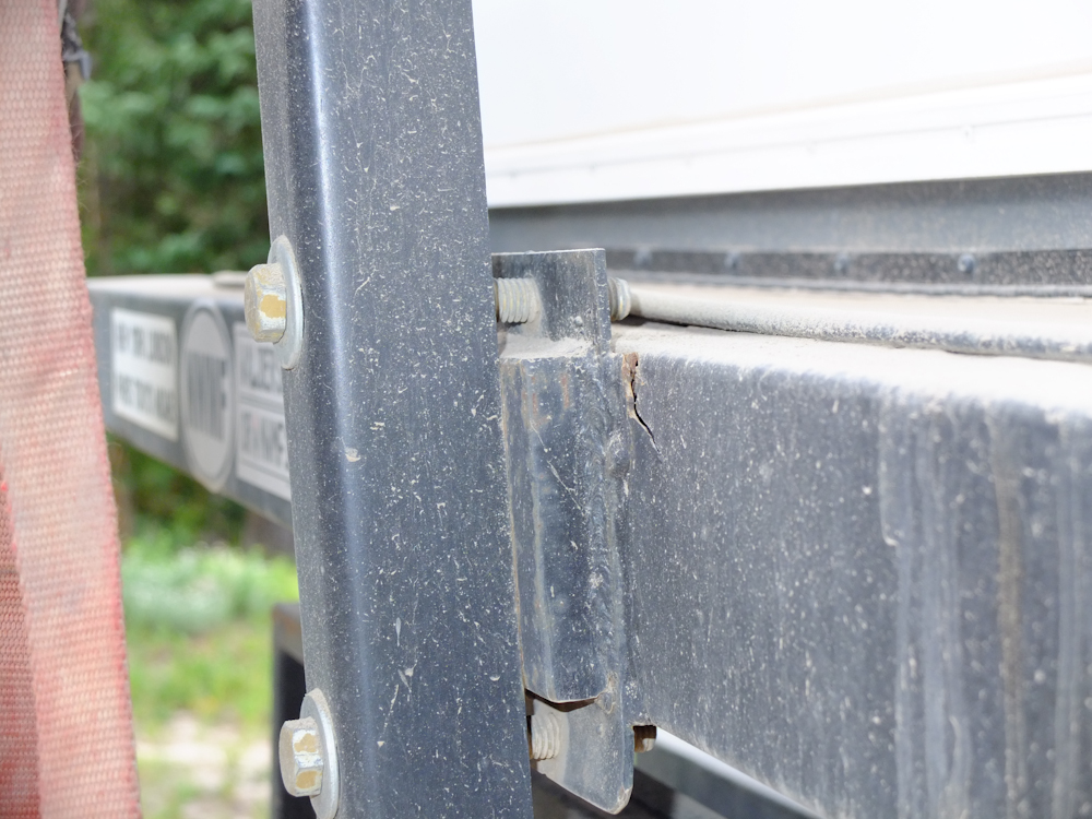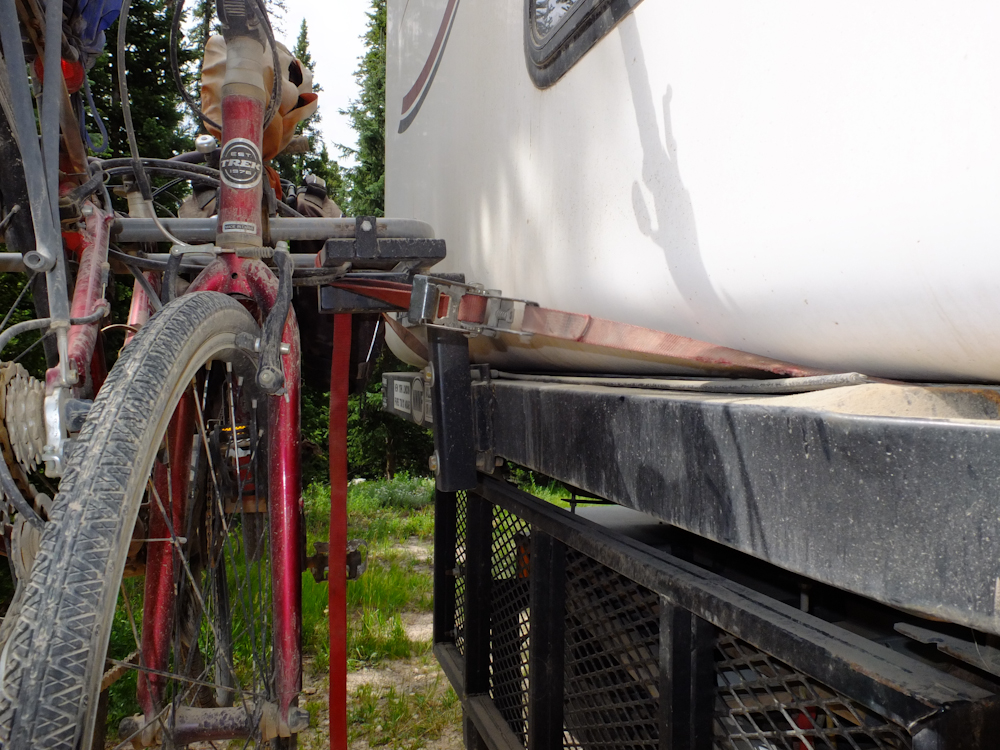
The
photos below are what we saw.

Several days earlier we noticed that
our bike rack was ripping from it's mount. The interesting
part of this story is that this mounting was intended to hold the
spare tire for the HiLo trailer. The bikes are a MUCH
smaller load so this setup would have had a very short life in the
real world. The tire mount is a great example of the
generally poor build quality of the trailer and why we will be
replacing it in the near future.

We applied a side of the road patch
to the situation but we both knew that it would not last much
longer. We planned to repair it upon our return to La Junta
for the air conditioning installation, but the trail would change
our plans.

The
fields west of Saratoga were irrigated and used for growing
alfalfa hay. The local population of antelope were quite
happy about this fact and were hanging out in the fields as we
drove by.

Antelope
are wary animals and they saw us long before we saw them.
They watched us until we were about 200 yards away and then they
bolted.

Higher
into the mountain areas we saw reasonably big herds of
'lopes. The buck is on the right of the photo above.
There were antelopes everywhere and I am sure this is the case
right up to the opening day of hunting season.

We
were headed to Jack Creek campground but were thwarted by a closed
road. So, we turned around and headed back down the mountain
and then headed north toward Rawlins, WY and I-80.

Because
of the direction we came into Rawlins, we were forced to get an
extended tour of the town. No offense intended, but Rawlins
is a wretched little town with little to its name except hosting a
railroad stop and a state prison. I was happy to
leave. As we were trying to find a food store in town we
were stopped by the busy Union Pacific main line and got the photo
above of a long freighter heading east.


Despite
it's myriad of faults Rawlins did have cell service which allowed
us to get some information on the outside world. The
National Weather Service was calling for "Red Flag" conditions in
the area due to high winds and the drought. Red Flag means
high fire danger and when winds meet dry grass bad things
happen. When we got atop a nearby hill on the interstate we
saw a large brush fire north of Rawlins. Indeed, in Rawlins
we had seen water-drop helicopters leaving the area headed for the
fire.

The
interstate heading west was boring and except for an extended
section of road under construction was uneventful. We came
to Rock Springs, WY and then headed south toward Flaming
Gorge. We had been to Flaming Gorge before, but always on
the other side of the reservoir. When we rolled into the
camping area at Fire Hole, we were treated to the view above.

There
were a number of nice hoodoos in the area, but the one above was
the most radical.

View
from the camp looking to the northeast.

To
the northwest were more large mesas.

Our
camp was basic but had several attributes that we were seeking: a
(mostly) level pad and a hot shower. Note the concrete
structure to the left of Thor; this is a wind shelter. The
wind blows fast and hard here most of the time and there would be
no hope of eating outside in high winds.

The
luck of the draw gave us a nice full moon that night. Lucky
for us, the winds abated at sunset and it was a calm, cool night.

Next
morning, we could see folks on Flaming Gorge Reservoir having fun
with their water toys.

This
pair of girls are getting ready to get pulled on their inflatable
raft.

To
the west of our camp there were large mesas that rose high above
the level of the reservoir.


The
HiLo guys did not even weld all sides of the mount, thus the
ripping. The repair welder put a bead on all 4 sides of the
mount and braces on the top.

For
whatever reason I did not take a photo of the final repair, but no
matter. It was ugly and not up to my personal standards but
it just had to get us back to San Diego. And I am pretty
sure that it will.

When
the repairs were completed we got fuel and ice and headed back to
Fire Hole. As we continued south along Flaming Gorge Reservoir we
got nice views of the canyon areas.

The
trail went up over high ridges allowing clear visibility of the
reservoir.

We
headed south looking for a remote camp on one of the many beaches
on the east side of the reservoir. About 25 miles of dirt
did the job and we parked beneath an interesting stone
outcropping.

To the east of our camp was a nice, wide valley. Note the barren hills.

We
went to the water for a swim and spotted these otters watching us
carefully.

In
the valley we could see deer grazing. They perked up when I
attempted to start our generator. I failed at that attempt
likely due to bad gas, which is odd. We used the generator
heavily just 30 days ago and filled the tank. But, we had
suffered excessively hot temperatures in the interim which likely
caused the bad gas.

Nearer
sunset, more deer came down to the lake shore to drink and eat the
grass.
| Previous Adventure | ||
Photos and Text Copyright Bill Caid 2012, all rights
reserved.
For your enjoyment only, not for commercial use.