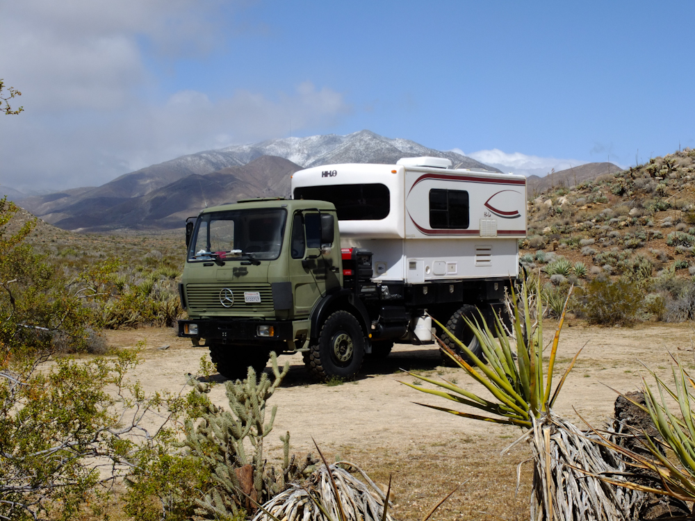
The first part of our journey was to travel from San Diego to the Anza-Borrego desert east of San Diego. The luck of the draw subjected us to an late-winter Pacific storm of epic proportions. The storm started just as we left the San Diego area and followed us into the desert. The good news, if there is any to be found, was that the full force of the storm did not hit until we had located the camp site and had fully setup. The night was cold, windy and rainy. Wind gusts were reported by the NWS to be on the order of 50 mph, so the camper was rocking pretty good. But, were reasonably comfortable and dry (which is always a nice thing).
Saturday
morning, we were joined by the other members of our group.
The photos below are what we saw.
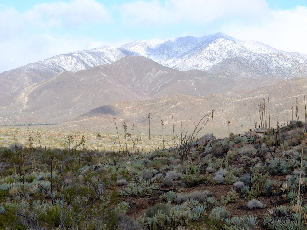
When
I opened the door on the camper, I got a good look at the snow on
Granite Mountain to the west of our camp. While it appears
clear in the photos above, the wind was still blowing cold and
hard.
The
other members of our party wimped out the night before and it
would be several hours before they arrive at the camp the
following morning.
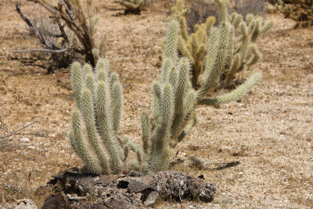
Since
I had time to burn, I got a photo or two of the surrounding
flora. This cactus has evil thorns and was plentiful on the
surrounding hills.
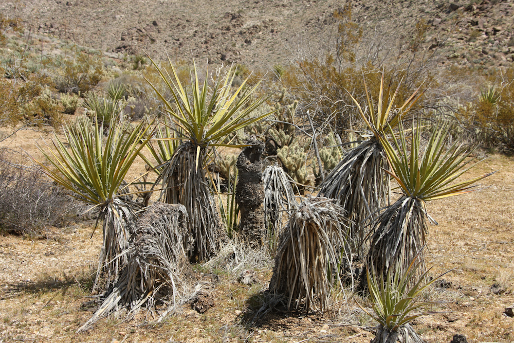
There
was plenty of yucca in the nearby area.
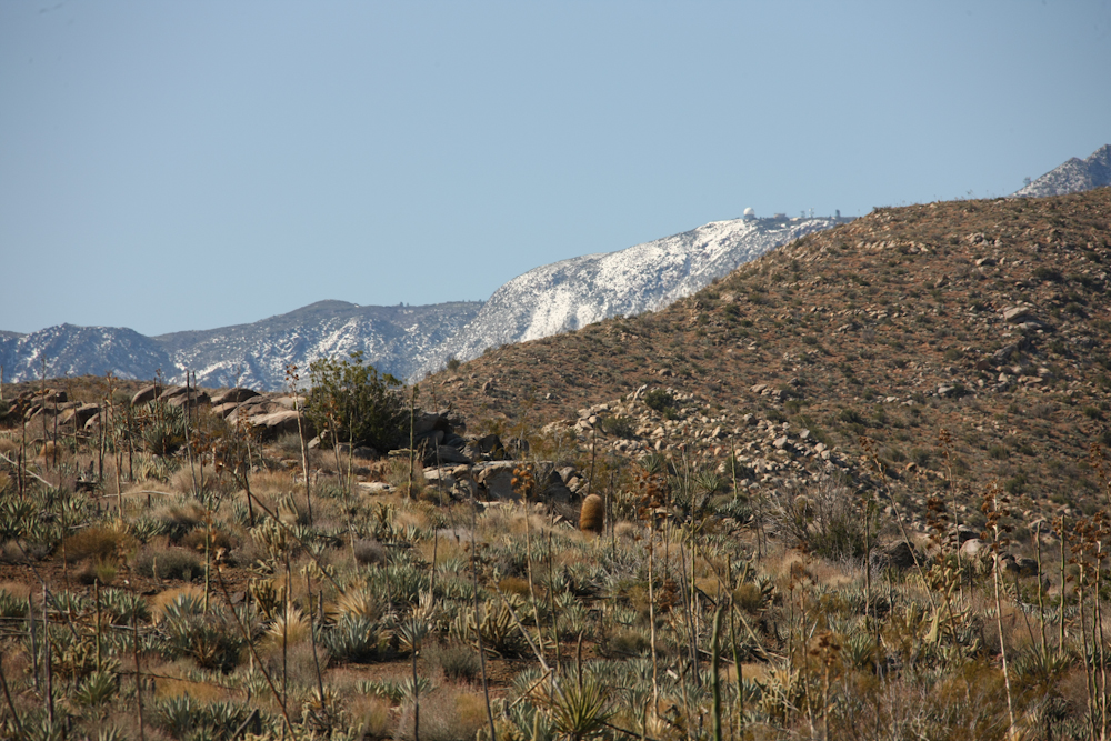
To
the south, the observatory on Mt. Laguna was visible with more
snow due to the higher elevation.
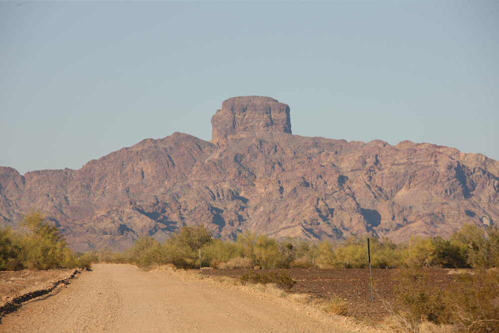
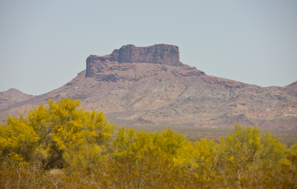
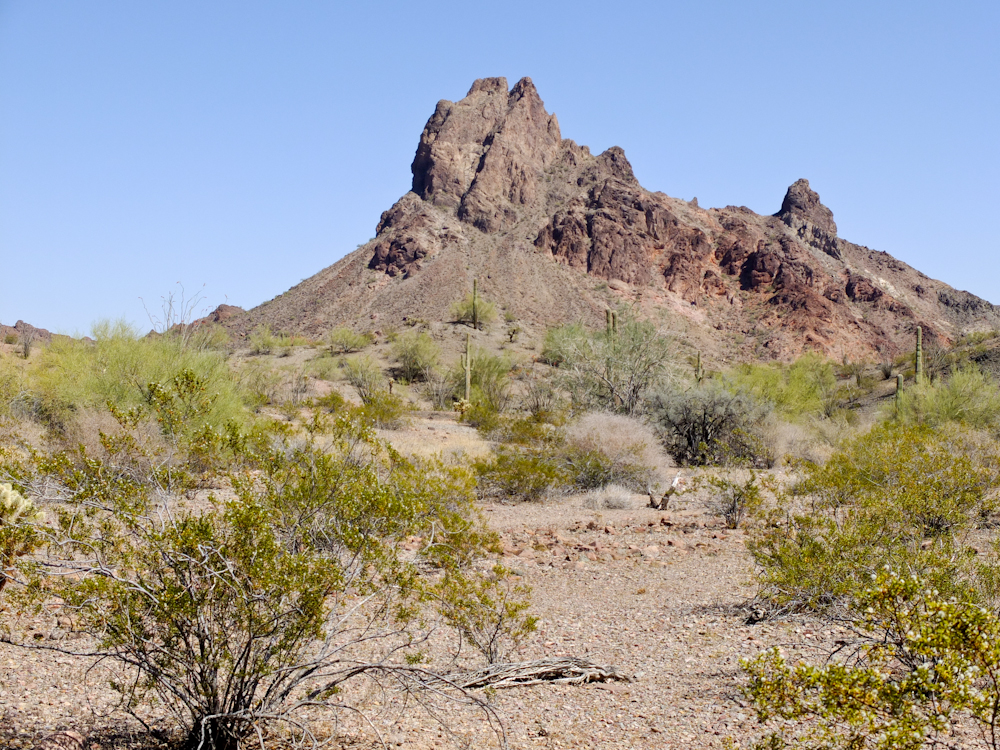
After
we concluded our liquor-fueled debauchery with our Musicmatch
pals, we headed east to Yuma, AZ. Our path would take us to
the Kofa Wildlife Refuge and past Castle Dome, shown above.
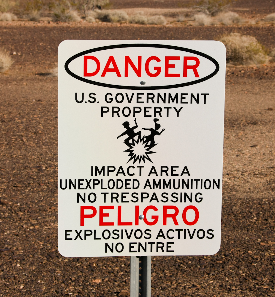
These
signs were everywhere along the road suggesting that travel into
the specified areas might not be a good idea. I love the
icon of the guy and gal partying down. It looks like they
are having a blast!
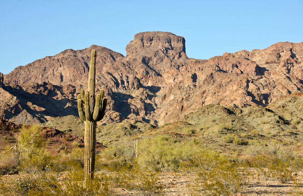
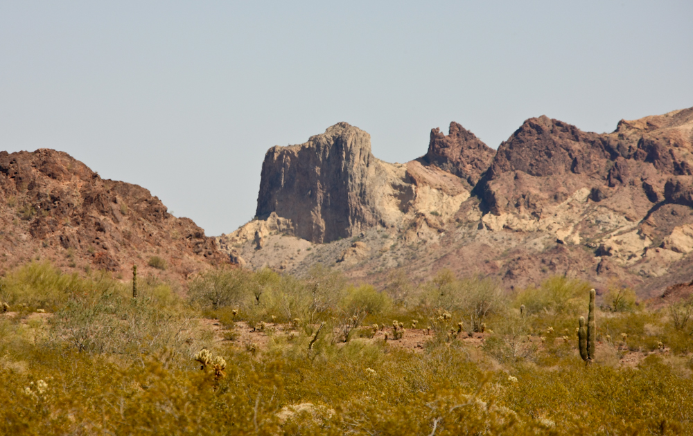
We
found an acceptable camp site as nightfall was approaching.
Our camp offered an awesome view of Castle Dome.
The
camp site was nothing special, but it was mostly flat which is
always a plus. We were all by ourselves. In fact, we
did not see another soul until late the following day.
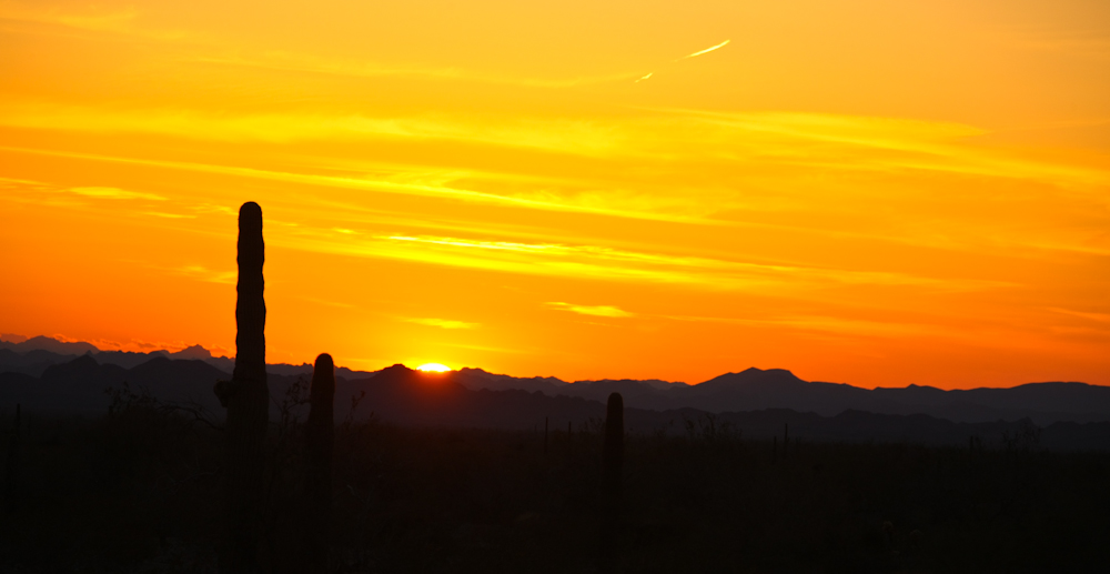
We
got an awesome sunset as a end-of-day treat.
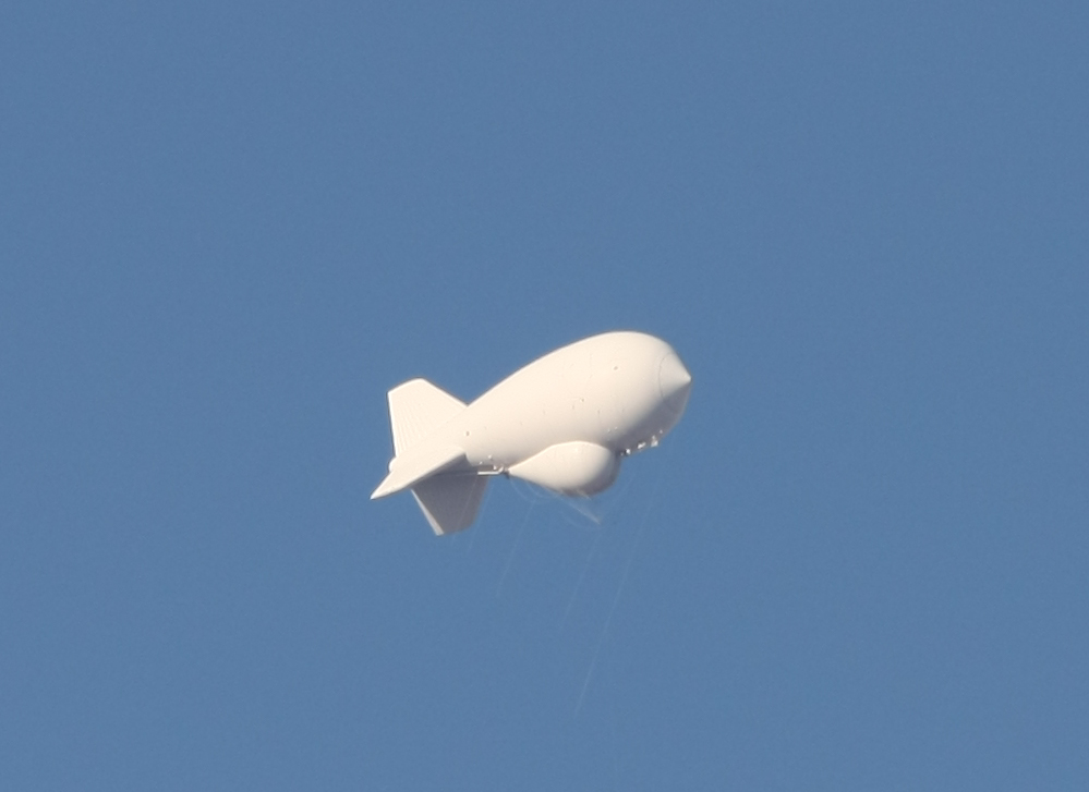
The
night was uneventful and cool. Next morning, we got a view
of the aerostat that is teathered at the Yuma Proving
Grounds. These balloons have sophisticated radar systems
that are used to monitor air and ground traffic along the
border. In theory, this information is used by Customs and
Border Patrol for drug interdiction.
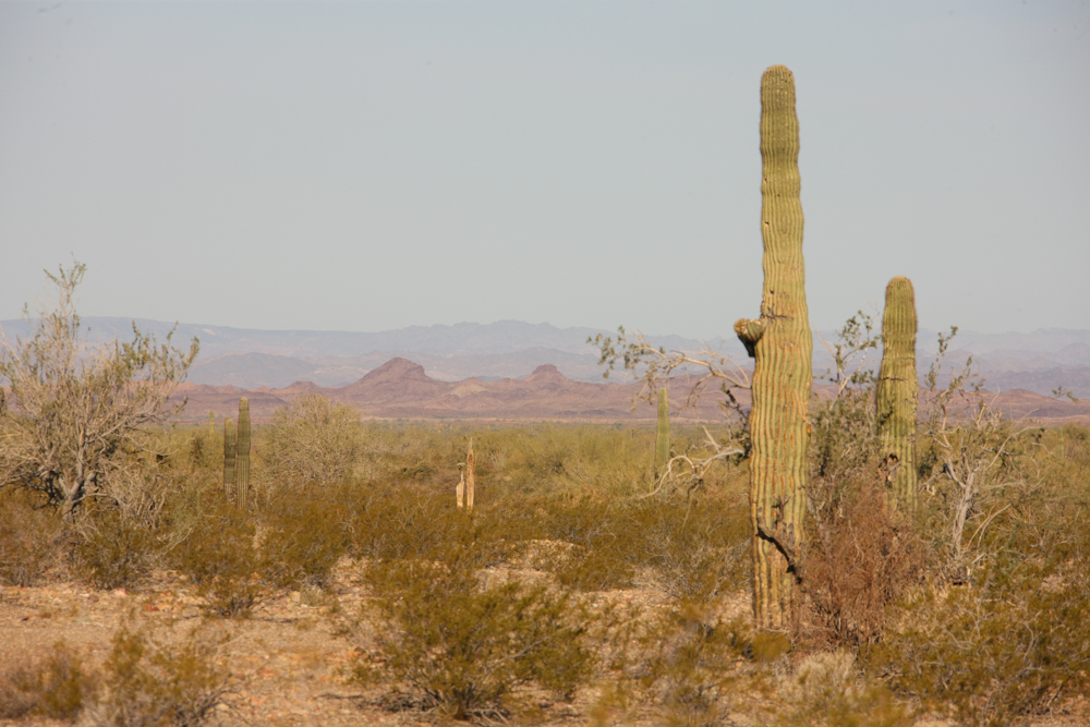
To
the west from our camp, we could see nearly to the Colorado River.
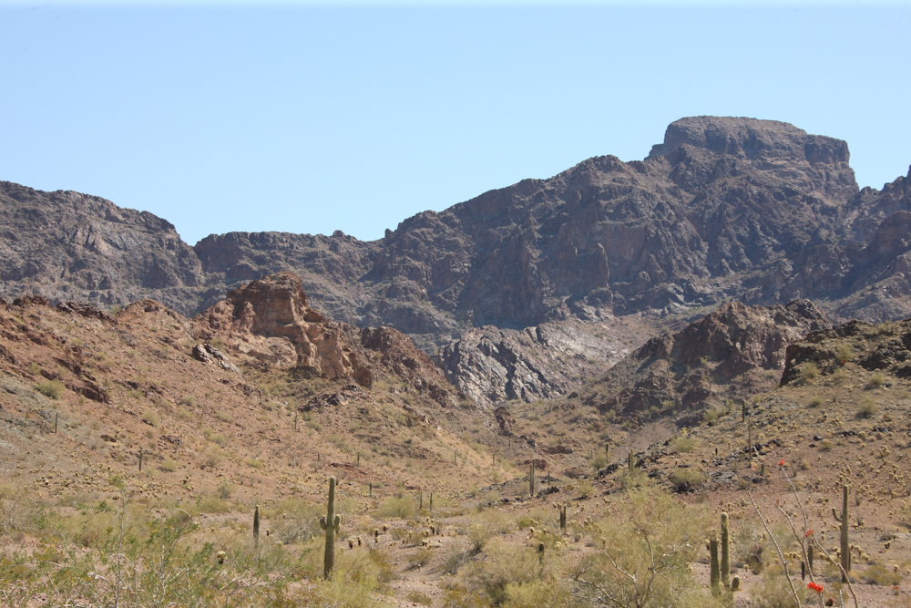
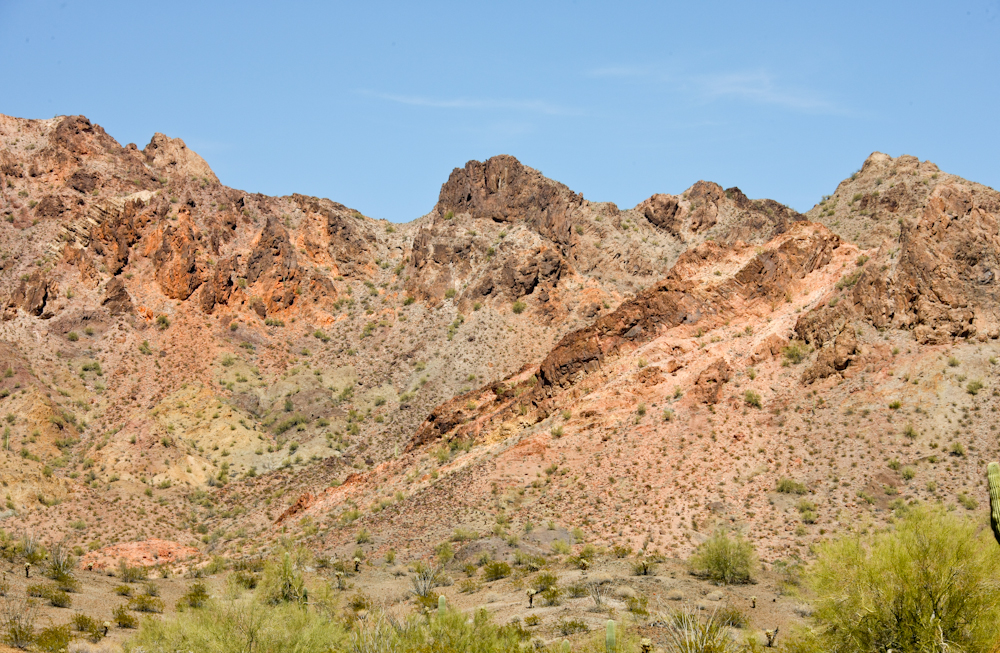
The
Castle Dome mountains have some impressive volcanic outcroppings.
Some
of the outcroppings show the coloring characteristic to heavy
mineralization that is associated with successful mining
operations. Indeed, there were a number of mines in the
area.
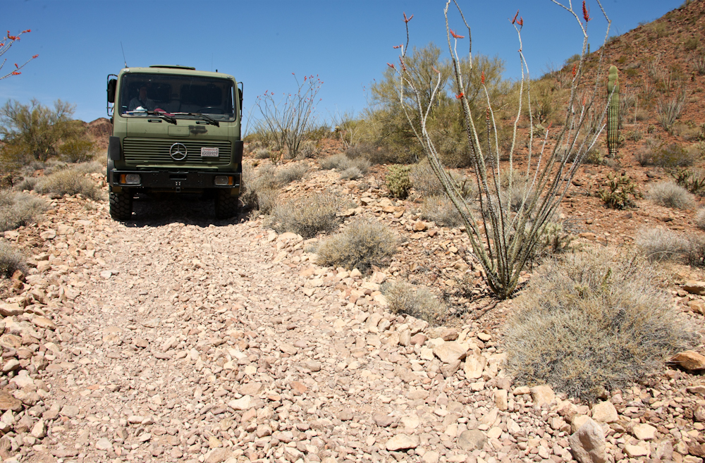
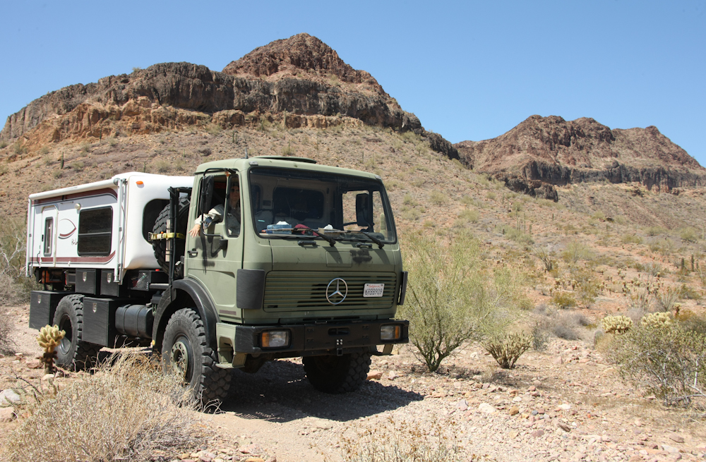
The
trail into the Kofa Wildlife Refuge was reasonably rough.
Thor (our truck) had no problems with the terrain, but it was
quite narrow in many spots. And, there was plenty of brush
overhanging onto the trail. We took some pretty hard hits
from the trees and in fact the brush ripped off the weather seal
to our door. Above, you can see the cobbles that comprised
the trail. The cobbles made for slow travel.
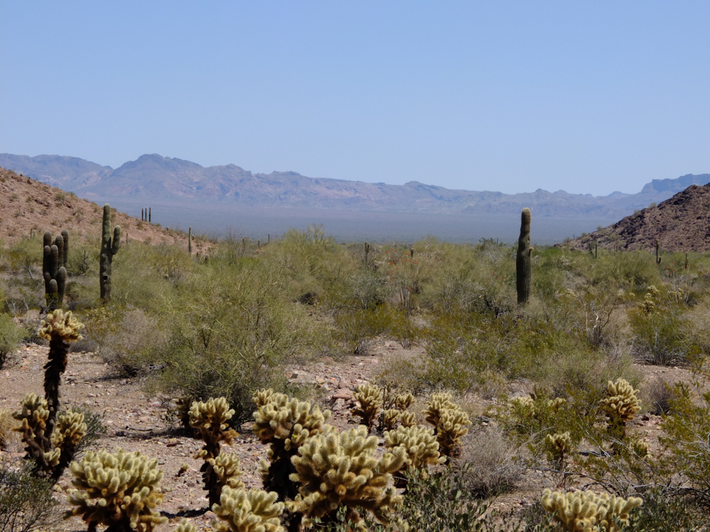
The
trail would take us into the valley floor and over the Kofa
Mountains in the distance.
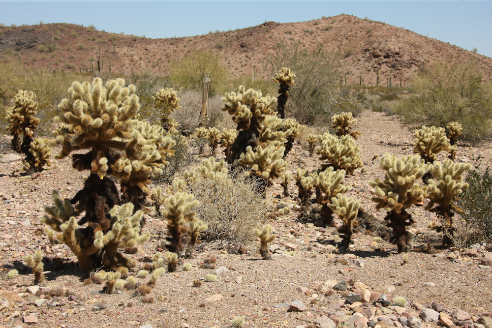
There
were large stands of cholla in the area. I call these plants
"Children of the Devil" due to the nasty thorns.
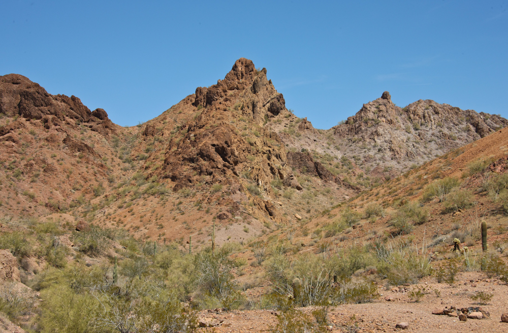
The
pass through the Castle Dome mountains was narrow and rough.
When we emerged on the north side, we stopped for a photo or two.
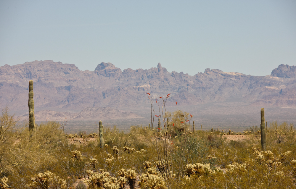
The
Kofa Mountains in the distance were as rough, or rougher than the
Castle Dome range we just traversed.
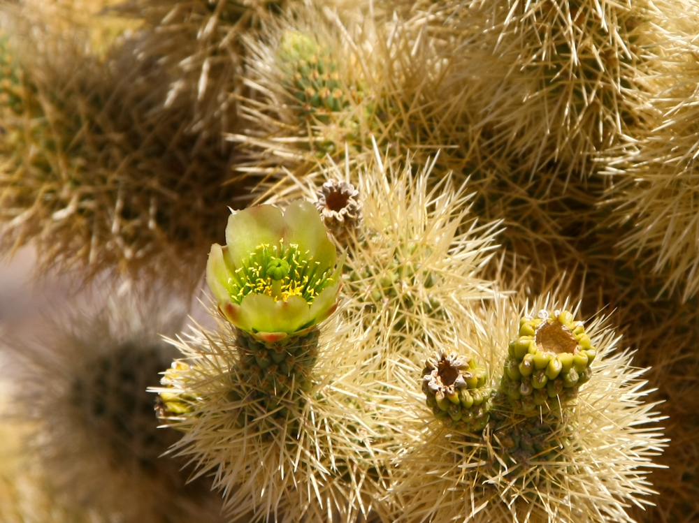
This
cholla is in bloom. While the flowers are "pretty" the
surrounding wall of thorns make viewing from a distance manditory.
We
crossed the valley floor and started up the bajada (alluvial fan)
on the far side. From the trail, we got a nice view of
another large volcanic outcropping. As a plus, the Palo
Verde trees are in bloom with bright yellow flowers.
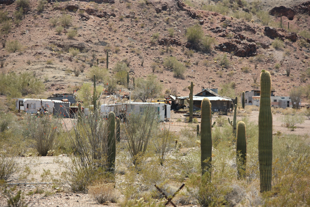
The
trail passed another mining area. This area is on private
land and Jed surely lives here with his buddies.
As
we traversed the Kofa range, the trail was quite rough and
tight. The trail-side brush was taking a toll on Thor's
paint job. But, despite the thrashing, we did get some great
views of the volcanic cliffs.
Some
of the areas were very rugged and barren.
This
outcropping was particularly gnarly.
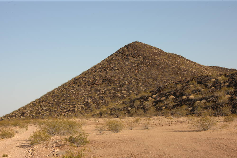
To
exit the area, we had to pass over the Yuma Proving Grounds for a
few miles. On the east side, we turned south and had to go
30 miles or so past some hills that were covered with volcanic
ejecta from the Sentinel Crater many miles to the south.
These hills must be hellish in the summer when the black rocks
heat up from the searing summer sun.
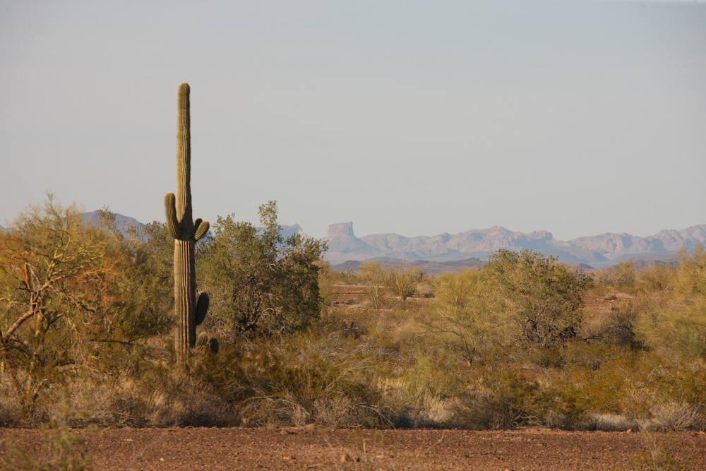
After
30+ miles of washboarded trail, we finally reached the
asphalt. We traveled east toward the nearly-not-there town
of Hyder, AZ. Hyder has no stoplight, no stop sign, no gas
station, no store and I did not see a post office. But, it
did have a great view of the volcanic mesas to the north.
Note the large plug on the horizon in the photo above.
Eventually,
we ran out of daylight and elected to do a side-of-the-trail
camp. We pulled off the dirt road into some brush along a
wash and had a great dinner. Kathleen made chicken pot pie
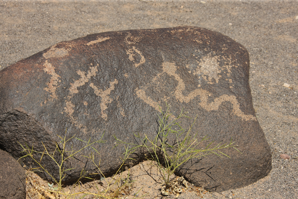
and it was a calm, cool night. Next morning, we broke camp
and headed to the Painted Rock Petroglyph site. Painted Rock
had been our objective the previous day, but the trail was just
too rough to allow us to proceed at a faster pace and we were
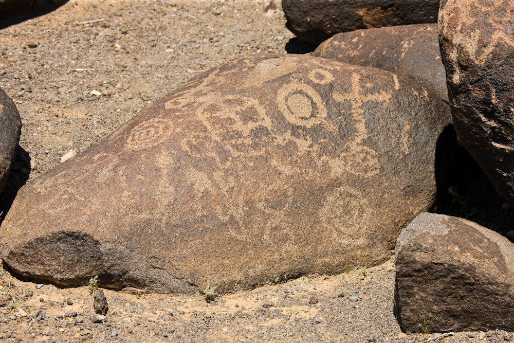
overcome by darkness. Painted Rock has many, many
petroglyphs and they are easy walking distance of the parking
area. This site is very similar to Three Rivers in New
Mexico in that the petroglyphs are on individual rocks (as opposed
to canyon walls like China Lake).
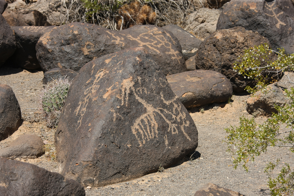
The
petroglyphs were in good shape and represented most of the glyphs
that are seen in the American west. The big glyph above
appears to be a thunderbird.
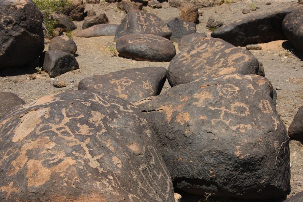
Note
the small amount of defacement on the stone at the upper center of
the photo.
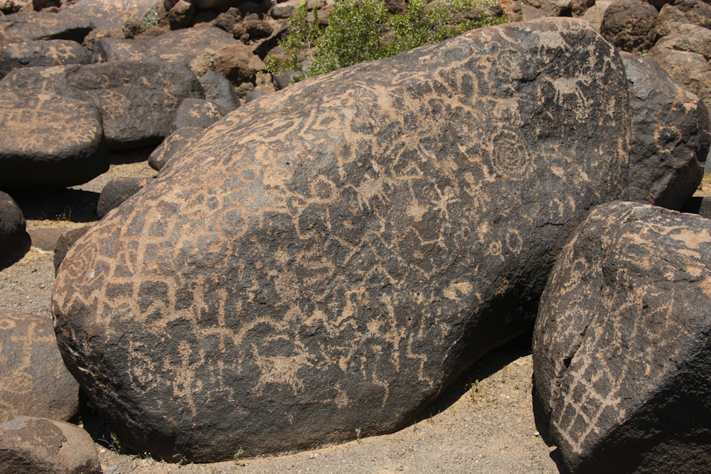
There
were so many glyphs on this stone that there was almost no patina
left.
There were several glyphs on this stone that I have not seen before.
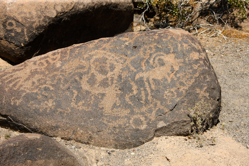
The
sheep on the stone above is one of the only ones that I saw.
I saw plenty of snakes, lizards, humanoids and spirals, but very
few sheep.
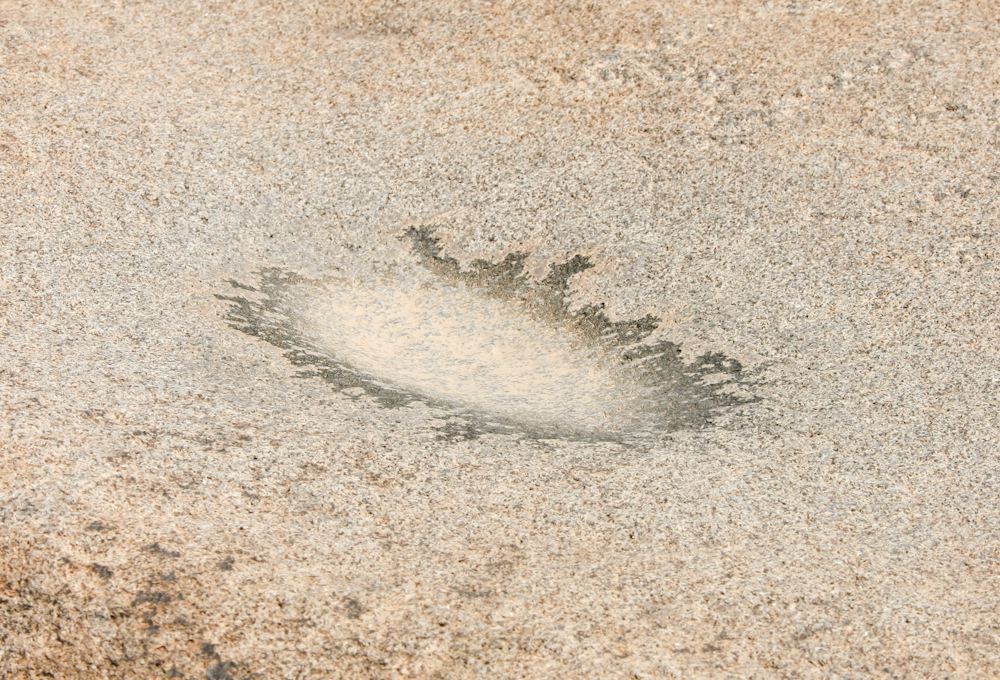
Frequently
where there are petroglyphs, there are also morteros. A
mortero is a stone surface used to grind seeds into "flour" as
part of the cooking process.
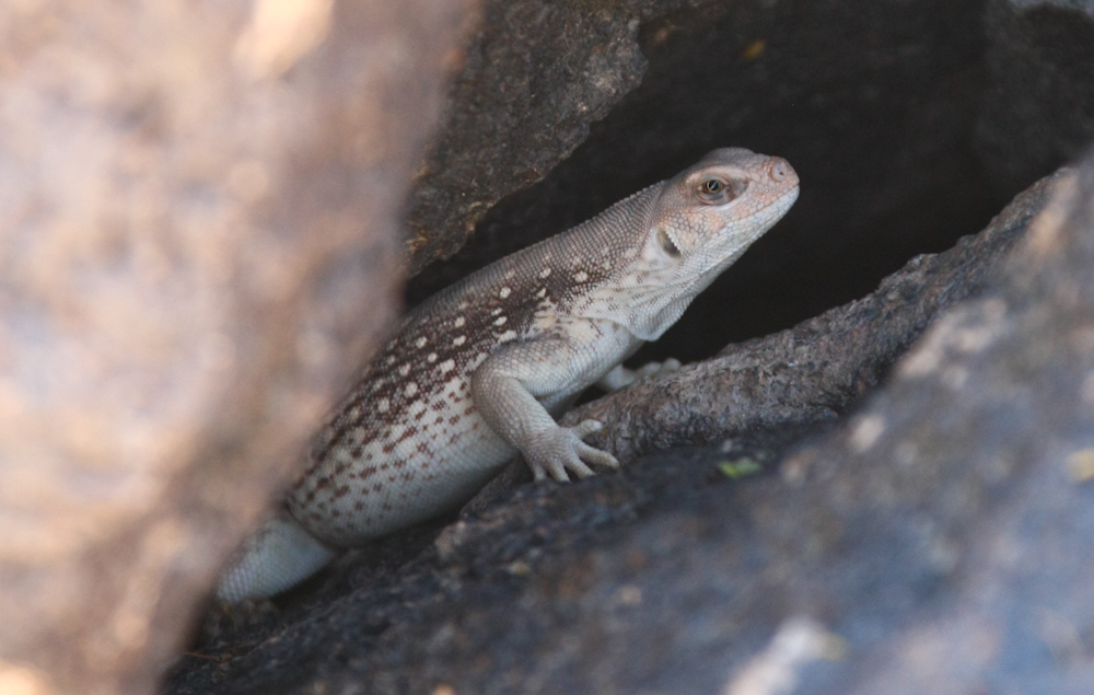
I
spotted this critter deep in a crevice in the rocks. He was
quite fat and about 10" long.
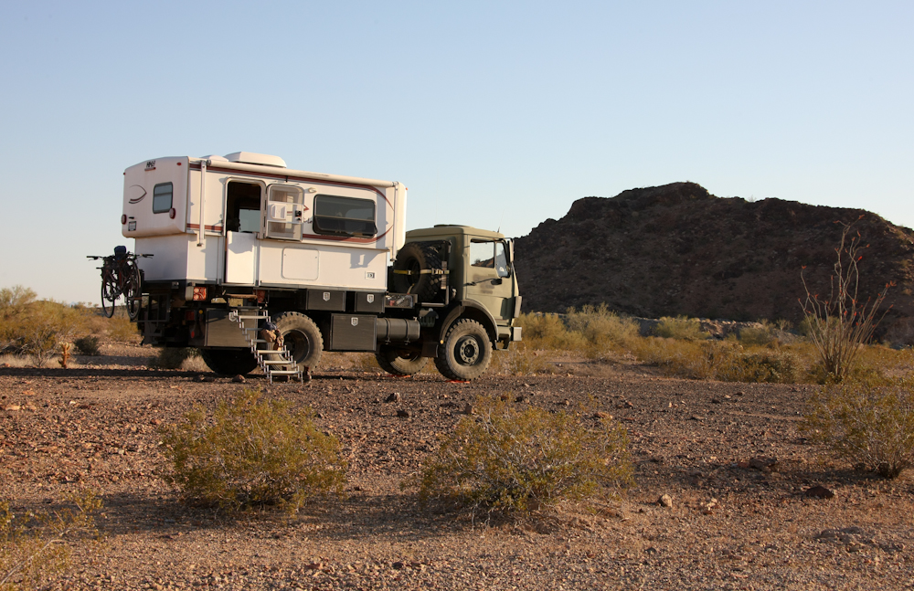
We enjoyed camping with our ex-Musicmatch friends. That said, it was cold, rainy and windy prior to their arrival at the camp. The trail across Kofa is long and rough. A large, wide vehicle like Thor required careful driving and precise wheel placement to prevent real damage. The brush took its toll on Thor's paint and tool boxes. The brush ripped off the weather seal from our door, removed the cap to the black water hose storage area and damaged the hose. We tagged the tool boxes repeatedly due to the steep exit angles required to pass some of the obstacles. But, despite the challenges, the trail was worth it. Not just for bragging rights, but becase of the great scenery.
From Painted
Rocks, we traveled to Tucson to visit family.
| Previous Adventure | ||
| Trip Home Page |
Photos and Text Copyright Bill Caid 2012, all rights
reserved.
For your enjoyment only, not for commercial use.