We spent the night at a Texas
state park park
campground along the Brazos River. The park was called Brazos
Bend SP. There, we spotted a few alligators and some interesting
bird life in the nearby swamp. From there, we headed into Houston
to meet an ex-work mate and from there south to the gulf coast and some
remote camping. Then, along the coast into Louisiana and creole
country.
The photos below are what we saw.
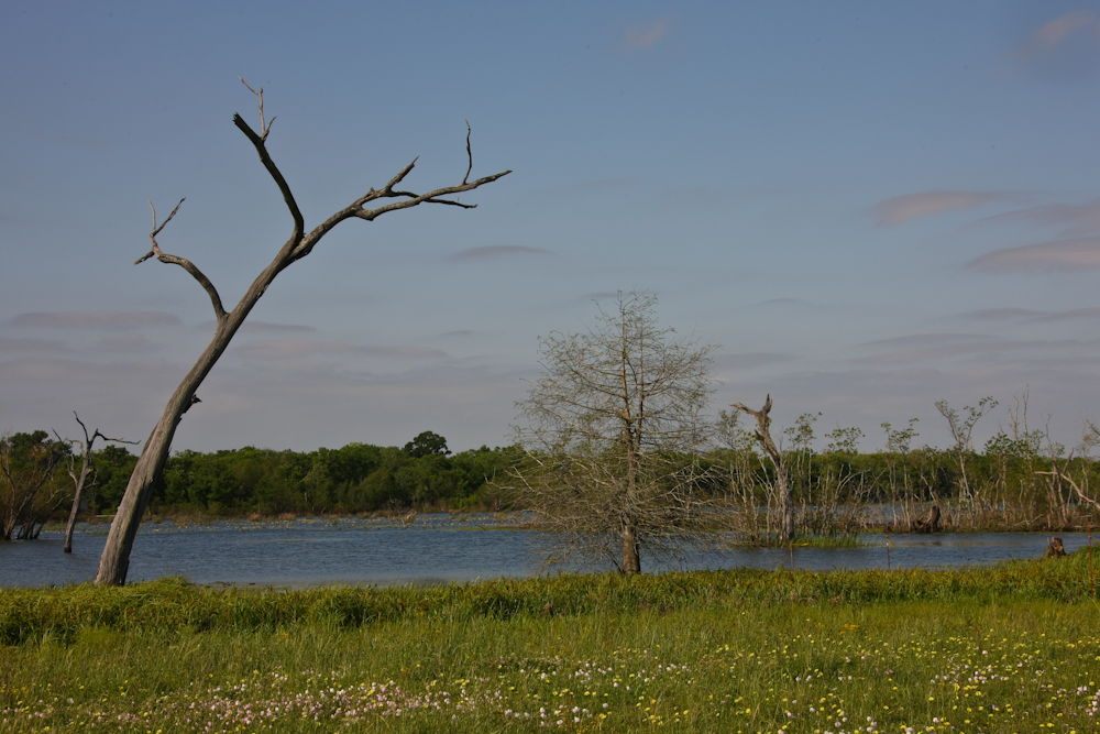
There were several swamp areas in
Brazos Bend. In the photo above, we hit the area on our bikes
near sundown hoping to spot more gators. But, we saw none and
went back to camp for dinner.
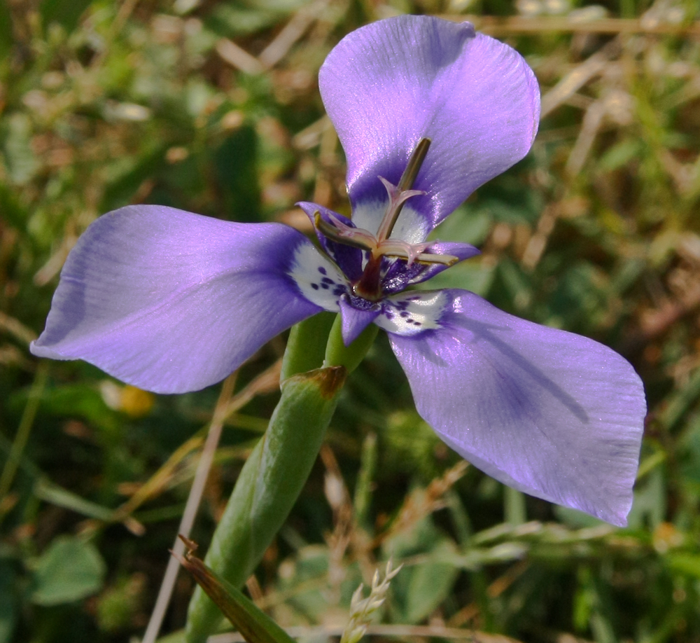
In the park we spotted some nice
flowers.
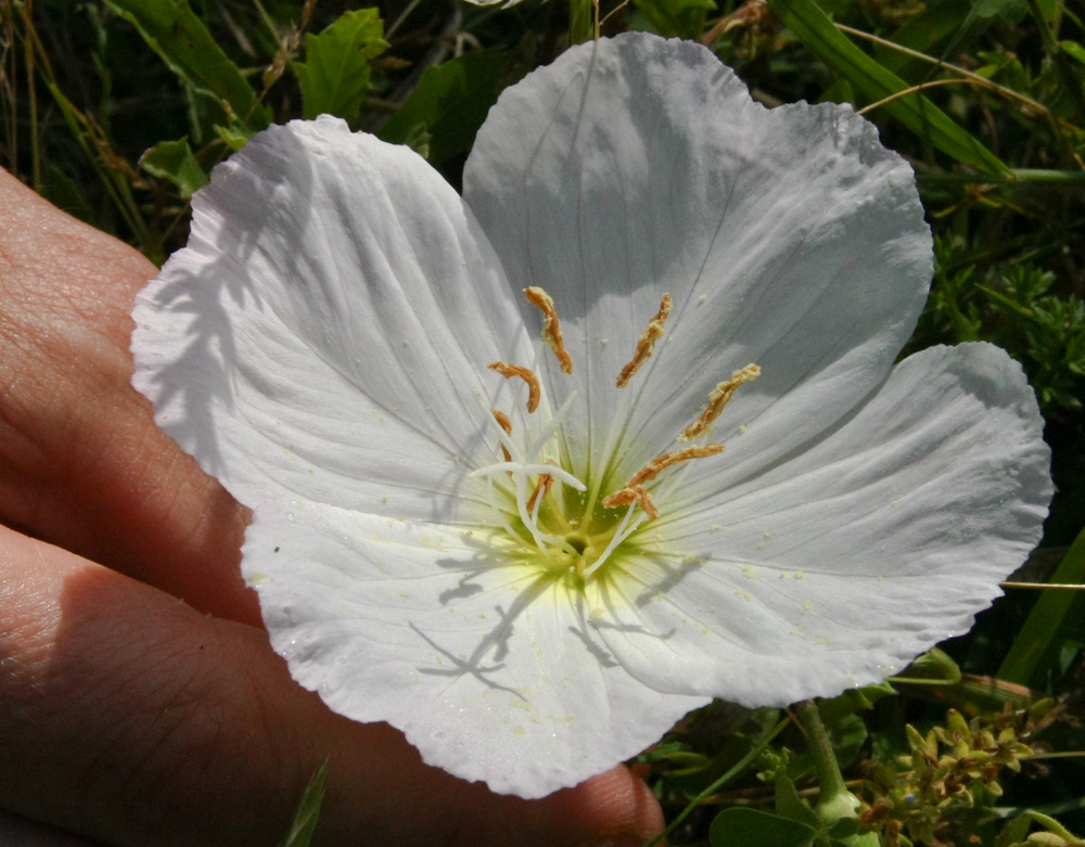
There was plenty pollen in the air
(according to my nose), some can be seen on the bloom above.
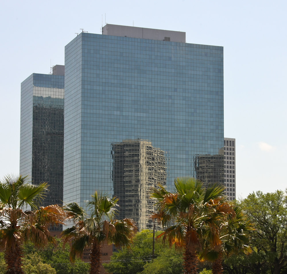
We met our friend Tejveer near
downtown Houston. The mirrored glass of the tall buildings
provided some interesting reflections.
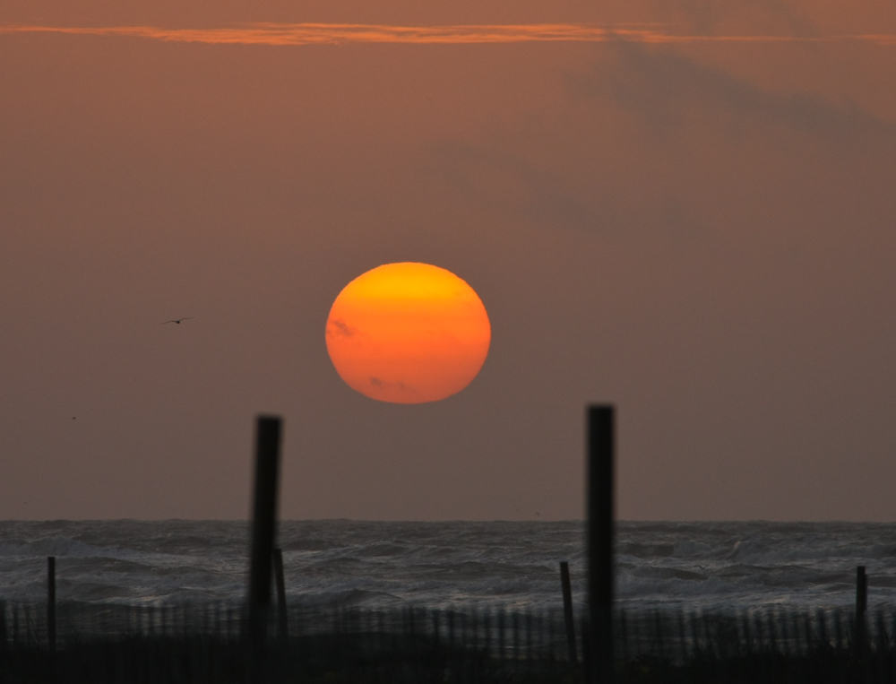
From Houston, we headed toward
Galveston and stayed at the state park on the beach. The
facilities were fine, but the wind was punishing. Sustained 30
mph winds blew for the entire time we were there. I awoke just
before sunrise and was sufficiently functional to get the sun coming
over the
horizon, just visible through the marine layer.
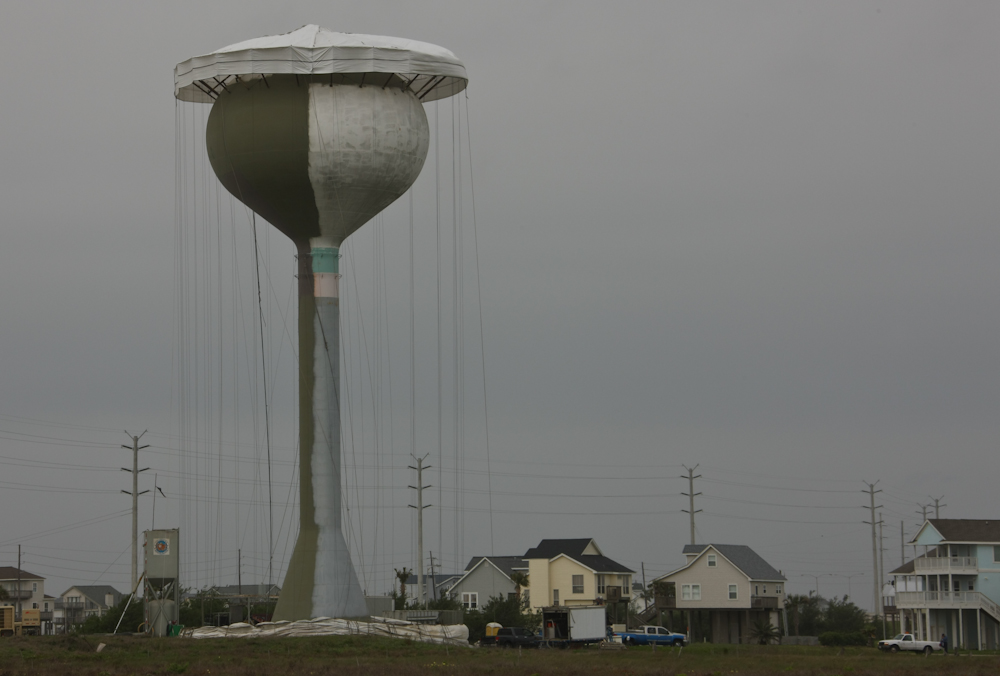
We drove along Galveston Island to see what was there. Along the way, we passed this water tower undergoing restoration. The cover and tie lines made it look like a giant jellyfish.
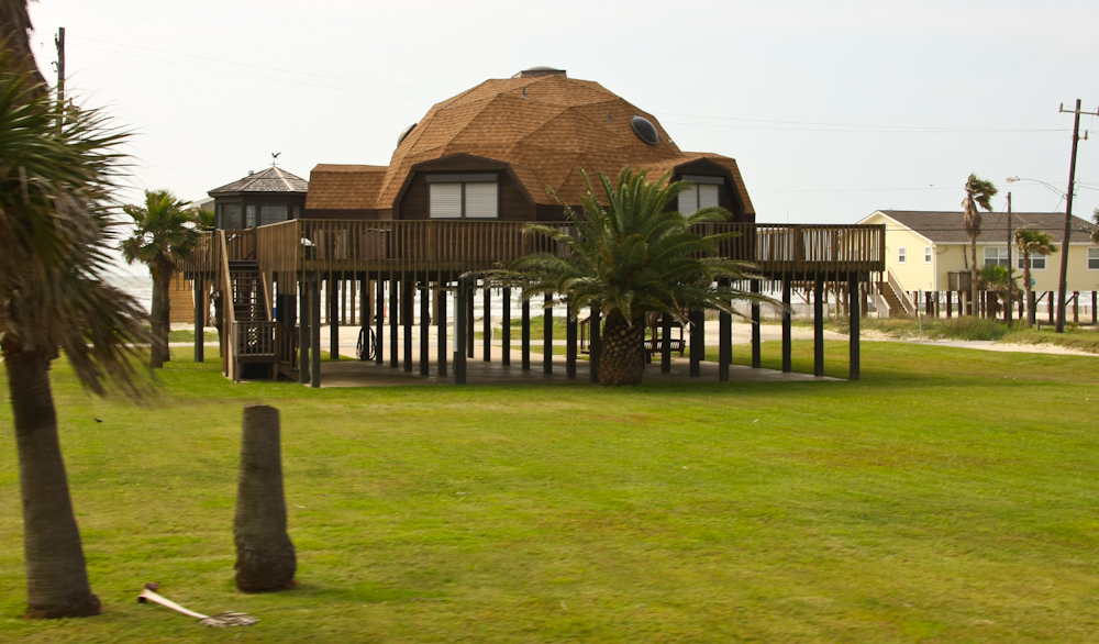
We passed many structures and homes on the island, and in general, they were all built on pilings to help minimize damage due to hurricane storm surge.
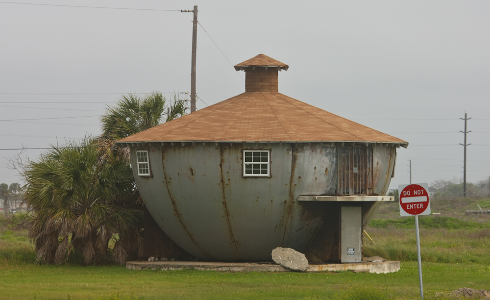
Some structures were odder than
others. This place appeared to be made from an old mooring
buoy. I wonder if it will float away during the next big
storm. The sign applied to the street in front of the residence
rather than the home. But, given the bars on the access hatch, it
was probably still relevant.
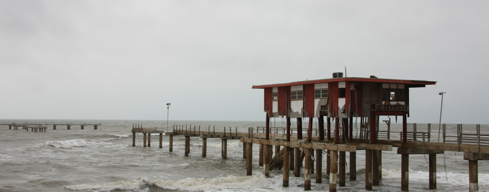
Hurricane Ike hit this area a few
years ago and the damage was widespread and severe. Above, you
can see one of the piers along the Galveston seawall that was destroyed
by the hurricane. We saw many damaged or destroyed structures
including many hotels along the waterfront.
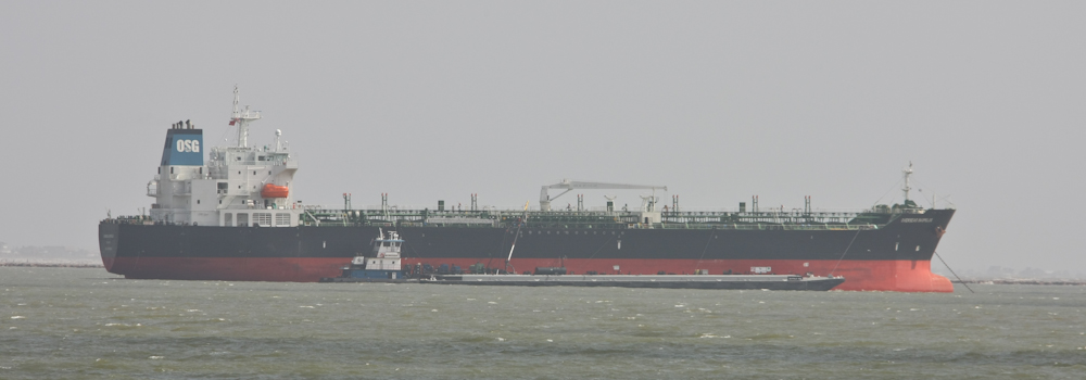
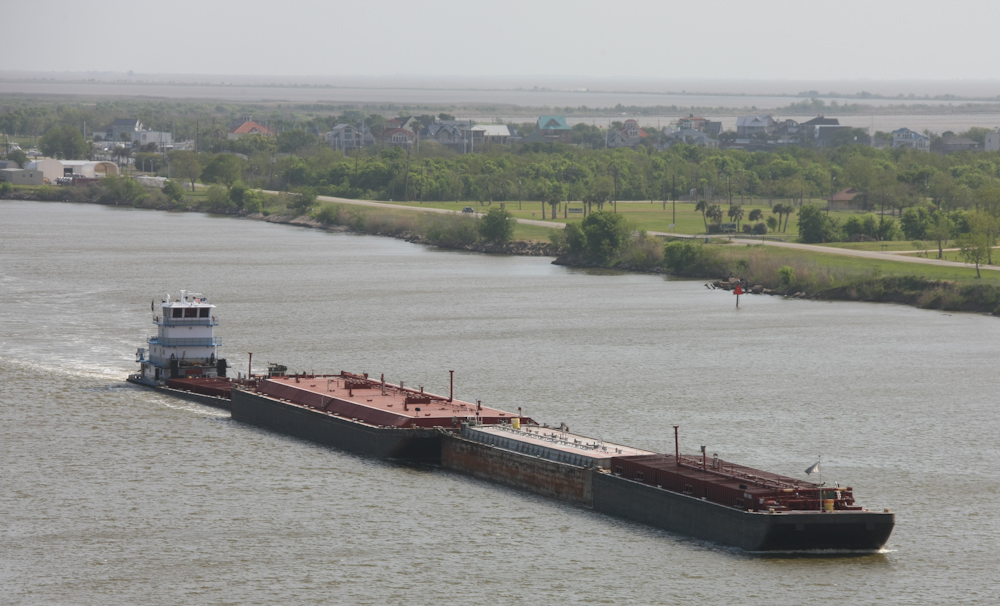
We drove to the east end of
Galveston Island and spotted this large tanker and tender barge.
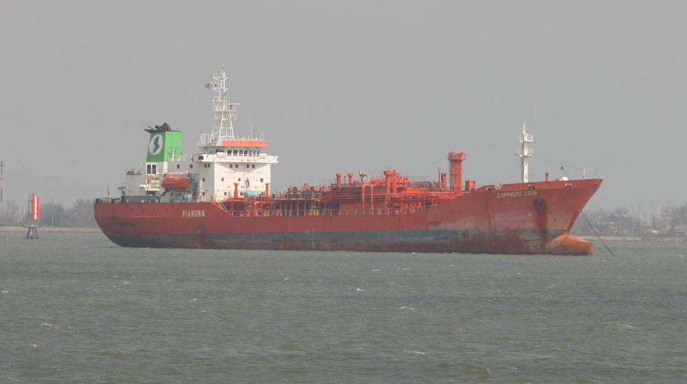
More large tankers were visible in
Galveston harbor. Some were in better shape than others.
Note the bow on this one. I think that the protrusion was added
as a retrofit after the ship was built.
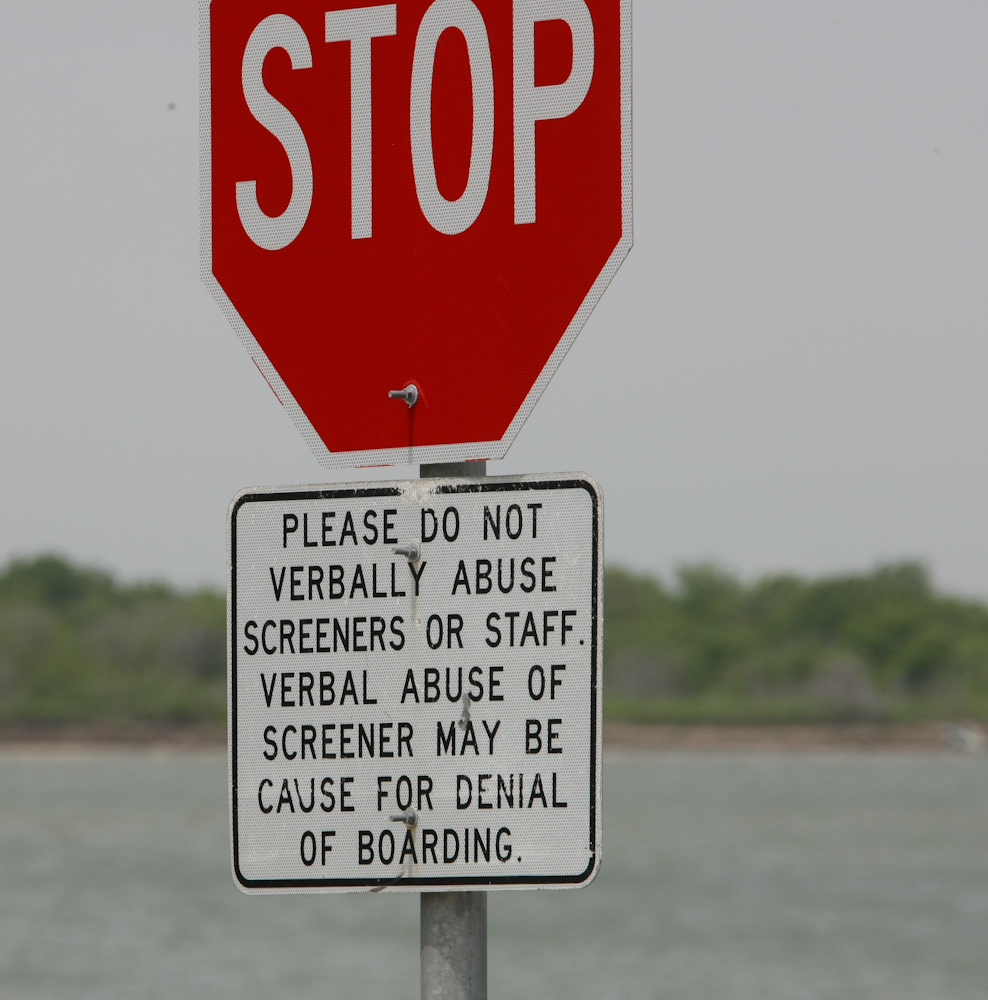
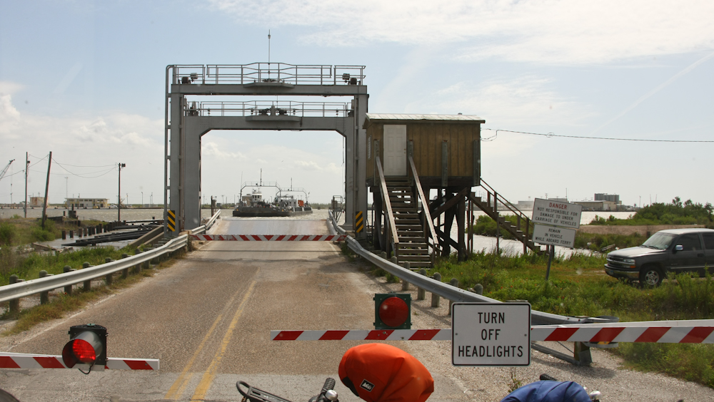
We had to take a ferry to get out
of Galveston going to the east. I can only imagine what events
led up to the posting of this sign.
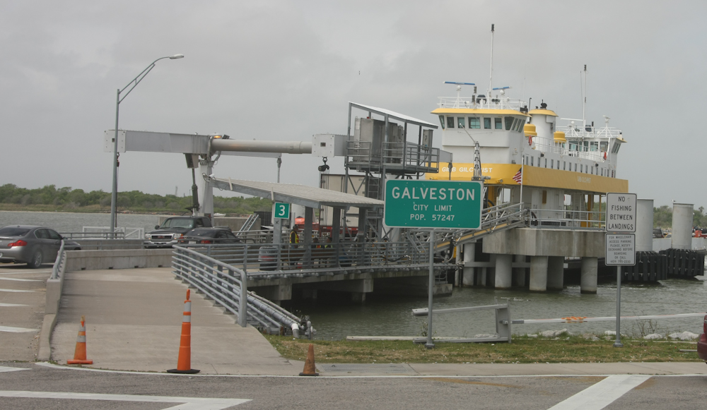
There were a number of ferries in
service on this run and they were quite large. Not as large as
the ones we rode in the Seattle area, but still capable of taking many
18-wheelers at one time.
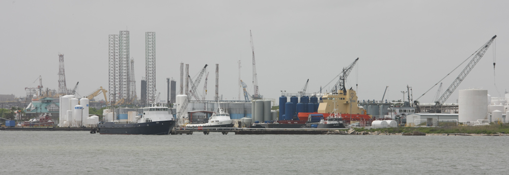
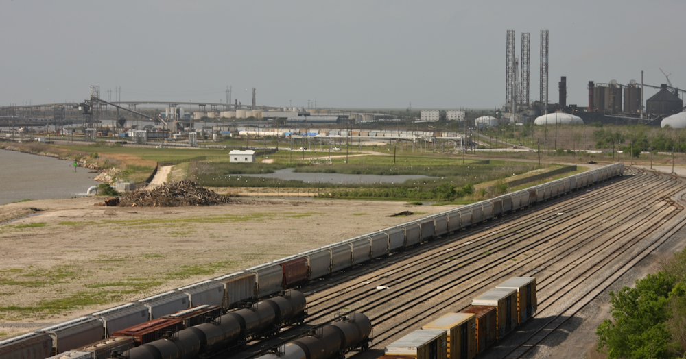
The Galveston harbor waterfront area was heavily industrialized with most of the infrastructure supporting the off-shore oil industry.

Once we were on the ferry, we encountered a really big tanker heading into the ship channel.
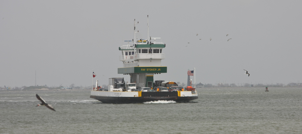
The sister ship to our
ferry. There were a number of cargo trucks on board as well as
the school bus, so you can judge the size from those.
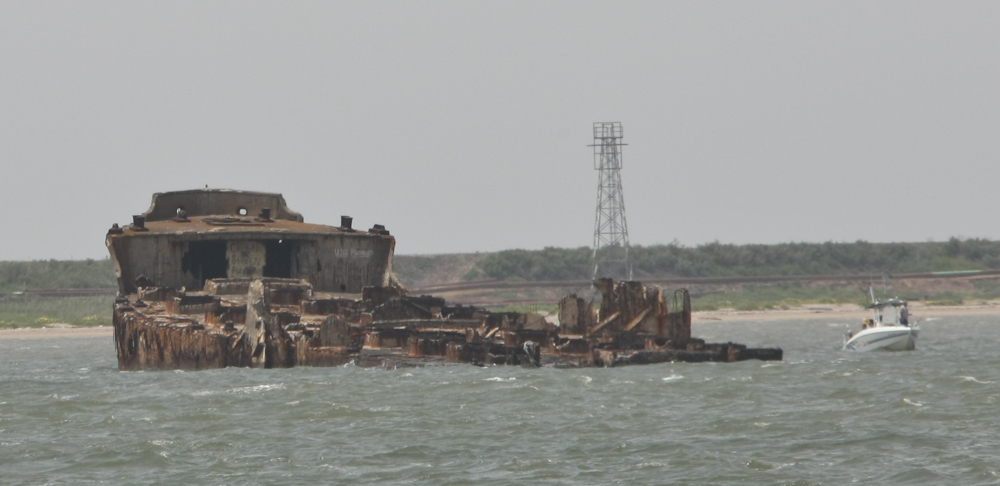
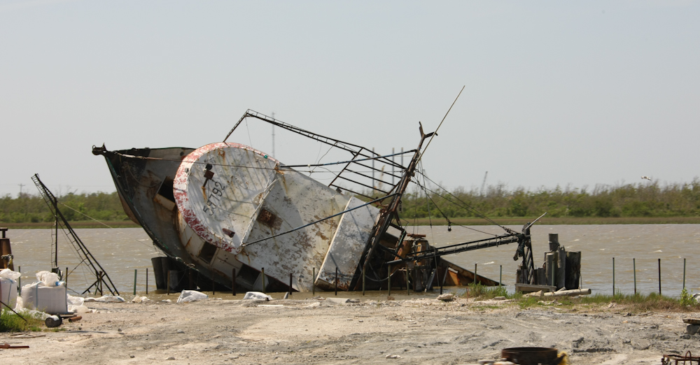
We passed this rusting hulk in the
harbor. I think it was a casualty of one of the big storms that
passed through this area.
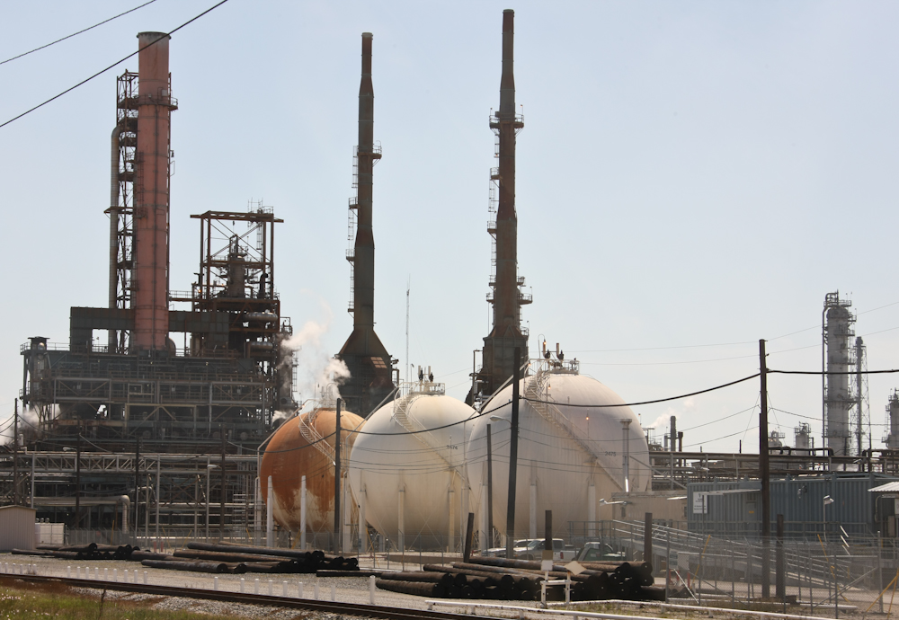
We headed east along the coast and
encountered many oil refineries.
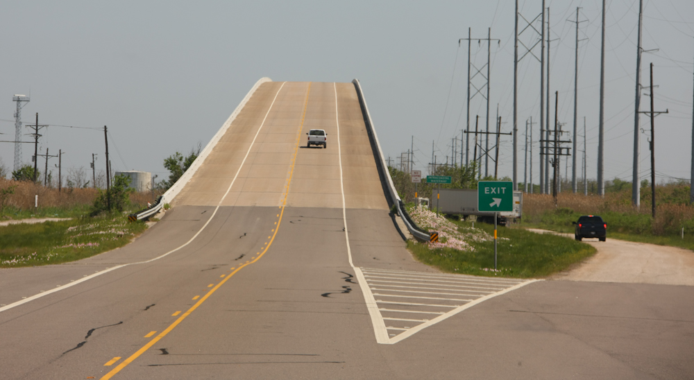
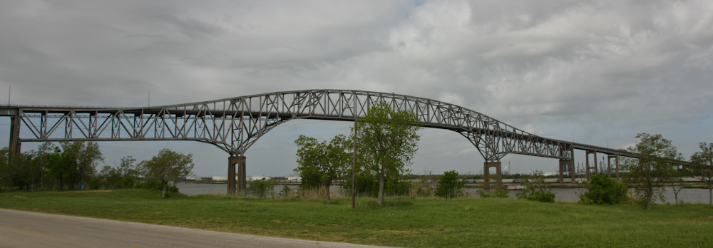
We passed over the intracoastal
waterway many times and each crossing had a big, steep bridge.
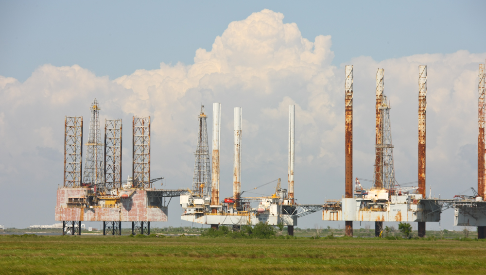
We headed back to the coast at
Sabine Pass and encountered a bunch of coastal drilling rigs in a
storage zone.
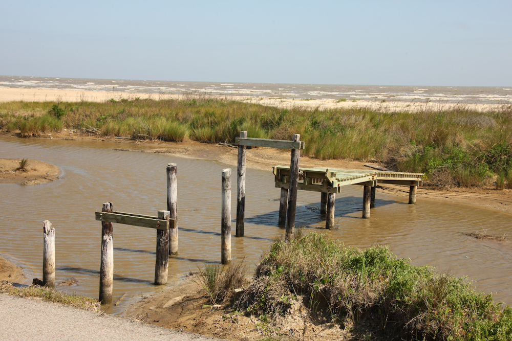
There was a state park on the
coast near Sabine Pass, but the last hurricane destroyed it.
Officially, the park is closed, but we decided to camp on the beach
anyway. Above, you can see some of the boardwalk that remained
after the hurricane. We went down to the beach and headed east on
the sand.
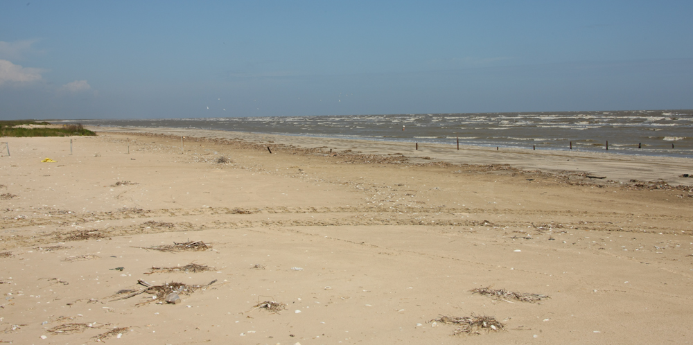
We found a totally deserted spot
to camp, which was nice. The wind, however, was not nice.
It was still steady at about 30 mph and it was blowing sand everywhere
making fantasy of a nice walk on the beach at sunset unrealistic if not
downright uncomfortable.
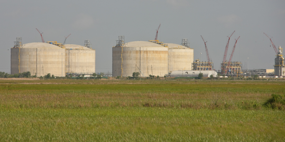
On our way back into Sabine Pass,
we encountered a large LNG terminal under construction.
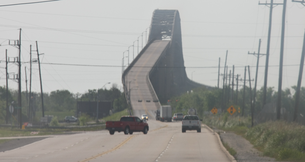
At Sabine, we had to cross the
intracoastal waterway again. Check out the size of this structure!
From the bridge, we could see more
destruction from hurricane Ike.
Some of the oil infrastructure at
Sabine Pass.
We passed many barges on the intracoastal waterway.
The intracoastal bridge at Sabine
Pass.
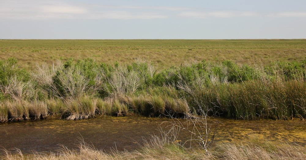
The areas just inland from the
beach were coastal swamp and flat as a board. I was told by a
local that when Ike came to the area, they had a 30 foot storm surge
that sent water inland nearly 20 miles. They determined that by
the location of some of the floating debris that could be identified.
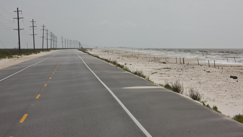
East along the coast, toward
Cameron, LA, the road went right along the water. Since the road
was basically at sea level, I have to imagine that the storm damage was
severe. Indeed, the road looked new and in good shape as if it
had been recently rebuilt.
At Cameron, LA we had to get back
on another ferry. This was a small crossing and only one ferry
was in service.
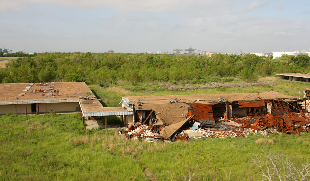
More hurricane damage. From the coast near Cameron, we headed north to Lake Charles to find an RV park to do laundry and catch up on email.
This area was nice and green and a pleasure to see. The wind made things uncomfortable, but we were really happy that we had a hard-walled camper. I was shocked to see the extent of the hurricane damage. The hurricane came several years ago and many debris piles and damaged/abandoned buildings still remain. I can only imagine what the storm must have been like.
| Previous Adventure | ||
| Trip Home Page |
Photos and Text
Copyright Bill Caid 2010, all rights reserved.
For your enjoyment only, not for commercial use.