After a great visit in Logan, UT, and with advice on the best sites to visit from Jud, we headed north toward Bear Lake. We were told that the local treat was the raspberry shake, so we had to stop and get one. They were indeed tasty. And what better to have with a shake but a burger and onion rings? There were no camp sites on Bear Lake that we deemed acceptable, so we headed north along the western shore to find something suitable. Many thanks to Jud and his wife Sadie for their hospitality and a great dinner.
The photos below are what we saw.
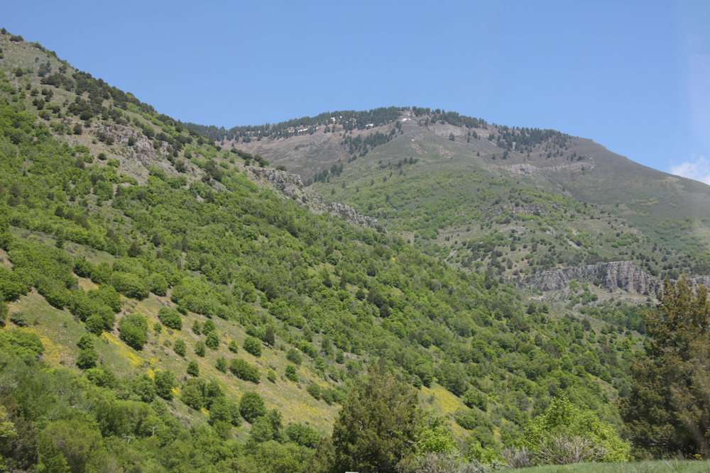
Our path out of Logan, UT took us through the canyon created by the Logan River. The canyon was deep and some of the peaks still had snow.
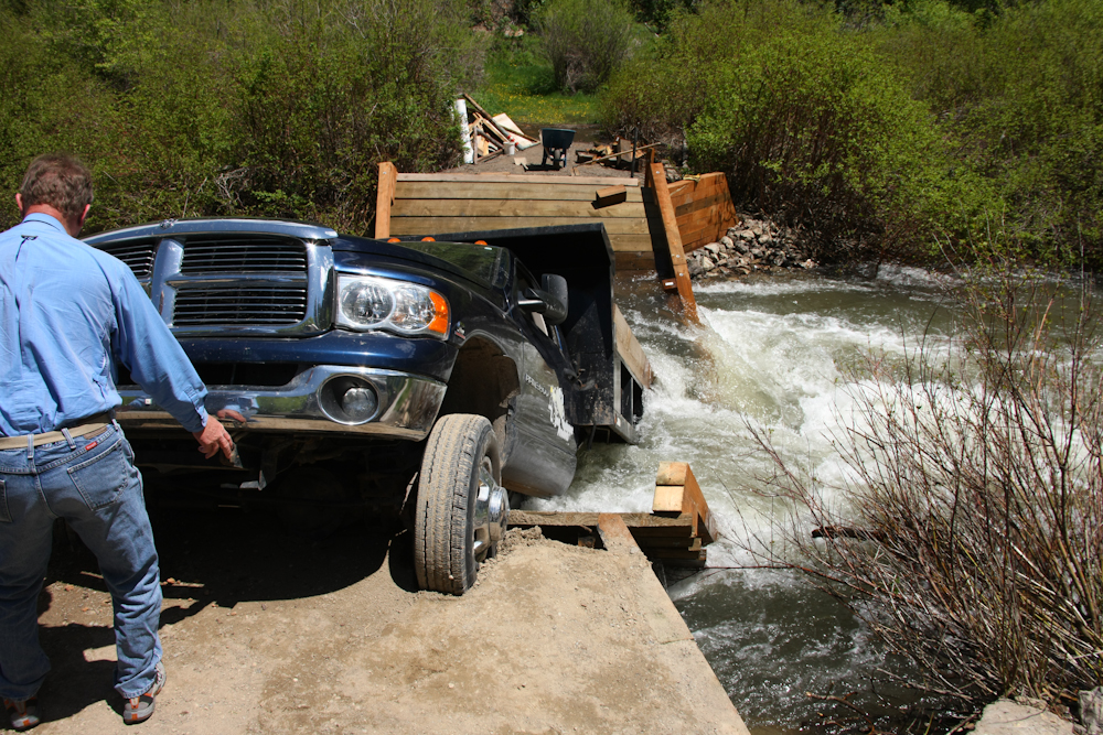
Houston, we have a problem. About mid-way up Logan canyon, we came upon this unlucky fellow, Stevie. It seems that the owner of the bridge was "sure" that the newly refurbished bridge would hold the weight of the truck. Not. The driver was not hurt, but the bridge was totaled. We stopped and I was pretty certain that I could pull him out with my winch. But, we would have had to winch across US 89 (with traffic) and there was a reasonable chance that after I took a strain on the truck, that the river current would pull the truck, and my mog, down river. The fellow with his back to the camera claimed to be an ex-police officer, and he suggested that we NOT winch him out for a variety of reasons, including liability. So, we watched for a bit and then motored on.
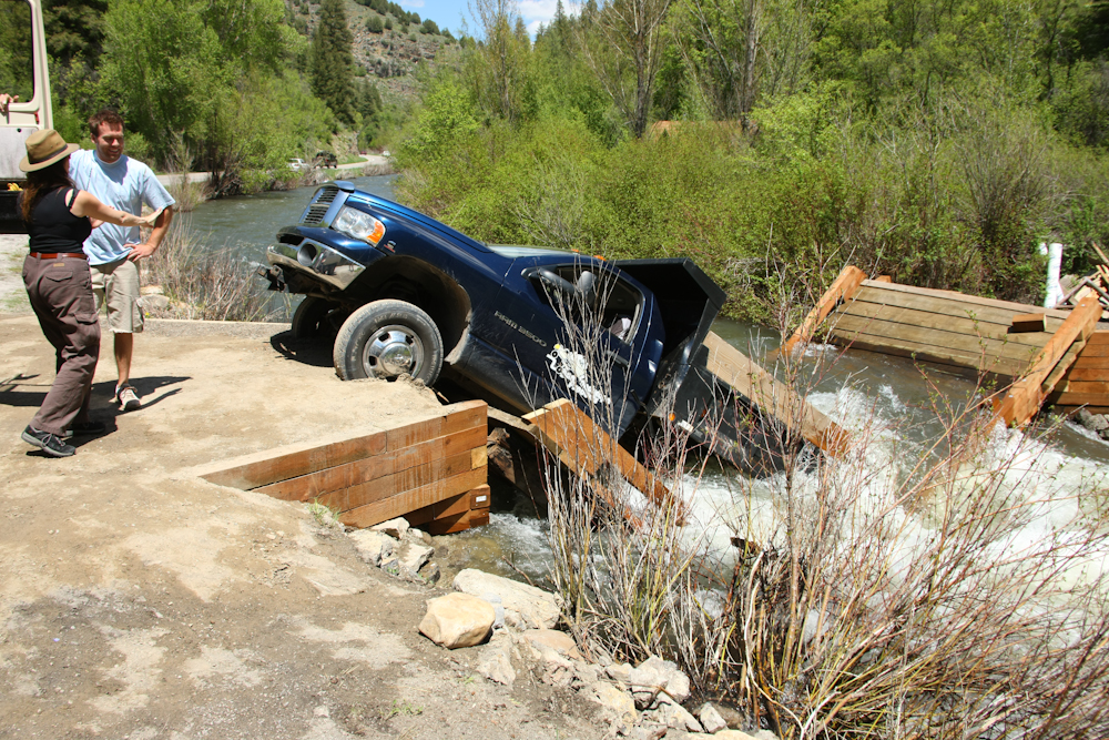
Another view of the bridge. Note that most of the visible wood is new. The operator of the truck is talking to Kathleen.
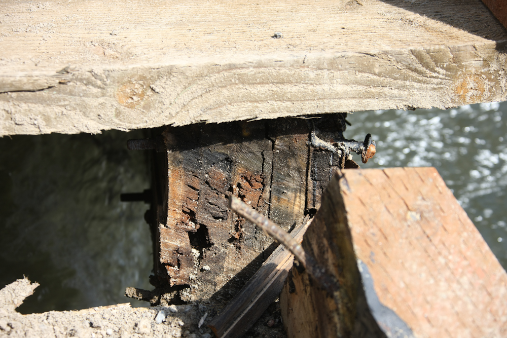
Sadly for both the bridge owner and the truck owner, the main beams of the bridge were not replaced. As can be seen from the photo above, these were "composite" beams formed from a set of 2x12 timbers bolted together. And, it can be seen that they were somewhat rotten, resulting in rotten luck for the trucker.
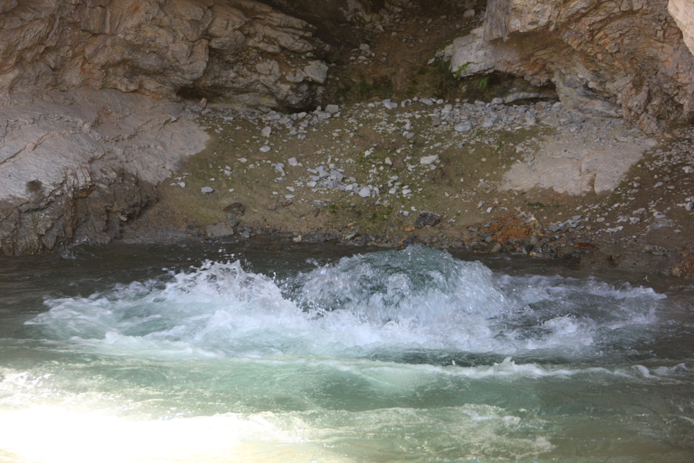
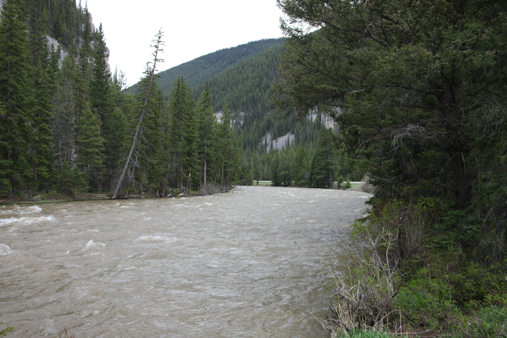
From the bridge collapse, we continued up Logan Canyon to a major spring. The water literally erupts from the ground. The sign at the spring stated that it is generally believed that the spring is hydraulically connected to Logan River.
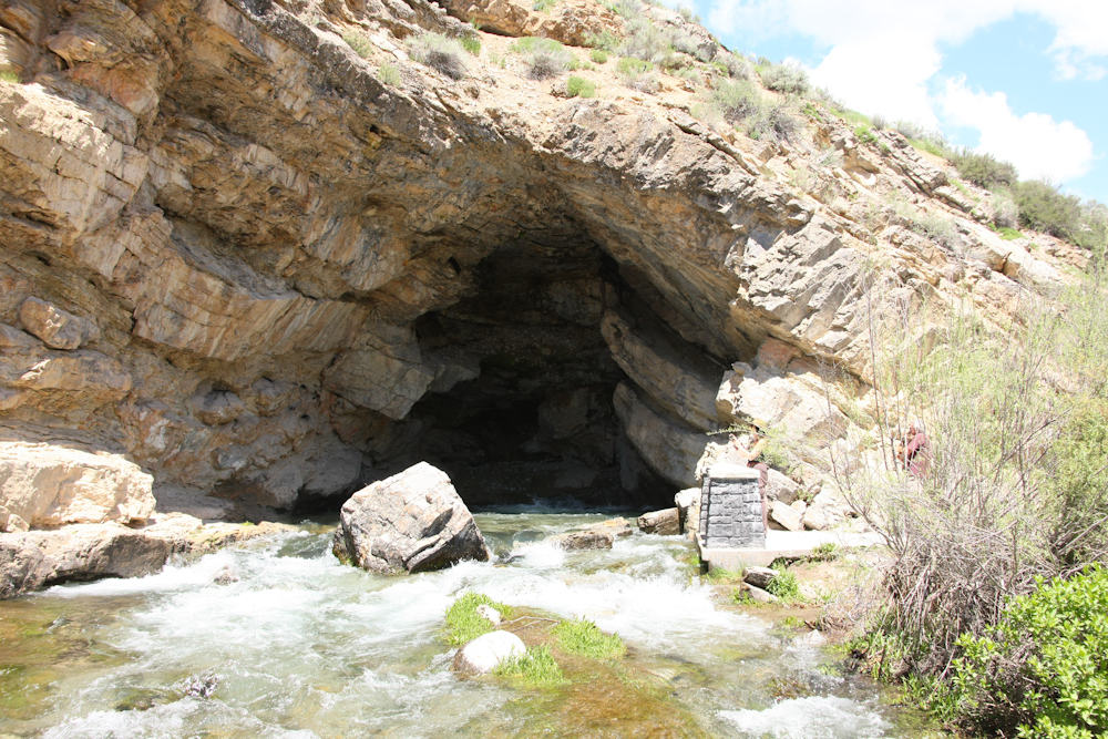
The flow from the spring has eroded a large cavity in the cliff wall. As you can see, the flow is substantial.
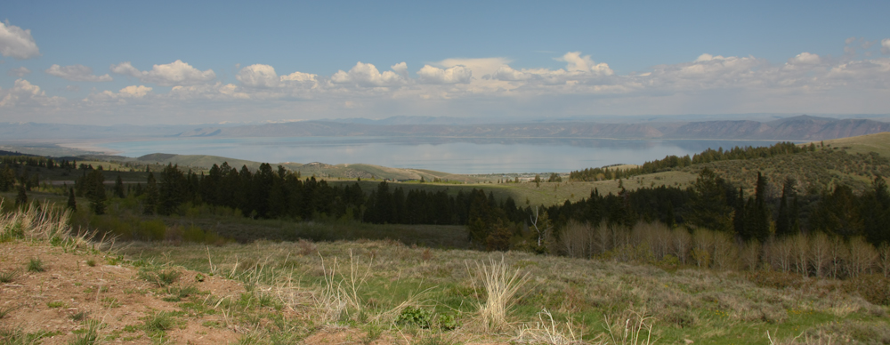
We continued over Bear Lake Summit and got our first view of Bear Lake. Bear Lake is at 5923 feet elevation and is a nice pale blue color.
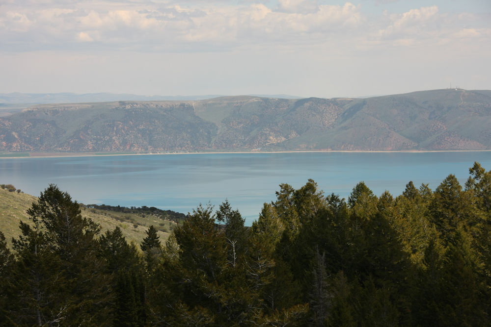
The color of the lake was quite remarkable and the photo above really does not do it justice. We did not find a campsite near Bear Lake that met our criterion, so we continued north on US 89 to the small town of St. Charles where we headed west into the hills again.
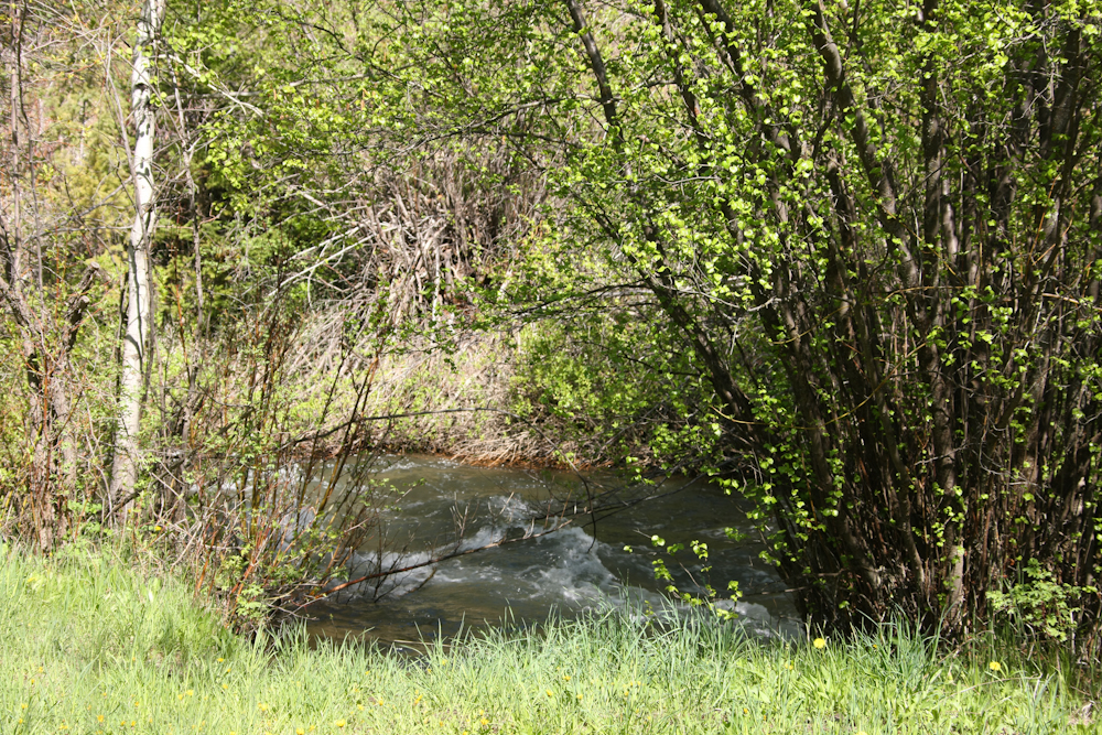
We found the camp site we were seeking next to the St. Charles creek. The creek was flowing fast and cold. I did try my luck and go in the water, but only got ankle deep. The water consisted mostly of spring melt water and was so cold that it hurt.
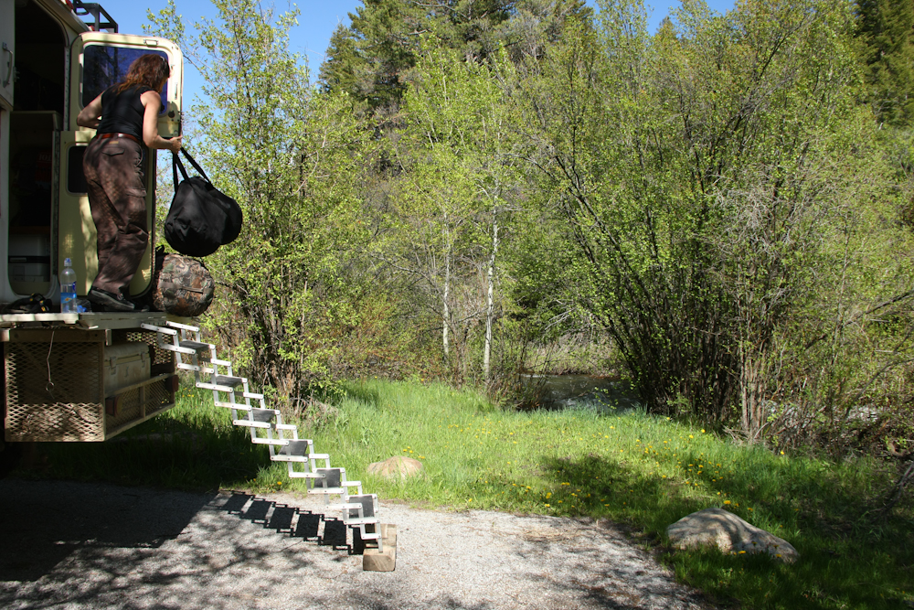
Our camp was right next to the creek and the sound was quite loud. There were some bugs, but not enough to be a true issue. And best of all, we had the whole place to ourselves.
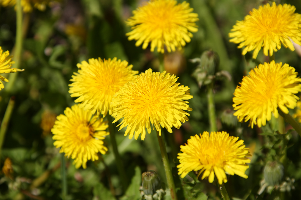
Spring brings out the flowers in the area.
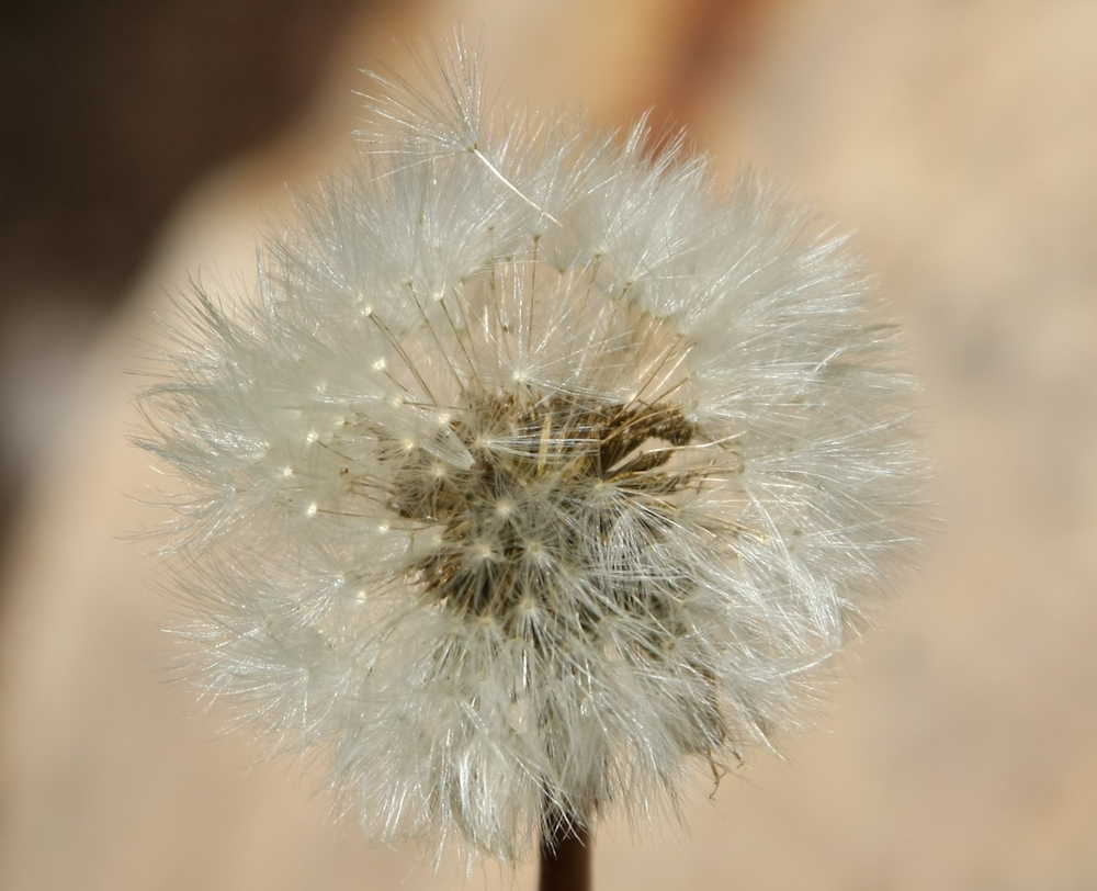
The dandelions were dandy.
At Geneva Summit, we spotted this sign.
The sign was interesting, but not interesting enough to cause us to deviate to visit the spring.
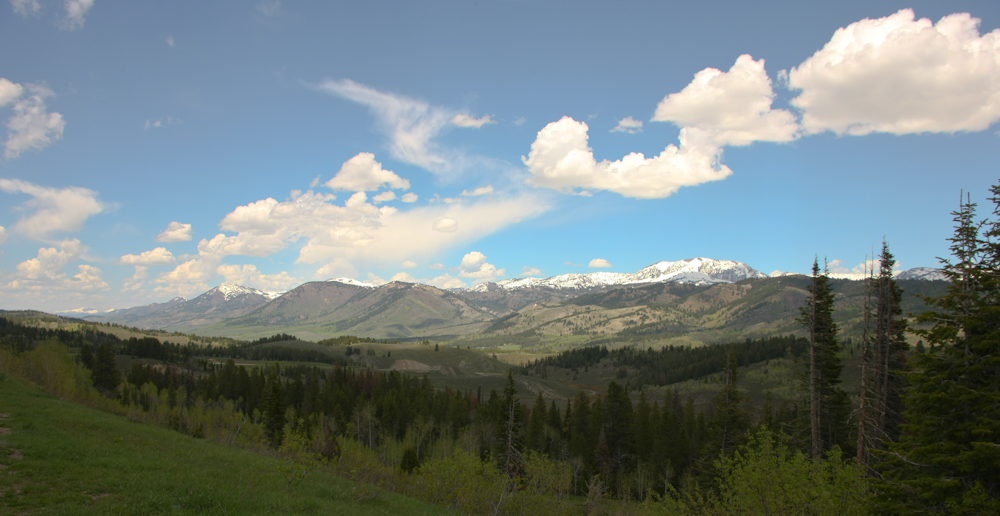
The views of the snow-capped peaks in the distance were stunning.
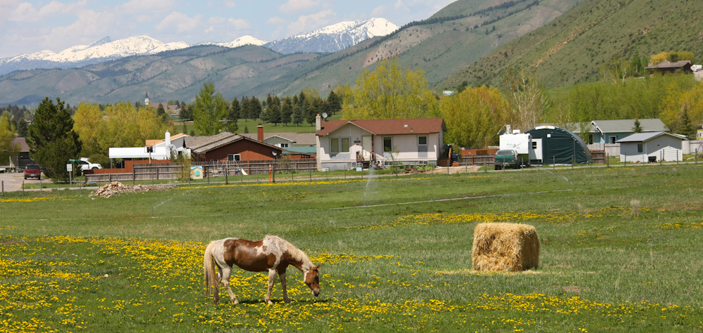
This is one definition of heaven - horses in flower covered field with snow-capped peaks in the distance.
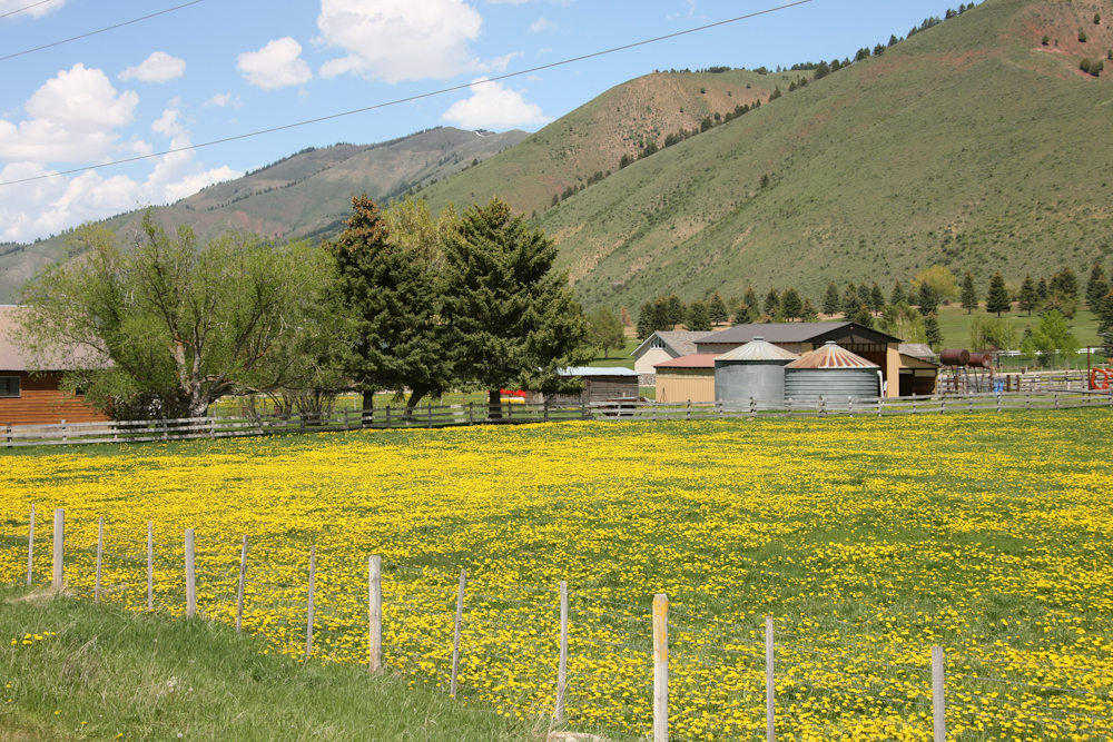
Some of the fields were nearly completely covered in flowers.
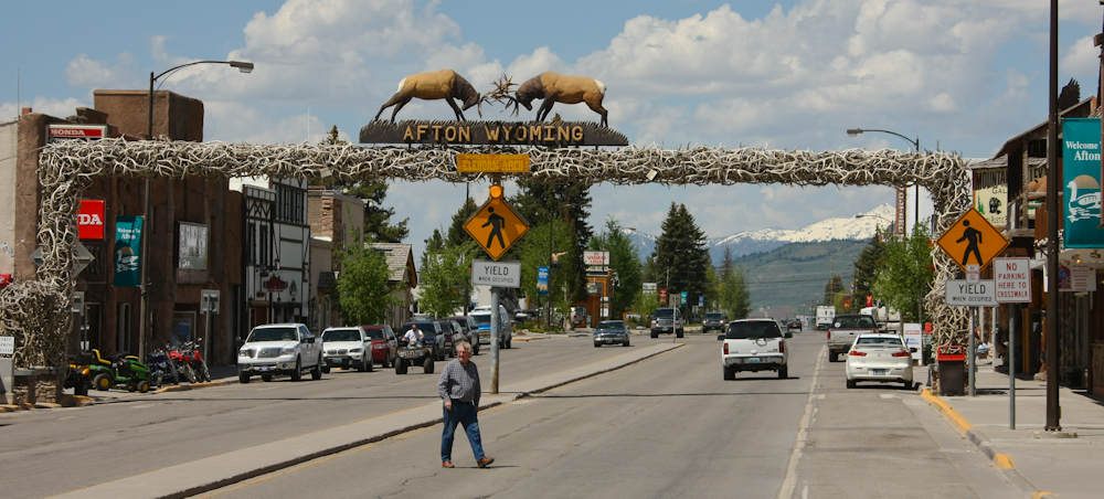
The main point of attraction in Afton, WY is the antler bridge. They claim 3,100 antlers are in the bridge.
From Afton, we continued to follow US 89 and finally settled on a camp site at Station Creek next to the Snake River.
This is the Snake River as seen from Station Creek. The river is big, fast and cold.
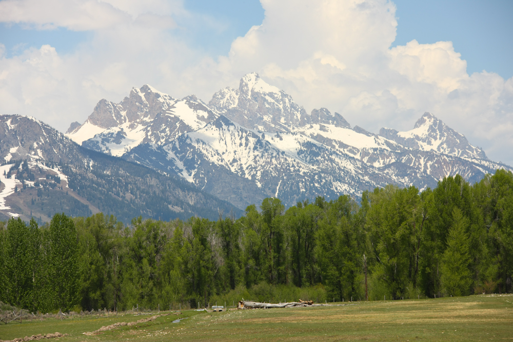
We stopped for supplies in Jackson, WY and then headed north over Teton Pass. The approach to the pass gave us great views of the Teton range.
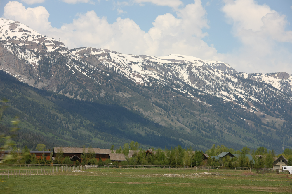
There were some nice homes near Teton Village.
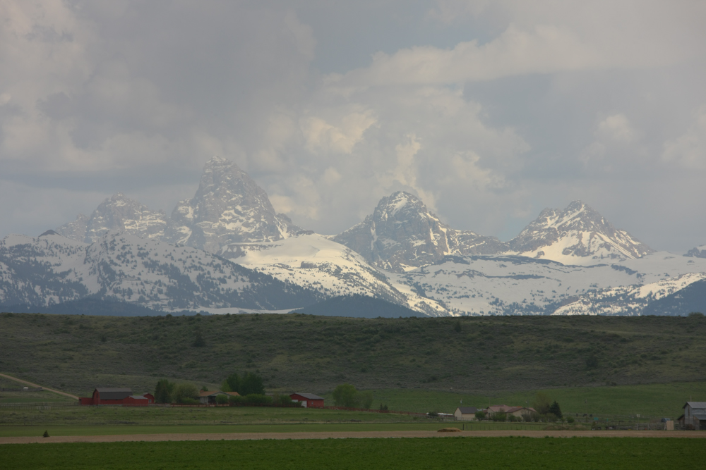
From the west side of the pass, we got an alternate view of the Teton peaks.
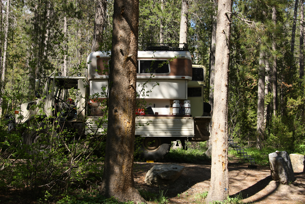
We went past Warm River and decided to pass on that camp and instead chose to head into the hills up Fish Creek road. We finally chose the site above at about 6500 feet elevation. While there was still some snow in the shady areas, the air temperature was warm and comfortable. That said, there were PLENTY of bugs and we were reduced to walking serum banks for the hungry swarms. In the end, we retreated into the camper and watched a DVD and never had a fire.
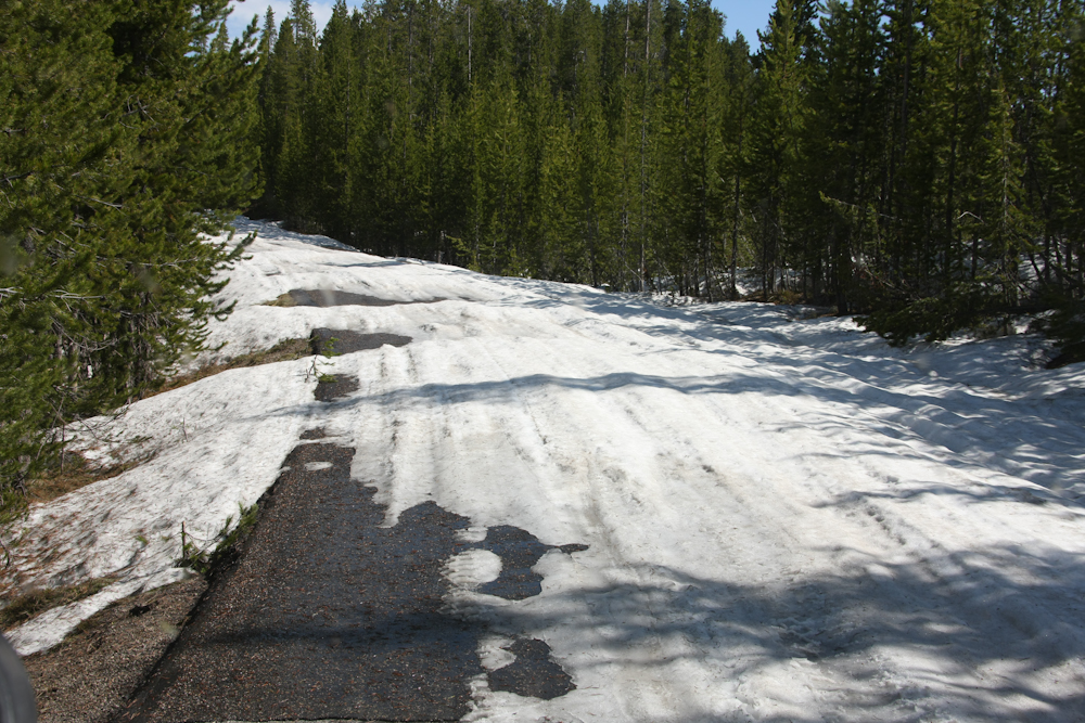
Next morning, we broke camp and continued higher into the hills on Fish Creek Road. Our goal was to get to Mack's Inn "the back way", but the snow had other ideas. We busted snow drifts for awhile, but eventually we got to an altitude where the snow fully covered the road. The only sane choice was to backtrack, which is what we did.
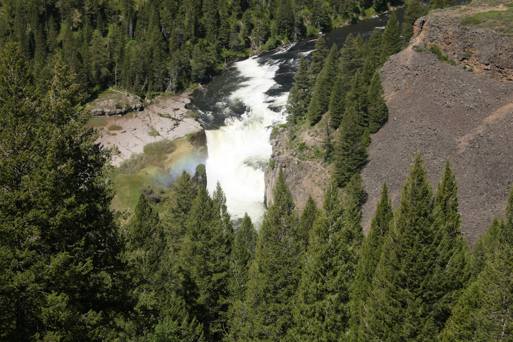
In retrospect, the backtrack was actually a good thing. We would have missed upper and lower Mesa Falls if we had continued on the back road. Above is our first view of the lower falls.
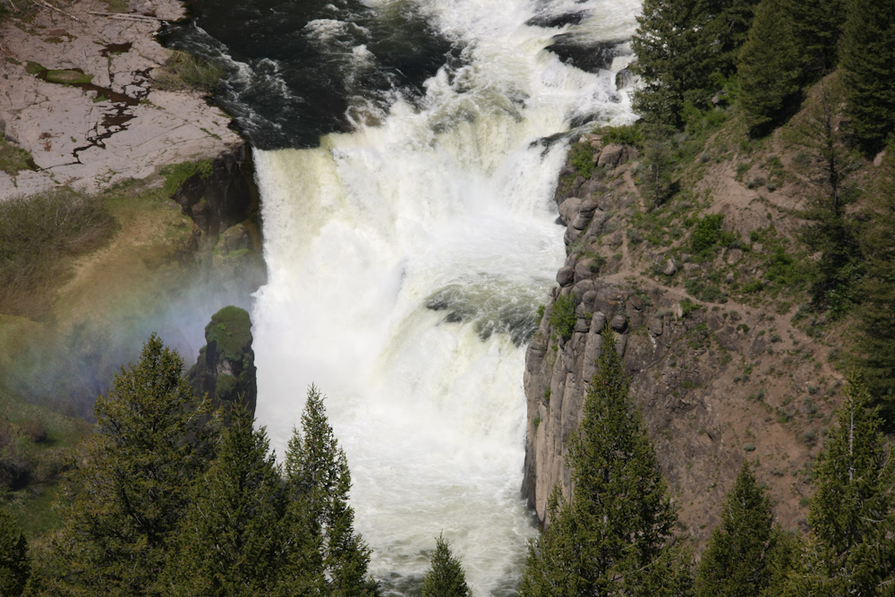
Another view of the lower falls. The falls are on the Henry's Fork of the Snake River. These were big falls.
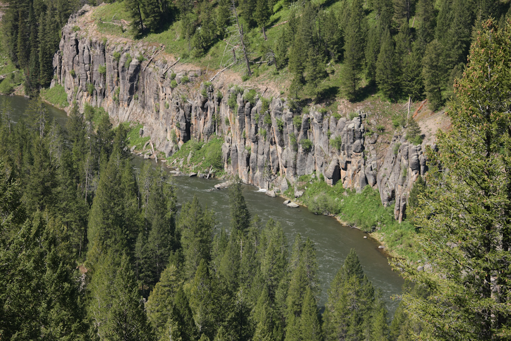
The canyon was deep and was lined with big walls of volcanic basalt.
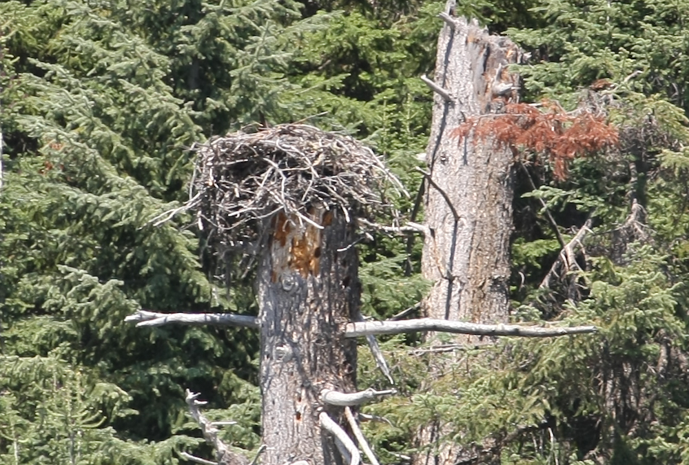
One of the other visitors told me that there was an osprey's nest across the river. I was able to find it and the result can be seen above.
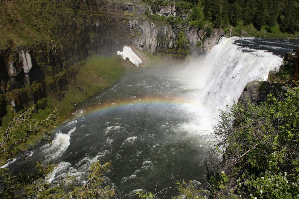
Upper Mesa Falls. Note the rainbow.
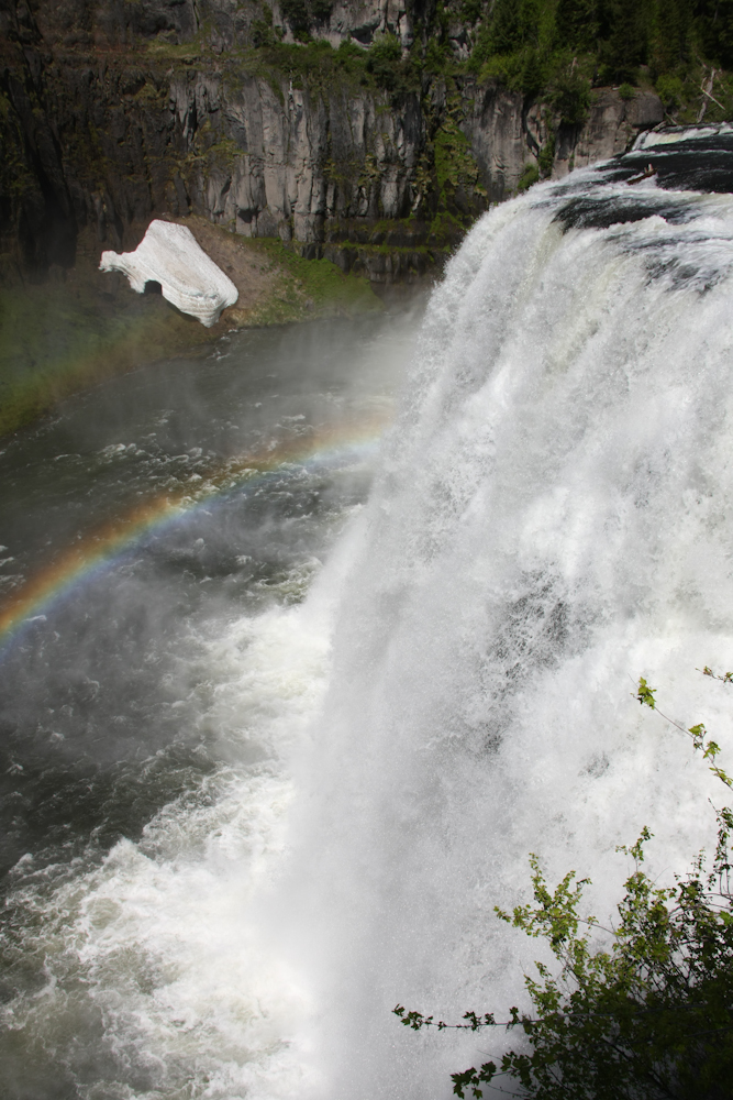
This was a big falls with a large drop. Note the snow bank on the opposite side of the river.
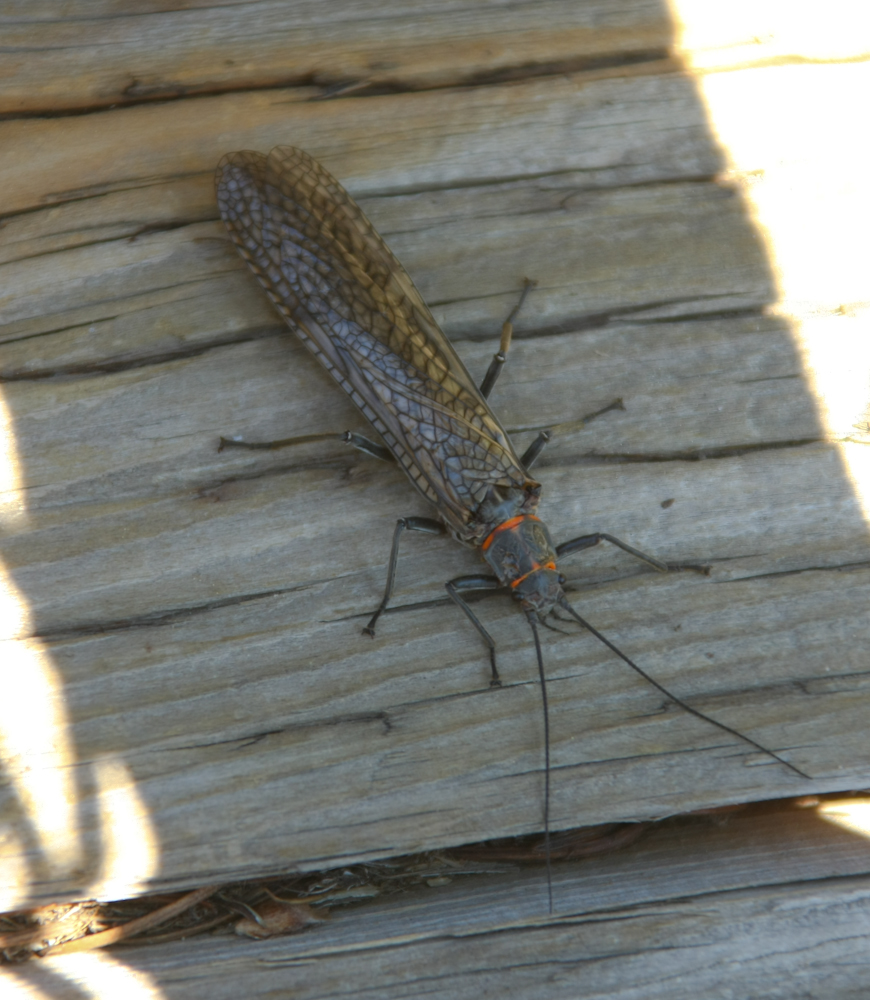
I spotted this bug on the steps leading away from the falls. This fellow was big -- perhaps 2 inches.
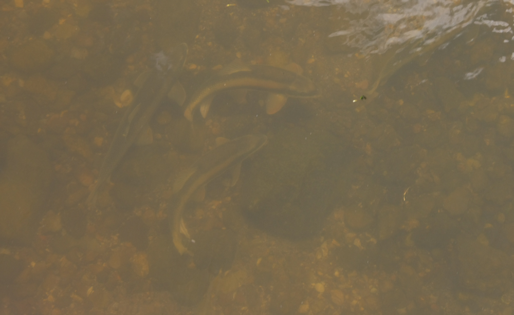
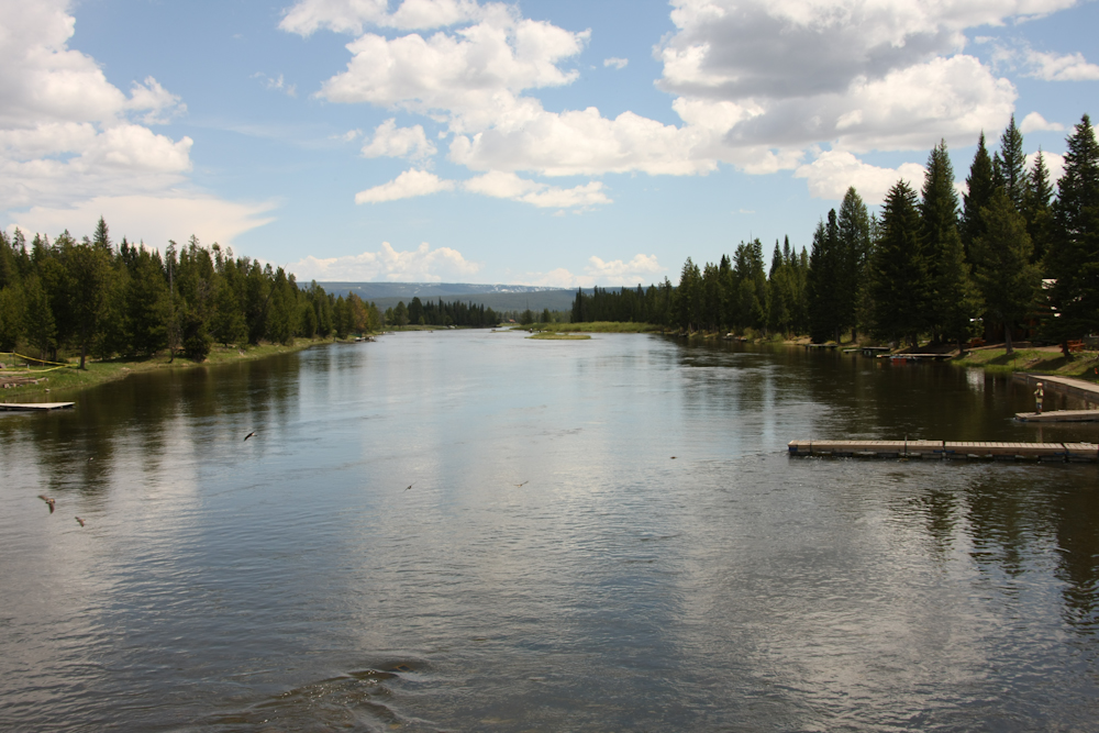
We stopped at Mack's Inn and went out on the bridge over the Henry's Fork to see the fish. Above, you can see 18" trout just hanging out in the water under the bridge. These guys were big but not hungry. They generally ignored the hooks that were being cast their way.
Every one of those dark spots is a large trout.
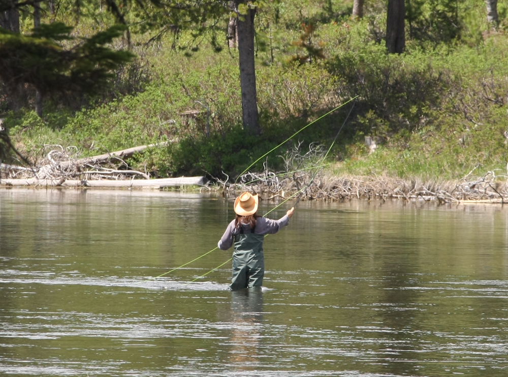
Just upstream from the bridge, this fisher woman was fly casting.
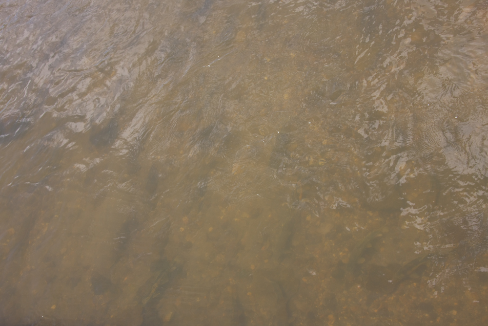
Downstream from Mack's, the river was placid and wide.
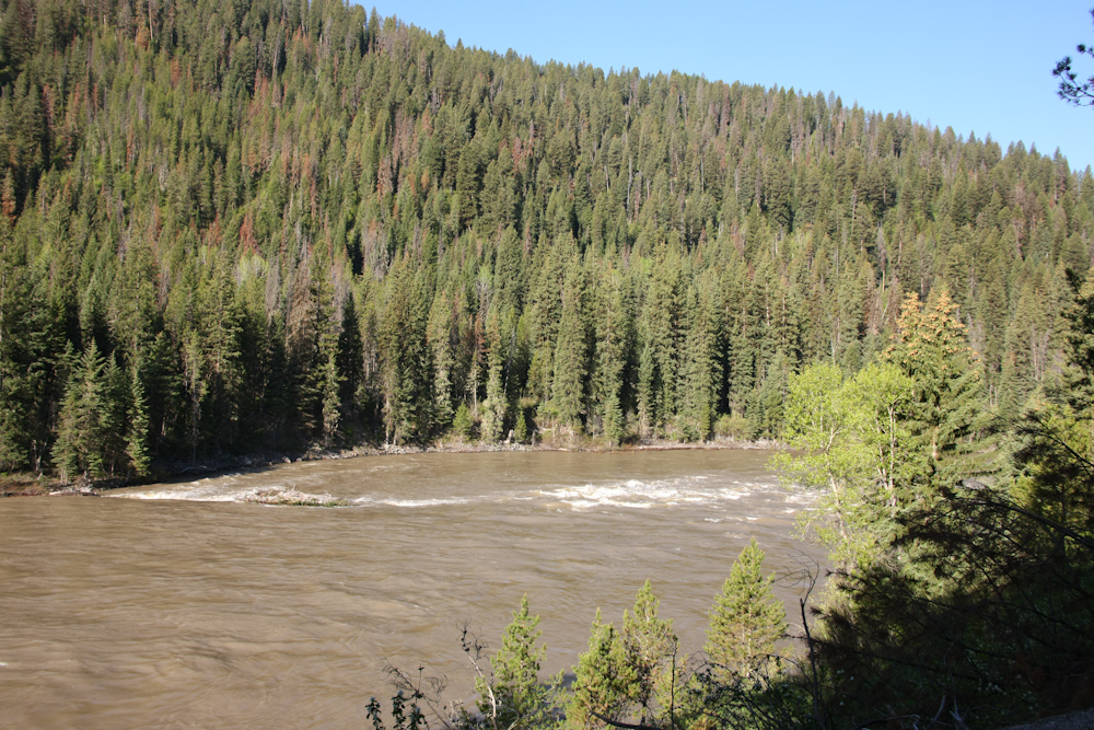
Next to US 89, the Gallatin River was flowing fast and strong. There were many white water rafters upstream of where this photo was taken.
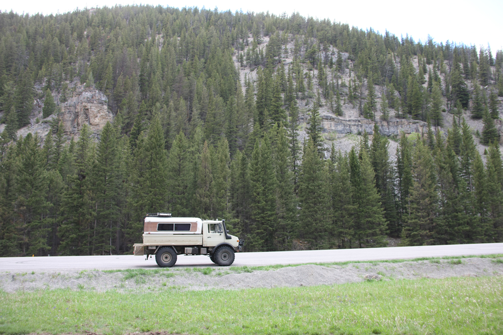
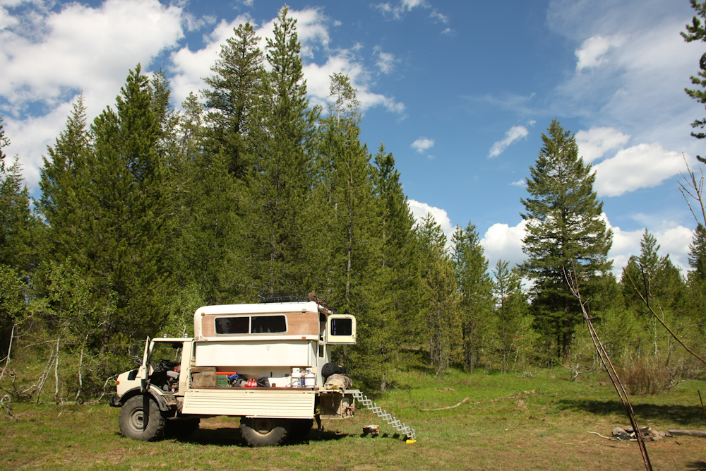
A view of our rig near the Gallatin River.
Somehow, I was not all that surprised that we were defeated by snow. We were a bit early in the season, but hope springs eternal. We finally arrived in Helena, MT and stayed with our friends Ben and Krista and decided to spend a few days before continuing on to Glacier National Park. As of the date of this writing, we know that the pass over Glacier, "Going to the Sun Road" is still not open. Perhaps in a couple of days they will complete the plowing.
| Previous Adventure | ||
| Trip Home Page |
Photos and Text Copyright Bill Caid 2009, all rights reserved.
For your enjoyment only, not for commercial use.