Lake Kinaskan was a pretty place, but very buggy. We were very happy to get rolling the next morning and away from the mosquitoes. We continued down the Cassiar highway and decided to take a little side trip to Hyder, AK. We did this on a whim (it was a road on the map, so we decided to go) and we met a fellow at a road side stop who told us we HAD to go up to the Salmon Glacier, north of Hyder. So, we did.
The photos below are what we saw.
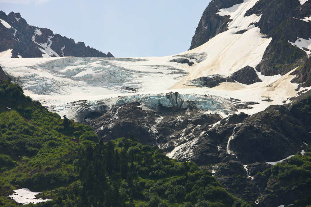
Once we took the cutoff on Hwy 37A, we immediately got some great views of the ice fields to the south of the highway.
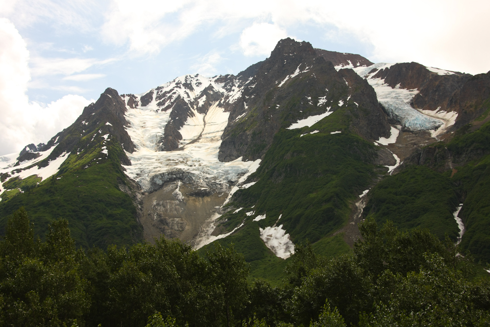
A number of the glaciers had big hanging walls.
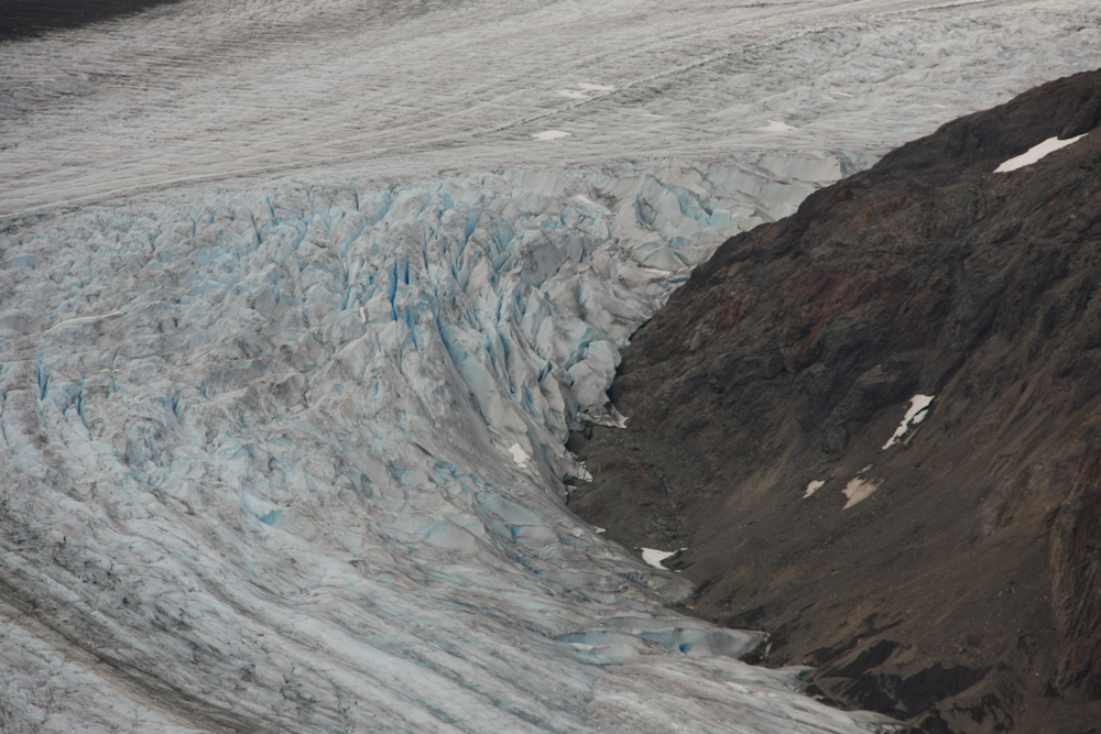
The toe of this glacier is clearly visible as is the blue color of the ice.
The coastal overcast and generally poor lighting made rendering true colors difficult. But, my Mark 3 did a nice job anyway.
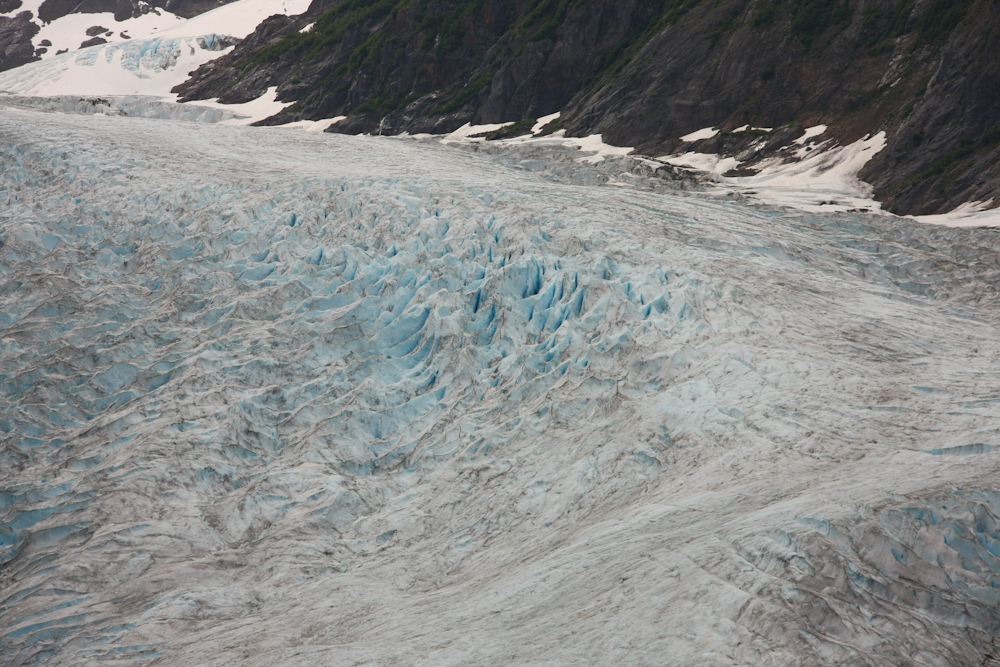
The cracks in the ice surface due to motion of the glacier are clearly visible above.
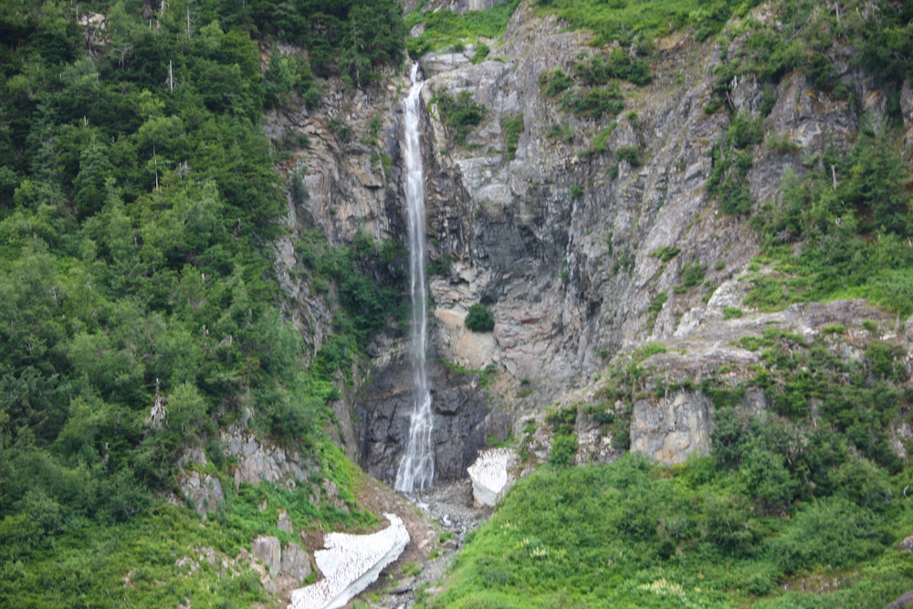
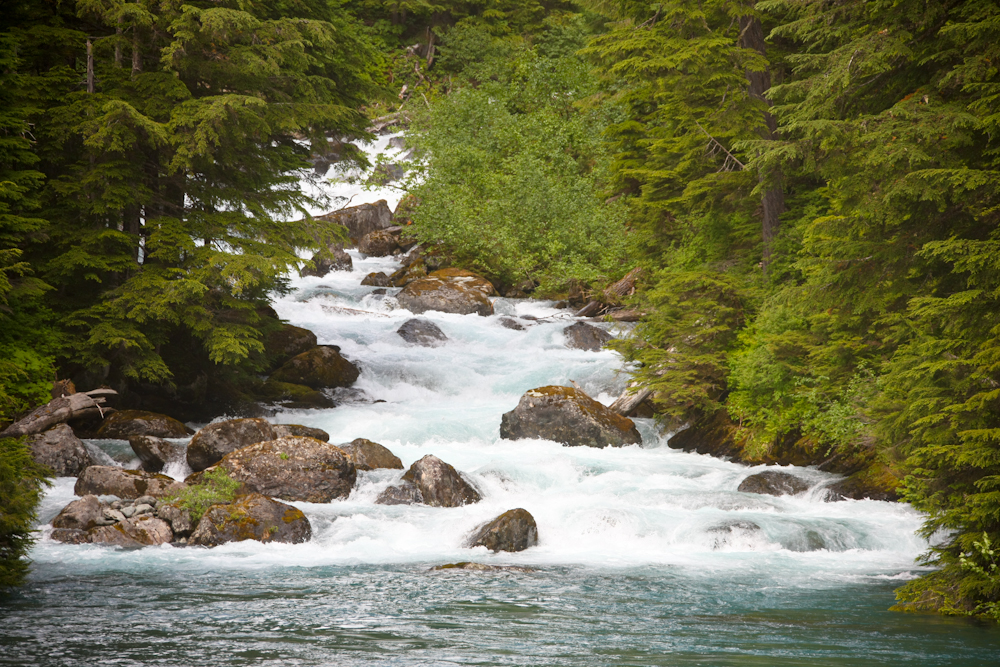
Closer to Stewart, BC we encountered some nice waterfalls.
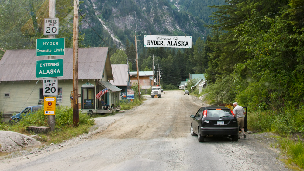
Hyder, AK is right next to Stewart, BC. The Canadian side has a customs station, but the U.S. side does not. We passed from Canada to the U.S. without stopping. Hyder is quite funky. Notice that the asphalt goes away at the border.
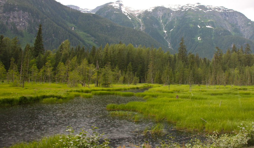
We headed north out of Hyder toward the Salmon Glacier. The dirt road passed Moose Pond just north of town, shown above.
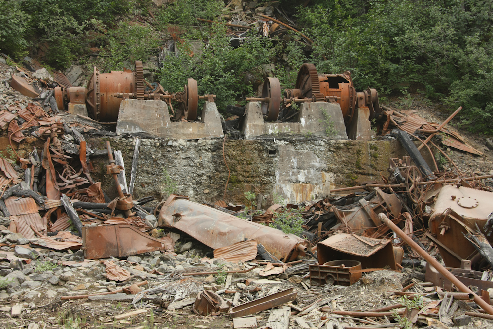
Just a few miles out of Hyder, we passed this abandoned mine with it's equipment left to rust.
We stopped next to a borrow pit for the road.
On the far wall of the canyon were some rather big streams that emptied into the bay.
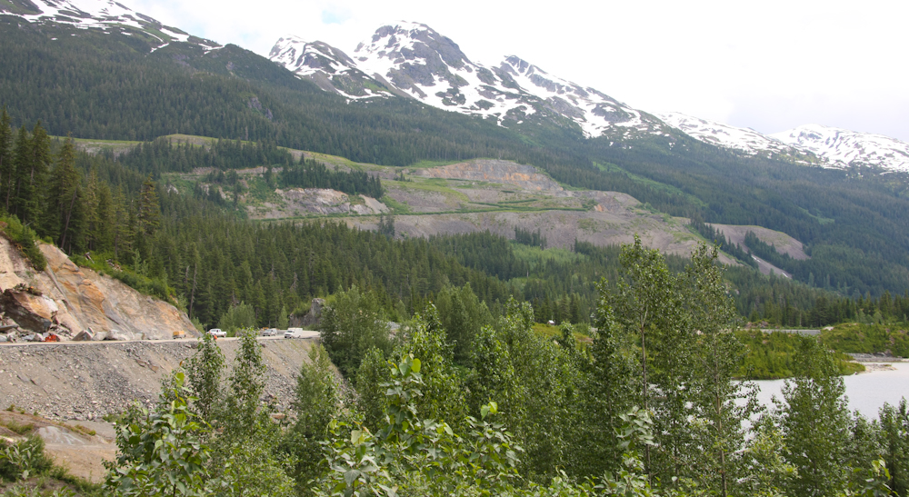
Near the first summit, we got a view of one of the bigger mines in the area. The active area is visible on the far canyon wall.
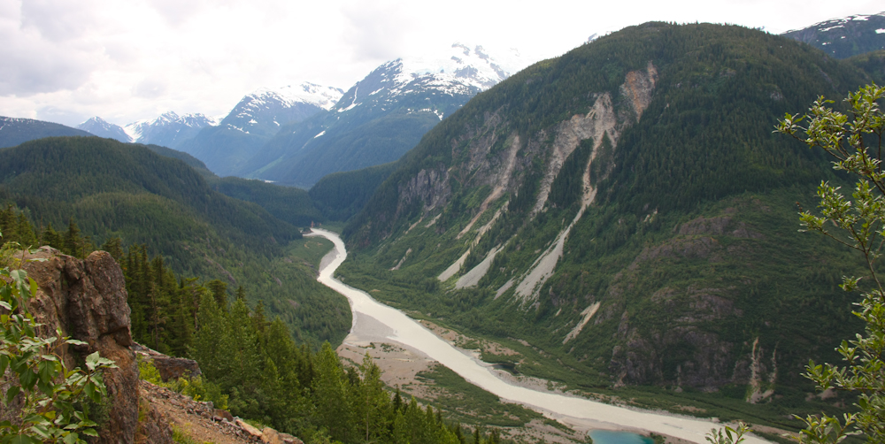
From close to the mine site we got a nice view of the river heading toward Hyder and the Portland Canal beyond.
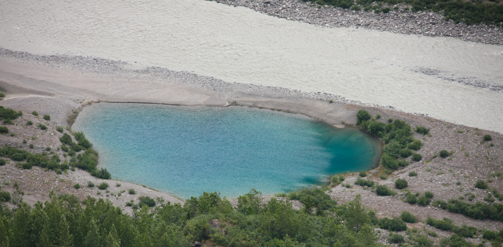
The depression that resulted in the pond by the side of the river was likely left by a melting chunk of glacial ice. I believe these are called "kettles".
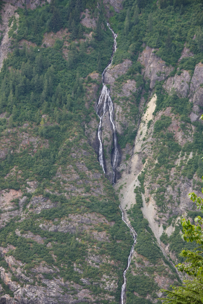
The far wall of the canyon had some very large waterfalls.
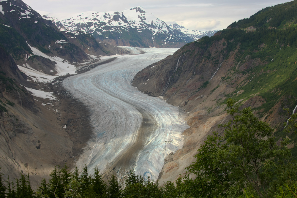
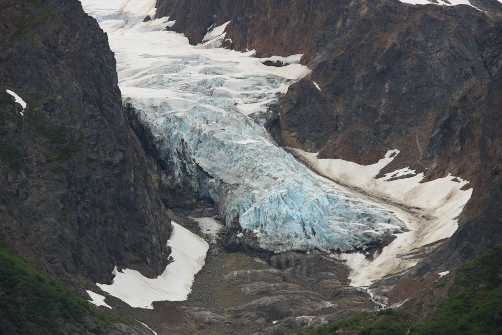
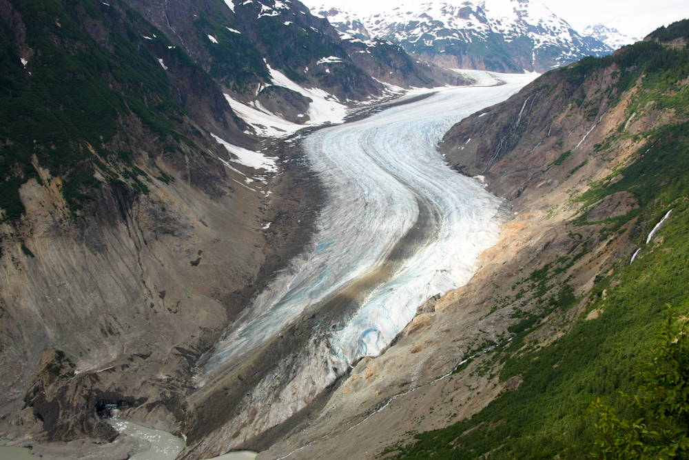
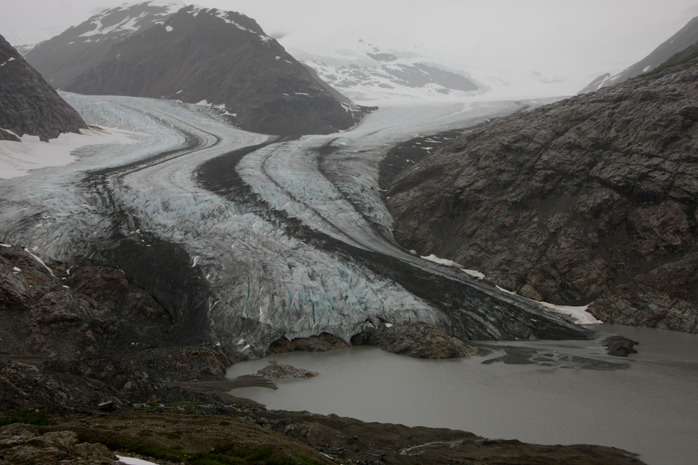
We hit the second summit and got our first view of the Salmon Glacier. Oddly enough, the road was quite a bit higher in altitude than the glacier itself, allowing us to look down on it.
Intense cracking is visible as the glacier makes a turn.
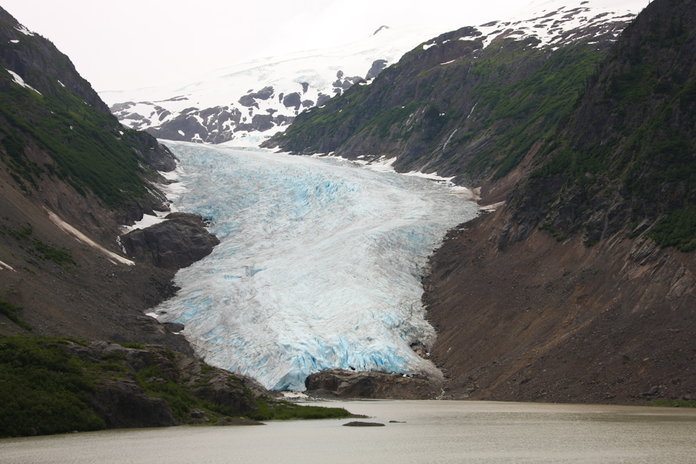
The medial moraine (the dark line in the center) is the result of two glaciers merging.
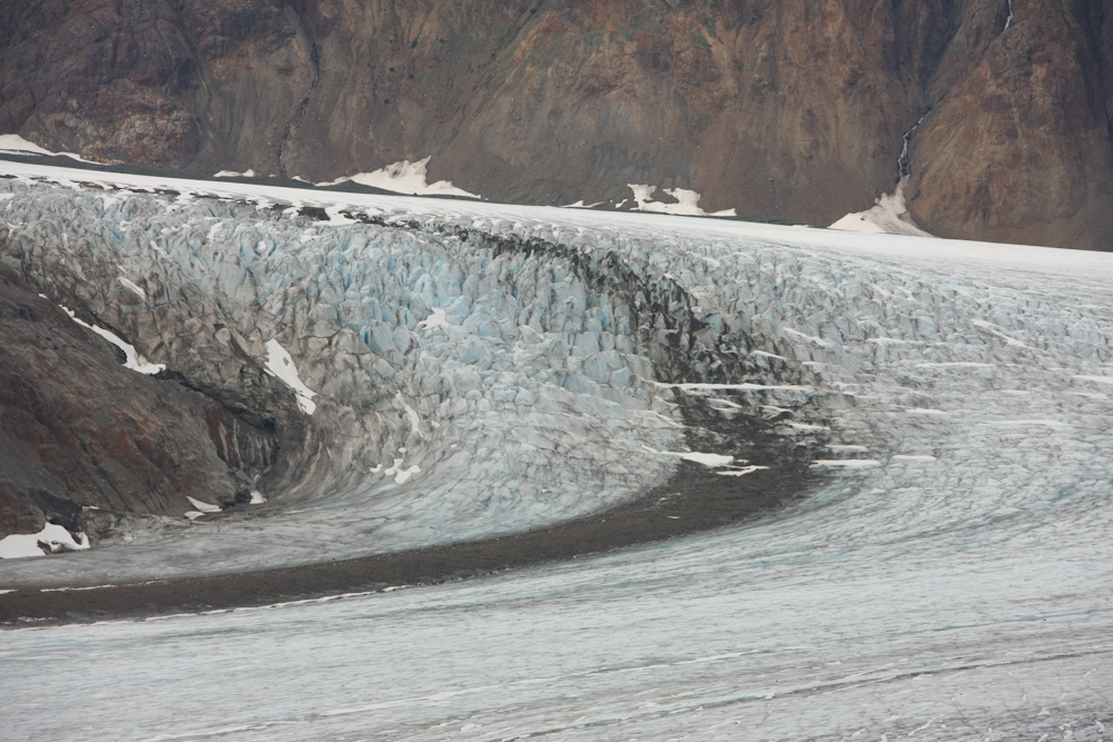
Other banding is visible along the sides of the flowing areas.
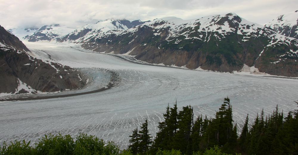
The glacier actually forks and heads in two directions.
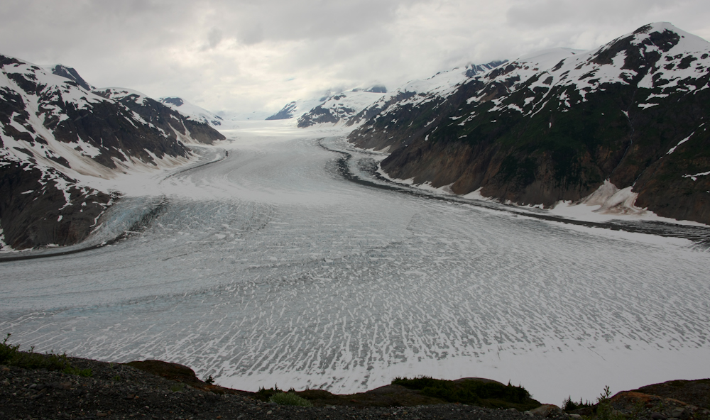
The left and right forks are visible above.
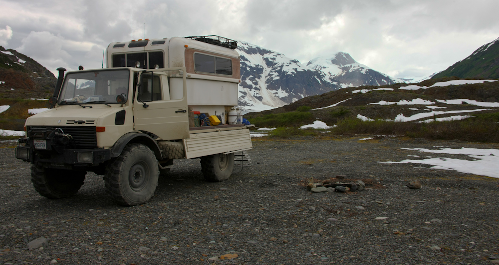
From the glacier overlook, we continued up the mining road until we found an open area away from the main route. We put the mog into 4x4 and headed toward the open area where we set up camp for the night. Despite the overcast, the winds were pretty light. Plus, for whatever reason, the mosquitoes were light which was a welcome relief. Kathleen made a chief's salad with halibut, ham, fresh hard boiled eggs and all the trimmings. Once we ate, we watched a DVD and then got a sound, mosquito-free night's sleep
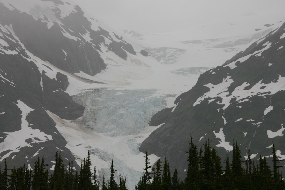
It rained over night and the weather conditions generally degraded. Upon rising, I got the view above from the back porch of the camper. There are a number of glaciers in the area, and we could see several from our camp site.
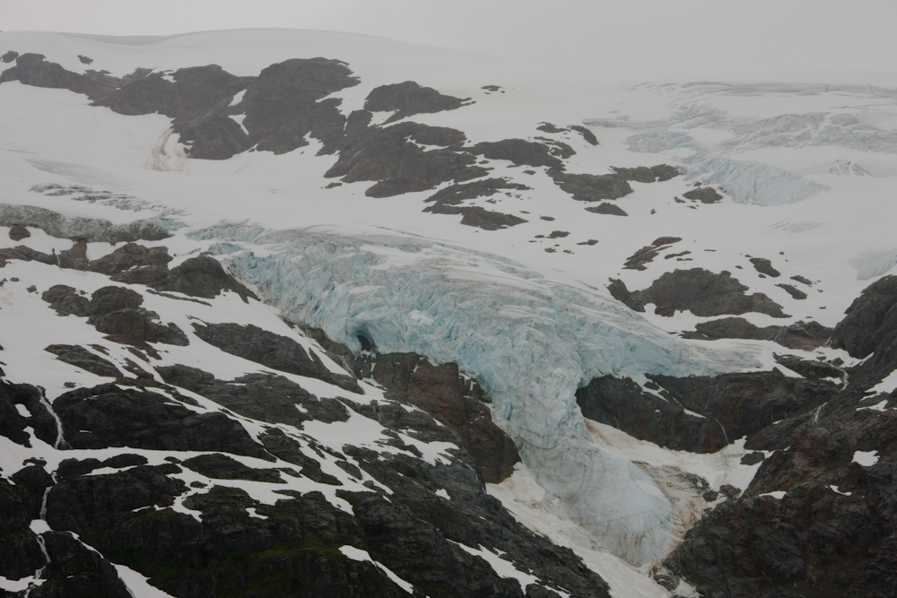
One of the other glaciers visible from camp had this big hanging wall.
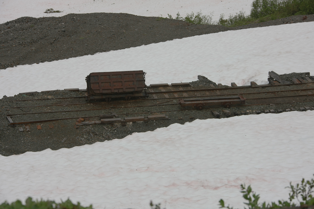
We continued further up the mining road and saw quite a bunch of abandoned mining equipment.
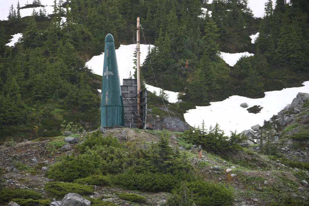
I spotted the structure above across the canyon from the mine access road. I have no idea what this is.
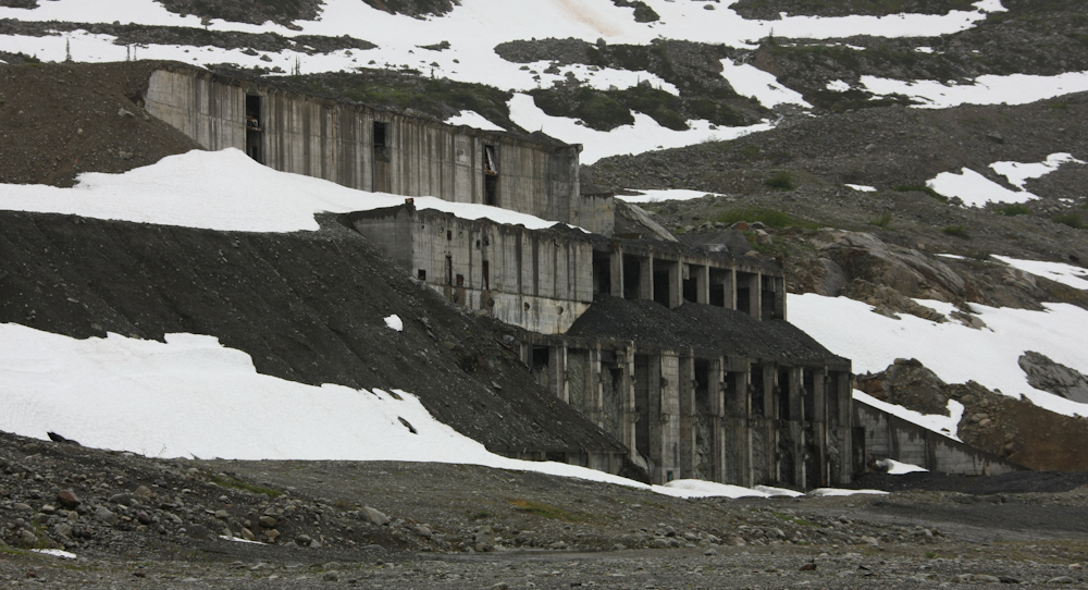
The road ended at another abandoned mine. This one was quite large.
From the mine site, we had a good view of more glaciers across the canyon. These two merge into one before terminating in the lake at the bottom of the canyon.
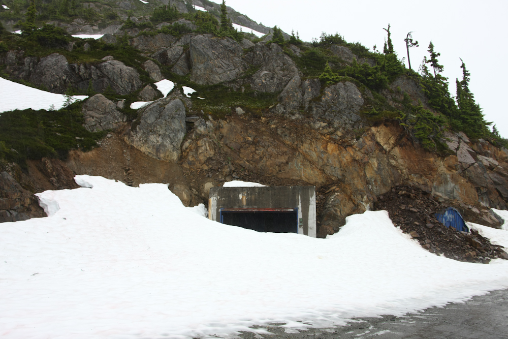
This was a tunnel that supported a full sized rail road that serviced the mines in the area.
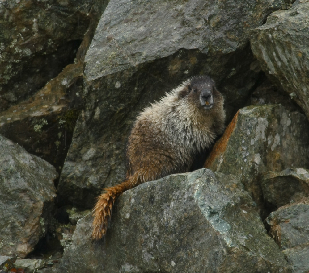
I got the same slack-jawed look from this critter as I get from many humans when they see the mog. The look clearly says "What the f*** is that?". He was crossing the road, looked at us, then did a double-take.
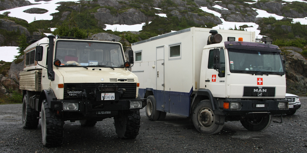
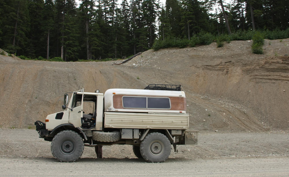
On the way back to the glacier overlook, we came upon this MAN truck-camper combo. The owners were unavailable, but were clearly from Switzerland. This rig was not four wheel drive.
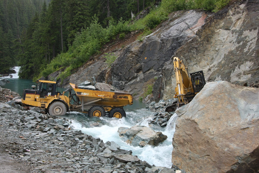
We passed through a construction zone of the glacier access road. This crew was re-routing the stream. Note they backed their truck right into the stream.
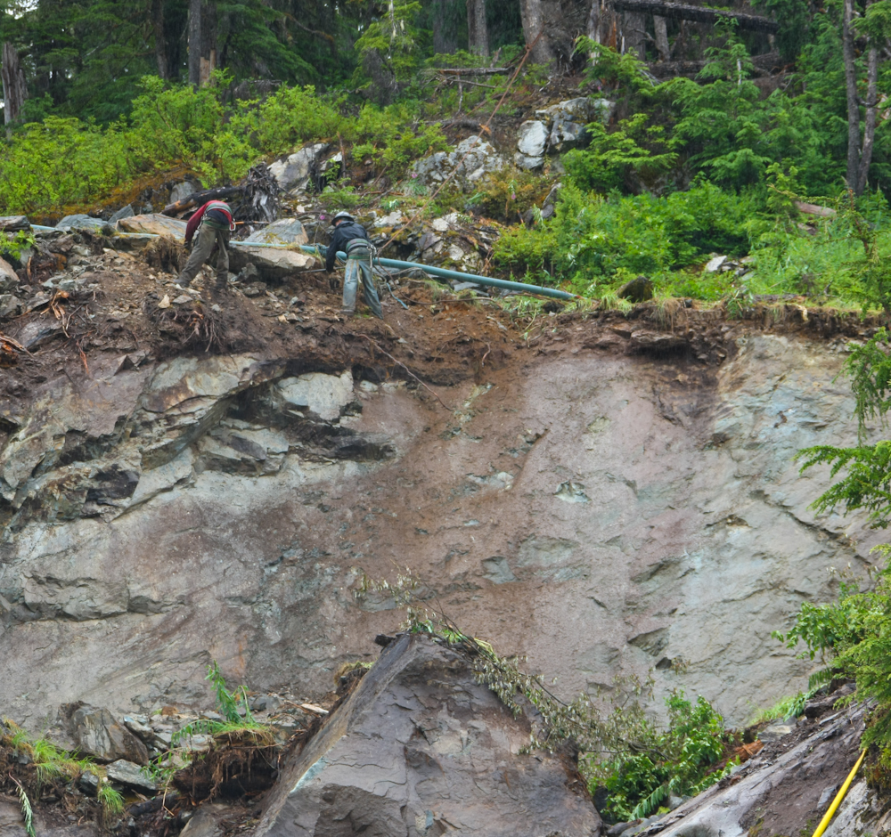
These workers were removing falling debris from above the work site.
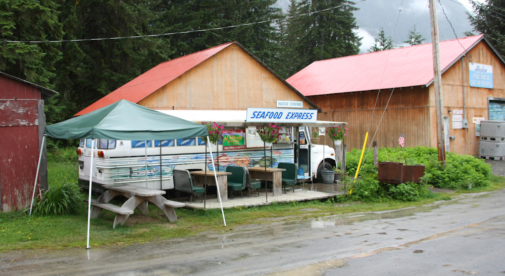
When we got back to Hyder, we decided to eat at the best restaurant in town. This bus was the cooking area. The food was good, but quite pricey.
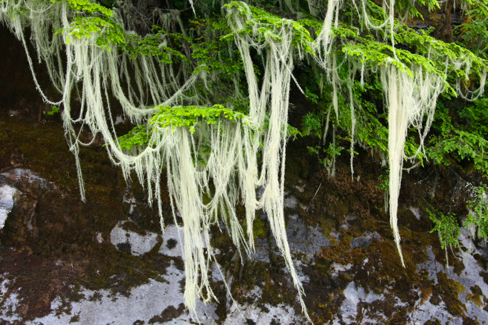
Past the border crossing into Stewart, BC we got to see large amounts of moss hanging from the trees by the bay.
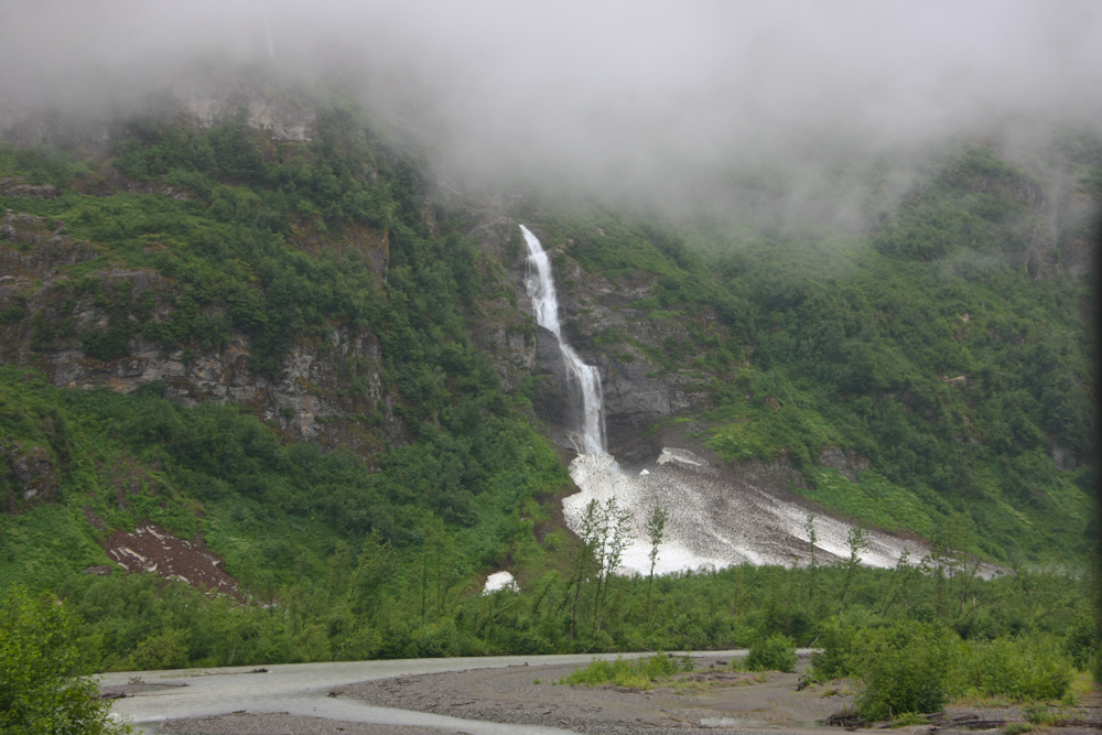
The cloud ceiling continued to fall, but we were still able to see some of the nice waterfalls by the highway. This one terminates in a snowbank at the base of the cliff.
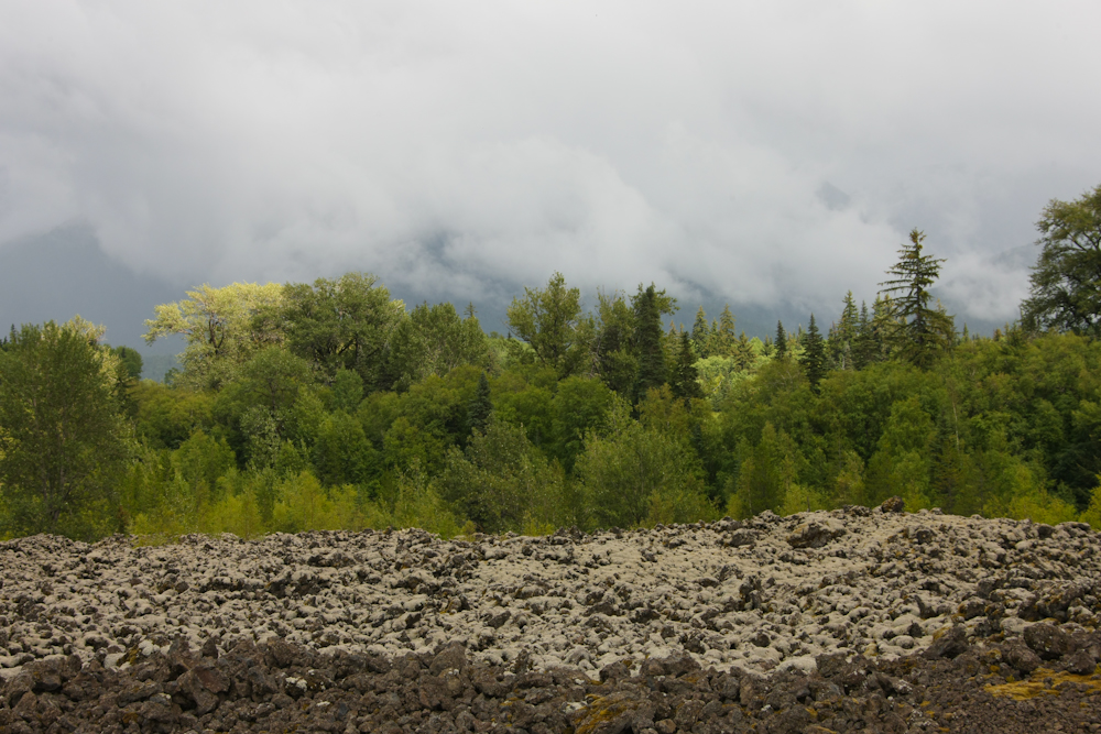
We got back on Route 37 and headed south to a place called Cranberry Junction, then we took a forest road to the west for about 60 km. From there, we headed to the Provincial Park at the Lava Flows where we spend another buggy night. The lava flow was not "all that" and was like any other lava flow that I have seen, except unlike those in desert areas, this flow was covered by moss.
The Stewart-Hyder area was perhaps the highlight of our trip. Remote camping above the glaciers was a rare treat and we were very lucky that the weather held while we were there. It was not too cold and not too windy. Just right. Tomorrow, we would head south through Terrace and then west to Prince Rupert.
| Previous Adventure | ||
| Trip Home Page |
Photos and Text Copyright Bill Caid 2009, all rights reserved.
For your enjoyment only, not for commercial use.