The plan for the day was to travel on the highway across the state of Nevada from Beatty to Great Basin National Park almost at the Utah border. Our path took us directly across he "basin and range" province and consisted of intermountain basins at about 5,000 feet altitude and passes on both east and west sides at anywhere from 6,000 to 8,000 feet. The day started warm and clear, but the weather progressively deteriorated during the day. In the end, it snowed on us. The photos below are what we saw.
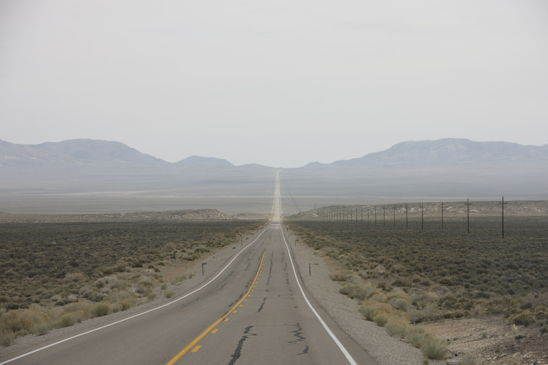
We started from Beatty, NV near Death Valley and headed north or Hwy 95 toward Tonopah. Above, you can see that in this area, the roads are laser straight and head down to the bottom of the valley then back up the pass on the far side.
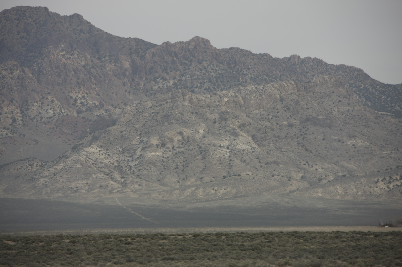
The ranges that flank the valley are usually rugged. In many cases, access roads leave the main highway and head straight up gravel fans to the mountains themselves.
Along the way, between Tonopah, NV and Ely, NV, somewhere near the Duckwater Indian Reservation in Railroad Valley, we passed what appeared to be either a Husky or Malamute dog along the side of the road. At the time we passed the dog, we were in one of the intermountain valleys. What caught my eye was that the dog had a collar with a small length of rope attached and that the dog was clearly not a "native animal". Kathleen and I discussed picking up the dog, but the question was where we would take it. We slowed down to a stop (since there was nary a car in sight), but the dog had no interest in us. Since there was nothing close on the map or on the GPS, we were not sure what to do. In the end, we did nothing and drove on. Once we returned to San Diego, I saw the following news item on the internet:
ELY, Nevada (AP) -- A dog that ran off during a road-trip rest stop apparently made her way nearly 80 miles across Nevada's high desert and two mountain ranges to return home a week later.
Moon, a Siberian husky, was reunited April 14 with owner Doug Dashiell, who had last seen her April 6 near Railroad Valley, about 77 miles from his home in Ely.
Moon, who is nearly 2 years old, was no worse for the wear, with the exception of stinking like a skunk that apparently sprayed her somewhere along the journey.
"I've had trouble with her running away before. She's always come home," Dashiell said. But he didn't expect her to show up after a week had passed.
"After seven days -- no way," he told the Ely Times.
Then the White Pine Veterinary Clinic called Dashiell and told him Moon was back in town. She had wandered up to an Ely residence where Alvin Molea took her home, fed her and gave her a place to sleep.
Molea called the clinic because the dog was wearing a tag from there.
The dog's journey would have taken her across the White River and Ward mountain ranges.
We were somewhat shocked to realize that the dog in the story was the dog that we saw. I think that we did the right thing at the time, and in this case the story had a happy ending. I suppose that if I had stopped to check, I would have seen the tags. Then I would have had a different dilemma.
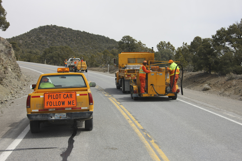
Most of the passes are sufficiently high in elevation to get snow. Snow, and the associated freeze-thaw cycle, hammer roads and cause cracks and potholes. Above, the NDOT service one of the roads. Generally, the roads were in great shape due to the efforts of these guys. This is good, because we traveled for several hours and did not pass another vehicle. So, a break-down would be a very, very bad thing.
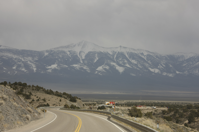
We passed through Ely, NV and got supplies and diesel. Then, we continued east over Connor and Sacramento Passes, both over 7,000 feet. From the pass, we got our first view of Wheeler Peak, Nevada's second highest mountain at 13,061 feet.
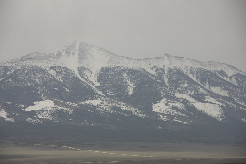
The western flanks of the peak show the trails of many avalanches. As we drove further east, the weather continued to worsen.
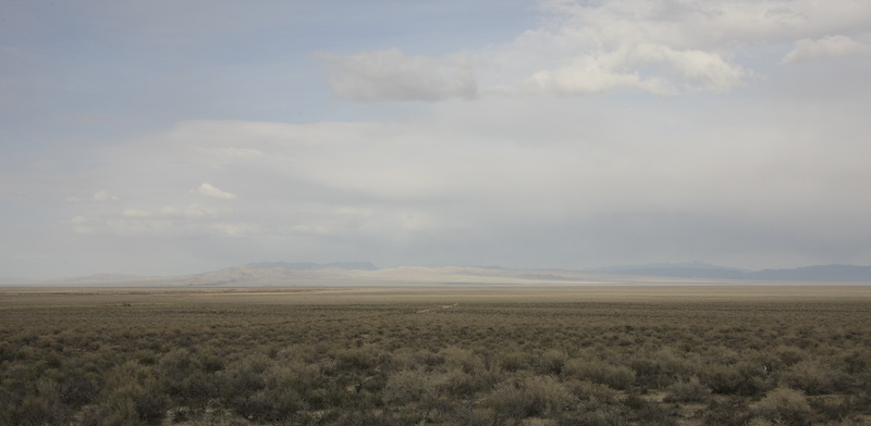
Once over Sacramento Pass, we descended into Snake Valley. The pass gave us a broad view of the basin beyond.
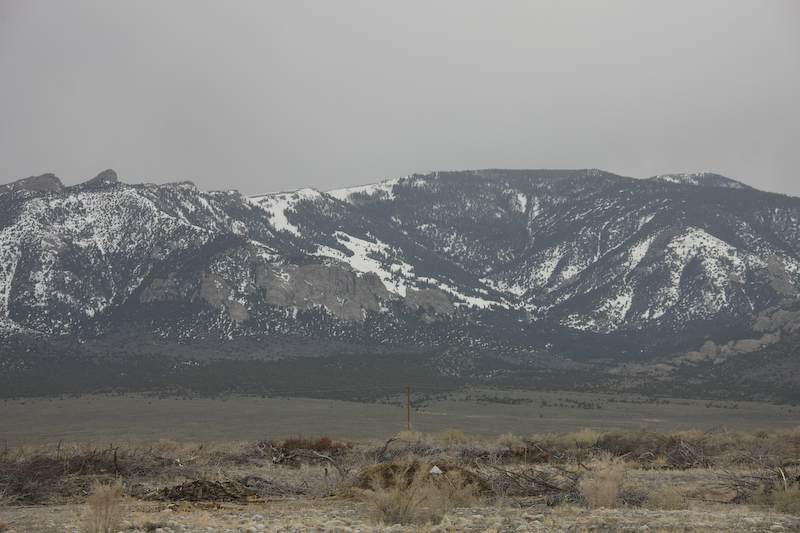
We went into the tiny town of Baker, NV and then went to the GBNP visitor center to get intelligence on places to stay for the night. The campgrounds in the park were over 7500 feet, and would therefore be much colder and likely to get snow that night due to the oncoming storm. In the end, we elected to find an open area south of town and camp there. The wind was starting to pick up and the clouds were building. Above, Wheeler Peak can be seen as the dominant feature on the western skyline.
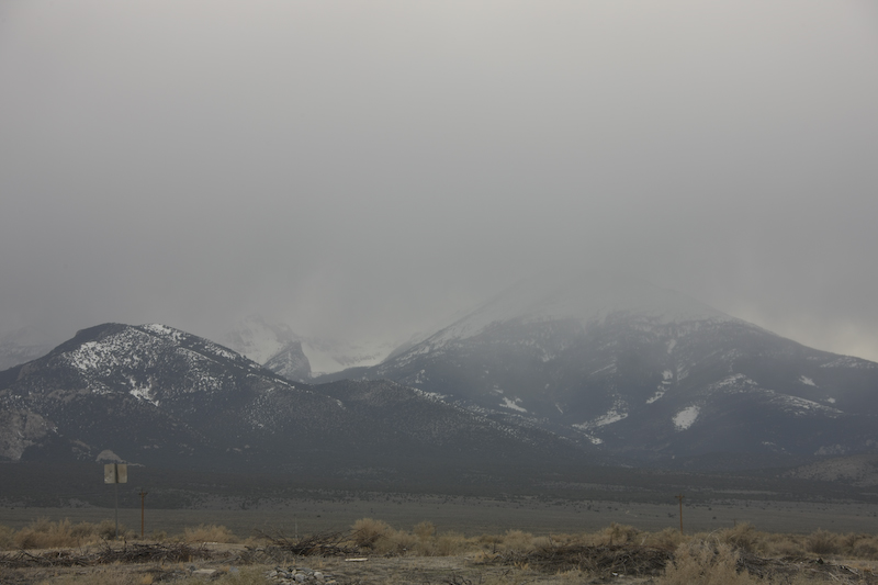
As evening fell, the storm was upon us. We got light flurries at our location, but the campgrounds got significant snow over night. We used the heater in the camper for the first time on this trip. We guessed that the outside temperature went down to the mid-twenties.
We were lucky there were no issues with the mog. The trip went well, but the high passes stressed the engine. Tomorrow, we would go to Lehman Cave and take the long tour to see the inside of the caverns. Once, completed with the cave, we would head back over the 7136 foot Sacramento Pass and then head south on Hwy 93 to Cathedral Gorge.
| Previous Adventure | ||
| Trip Home Page |
Photos and Text Copyright Bill Caid 2008, all rights reserved.
For your enjoyment only, not for commercial use.