Scorpion was be the best camp so far in the trip. The sand was smooth and felt good under our feet. We had pancakes, sausage and leftovers for breakfast. And, the shower the night before put things in the correct perspective.
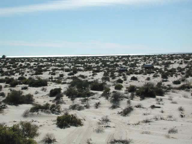
After leaving Camp Scorpion, we continued to head toward our artificial goal. While the dunes were not as high, the sand continued getting softer. There was substantially more vegetation and a larger number of tracks in the sand. And, for the first time in the trip, there were burrows indicative of larger animals, possibly Kit Foxes or other desert canines. We did see coyote tracks, but these were clearly made by a smaller four footed animal.
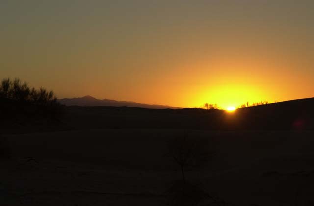
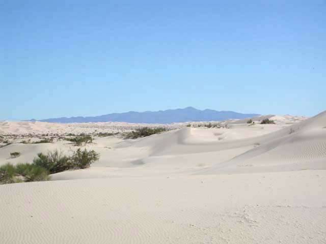
I was fast enough to get out of the sack to get the photo below. The mountain on the horizon left of center is Sierra Pinacate.
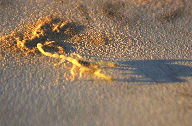
As we were packing to hit the trail, Scott discovered a visitor under his sleeping bag, ergo the name of the camp. As we sharpened our eyes, we found tiny scorpions in many places. None of the team reported a bite however. I personally have never been bitten, but have friends that have. They report that it is excruciatingly painful. And the so-called straw colored scorpions, like this one, give the worst bite.
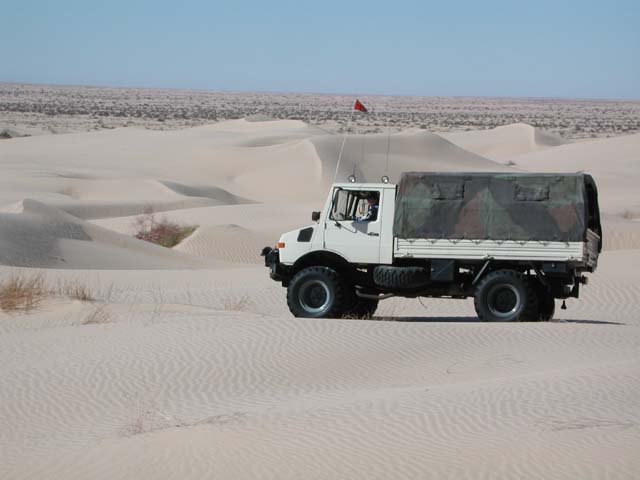
We made reasonable progress during the morning, traversing the dunes without any real problems. Kathleen drove the 1300 and I rode the Banshee.
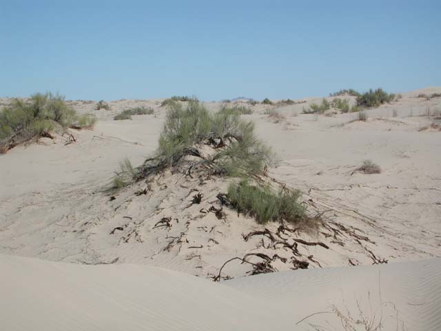
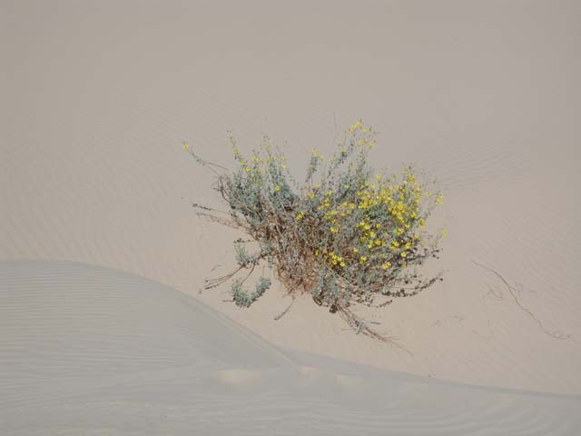
Below, you can see the root structure of the so-called Horsetail plant. The amount of greenery is minimal, the "leaves" are actually green rods about 1/8" in diameter and coated with a waxy substance to reduce moisture loss. The roots, however, are extensive. All the root matter in the hillock was due to the same plant. These roots serve to keep the desert in place, and as you can see, without them, the sand continues to blow.
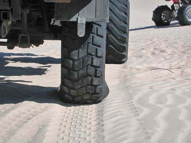
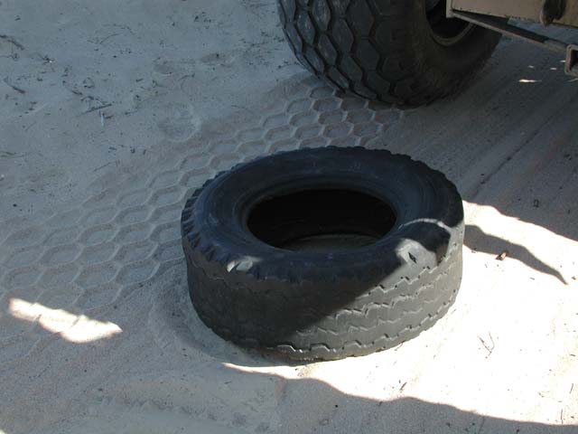
The photo below shows the difference between the stock 14.5R20 tire (rear) at 15 PSI and the Terra Tires at 12 PSI (front). Operation of the tires at low pressure and high speed (more than 20 mph) will cause sidewall damage as we will later see. The truck performed acceptably well in this mixed-mode configuration.
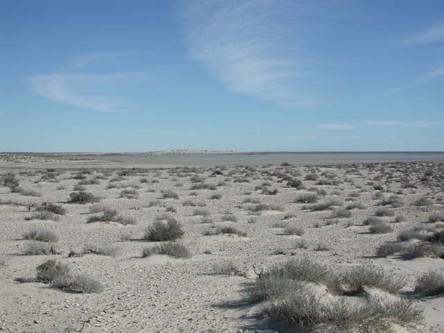
As we got closer to the water, there were more signs of both vegetation and animal life. This bush was actually in bloom.
One of the 2 defining features on the horizon in the Altar is Sierra Pinacate. Below, the outline of the volcano can be clearly seen against the northern skyline through the dunes. Los Pinacates, also known to the locals as Los Vidrios (the glass, as in obsidian the volcanic glass) threw out great amounts of ejecta that traveled for miles. And, as shown in earlier photos, the black sand has intermixed with the river delta sand that is the predominate component of the Altar dunes. Los Pinacates are clearly visible in satellite photos Figure 1 and 2 on the home page of this trip report. There you can see that there were many vents, but one primary cinder cone.
The Banshee had been slightly unhappy for days, mildly overheating. Kai thought that the reason was that the radiator was not getting sufficient air flow. Probably correct, because travel through the tundra was slow going for quad or mog. Note the dark spot on my left thigh that resulted from the radiator burping fetid fluid on my leg. Gladly, I was not scalded, but it did smell foul. And was greasy, implying that there was some oil in the water.
After many miles of travel in the tundra, we finally spotted the Gulf of California (or the Mar de Cortez for the linguistically minded). The shimmer of the waves could be seen in the distance in the photo below. But, it was slow going in the tundra. The hillocks would hit those wide tires and whip the steering wheel around risking damage to your wrist and thumbs if you did not have good driving posture. Indeed, on the previous day, the wheel whipped so hard that it bruised my thumb and tweaked my lower back as I attempted to control it.
We followed a direct line to the water's closest edge until we hit the trans-Mexico railroad tracks, the only machine to truly conquer the Altar (conditions apply, your mileage may vary). We crossed the tracks, went east a short while and found something for dessert in the desert. While stopped, I repeated my stories about "young bucks" who took their trucks into tidal flats in San Felipe, only to get them stuck and have the tide come in and swamp the truck. Kai and Dan listened casually, but mostly the message was lost in the chatter of normal beer stop conversation.
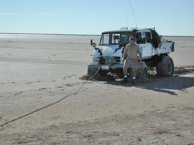
After crossing the tracks, we headed toward the water's edge. Kai and Matt had the presence of mind to get and check a tide chart. One of the highest tides in the past several years occurred a couple day's previous and it had flooded great tracts of land. This was a 27 foot tide and with the very shallow slope on the land, the water comes many, many miles inland. In some cases it flows past the railroad into the flats beyond. To get away from the rough going of the hillocks, we attempted to travel along the edge of the flats. As can be seen below, that is a risky thing to do. The chief issue is that the water table is just below the surface. You can easily be fooled into thinking that a section of ground is stable because the top is dry. But beware, a dry surface does not always imply that the ground is passable. Many a vehicle has been stuck in these kinds of flats due to that misconception. Below, Kai attempts a self rescue after breaking through the crust. He used Dan's truck as the anchor, but I stayed well away. The mud is thick, very fine silt with a high clay content making it mechanically unstable and very slick. Gladly, he got out easily. But, as we will see later, the risk is ever present and caution is always indicated.
The tidal flats run for miles and while rich in clams and sea snails, they were dangerous to traverse and had no cover from the wind. So, we elected to take the railroad path closer to Puerto Penasco.
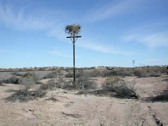
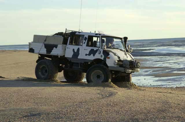
On our path back to the railroad, we came upon an eagle's nest in an abandoned phone pole. Note the 416 crossing the tracks.
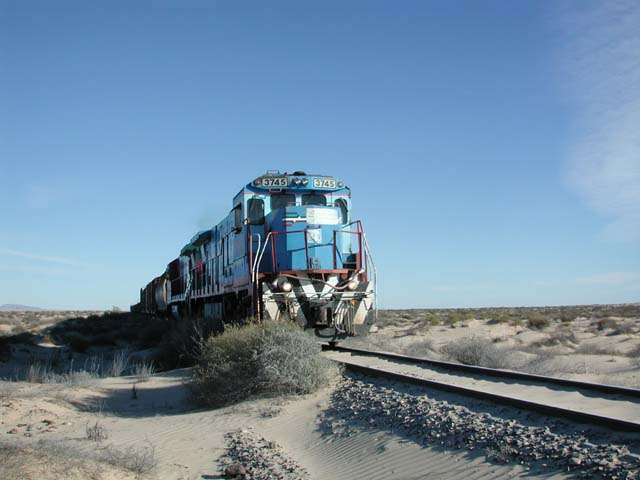
We crossed the tracks and followed the dirt road for a number of miles. I was on the quad and while stopped waiting for the trucks, I happened to look up in time to get this photo of an actual train. The tracks are not heavily used, or at least were not while we were traversing the road for several days. But, it is the only fast way across the Altar as there is no road. The engine looks like an GM EMD GP-35 based on the dropped snoot.
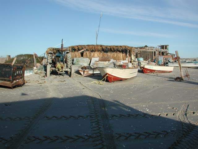
We traveled along the railroad tracks for many miles until we came to an abandoned railroad town; I did not take photos as it was unremarkable. There we crossed the tracks and assumed that there would be a track that would take us directly to the water's edge. We were correct in our assumption and in only a few miles, we were on the beach. We turned east toward Puerto Penasco (Rocky Point) and planned to follow the beach to the town to buy shrimp, clams, ice, beer and diesel. After a short stint on the beach, we came upon this small fish camp. We stopped to see if they would sell their catch, but nobody was home. The place was actively inhabited, so they must be out working for a living. Note the tractor. The curious thing is that the palm fronds that were used for the walls had to be imported from somewhere else, as there were no trees of any kind in sight.
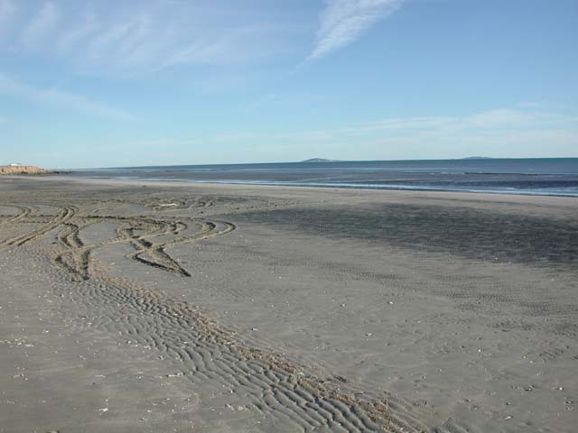
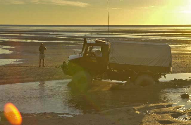
As we progressed down the beach, I was getting progressively more nervous. First because the light was waning and we still had a long way to go to get to Puerto Penasco. Second, because we had been traveling all f**king day and I was tired. Third, the tide was out and the beach sand was very soft. Below, you can see that when the tide is out, the beach goes far into the water. The recent high tide was fresh in our minds as we chose our path down the beach.
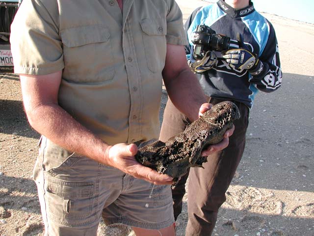
At a beer stop, Kai discovered some flotsam on the beach. This is a sea sponge.
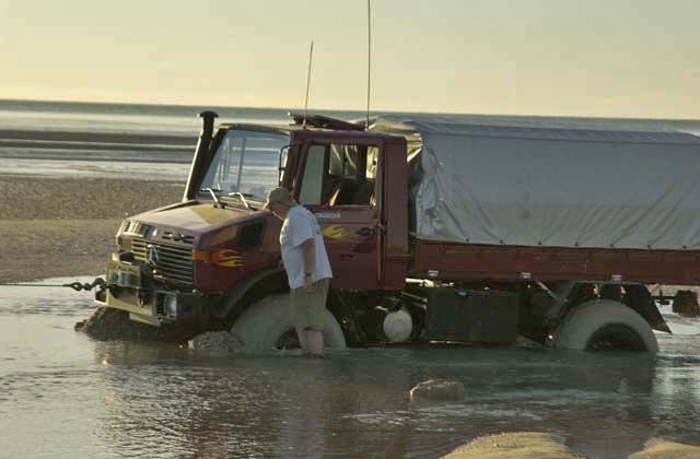
As we progressed down the beach, the tide turned and was starting to come in. We had to cross a small river that was created by an inland estuary that was filled by the high tide. Kai crossed fine. Dan did not. He followed in Kai's tracks, as we had been for hours, but he had perturbed the sand enough to make it fatally unstable. Below, Kai is attempting to pull Dan out. Note the skid wave from the tires being drug through the soft sand.
One of the biggest problems in getting stuck in these areas is that there is nothing to winch to. There are no trees, no rocks, nothing stable. As you can see below, Dan is in deep. He is buried right to the differentials. Note the bow wave of mud on the front of the wheels as Kai attempts to pull him out. The sand here is composed mostly of broken shells. It is unstable, and very sharp on the skin. As we struggled to get Dan out, the tide continued to advance, raising our concerns to a fever pitch. If we could not get his truck out in a couple hours, it would be covered to the bottom of the canopy, with obvious consequences.
While I did not time the event, it is clear from comparing the photo above and the one below that the sun is setting. And the clock is running out.
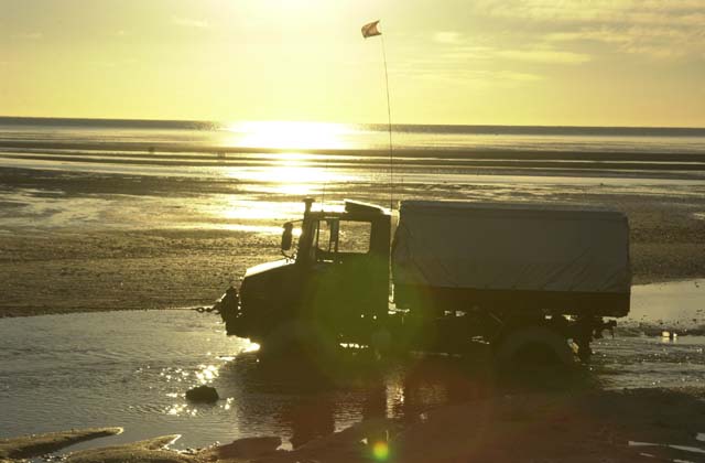
Finally, after a number of attempts, with Kai's winch at maximum capacity, the truck started to free itself. I can only assume that in this case the incoming water actually helped by lubricating and breaking the suction of the mud that had a grip on the tires.
Once Dan was out, I headed directly to the bluffs away from the water. Kai and Dan continued along the beach until they could get to the bluffs. The plan was to still attempt to make it to Rocky Point to get seafood. But we were thwarted by a number of flooded roads with ugly river crossings. In the end, cooler heads prevailed and rather than getting to Puerto Penasco at any cost, we set up camp on the bluff overlooking the water and safely above the high tide line. The chart suggested that another very high tide was due that evening.
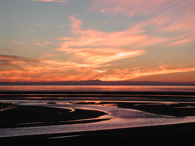
As if there was some meter on the pain that was being exerted on the team, we were again rewarded with an awesome sunset. I mentioned that there were 2 defining features in the area. One is Sierra Pinacate. The other is Picacho del Diablo. Picacho is on the western horizon, in the center of the Baja peninsula and is over 10,000 feet tall. I am guessing that it is 150 miles across the water and desert on the far side to the peak, but still clearly visible on the skyline. Note the rivers in the mud flats that are flowing.
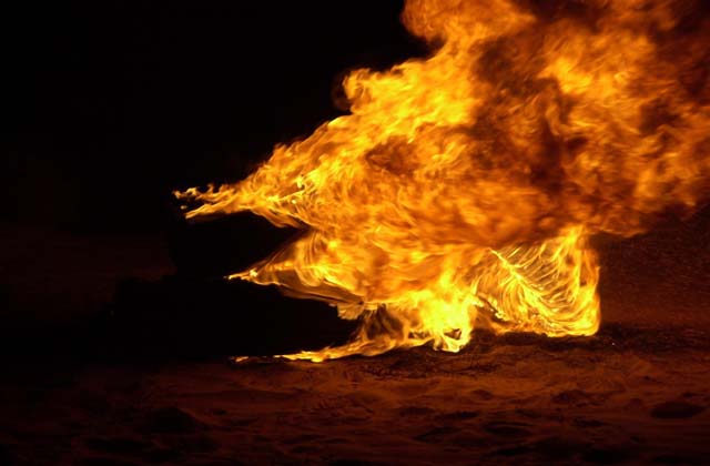
After a great dinner, we had dessert. Matt had brought a magnesium engine block, which burned but with somewhat unspectacular results.
The wind was good to us that evening. Near 1 am, Kai turned on his headlights to see the extent of the tide's inflow. We could hear the water rushing through the tidal flat rivers. But, being on the bluff, it could not be easily seen. Kai and Dan walked down the bluff for a closer look. I stayed in the sleeping bag and Kathleen, as usual, slept through the whole thing.