We had a great dinner the night of our arrival. Dinner was followed by drinks in the bar. I was shot from getting up early and driving all day, so it was an early night for me.
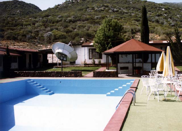
The next morning, after a great group breakfast in the dining room, I prowled around to take some photos. Below is a shot looking to the south from the office area. Note the (empty) pool and satellite dish. The dish was for the TV in the bar. Guest rooms can be seen on the left and in the center behind the gazebo. Mike's was a nice place, particularly when the only alternative is camping in the silt-fine Baja dirt.
The courtyard at Mike's Sky Ranch.
This is looking to the north from the office. You can see the low brush as well as the access road coming in from Valle de Trinidad to the north. The is a year around river down in the creek bed in the center of the photo. Persistant water in Baja is a rarity.
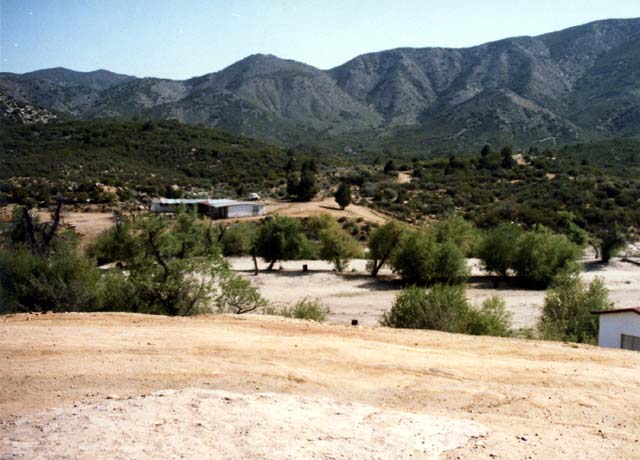
The north entrance road at Mike's
Here is a view looking to the east from the office. Arroyo San Rafael is in the center, the river, and flows down from the 10,000 foot peak of Pichacho del Diablo (Peak of the Devil) that is to the south east of Mike's. The buildings on the right (from right to left) are the garage, workshop/storage and diesel generator shack. The workshop would later become important as Mike had something that I would desperately need to get back to the United States.
There trout in Arroyo San Rafael, and one of the guys brought a rod and reel. He caught some fish and brought them back and the cook prepared them for breakfast. It was an unusually tasty treat.
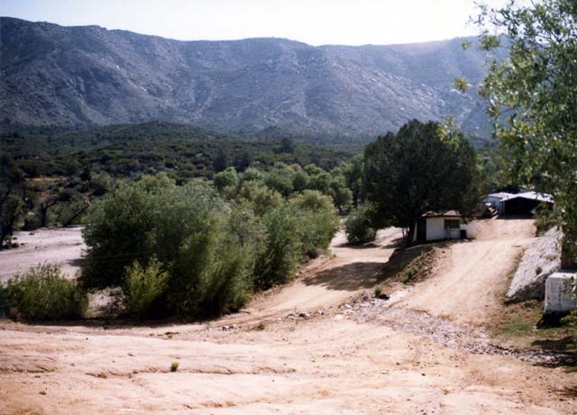
Looking east to the workshop, and garage generator house (R to L).
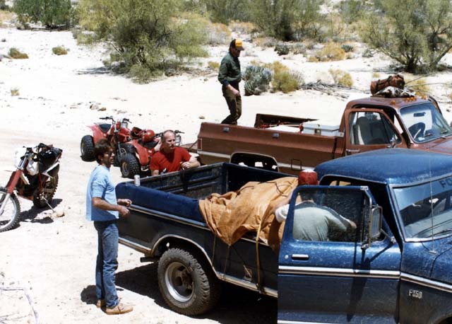
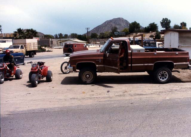
Below, the group saddles up for the first part of the trip to San Felipe. My 3 wheelers are loaded because the dirt trail back to Mex highway 3 is unremarkable and not all that much fun on a 3 wheeler. Plus, we could not keep pace with the bikes. You can see the red tile roof of the hotel office in the left center of the photo as well as the various radio antennas at the facility. The bar and pool room is behind the fellow in the bed of the truck on the right.
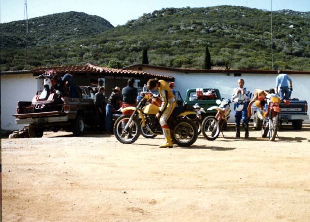
Loading for San Felipe
The route to San Felipe took us north from Mike's to Mex 3. Then east, to San Matias wash. At the wash, we would turn south and head back into the wild. There was a dirt track that went to the south east, running parallel to the cliffs of the Sierra San Pedro Martir mountains and across the dry lake bed of the Laguna Seca del Diablo. Once we crossed the dry lake bed, we would head east over another set of low mountains and then descend into San Felipe from the west. Once the group was at San Matias wash, we unloaded our stuff, got beers and put our trail face on. Below, the equipment is unloaded and we prepare for the trail.
Unloading at San Matias .
As we headed south, the steep escarpment of the Sierra San Pedro Matrir dominated the western skyline. The prominent feature on the horizon was Pichaco Del Diablo, Baja's tallest peak, visible below.
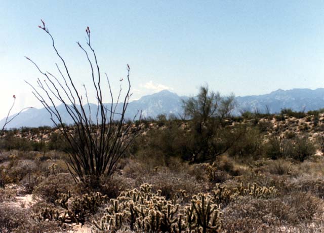
Pichacho del Dablo on the skyline.
Pichaco is both tall and rugged. The peak rises to a full 10,000 feet from nearly sea level in only a few miles. Below, you can see the huge granite cliffs of the eastern face of the peak.
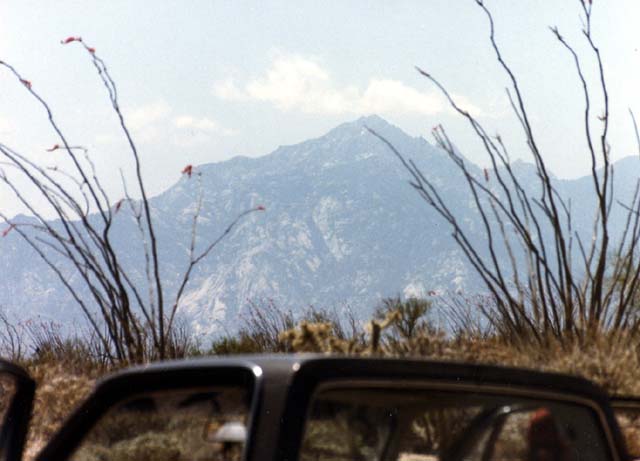
A close up of the rugged Pichaco del Dablo.
As we made our way south, there was plenty of flora to capture our attention. One rather rare item is the so-called "Creeping Devil" cactus, below. The creeping devil is interesting both because of it's propensity to grow along the groud and the fact that the sap is toxic. When the natives dominated this region, the used the sap from crushed cactus to fish. They would toss the crushed pulp into calm bays and the toxin would stun the fish, causing them to float to the surface to be caught. This was mentioned in several of the books I had read in preparation for the trip. None of the books mentioned what the toxin did to the indians that ate the fish, however. Nor did it mention the effect of the raw juice on humans.
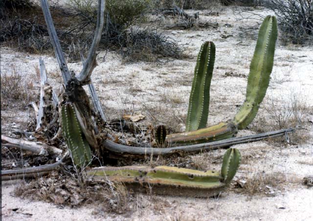
Creeping Devil Cactus.
Below, a Palo Verde tree is in bloom. Note the copious yellow flowers.
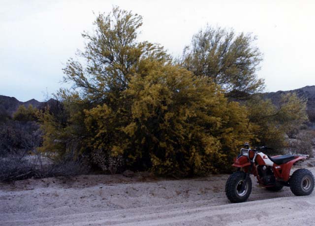
A Palo Verde in bloom.
There were a variety of cactus along the trail. In addition to the Creeping Devil, there were cholla of many varieties. Below is a long-thorned pencil cholla with vicious spines.
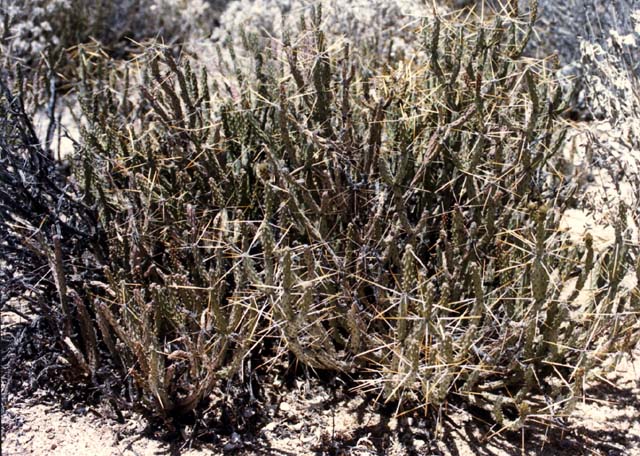
A variety of Pencil Cholla with very long spines.
Also next to the trail was something that I had heard about, but had never seen in the wild -- an Elephant Tree. The "tree" is really a succulent and the trunks and branches are just fibrous pulp. These plants do not have many leaves. In the photo below, it just looks like a bunch of naked sticks.
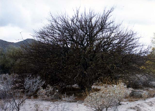
Thick branched Elephant Tree.
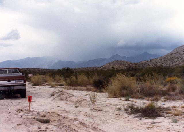
As we headed south toward San Felipe the desert brush got quite thick, remenesent of the Sonoran desert around Tucson. Below, you can see several kinds of cholla, ocatillo, palo verde and mesquite. Also note that there was a storm bearing down on us. The clouds seemed to evaporate at the ridgeline, but it was still a concern.
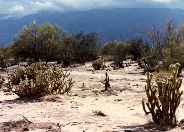
Brewing storm and local flora
As we proceeded south, the storm got bigger. Note the rain squall in the center of the photo below. While rain in the distance was not a concern from the standpoint of getting wet, it was most definitely a concern due to the potential of flash floods. All the eastern faces of the Sierra drain toward San Felipe. Having seen the impact of flood waters when I lived in Tucson, I really had no desire to deal with that issue on this trip.
Weather brewing on our way south.
The weather did not cause us problems and while there may have been flooding somewhere, it was not impacting us. The path from the Laguna Seca del Diablo (the dry lake east of the main peak) was reasonably fast and easy. When we got to San Felipe, we took care of first things first. That means beer and ice. Below, the group addresses the most pressing needs.
First things first.
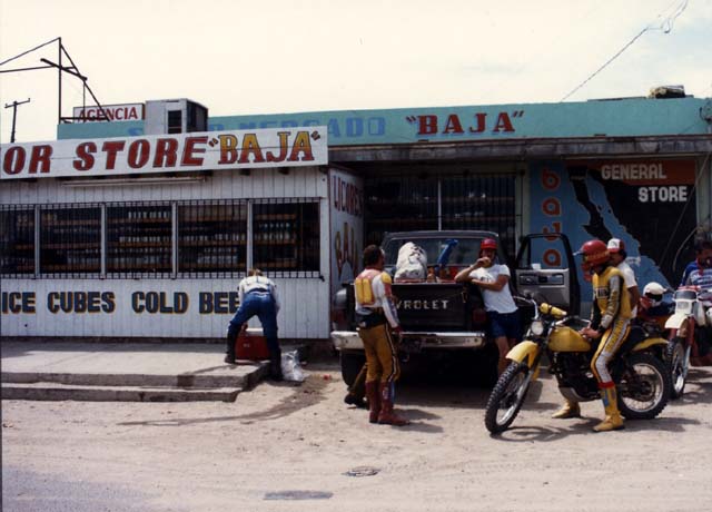
On interesting thing about Mexico back then was the ability to ride your 3 wheeler right down the main road in town. As you can see below, we just rode in like we owned the place.
Scoring beer and ice in San Felipe.
San Felipe was not very big back then, perhaps a few hundred people lived there. It was a sleepy little fishing village catering to the fishermen and the occasional off roader passing through. Below is the main intersection in town. Actually, San Felipe is bigger than some of the towns we passed through because the road is paved as opposed to dirt.
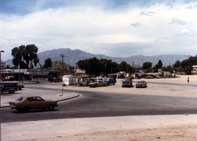
The main intersection in San Felipe, 1982.
On our way to the motel, we passed near the marina and came across this hulk. The hull was seemingly completed, but sat rusting on the shore, quite a long stretch from the shore..
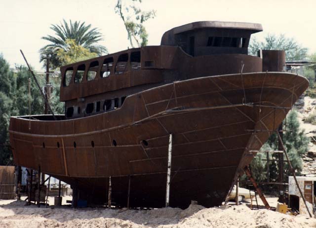
Work in progress on the beach.
The group stayed at some motel on the water, but I cannot remember the name of the place. Below is a photo of the office area. Note that the parking lot is dirt. I do recall the group ate at an interesting resturant and I had broiled quail for dinner.
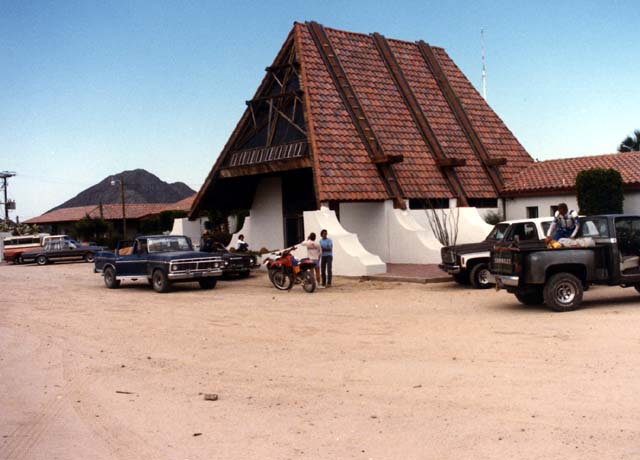
The motel on the beach.
Next morning we would be packing for our return to Mike's back across the desert.